JavaScript and Cookies are required to view this site. Please enable both in your browser settings.
The Earth Observatory (23 Photos)

The Earth Observatory (23 Photos) 

Current Rating:

Unlimited Views No Ads No Algorithms Lifetime Account

Documenting Reality

Community Forum · Est. 2006

Join Now
Thread Tools
  #1  
04-17-2010, 11:00 PM
güttsfükk's Avatar
güttsfükk
Offline:
Super *********
Poster Rank:88
Join Date: Nov 2008
Posts: 17,426
 
Mentioned: 5 Post(s)
Quoted: 99 Post(s)
Activity Longevity
0/20 18/20
Today Posts
0/11 ssss17426
The Earth Observatory (23 Photos)

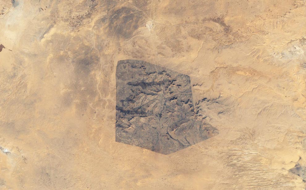
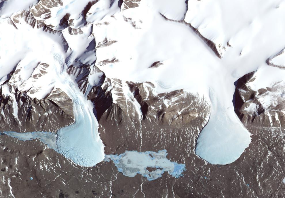
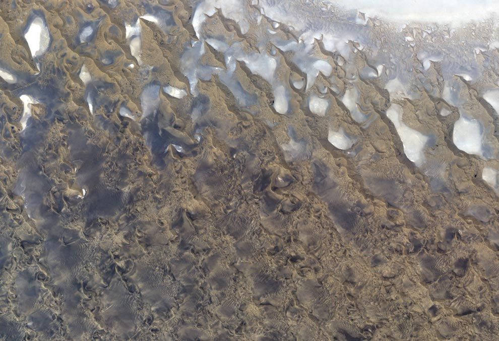
The Earth Observatory is a website run by NASA's Earth Observing System Project Science Office (EOSPSO). Bringing together imagery from many different satellites and astronaut missions, the website publishes fantastic images with highly detailed descriptions, feature articles and more. Gathered here are some standout photographs from the collections in the Earth Observatory over the past several years.
feel free to check the site and bring your own favouries and post them in this thread.

Source : 
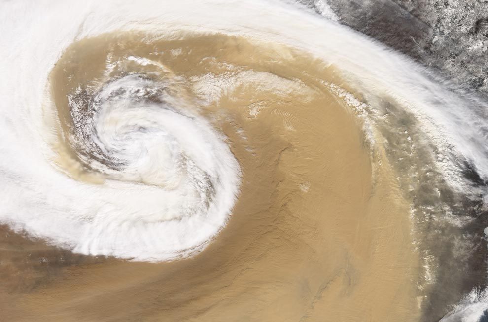
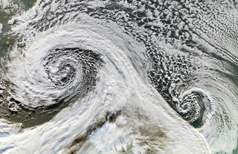
http://earthobservatory.nasa.gov/


The Moderate Resolution Imaging Spectroradiometer (MODIS) on NASA's Terra satellite captured this image of a dust storm as it swirled over China in April of 2001. A strong temperate cyclone spun counter-clockwise over China, pushing a wall of dust as it moved. The deep tan dust is not only thick enough to completely hide much of the land surface below, but it almost forms its own topography, with ridges of dust rising up below the clouds. The spiral arms of white cloud are approximately 200km wide
e01_china_tmo.jpg
82.8 KB ·99 views
4 Users Say Thank You For This Post:
Black Knight, shooterb, Syl, vnathan
▼ PROMO FROM DOCUMENTING REALITY
Real Amateur Street Fighting Videos
View Now
Hidden for upgraded members.
  #2  
04-17-2010, 11:03 PM
güttsfükk's Avatar
güttsfükk
Offline:
Super *********
Poster Rank:88
Join Date: Nov 2008
Posts: 17,426
 
Mentioned: 5 Post(s)
Quoted: 99 Post(s)
Activity Longevity
0/20 18/20
Today Posts
0/11 ssss17426
Re: The Earth Observatory (23 Photos)

The Bear Glacier on the Kenai Peninsula along the Gulf of Alaska seen by the IKONOS satellite took this on August 8, 2005. This image shows the ablation zone where the glacier is primarily losing ice. Upslope from the lake, the foot of the glacier is riddled with crevasses - cracks in the ice caused by the glacier's movement over a rough surface. Down the middle of the glacier run dark gray stripes. As a glacier moves, it picks up dirt and debris from the rocks it passes. When two glaciers merge, as they have here, the dirt and debris they carry form parallel stripes, or medial moraines, on the ice surface.
e02_bear_iko.jpg
185.2 KB ·95 views
3 Users Say Thank You For This Post:
IRISH., shooterb, vnathan
  #3  
04-17-2010, 11:03 PM
güttsfükk's Avatar
güttsfükk
Offline:
Super *********
Poster Rank:88
Join Date: Nov 2008
Posts: 17,426
 
Mentioned: 5 Post(s)
Quoted: 99 Post(s)
Activity Longevity
0/20 18/20
Today Posts
0/11 ssss17426
Re: The Earth Observatory (23 Photos)

South of Khartoum, Sudan, where the White and Blue Nile Rivers join, a dizzying arrangement of irrigated fields stretches out across the state of El Gezira. The several bare-looking patches are small villages. This image was captured by the Advanced Spaceborne Thermal Emission and Reflection Radiometer (ASTER) on NASA's Terra satellite on December 25, 2006.
e03_aljazirah_ast.jpg
271.5 KB ·70 views
3 Users Say Thank You For This Post:
IRISH., shooterb, vnathan
  #4  
04-17-2010, 11:04 PM
güttsfükk's Avatar
güttsfükk
Offline:
Super *********
Poster Rank:88
Join Date: Nov 2008
Posts: 17,426
 
Mentioned: 5 Post(s)
Quoted: 99 Post(s)
Activity Longevity
0/20 18/20
Today Posts
0/11 ssss17426
Re: The Earth Observatory (23 Photos)

Deep in the Sahara Desert lies this crater. Nearly a perfect circle, it is 1.9 kilometers (1.2 miles) wide, and sports a rim 100 meters (330 feet) high. The crater sits in a vast plain of rocks so ancient they were deposited hundreds of millions of years before the first dinosaurs walked the Earth. Modern geologists long debated what caused this crater, some of them favoring a volcano. But closer examination of the structure revealed that the crater's hardened "lava" was actually rock that had melted from a meteorite impact. Advanced Spaceborne Thermal Emission and Reflection Radiometer (ASTER) on NASA's Terra satellite captured this image of Tenoumer Crater in Mauritania on January 24, 2008.
e04_tenoumer_ast.jpg
67.8 KB ·104 views
4 Users Say Thank You For This Post:
IRISH., shooterb, Stevee, vnathan
  #5  
04-17-2010, 11:04 PM
güttsfükk's Avatar
güttsfükk
Offline:
Super *********
Poster Rank:88
Join Date: Nov 2008
Posts: 17,426
 
Mentioned: 5 Post(s)
Quoted: 99 Post(s)
Activity Longevity
0/20 18/20
Today Posts
0/11 ssss17426
Re: The Earth Observatory (23 Photos)

Cloudless skies allowed a clear view of Tibet in mid-December 2008. The Moderate Resolution Imaging Spectroradiometer (MODIS) flying onboard NASA's Terra satellite captured this true-color, image on December 18, 2008. Snow caps some mountain peaks, and ice partially covers some lakes in this high-altitude region, nicknamed the "Roof of the World."
e05_tibet_tmo.jpg
233.4 KB ·94 views
2 Users Say Thank You For This Post:
shooterb, vnathan
  #6  
04-17-2010, 11:07 PM
güttsfükk's Avatar
güttsfükk
Offline:
Super *********
Poster Rank:88
Join Date: Nov 2008
Posts: 17,426
 
Mentioned: 5 Post(s)
Quoted: 99 Post(s)
Activity Longevity
0/20 18/20
Today Posts
0/11 ssss17426
Re: The Earth Observatory (23 Photos)

Sidi Toui National Park, in the southern half of Tunisia, close to the Libyan border, viewed by the Enhanced Thematic Mapper Plus (ETM+) instrument on NASA's Landsat 7 satellite on December 13, 1999. Native vegetation can be seen returning inside the borders of this protected park (approx. 7 kilometers wide), established in 1993 to protect the region against desertification. The effects of continued agriculture, overgrazing and drought can be seen on the surrounding arid landscape.
e06_siditoui_etm.jpg
93.6 KB ·103 views
3 Users Say Thank You For This Post:
IRISH., shooterb, vnathan
  #7  
04-17-2010, 11:07 PM
güttsfükk's Avatar
güttsfükk
Offline:
Super *********
Poster Rank:88
Join Date: Nov 2008
Posts: 17,426
 
Mentioned: 5 Post(s)
Quoted: 99 Post(s)
Activity Longevity
0/20 18/20
Today Posts
0/11 ssss17426
Re: The Earth Observatory (23 Photos)

Two cyclones are seen, after forming in tandem in November 2006. The Moderate Resolution Imaging Spectroradiometer (MODIS) onboard NASA's Terra satellite took this picture of the two cyclones south of Iceland on November 20 (South is up in image).
e07_iceland_tmo.jpg
201.9 KB ·84 views
This User Says Thank You For This Post:
vnathan
  #8  
04-17-2010, 11:08 PM
güttsfükk's Avatar
güttsfükk
Offline:
Super *********
Poster Rank:88
Join Date: Nov 2008
Posts: 17,426
 
Mentioned: 5 Post(s)
Quoted: 99 Post(s)
Activity Longevity
0/20 18/20
Today Posts
0/11 ssss17426
Re: The Earth Observatory (23 Photos)

Even the most snow-covered place on Earth has patches of snow-free ground. In Antarctica, a series of parallel valleys lie between the Ross Sea and the East Antarctic Ice Sheet. Known as the Dry Valleys, they are swept free of snow by nearly relentless katabatic winds - cold, dry air that rolls downhill toward the sea from the high altitudes of the ice sheet. The Dry Valleys harbor a collection of glaciers and ice-covered lakes. This false-color image was captured by the Advanced Spaceborne Thermal Emission and Reflection Radiometer (ASTER) on NASA's Terra satellite on November 29, 2000.
e08_taylorvalley_ast.jpg
120.5 KB ·51 views
2 Users Say Thank You For This Post:
shooterb, vnathan
  #9  
04-17-2010, 11:08 PM
güttsfükk's Avatar
güttsfükk
Offline:
Super *********
Poster Rank:88
Join Date: Nov 2008
Posts: 17,426
 
Mentioned: 5 Post(s)
Quoted: 99 Post(s)
Activity Longevity
0/20 18/20
Today Posts
0/11 ssss17426
Re: The Earth Observatory (23 Photos)

Roughly 480 by 320 kilometers, Dasht-e Lut is a large salt desert in southeastern Iran. This natural-color image, captured by the ASTER on NASA's Terra satellite shows part of the southeastern portion of Dasht-e Lut on May 13, 2006. This area consists of sand, and it contains some of the world's tallest dunes, some reaching a height of 300 meters (1,000 feet).
e09_dashelut_ast.jpg
143.0 KB ·85 views
This User Says Thank You For This Post:
vnathan
  #10  
04-17-2010, 11:09 PM
güttsfükk's Avatar
güttsfükk
Offline:
Super *********
Poster Rank:88
Join Date: Nov 2008
Posts: 17,426
 
Mentioned: 5 Post(s)
Quoted: 99 Post(s)
Activity Longevity
0/20 18/20
Today Posts
0/11 ssss17426
Re: The Earth Observatory (23 Photos)

During the last ice age, Canada's Akimiski Island was buried under several thousand meters of ice, but since its retreat, the island has rebounded (risen in elevation) and new beach areas have emerged, streams and lakes have formed, and trees and other vegetation have colonized the new territory. This image of Akimiski Island was captured by the Landsat 7 satellite on August 9, 2000.
e10_akimiski.jpg
98.3 KB ·87 views
4 Users Say Thank You For This Post:
IRISH., M27, shooterb, vnathan


Powered by vBulletin Copyright 2000-2010 Jelsoft Enterprises Limited.

Search Engine Friendly URLs by vBSEO