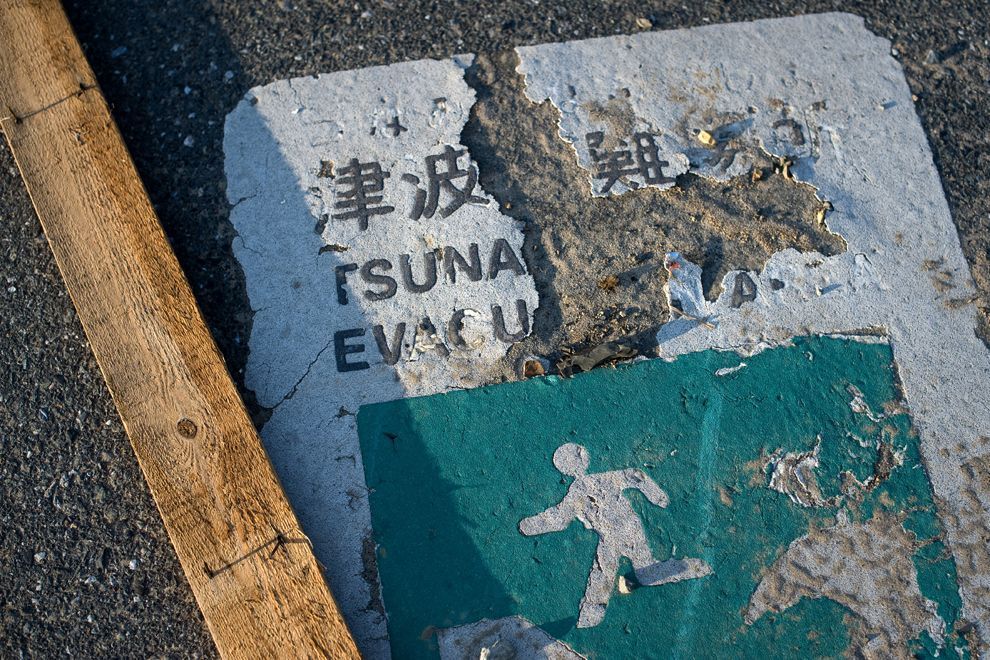
JavaScript and Cookies are required to view this site. Please enable both in your browser settings.
The 2011 Tōhoku Earthquake and Tsunami, Japan. (11 March 2011) -
Documenting Reality Caught on Camera Natural Disasters & Extreme Weather Events The 2011 Tōhoku Earthquake and Tsunami, Japan. (11 March 2011) -

The 2011 Tōhoku Earthquake and Tsunami, Japan. (11 March 2011) - 

Current Rating:

Unlimited Views No Ads No Algorithms Lifetime Account

Documenting Reality

Community Forum · Est. 2006

Join Now
Thread Tools
  #1  
04-26-2011, 12:18 PM
güttsfükk's Avatar
güttsfükk
Offline:
Super *********
Poster Rank:88
Join Date: Nov 2008
Posts: 17,426
 
Mentioned: 5 Post(s)
Quoted: 99 Post(s)
Activity Longevity
0/20 18/20
Today Posts
0/11 ssss17426
The 2011 Tōhoku Earthquake and Tsunami, Japan. (11 March 2011) -

Click image for larger version

Name:	bp6.jpg
Views:	2099
Size:	674.1 KB
ID:	266944


for more threads like this one : http://www.documentingreality.com/fo...me-line-45276/

Click Here To See A List of Tsunami Videos Posted on DR

also check out : http://www.documentingreality.com/fo...regions-73352/


The 2011 Tōhoku earthquake and tsunami (東日本大震災 Higashi Nihon Daishinsai?, literally "Eastern Japan Great Earthquake Disaster"), officially named the Great East Japan Earthquake, was a 9.0-magnitude undersea megathrust earthquake off the coast of Japan that occurred at 14:46 JST (05:46 UTC) on Friday, 11 March 2011. The epicenter was approximately 72 km (45 mi) east of the Oshika Peninsula of Tōhoku, with the hypocenter at an underwater depth of approximately 32 km (19.9 mi). The Japanese government named the disaster resulting from the earthquake and tsunami the "Great Eastern Japan Earthquake" (東日本大震災 Higashi Nihon Daishinsai?). The earthquake triggered extremely destructive tsunami waves of up to 37.9 meters (124 ft) that struck Japan minutes after the quake, in some cases traveling up to 10 km (6 mi) inland, with smaller waves reaching many other countries after several hours. Tsunami warnings were issued and evacuations ordered along Japan's Pacific coast and at least 20 other countries, including the entire Pacific coast of the Americas.

The Japanese National Police Agency has confirmed 14,416 deaths, 5,314 injured, and 11,889 people missing across eighteen prefectures, as well as over 125,000 buildings damaged or destroyed. The earthquake and tsunami caused extensive and severe structural damage in Japan, including heavy damage to roads and railways as well as fires in many areas, and a dam collapse. Around 4.4 million households in northeastern Japan were left without electricity and 1.5 million without water. Many electrical generators were taken down, and at least three nuclear reactors suffered explosions due to hydrogen gas that had built up within their outer containment buildings after cooling system failure. On 18 March, Yukiya Amano—the head of the International Atomic Energy Agency—described the crisis as "extremely serious." Residents within a 20 km (12 mi) radius of the Fukushima I Nuclear Power Plant and a 10 km (6 mi) radius of the Fukushima II Nuclear Power Plant were evacuated. In addition, the U.S. recommended that its citizens evacuate up to 80 km (50 mi) of the plant.

Estimates of the Tōhoku earthquake's magnitude make it the most powerful known earthquake to have hit Japan, and one of the five most powerful earthquakes in the world overall since modern record-keeping began in 1900. Japanese Prime Minister Naoto Kan said, "In the 65 years after the end of World War II, this is the toughest and the most difficult crisis for Japan." The earthquake moved Honshu 2.4 m (7.9 ft) east and shifted the Earth on its axis by almost 10 cm (3.9 in). Early estimates placed insured losses from the earthquake alone at US$14.5 to $34.6 billion. The Bank of Japan offered ¥15 trillion (US$183 billion) to the banking system on 14 March in an effort to normalize market conditions. On 21 March, the World Bank estimated damage between US$122 billion and $235 billion. Japan's government said the cost of the earthquake and tsunami that devastated the northeast could reach $309 billion, making it the most expensive natural disaster on record.

Click image for larger version

Name:	718px-Map_of_Sendai_Earthquake_2011.jpg
Views:	2173
Size:	111.0 KB
ID:	266922
Map of the Tōhoku earthquake and aftershocks on March 11. - 14. The size of the circles is a function of magnitude, and the color indicates the date: light green: March 11; yellow: March 12; orange: March 13; red: March 14.

Earthquake

The 9.0-magnitude (MW) undersea megathrust earthquake occurred on 11 March 2011 at 14:46 JST (05:46 UTC) in the western Pacific Ocean at a relatively shallow depth of 32 km (19.9 mi), with its epicenter approximately 72 km (45 mi) east of the Oshika Peninsula of Tōhoku, Japan, lasting approximately six minutes. The nearest major city to the quake was Sendai, on the main island of Honshu, 130 km (81 mi) away. The quake occurred 373 km (232 mi) from Tokyo. The main earthquake was preceded by a number of large foreshocks, and hundreds of aftershocks were reported. The first major foreshock was a 7.2 MW event on 9 March, approximately 40 km (25 mi) from the location of the 11 March quake, with another three on the same day in excess of 6.0 MW. Following the quake, a 7.0 MW aftershock was reported at 15:06 JST, followed by a 7.4 at 15:15 JST and a 7.2 at 15:26 JST. Over eight hundred aftershocks of magnitude 4.5 or greater have occurred since the initial quake. United States Geological Survey (USGS) director Marcia McNutt explained that aftershocks follow Omori's Law, might continue for years, and will taper off in time.

One minute before the earthquake was felt in Tokyo, the Earthquake Early Warning system, which includes more than 1,000 seismometers in Japan, sent out warnings of impending strong shaking to millions. The early warning is believed by the Japan Meteorological Agency (JMA) to have saved many lives.

Initially reported as 7.9 MW by the USGS, the magnitude was quickly upgraded to 8.8, then again to 8.9, and then finally to 9.0.

Energy

This earthquake released a surface energy (Me) of 1.9±0.5×10¹⁷ joules, dissipated as shaking and tsunamic energy, which is nearly double that of the 9.1-magnitude 2004 Indian Ocean earthquake and tsunami that killed 230,000 people. "If we could only harness the [surface] energy from this earthquake, it would power [a] city the size of Los Angeles for an entire year," McNutt said in an interview. The total energy released, also known as the seismic moment (M0), was more than 200,000 times the surface energy and was calculated by the USGS at 3.9×10²² joules, slightly less than the 2004 Indian Ocean quake. This is equivalent to 9,320 gigatons of TNT, or approximately 600 million times the energy of the Hiroshima bomb.

Japan's National Research Institute for Earth Science and Disaster Prevention (NIED) calculated a peak ground acceleration of 2.99 g (29.33 m/s²). The largest individual recording in Japan was 2.7g, in the Miyagi Prefecture, 75 km from the epicentre; the highest reading in the Tokyo metropolitan area was 0.16g.


Geophysical impacts

The quake moved portions of northeast Japan by as much as 2.4 m (7.9 ft) closer to North America, making portions of Japan's landmass wider than before. Portions of Japan closest to the epicenter experienced the largest shifts. A 400 km (250 mi) stretch of coastline dropped vertically by 0.6 m (2.0 ft), allowing the tsunami to travel farther and faster onto land. One early estimate suggested that the Pacific plate may have moved westwards by up to 20 m (66 ft), and another early estimate put the amount of slippage at as much as 40 m (130 ft). On 6 April the Japanese coast guard said that the quake shifted the seabed near the epicenter 24 meters (79 ft.) and elevated the seabed off the coast of Miyagi prefecture by 3 meters.

The earthquake shifted the Earth's axis by 25 cm (9.8 in). This deviation led to a number of small planetary changes, including the length of a day and the tilt of the Earth. The speed of the Earth's rotation increased, shortening the day by 1.8 microseconds due to the redistribution of Earth's mass. The axial shift was caused by the redistribution of mass on the Earth's surface, which changed the planet's moment of inertia. Because of conservation of angular momentum, such changes of inertia result in small changes to the Earth's rate of rotation. These are expected changes for an earthquake of this magnitude.

Soil liquefaction was evident in areas of reclaimed land around Tokyo, particularly in Urayasu, Chiba City, Funabashi, Narashino (all in Chiba Prefecture) and in the Koto, Edogawa, Minato, Chūō, and Ōta Wards of Tokyo. Approximately 30 homes or buildings were destroyed and 1,046 other buildings were damaged to varying degrees. Nearby Haneda Airport, built mostly on reclaimed land, was not damaged. Odaiba also experienced liquefaction, but damage was minimal.

Shinmoedake, a volcano in Kyushu, erupted two days after the earthquake. The volcano had previously erupted in January 2011; it is not known if the later eruption was linked to the earthquake. In Antarctica, the seismic waves from the earthquake were reported to have caused the Whillans Ice Stream to slip by about 0.5 m (1.6 ft).


Aftershocks

Japan experienced over 900 aftershocks since the earthquake with about 60 being over 6.0 M and three over 7.0 M. A 7.7 M and a 7.9 M quake occurred on March 11 and the third one on 7 April 2011, with a disputed magnitude. Its epicenter was underwater, 66 km (41 mi) off the coast of Sendai. The Japan Meteorological Agency assigned a magnitude of 7.4, while the U.S. Geological Survey lowered it to 7.1. At least four people were killed, and electricity was cut off across much of northern Japan including the loss of external power to Higashidori Nuclear Power Plant and Rokkasho Reprocessing Plant.

Click image for larger version

Name:	2011_tsunami_wave_height.jpg
Views:	1868
Size:	2.35 MB
ID:	266921
Calculated wave height of the 2011 tsunami originating near Sendai, Japan (from NOAA computer model).


Tsunami

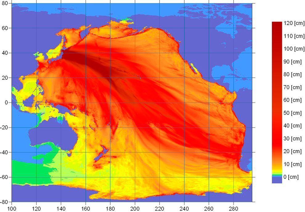
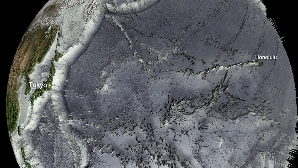
The earthquake which was caused by 5 to 8 meters upthrust on 180-km wide seabed at 60 km offshore from the east coast of Tōhoku resulted in a major tsunami which brought destruction along the Pacific coastline of Japan's northern islands and resulted in the loss of thousands of lives and devastated entire towns. The tsunami propagated across the Pacific, and warnings were issued and evacuations carried out. In many countries bordering the Pacific, including the entire Pacific coast of North and South America from Alaska to Chile; however, while the tsunami was felt in many of these places, it caused only relatively minor effects. Chile's section of Pacific coast is one of the furthest from Japan, at about 17,000 km (11,000 mi) away, but still was struck by tsunami waves 2 m (6.6 ft) high. A wave height of 37.9 meters (124 ft) was estimated at Tarō, Iwate.

Japan

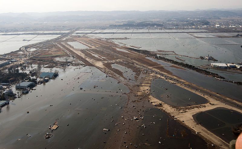
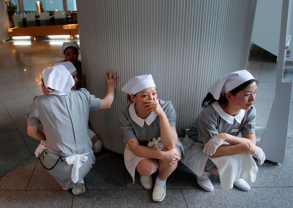
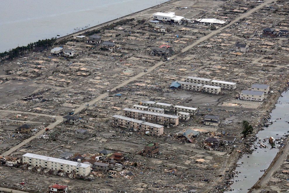
The tsunami warning issued by the Japan Meteorological Agency was the most serious on its warning scale; it rated as a "major tsunami", being at least 3 m (9.8 ft) high. The actual height predicted varied, the greatest being for Miyagi at 10 m (33 ft) high. The tsunami inundated a total area of approximately 470 km2 (181.5 sq mi) in Japan.

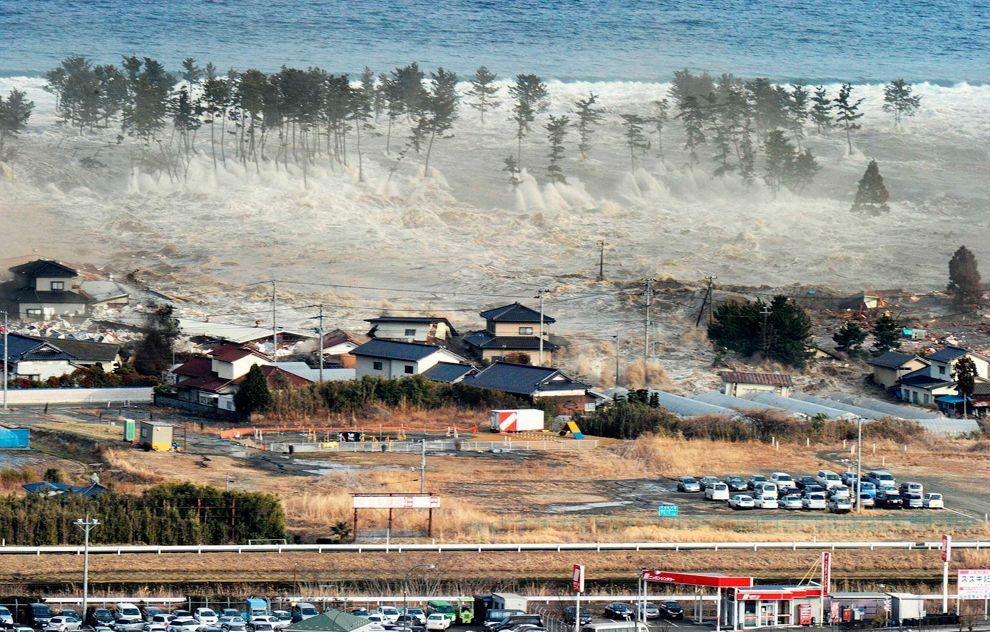
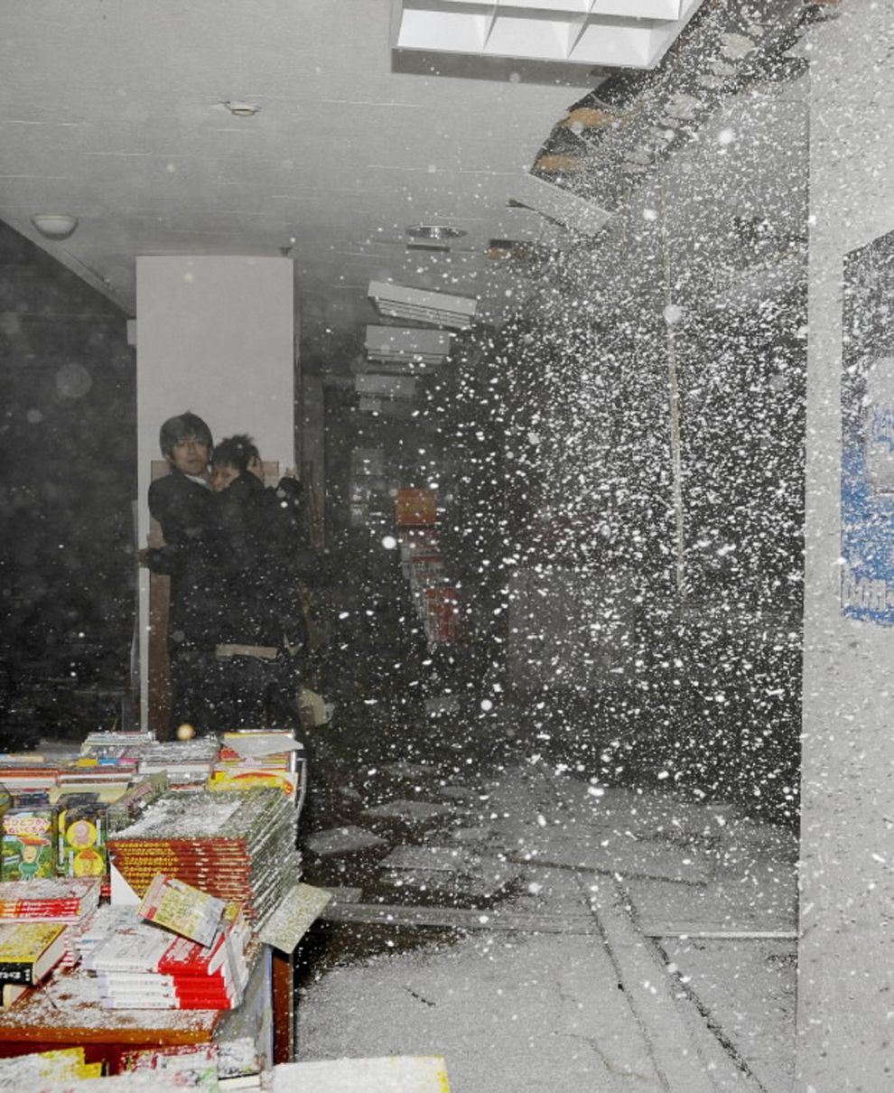
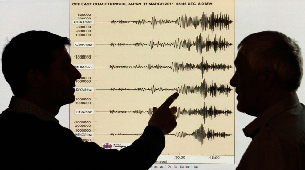
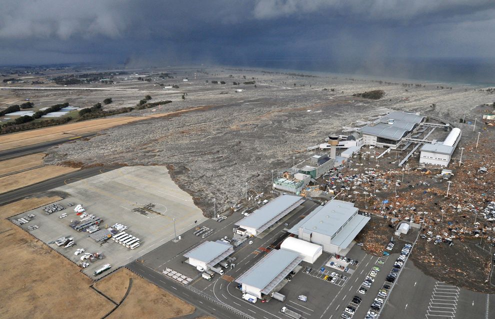
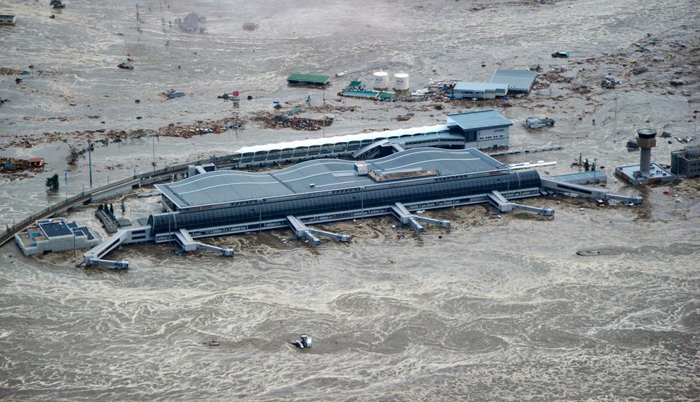
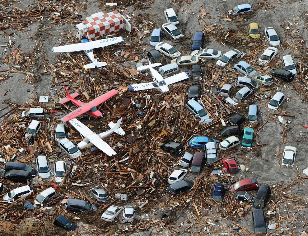
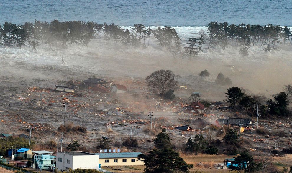
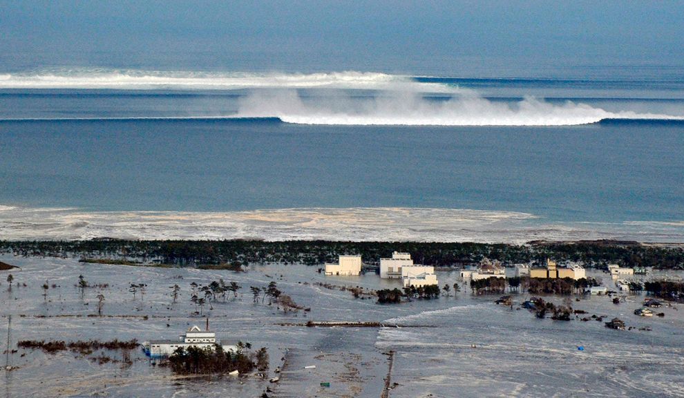
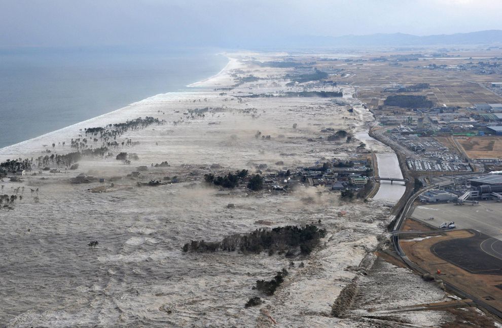
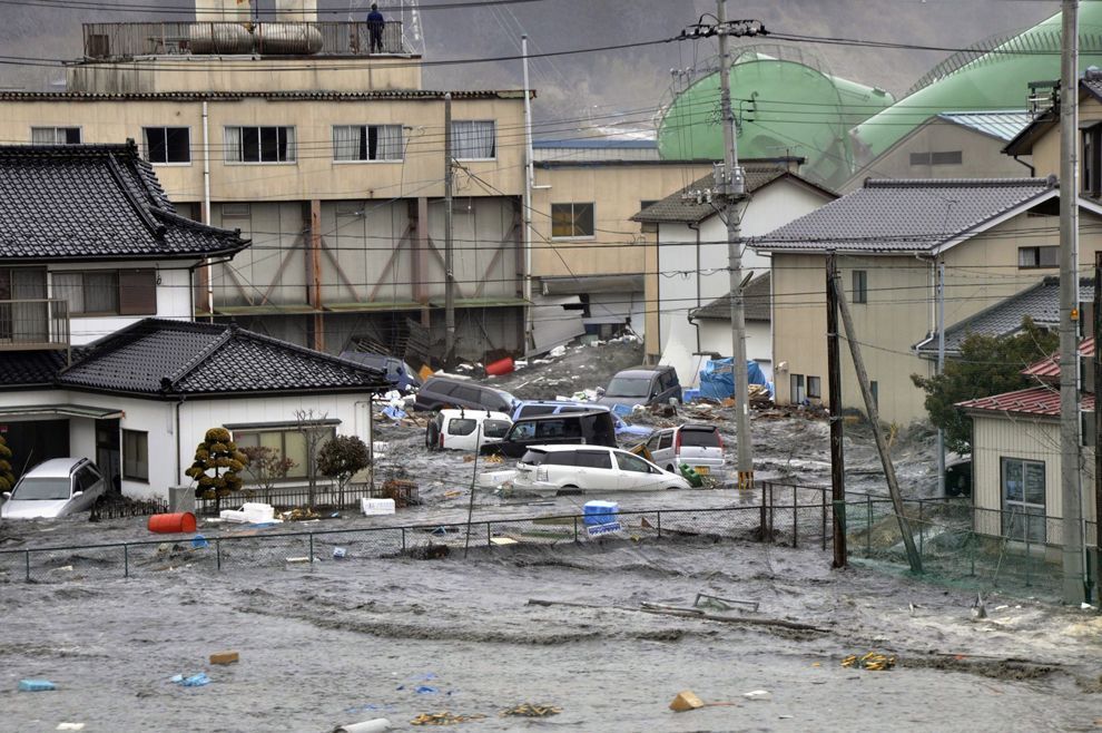
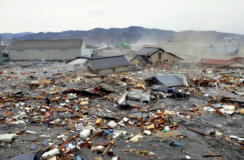
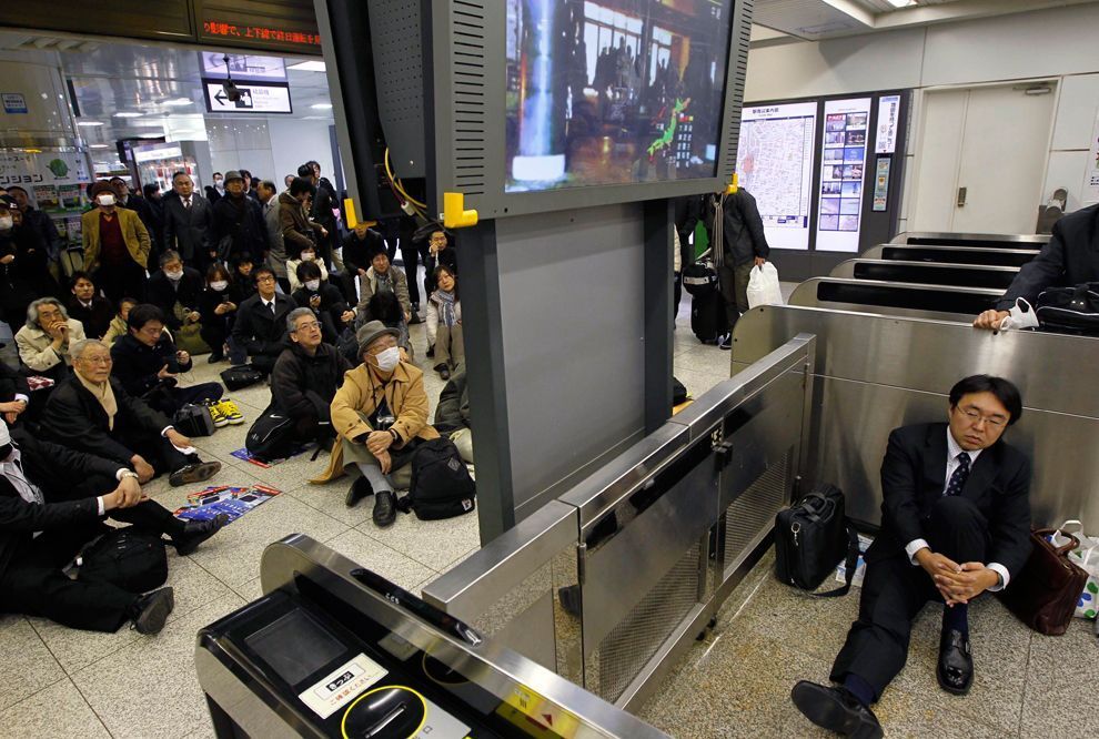
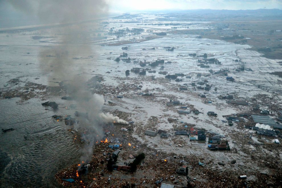
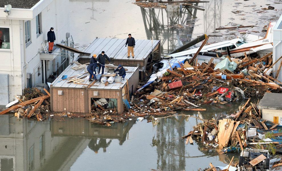
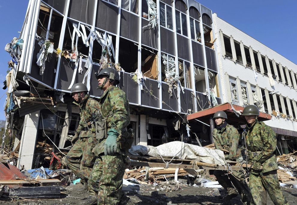
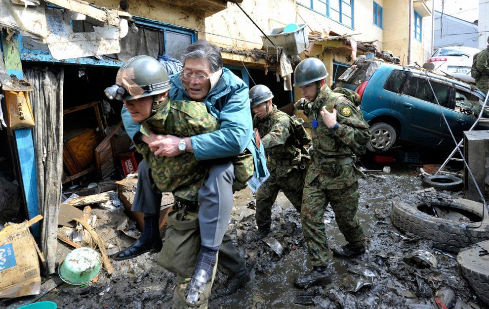
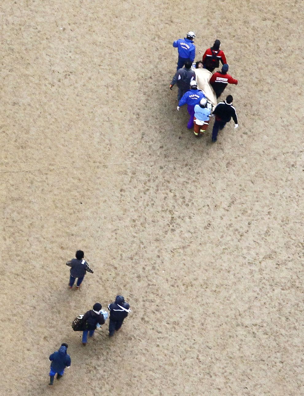
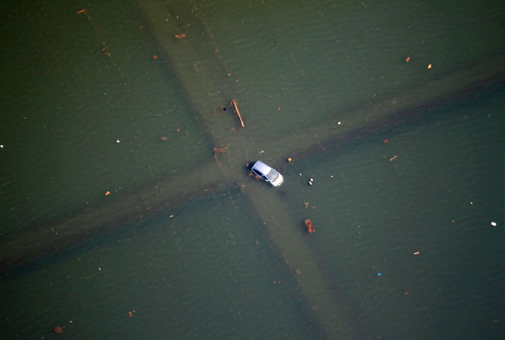
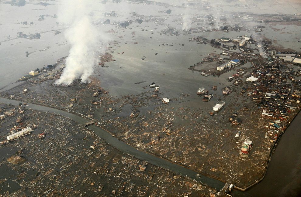
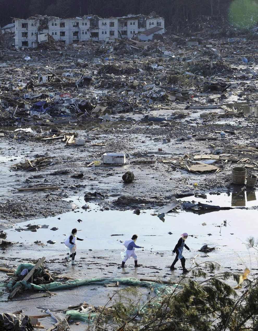
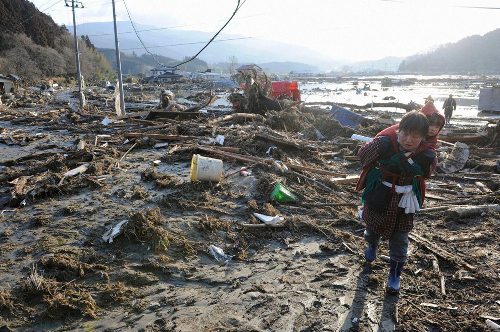
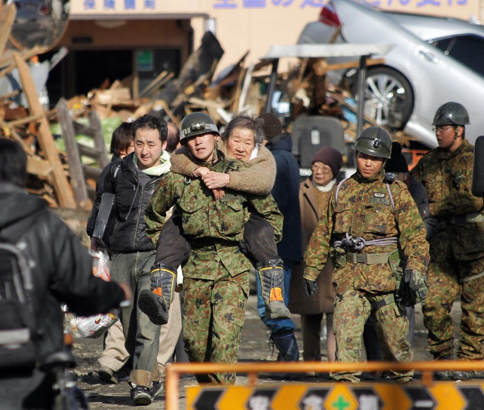
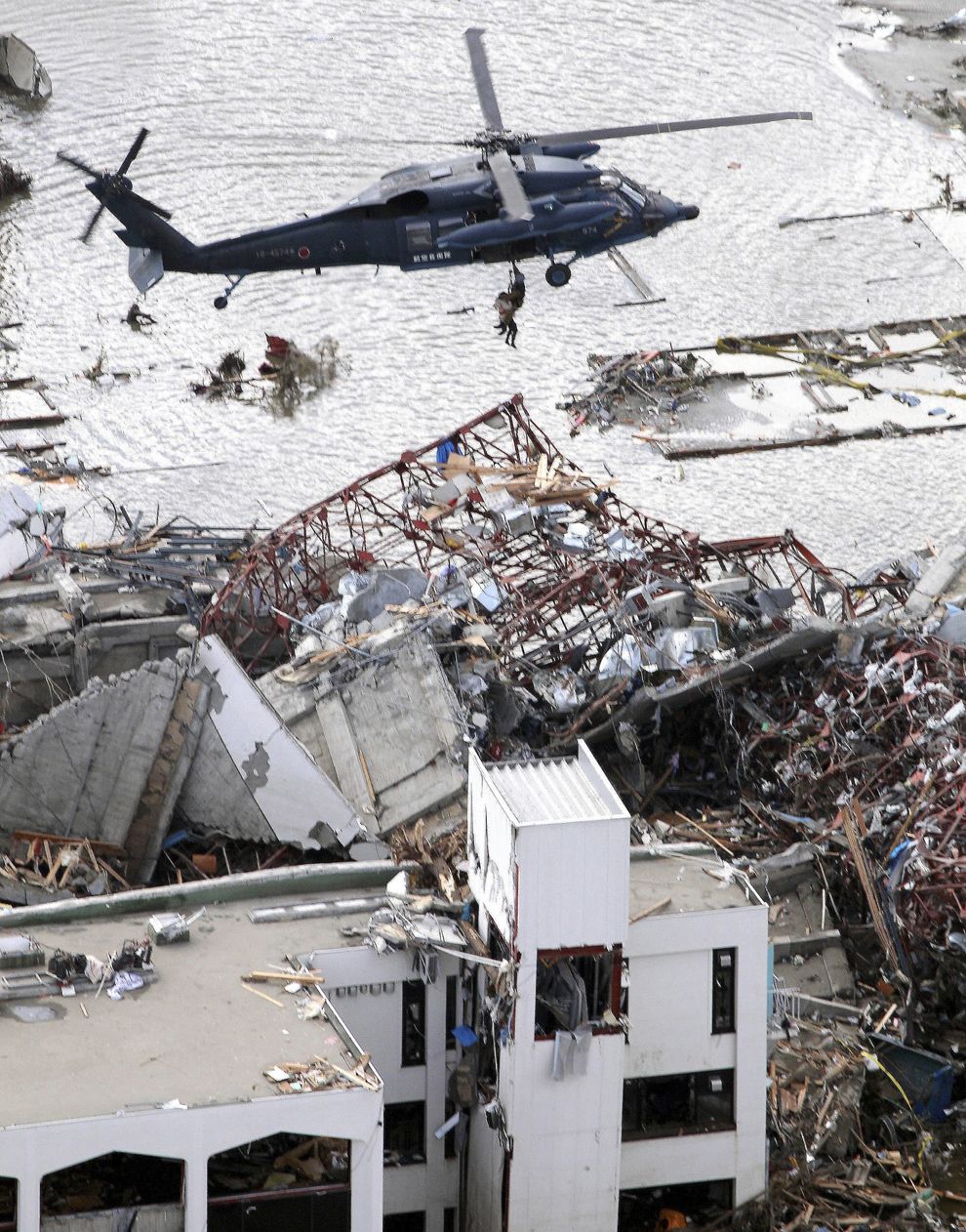
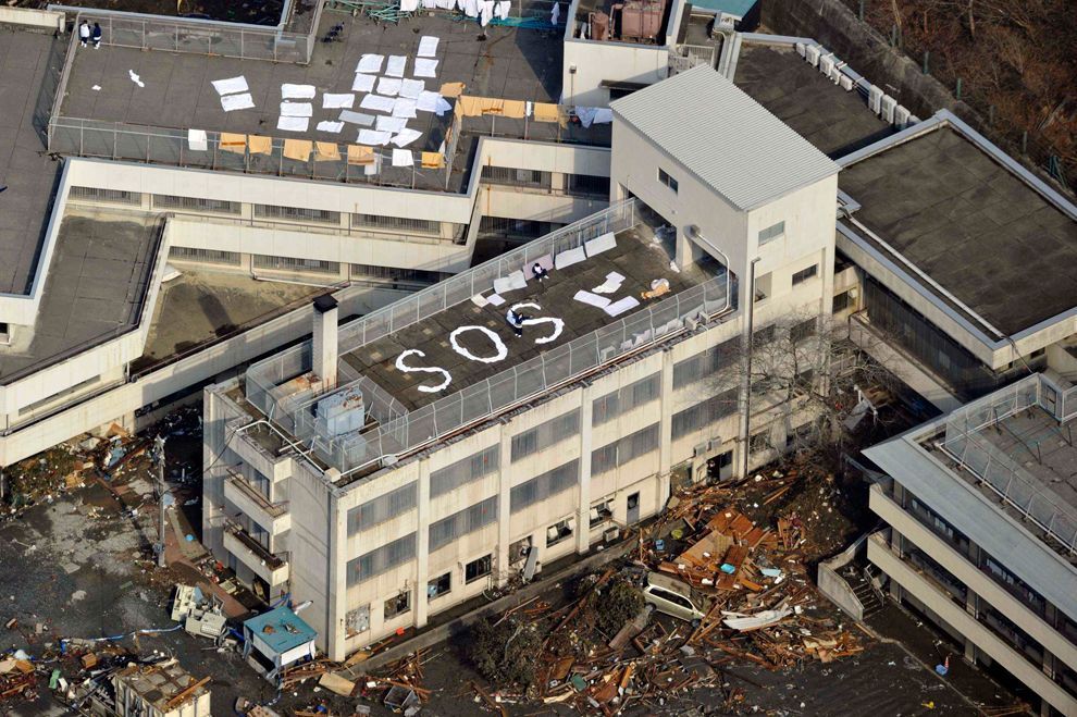
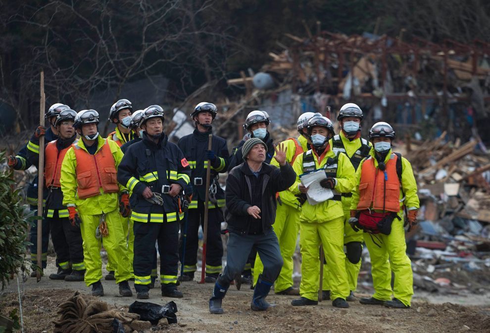
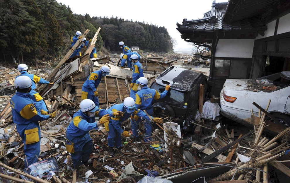
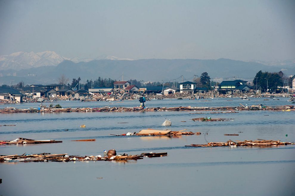
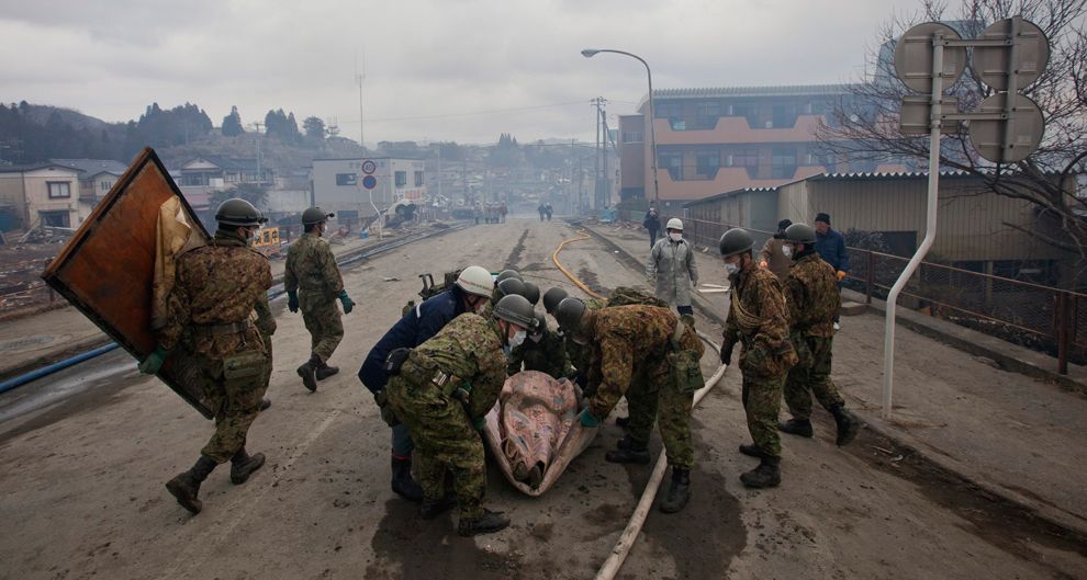
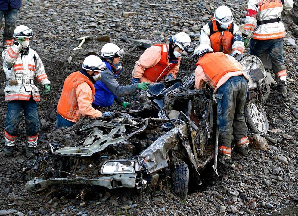
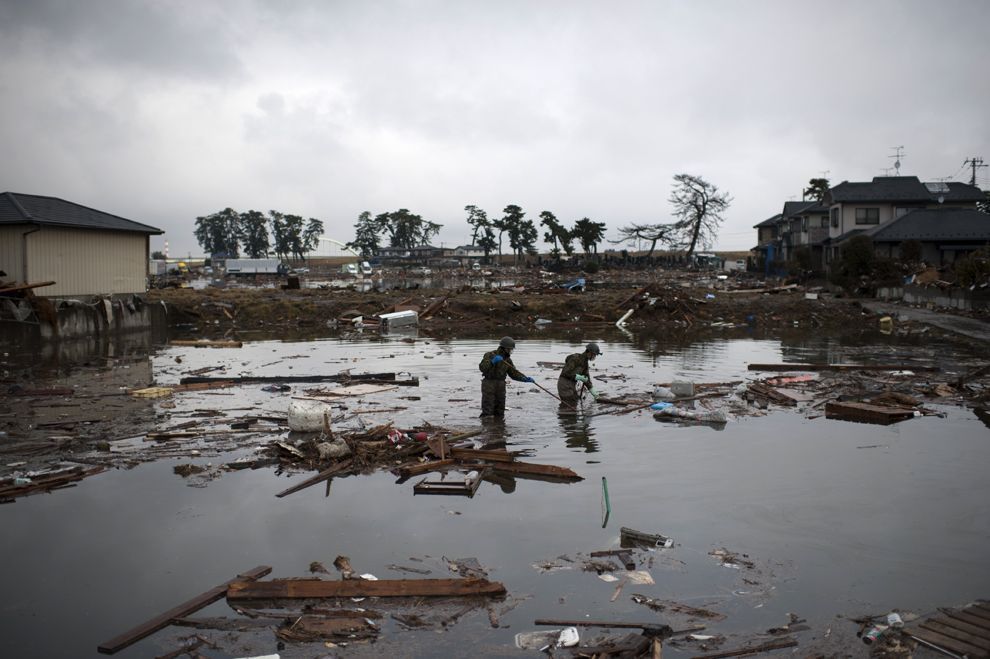
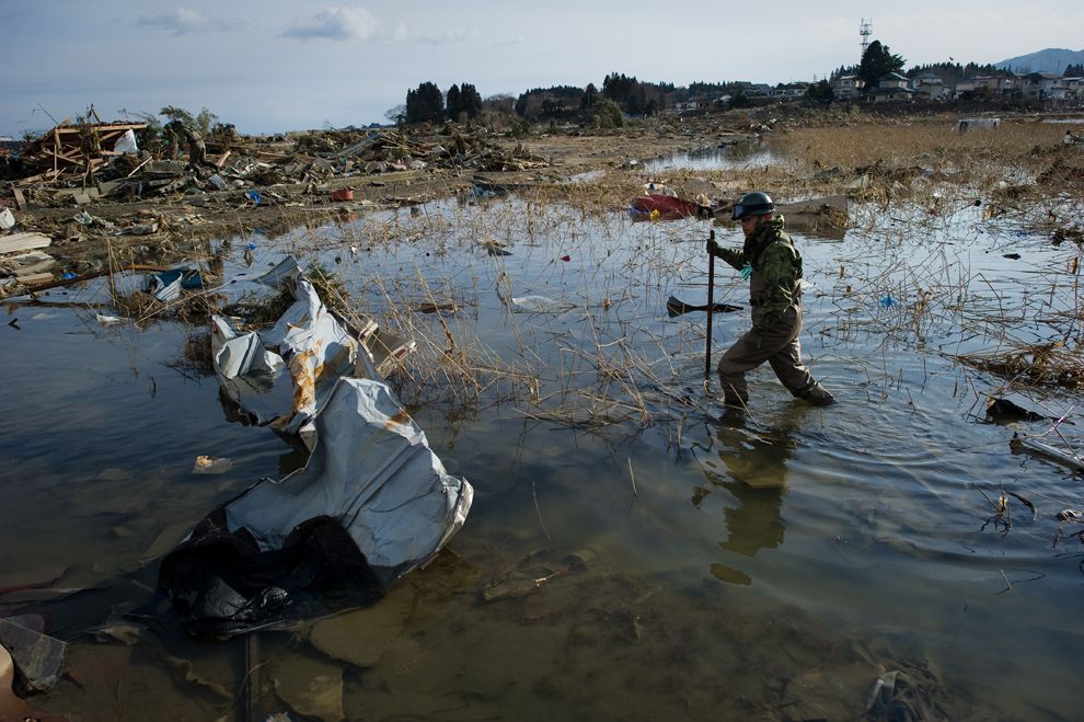
The earthquake took place at 14:46 JST around 67 km (42 mi) from the nearest point on Japan's coastline, and initial estimates indicated the tsunami would have taken 10 to 30 minutes to reach the areas first affected, and then areas further north and south based on the geography of the coastline. Just over an hour after the earthquake at 15:55 JST, a tsunami was observed flooding Sendai Airport, which is located near the coast of Miyagi Prefecture, with waves sweeping away cars and planes and flooding various buildings as they traveled inland. The impact of the tsunami in and around Sendai Airport was filmed by an NHK News helicopter, showing a number of vehicles on local roads trying to escape the approaching wave and being engulfed by it. A 4 m high tsunami hit Iwate Prefecture. Wakabayashi Ward in Sendai was also particularly hard hit. At least 101 designated tsunami evacuation sites were hit by the wave.

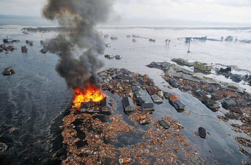
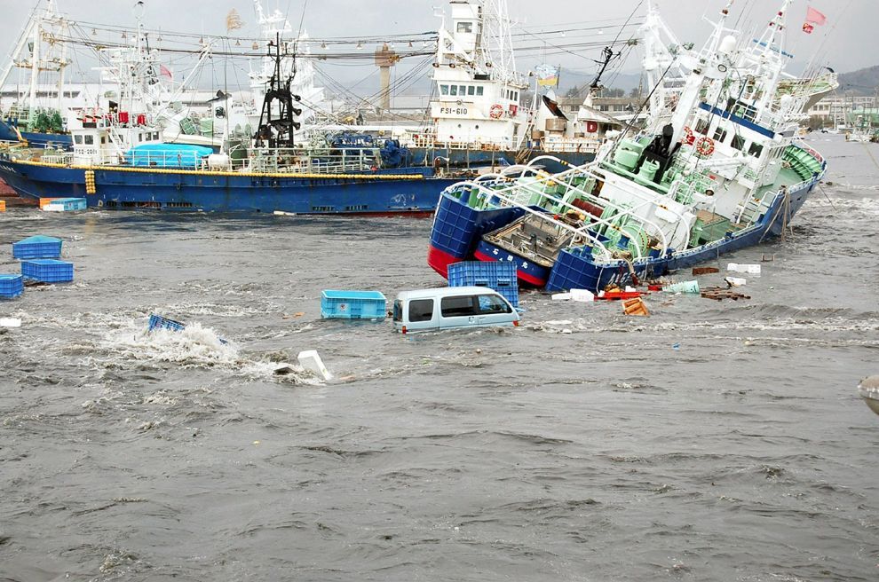
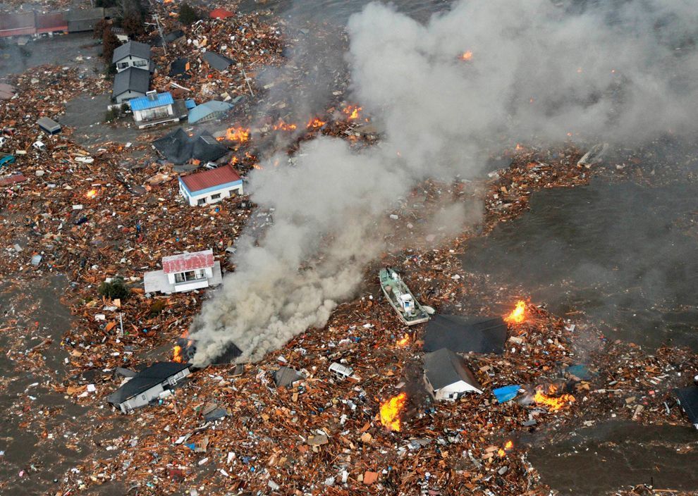
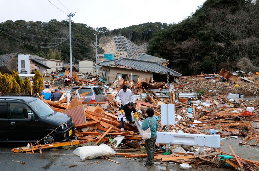
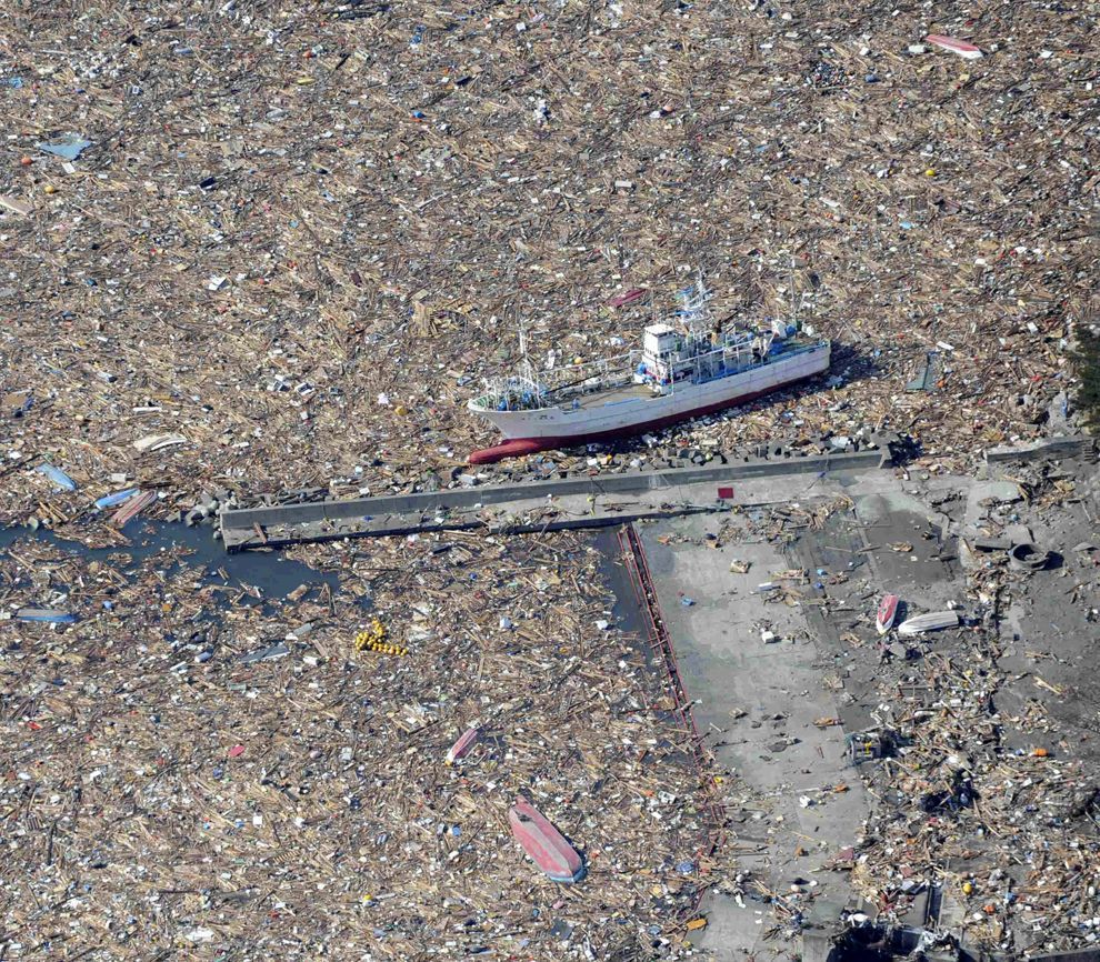
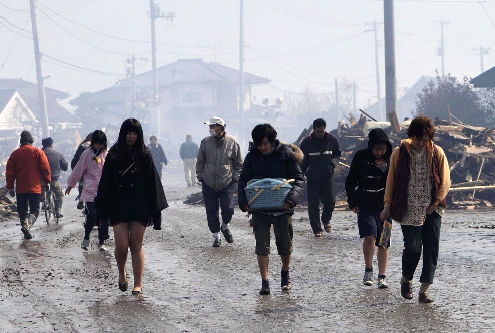
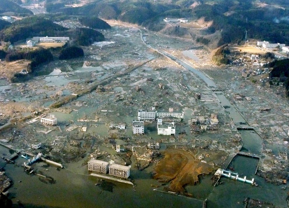
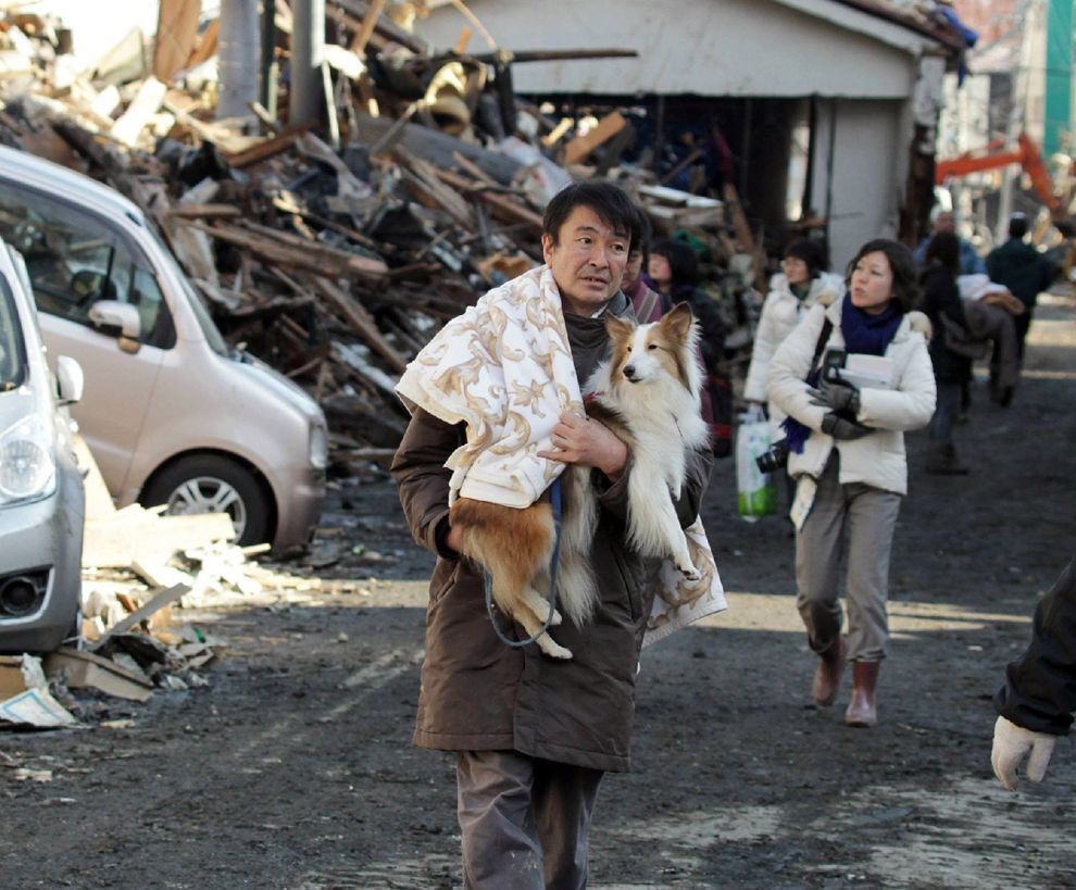
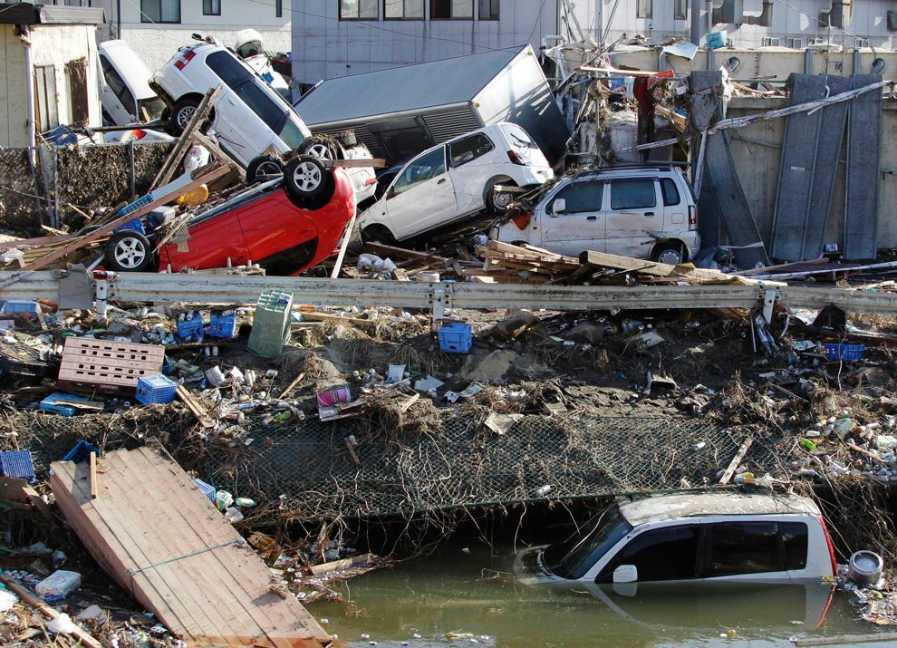
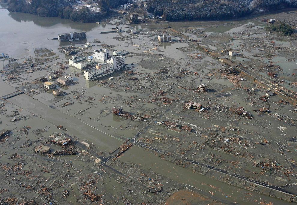
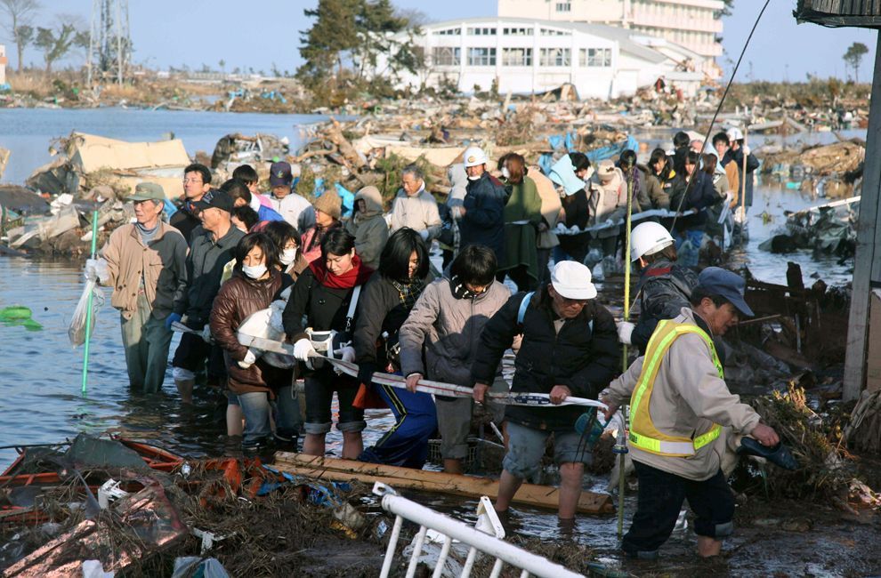
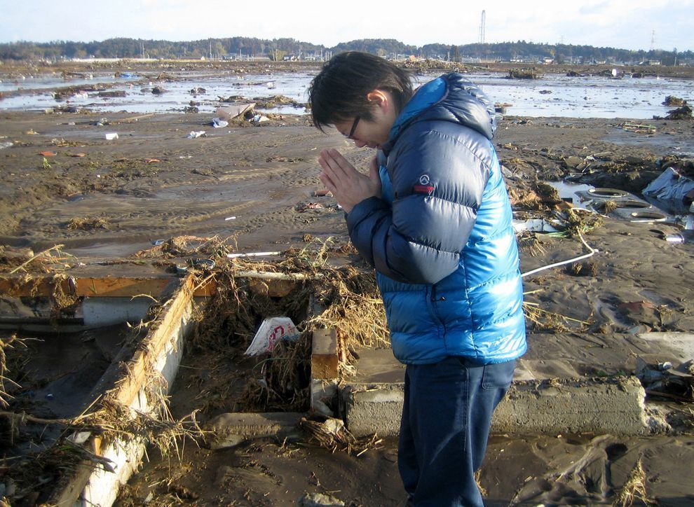
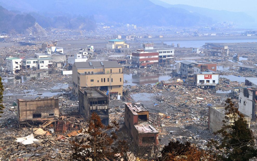
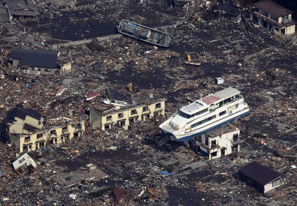
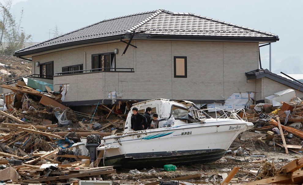
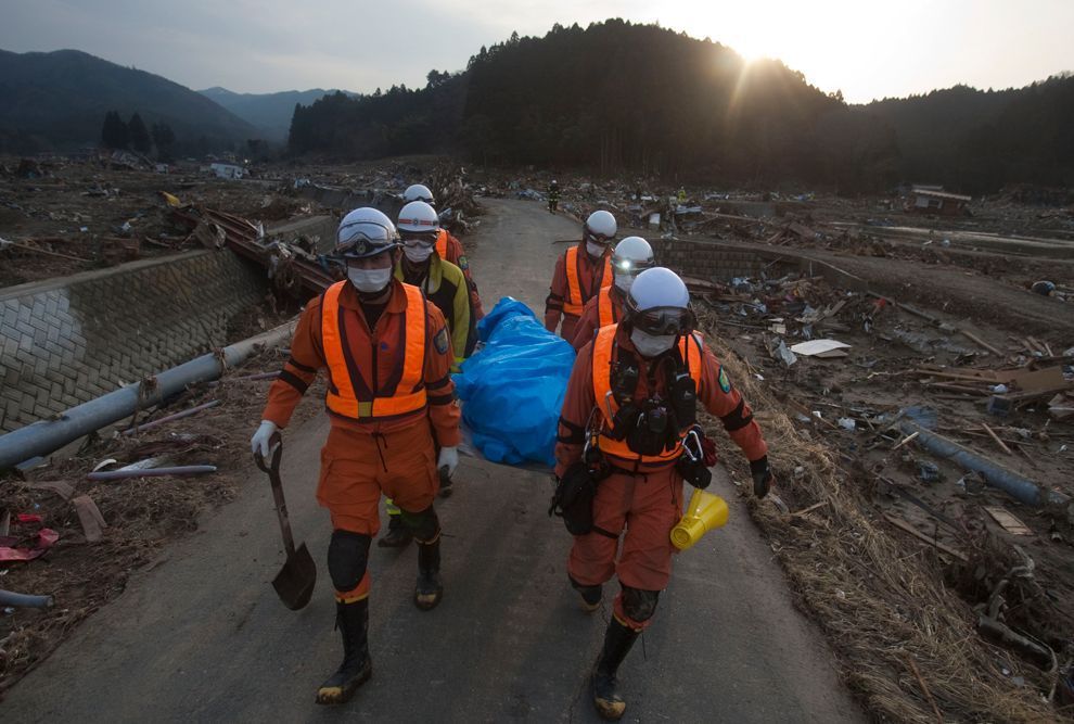
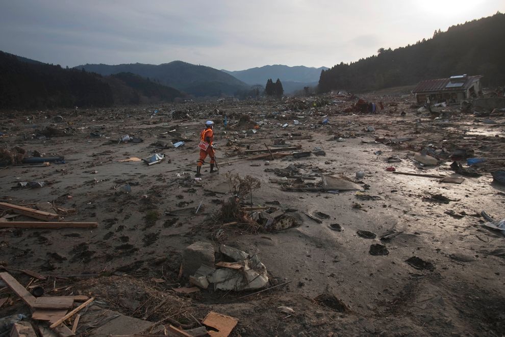
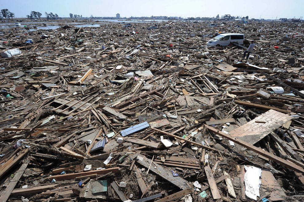
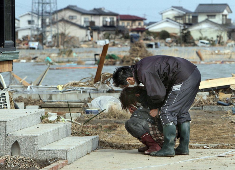
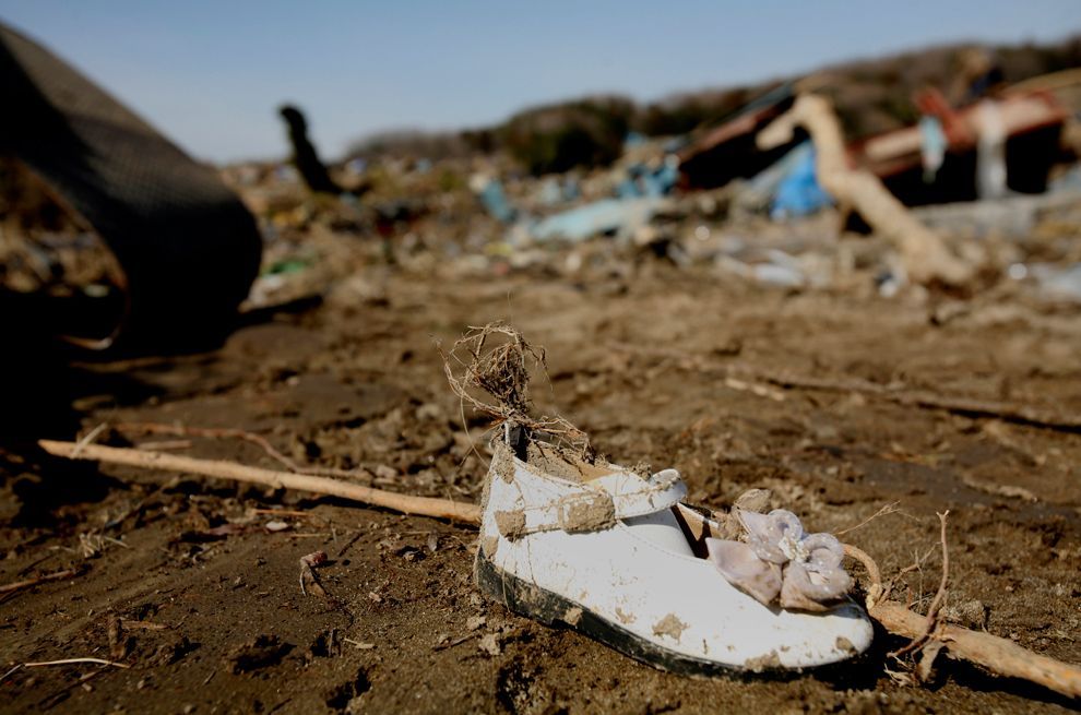
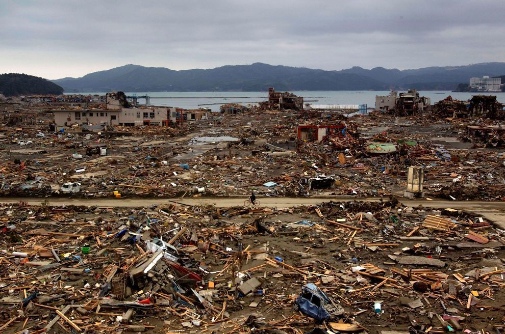
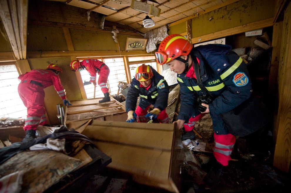
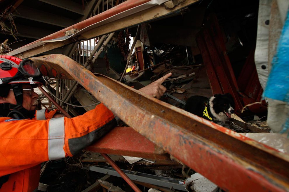
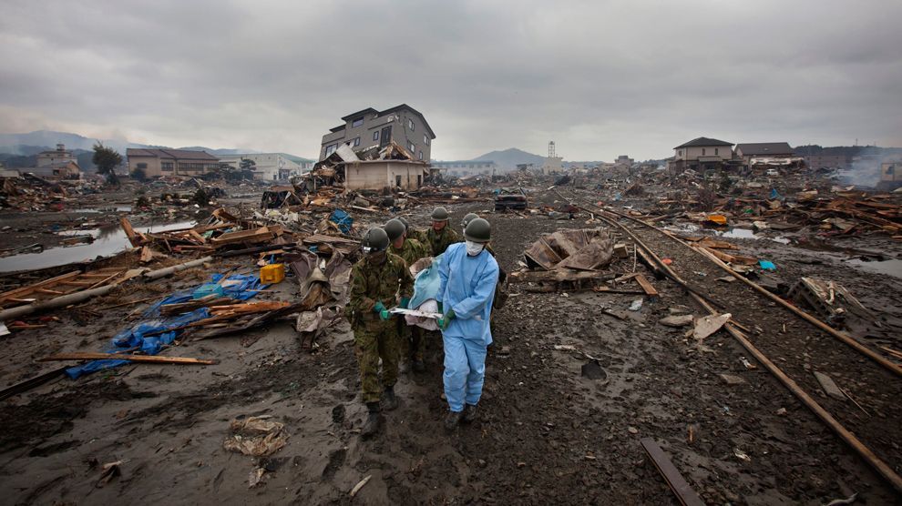
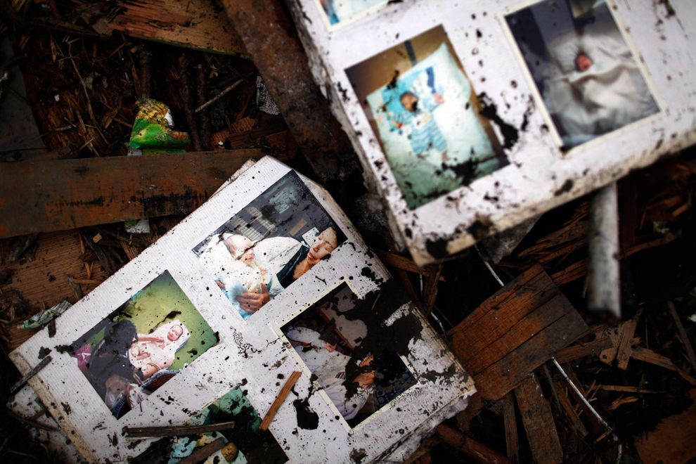
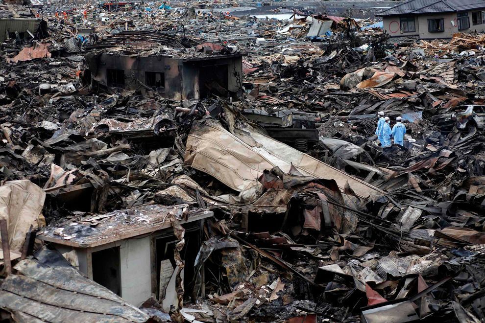
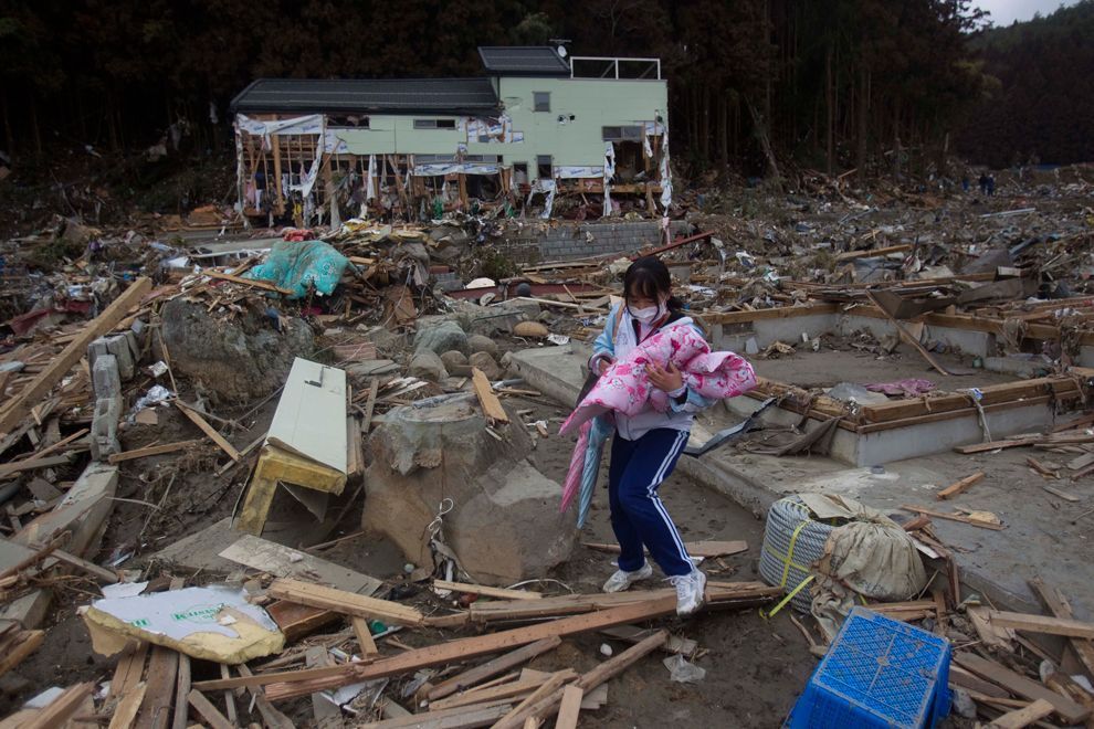
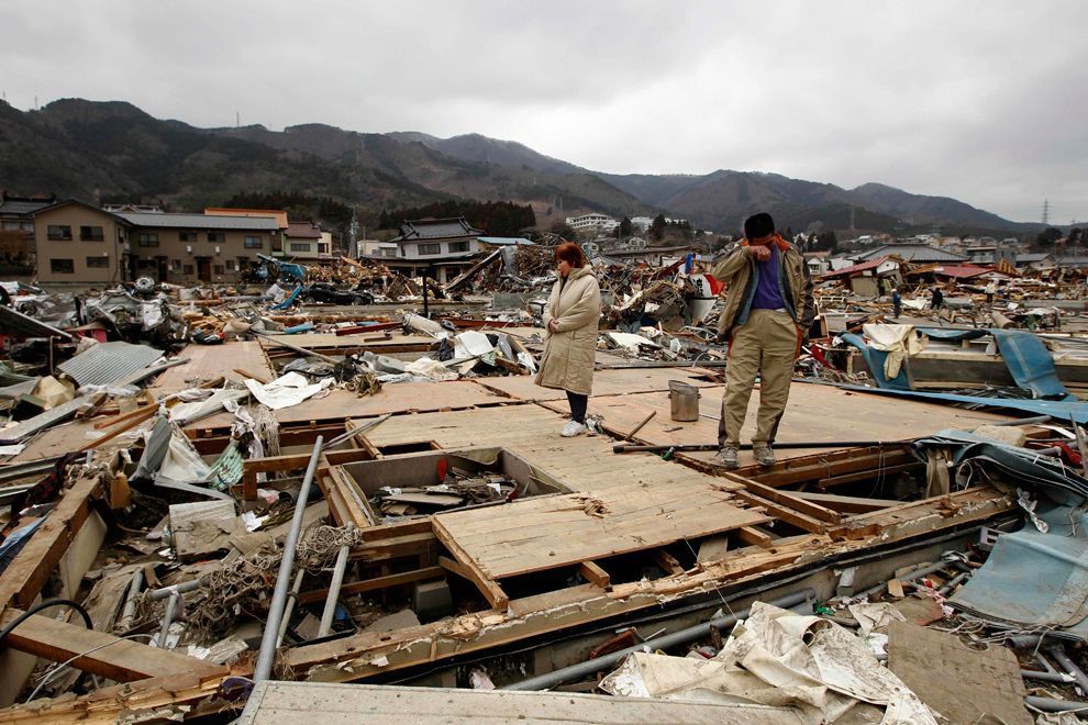
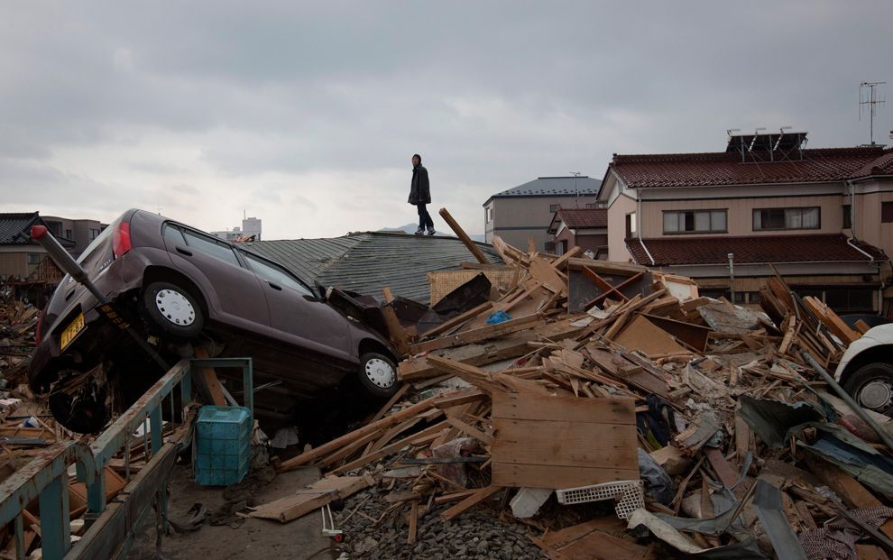
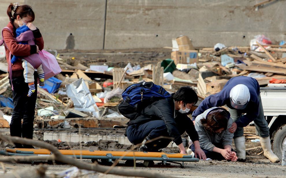
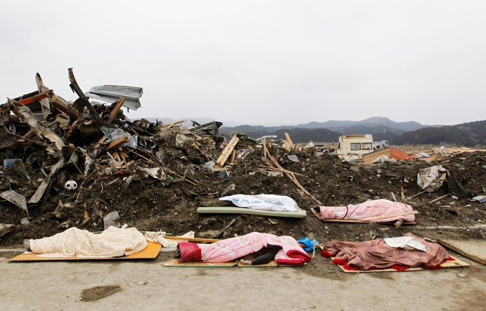
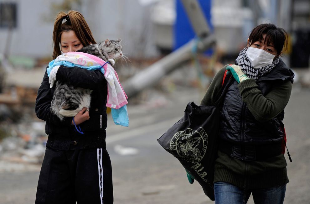
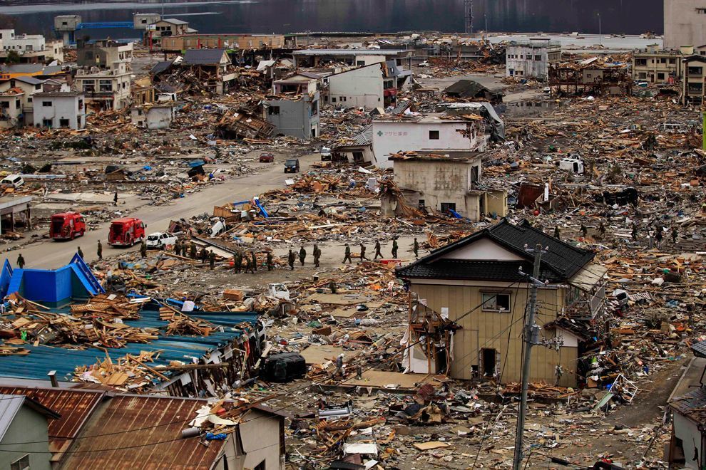
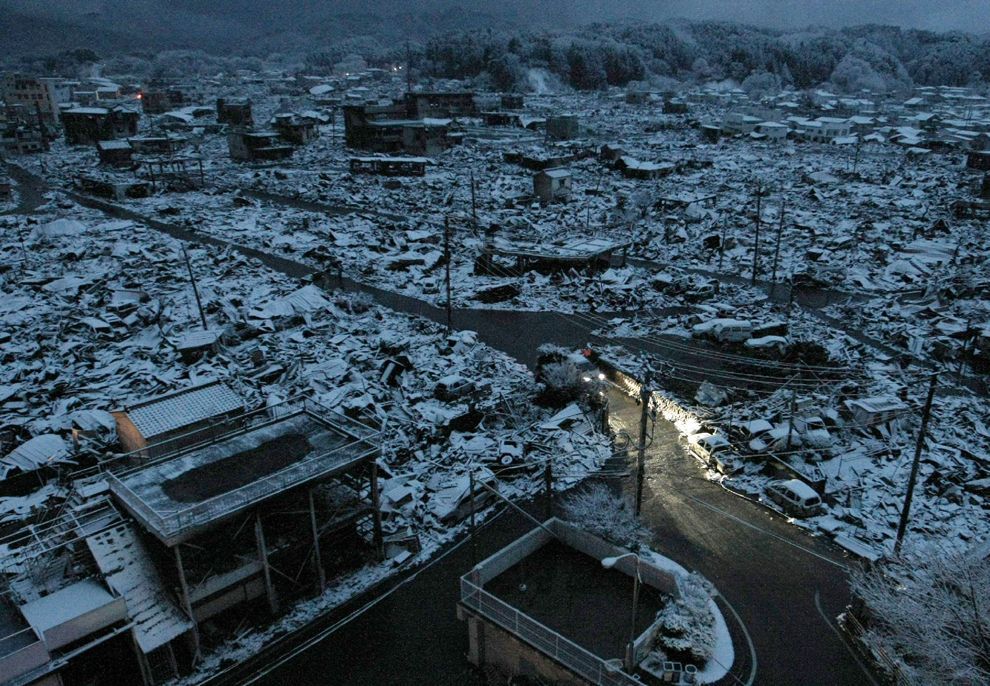
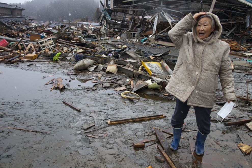
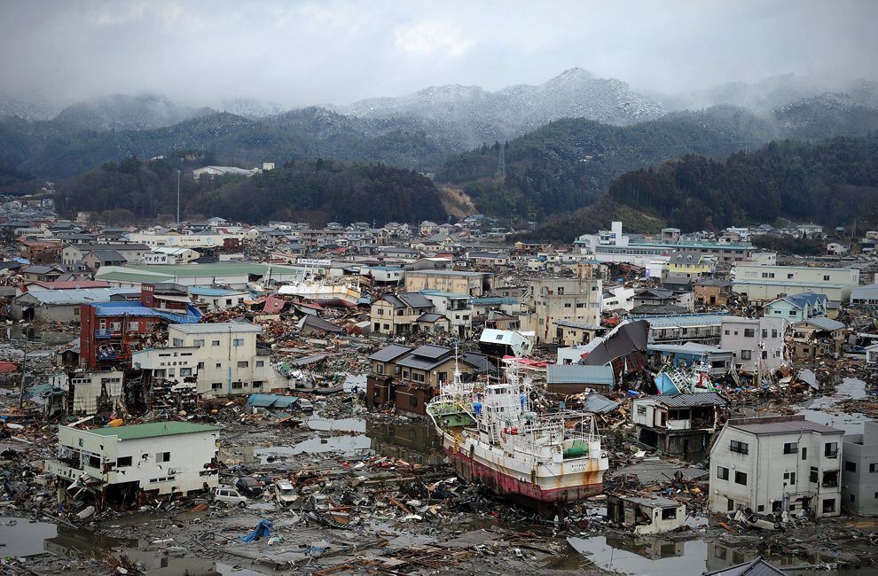
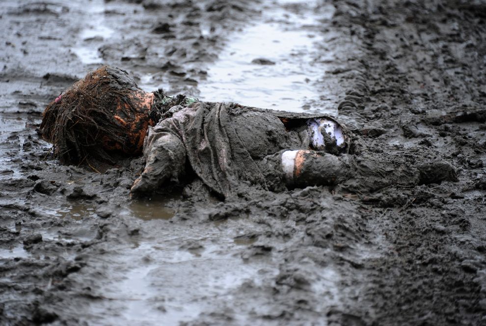
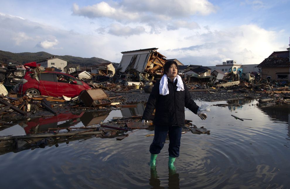
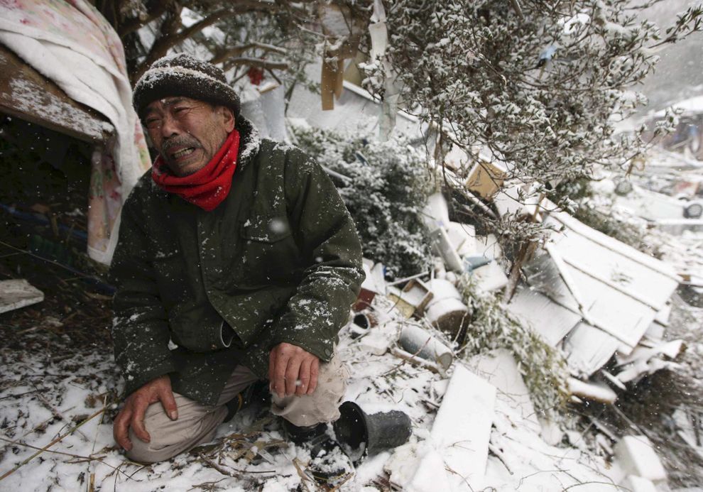
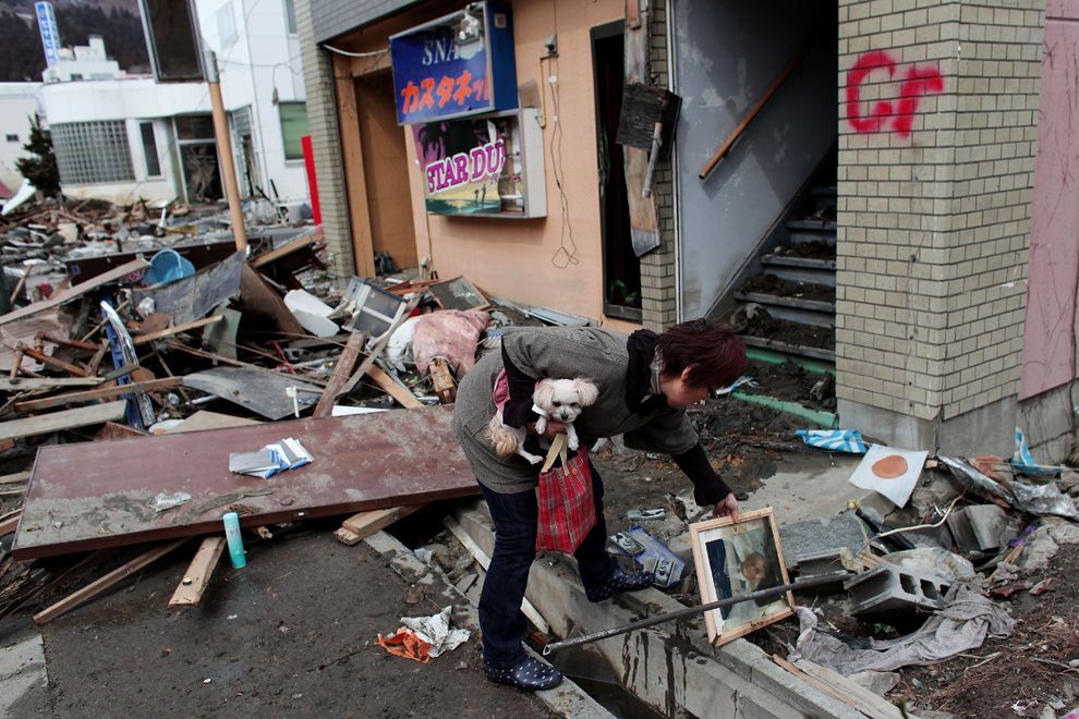
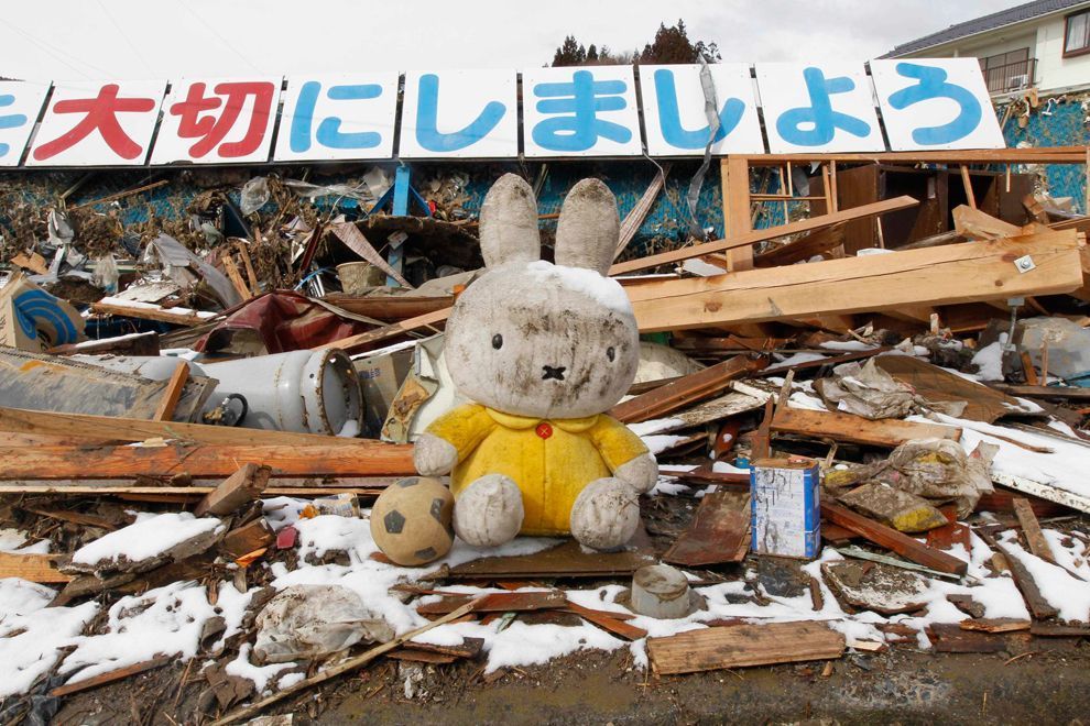
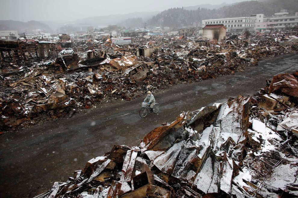
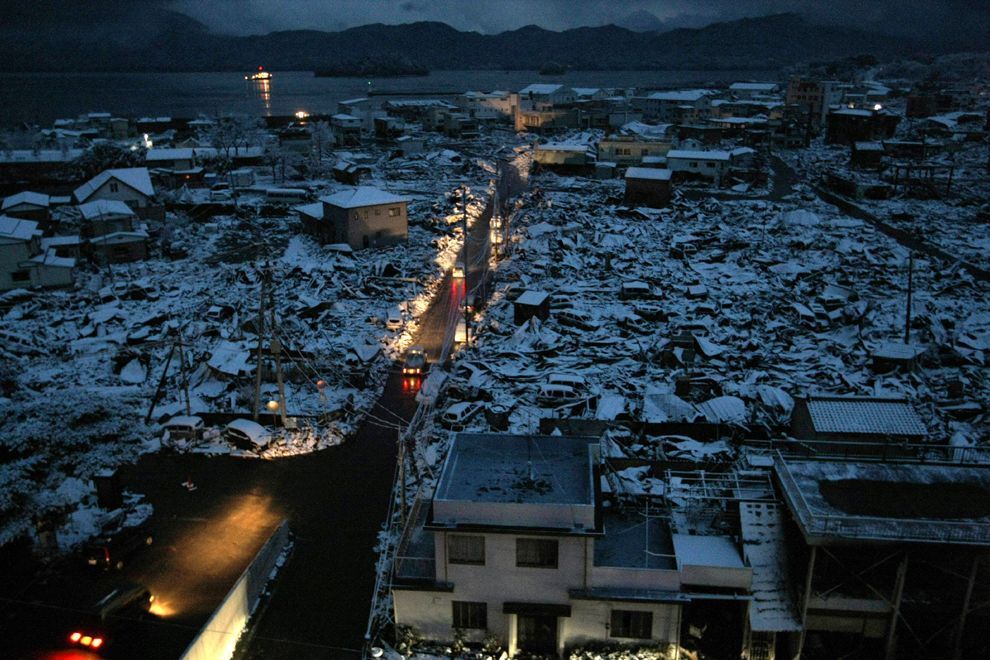
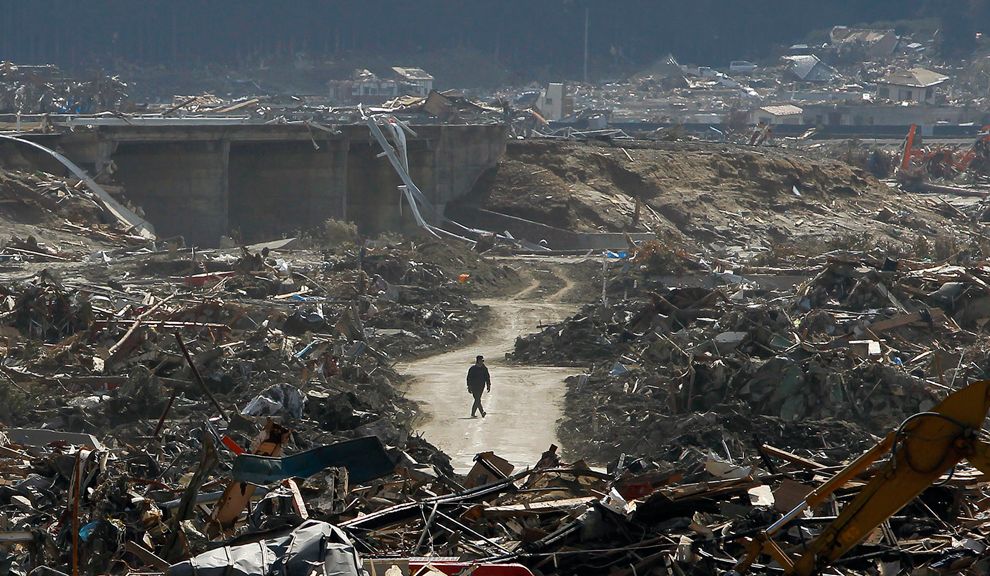
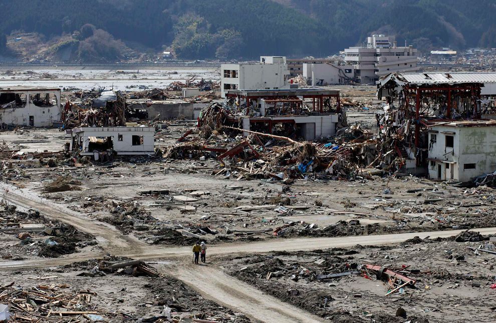
Like the 2004 Indian Ocean earthquake and tsunami, the damage by surging water, though much more localized, was far more deadly and destructive than the actual quake. There were reports of entire towns destroyed from tsunami-hit areas in Japan, including 9,500 missing in Minamisanriku; one thousand bodies had been recovered in the town by 14 March 2011.

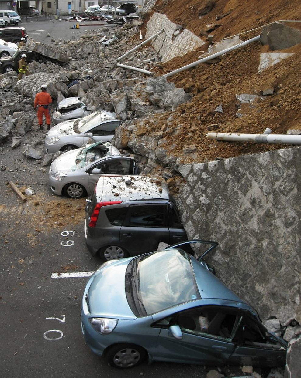
Among several factors causing the high death toll from the tsunami, one was the unexpectedly large size of the water surge. The tsunami walls at several of the affected cities were based on much smaller tsunami heights. Also, many people caught in the tsunami thought that they were located on high enough ground to be safe.

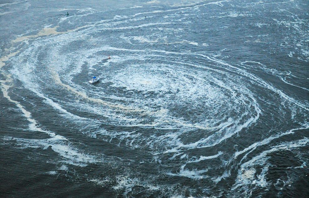
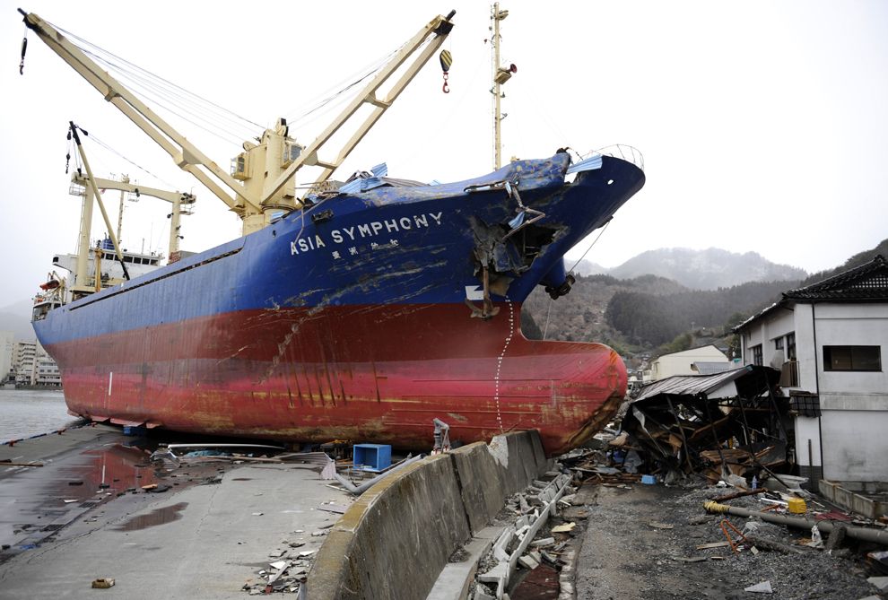
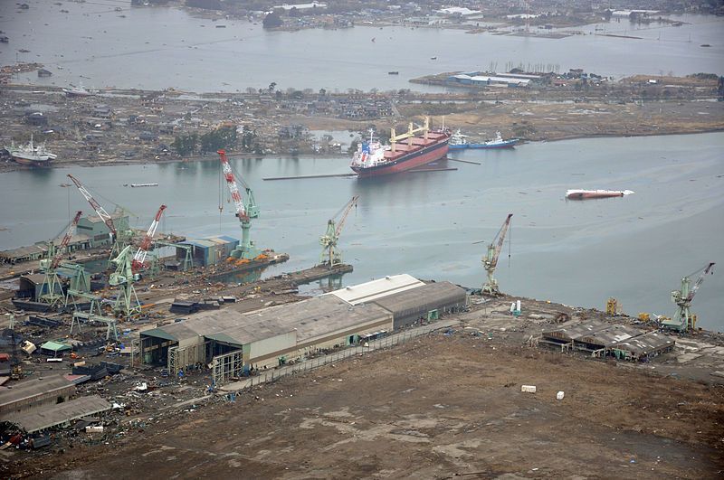
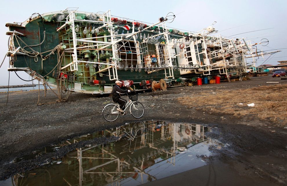
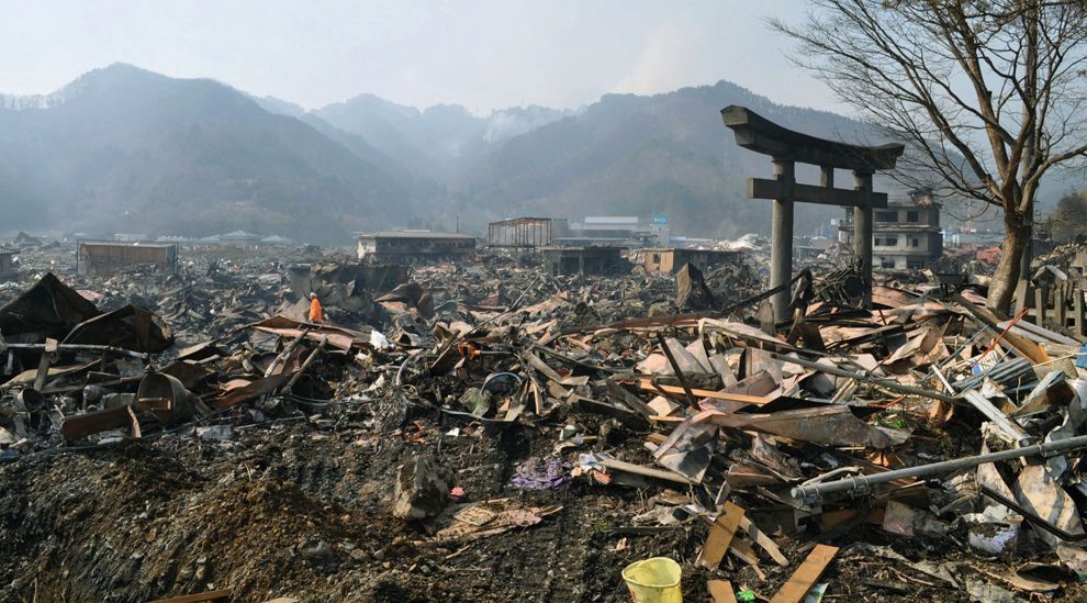
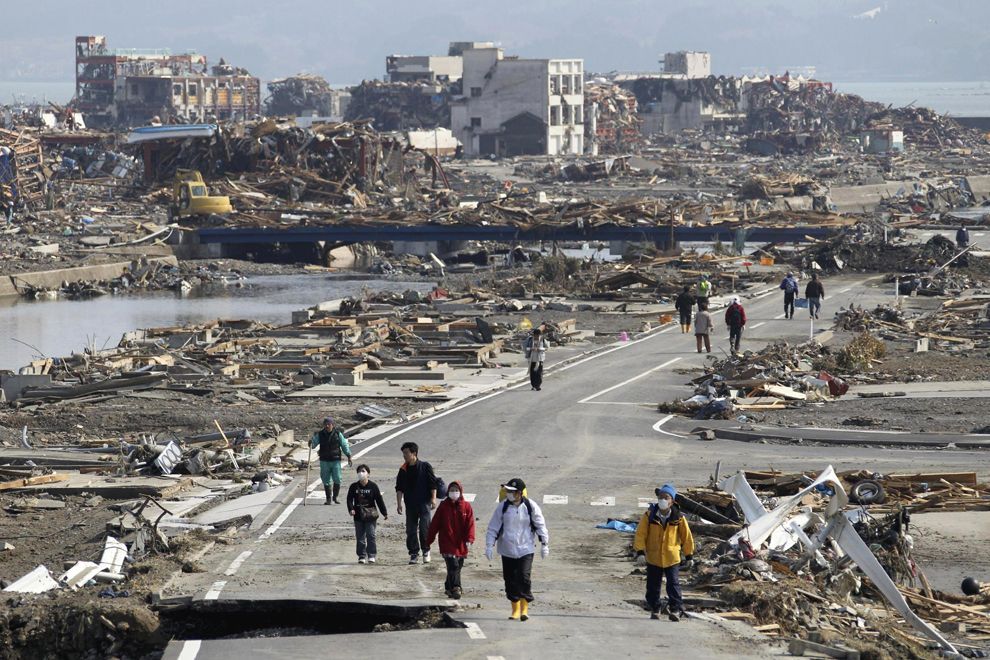
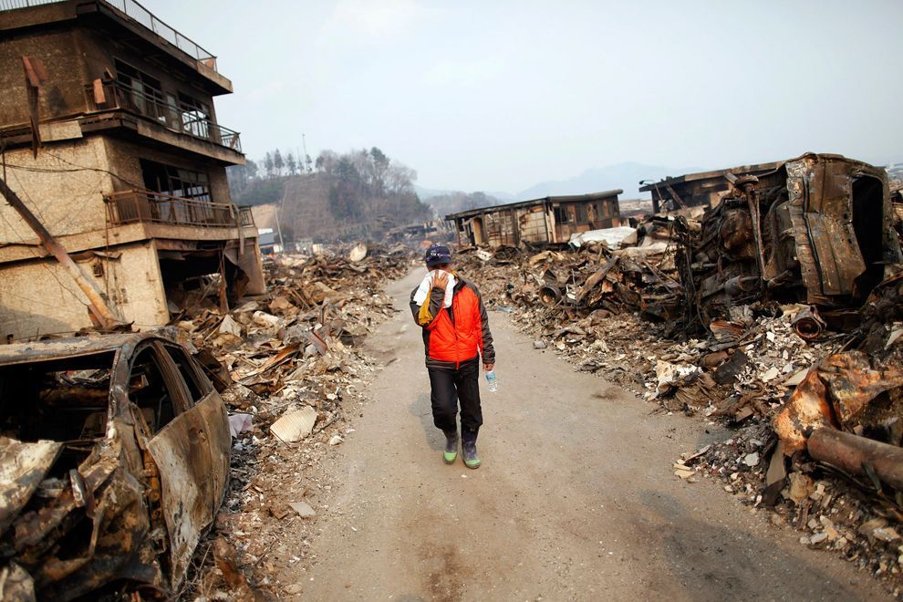
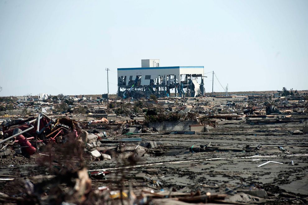
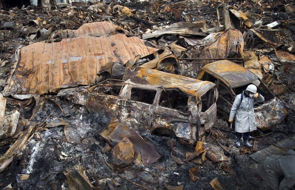
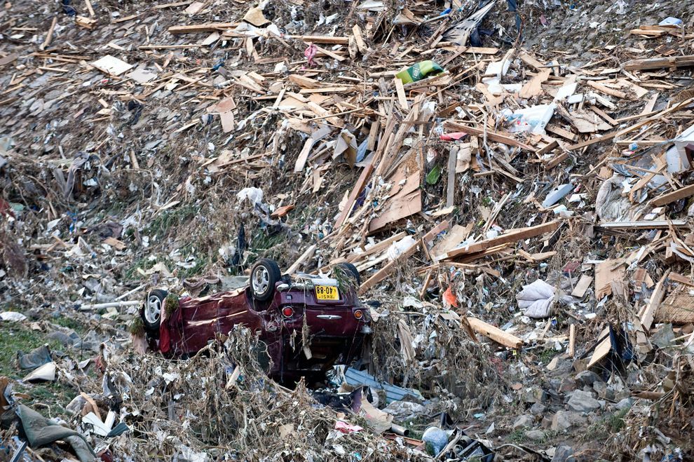
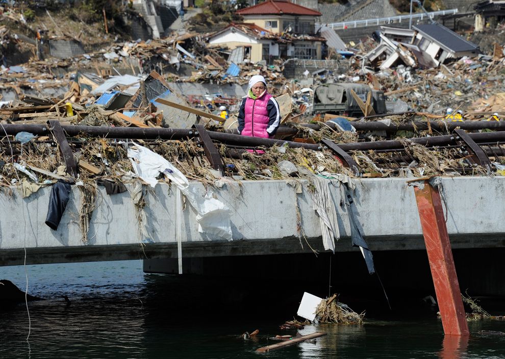
Kuji and Ōfunato were almost entirely destroyed. Also destroyed was Rikuzentakata, where the tsunami was reportedly three stories high. Other cities reportedly destroyed or heavily damaged by the tsunami include Kamaishi, Miyako, Ōtsuchi, and Yamada (in Iwate Prefecture), Namie, Sōma and Minamisōma (in Fukushima Prefecture) and Shichigahama, Higashimatsushima, Onagawa, Natori, Ishinomaki, and Kesennuma (in Miyagi Prefecture). The most severe effects of the tsunami were felt along a 670-km (420 mi)-long stretch of coastline from Erimo in the north to Ōarai in the south, with most of the destruction in that area occurring in the hour following the earthquake. Near Ōarai, people captured images of a huge whirlpool that had been generated by the tsunami. The tsunami washed away the sole bridge to Miyatojima, Miyagi, isolating the island's 900 residents. A two meter high tsunami hit Chiba Prefecture about 2 1/2 hours after the quake, causing heavy damage to cities such as Asahi.

On 13 March 2011, the Japan Meteorological Agency (JMA) published details of tsunami observations recorded around the coastline of Japan following the earthquake. These observations included tsunami maximum readings of over 3 m (9.8 ft) at the following locations and times on 11 March 2011, following the earthquake at 14:46 JST:
  • 15:12 JST – Iwate Kamaishi-oki – 6.8 m (22 ft)
  • 15:15 JST – Ōfunato – 3.2 m (10 ft) or higher
  • 15:20 JST – Ishinomaki-shi Ayukawa – 3.3 m (11 ft) or higher
  • 15:21 JST – Miyako – 4.0 m (13.1 ft) or higher
  • 15:21 JST – Kamaishi – 4.1 m (13 ft) or higher
  • 15:44 JST – Erimo-cho Shoya – 3.5 m (11 ft)
  • 15:50 JST – Sōma – 7.3 m (24 ft) or higher
  • 16:52 JST – Ōarai – 4.2 m (14 ft)
These readings were obtained from recording stations maintained by the JMA around the coastline of Japan. Many areas were also affected by waves of 1 to 3 meters (3.3 to 9.8 ft) in height, and the JMA bulletin also included the caveat that "At some parts of the coasts, tsunamis may be higher than those observed at the observation sites." The timing of the earliest recorded tsunami maximum readings ranged from 15:12 to 15:21, between 26 and 35 minutes after the earthquake had struck. The bulletin also included initial tsunami observation details, as well as more detailed maps for the coastlines affected by the tsunami waves.

On 23 March 2011, Port and Airport Research Institute reported tsunami height by visiting the port sites or by telemetry from offshore as follows:
  • Port of Hachinohe – 5–6 m (16–19 ft)
  • Port of Hachinohe area – 8–9 m (26–29 ft)
  • Port of Kuji – 8–9 m (26–29 ft)
  • Mooring GPS wave height meter at offshore of central Iwate (Miyako) – 6 m (20 ft)
    Port of Kamaishi – 7–9 m (23–30 ft)
  • Mooring GPS wave height meter at offshore of southern Iwate (Kamaishi) – 6.5 m (22 ft)
  • Port of Ōfunato – 9.5 m (31 ft)
  • Run up height, port of Ōfunato area – 24 m (79 ft)
  • Mooring GPS wave height meter at offshore of northern Miyagi – 5.6 m (18 ft)
  • Fishery port of Onagawa – 15 m (50 ft)
  • Port of Ishinomaki – 5 m (16 ft)
  • Mooring GPS wave height meter at offshore of central Miyagi – could not measure
  • Shiogama section of Shiogama-Sendai port – 4 m (13 ft)
  • Sendai section of Shiogama-Sendai port – 8 m (26 ft)
  • Sendai Airport area – 12 m (39 ft)

A joint research team from Yokohama National University and the University of Tokyo also reported that the tsunami at Ryōri Bay (綾里白浜), Ōfunato was about 30 m high. They found fishing equipment scattered on the high cliff above the bay. At Tarō, Iwate, a University of Tokyo researcher reported an estimated tsunami height of 37.9 m (124 ft) reached the slope of a mountain some 200 m (656 ft) away from the coastline. Also, at slope of nearby mountain from 400 m (1,312 ft) Aneyoshi fishery port (姉吉漁港) of Omoe peninsula (重茂半島) in Miyako, Iwate, Tokyo University of Marine Science and Technology found estimated tsunami run up height of 38.9 m (127 ft). This height is deemed the record in Japan historically, as of reporting date, that exceeds 38.2 m (125 ft) from the 1896 Meiji-Sanriku earthquake.


Elsewhere across the Pacific

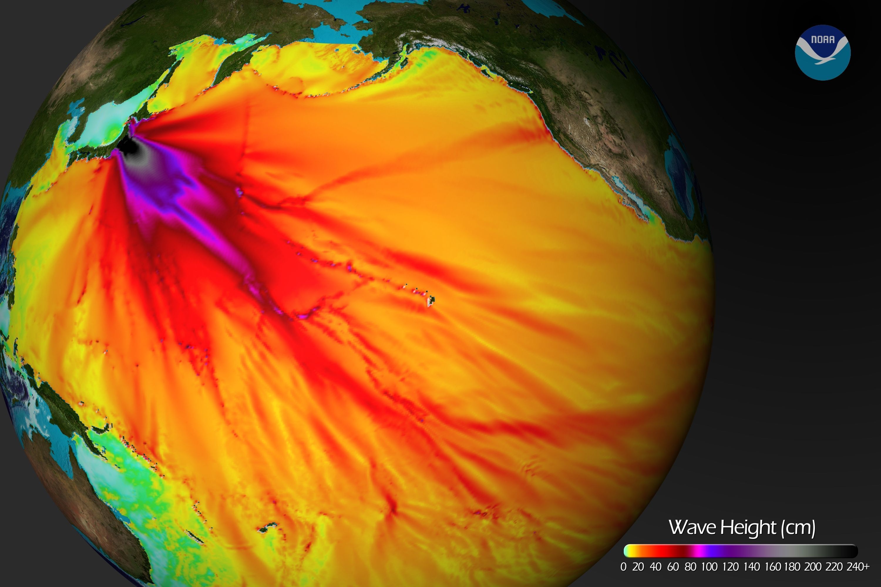
Shortly after the earthquake, the Pacific Tsunami Warning Center (PTWC) in Hawaii issued tsunami watches and warnings for locations in the Pacific. At 07:30 UTC, PTWC issued a widespread tsunami warning covering the entire Pacific Ocean. Russia evacuated 11,000 residents from coastal areas of the Kuril Islands. The United States West Coast and Alaska Tsunami Warning Center issued a tsunami warning for the coastal areas of most of California, all of Oregon, and the western part of Alaska, and a tsunami advisory covering the Pacific coastlines of most of Alaska, and all of Washington and British Columbia, Canada. In California and Oregon, up to 2.4 m (8 ft) high tsunami surges hit some areas, damaging docks and harbors and causing over US$10 million of damage. Surges of up to 1 m (3.3 ft) hit Vancouver Island in Canada prompting some evacuations, and causing boats to be banned from the waters surrounding the island for 12 hours following the wave strike, leaving many island residents in the area without means of getting to work.


Click image for larger version

Name:	Midway_bonin_petrel_2011_tsunami.jpg
Views:	2209
Size:	112.5 KB
ID:	266923
A Bonin Petrel, trapped in the sand on Midway Atoll by the tsunami, before being rescued.


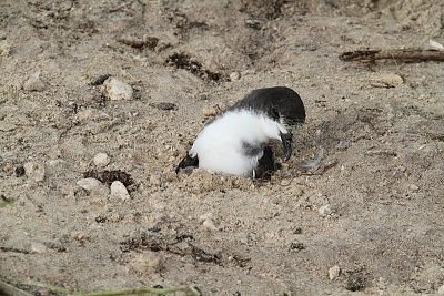
In the Philippines, waves up to 0.5 m (1.6 ft) high hit the eastern seaboard of the country. Some houses along the coast in Jayapura, Indonesia were destroyed. Authorities in Wewak, East Sepik, Papua New Guinea evacuated 100 patients from the city's Boram Hospital before it was hit by the waves, causing an estimated US$4 million in damages. Hawaii estimated damage to public infrastructure alone at US$3 million, with damage to private properties, including resort hotels such as Four Seasons Resort Hualalai, estimated at tens of millions of dollars. It was reported that a 1.5 m (5 ft) high wave completely submerged Midway Atoll's reef inlets and Spit Island, killing more than 110,000 nesting seabirds at the Midway Atoll National Wildlife Refuge. Some other South Pacific countries, including Tonga and New Zealand, and U.S. territories American Samoa and Guam, experienced larger-than-normal waves, but did not report any major damage. However in Guam some roads were closed off and people were evacuated from low-lying areas.

Along the Pacific Coast of Mexico and South America, tsunami surges were reported, but in most places caused little or no damage. Peru reported a wave of 1.5 m (5 ft) and more than 300 homes damaged. The surge in Chile was large enough to damage more than 200 houses, with waves of up to 3 m (9.8 ft). In the Galapagos Islands, 260 families received assistance following a 3 m (9.8 ft) surge which arrived 20 hours after the earthquake, after the tsunami warning had been lifted. There was a great deal of damage to buildings on the islands and one man was injured but there were no reported fatalities.


Casualties

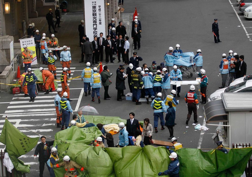
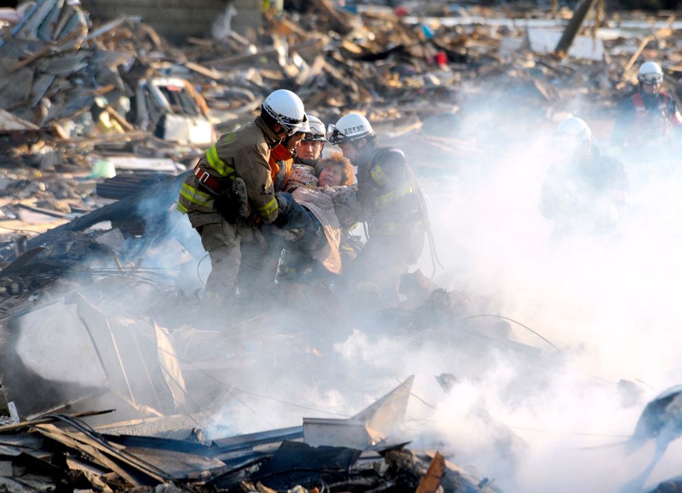
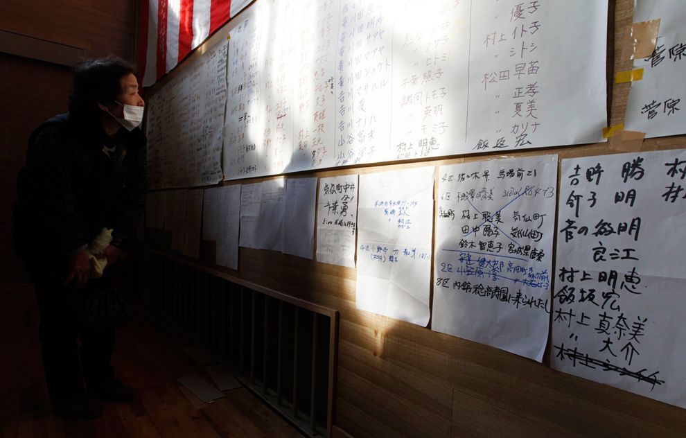
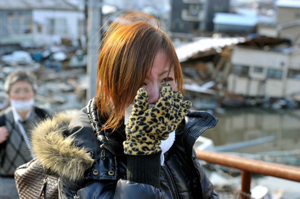
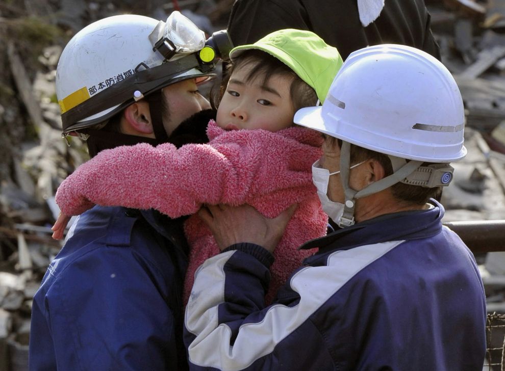
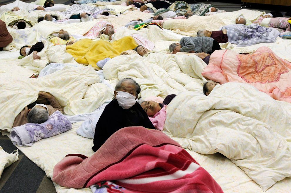
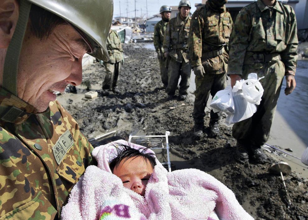
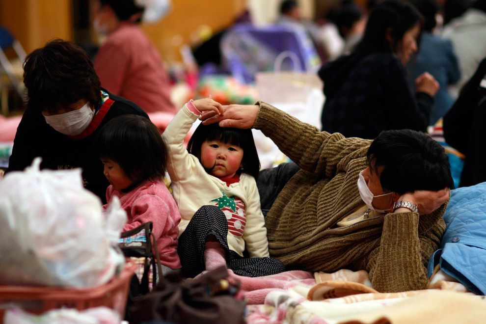
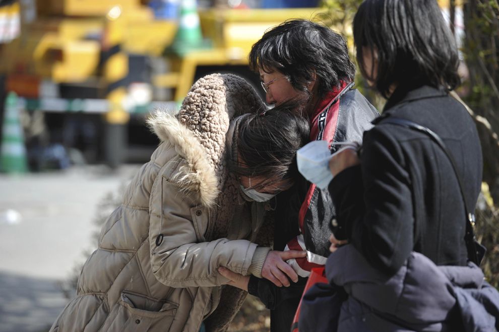
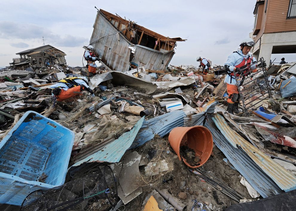
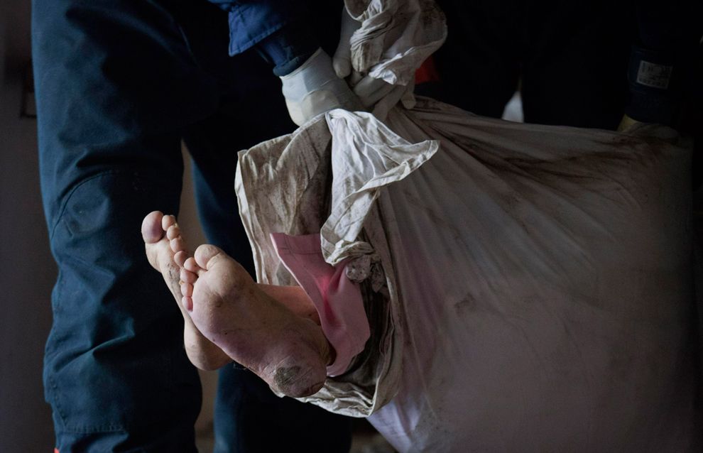
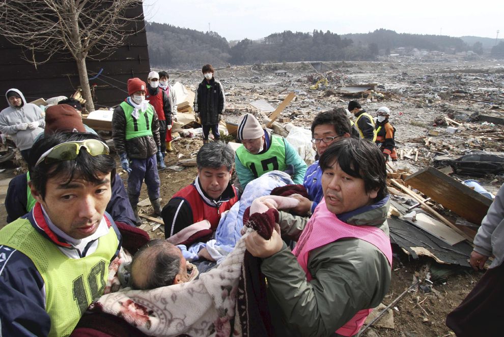
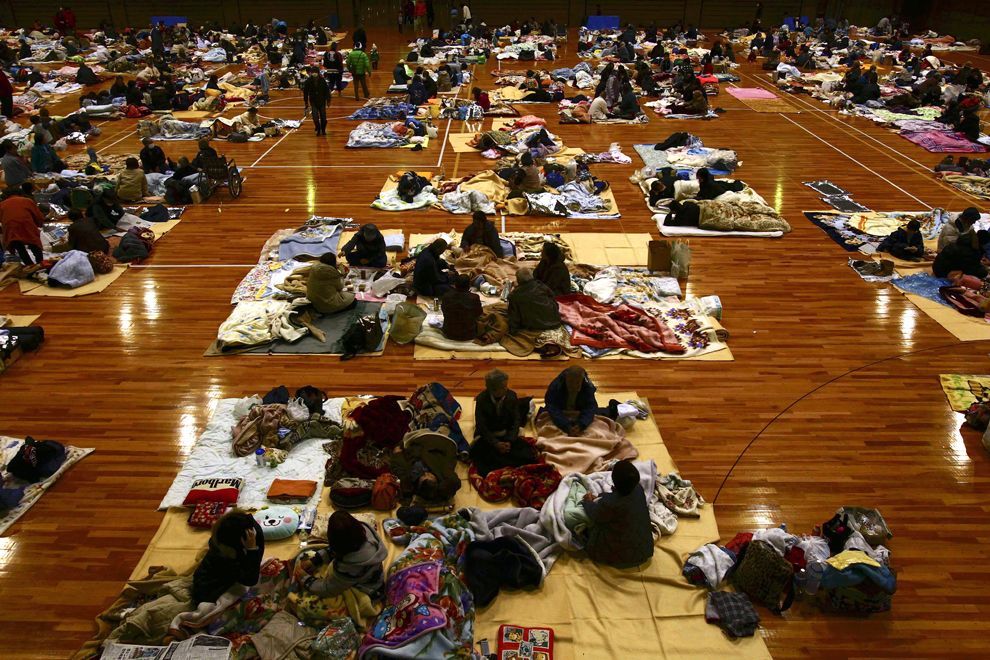
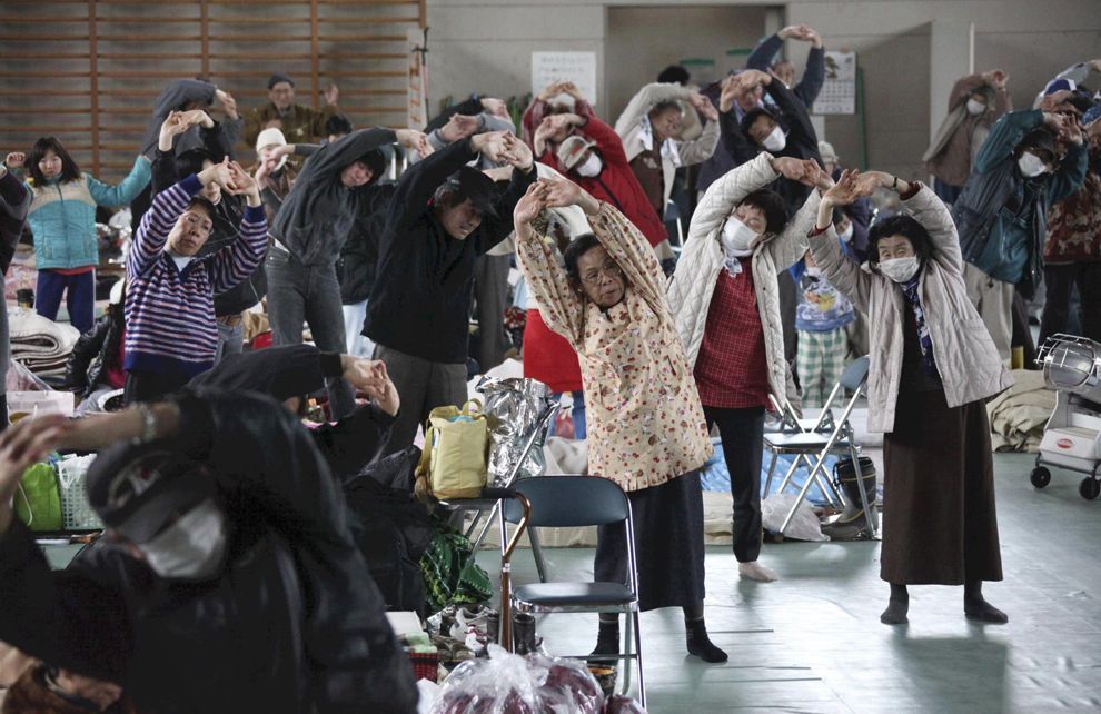
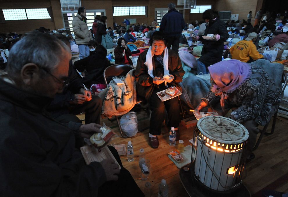
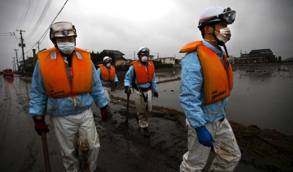
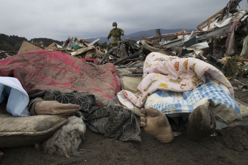
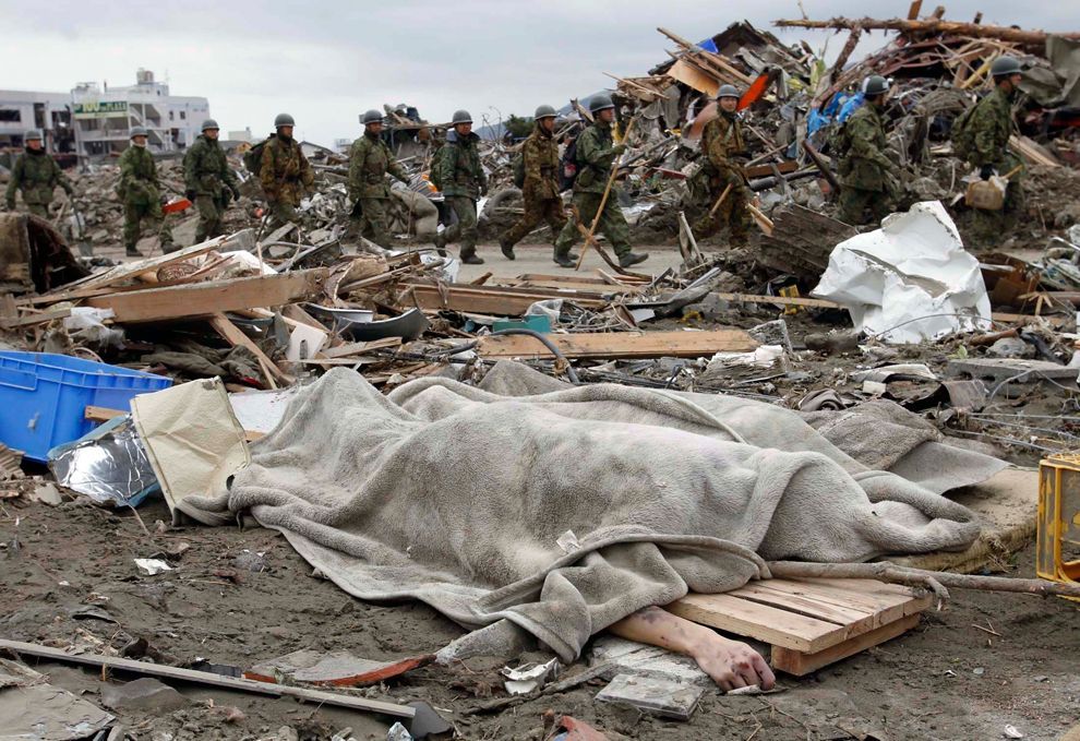
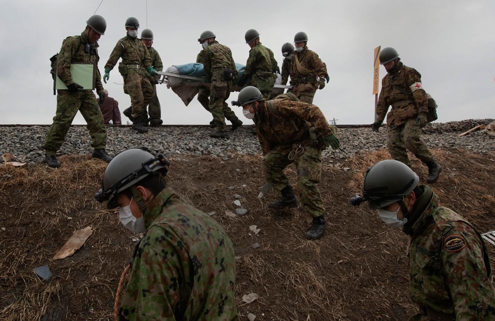
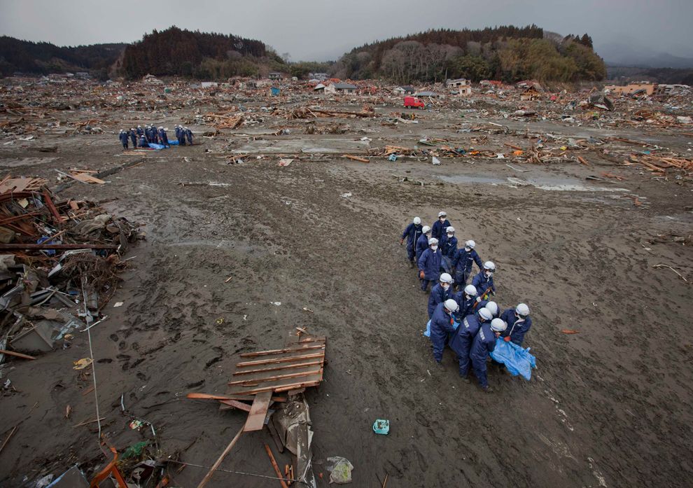
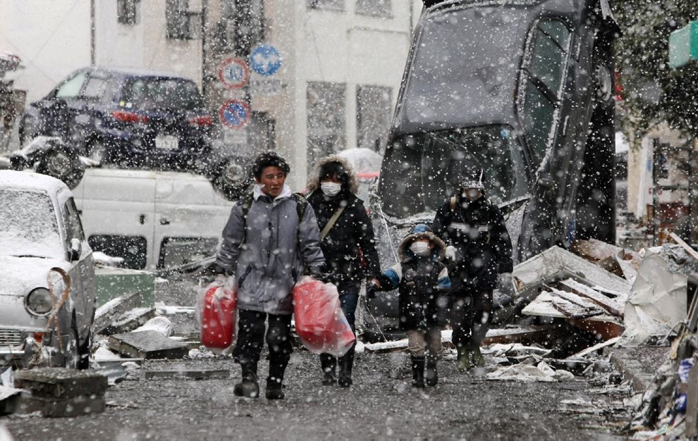
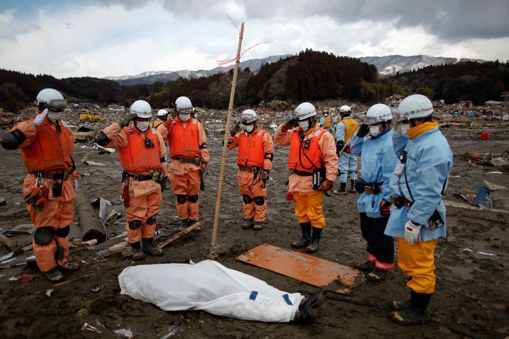
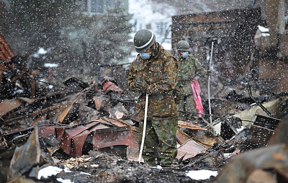
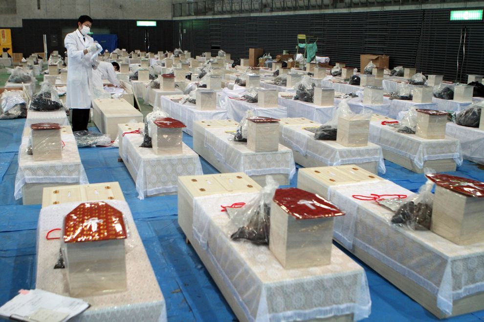
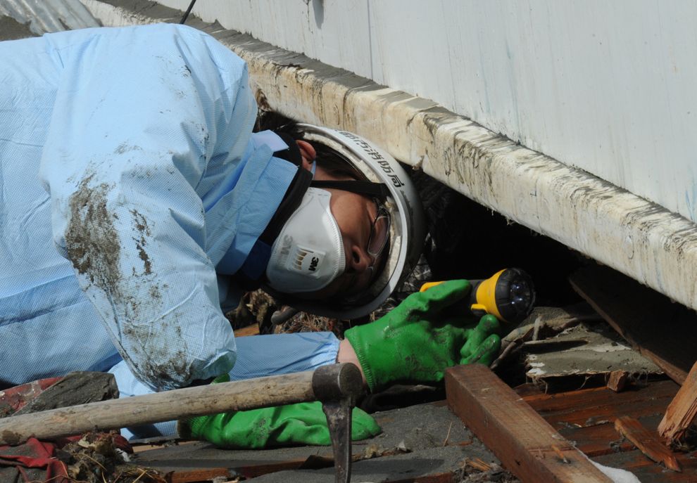
The National Police Agency has confirmed 14,416 deaths, 5,314 injured, and 11,889 people missing across eighteen prefectures. Prefectural officials and the Kyodo News Agency, quoting local officials, said that 9,500 people from Minamisanriku in Miyagi Prefecture—about a half of the town's population—were unaccounted for the day after the earthquake, and on the same day NHK reported that the death toll in Iwate Prefecture alone might reach 10,000. On 14 March, Kyodo News Agency reported that some 2,000 bodies were found on two shores in Miyagi Prefecture. As of 12 April 2011, Yomiuri Shimbun reported that 282 people had died from post-earthquake-related factors, such as exposure to cold and wet weather, communicable disease and infection, unsanitary conditions, or inability to receive adequate medical care for pre-existing conditions.

Of the 13,135 fatalities recovered by 11 April 2011, 12,143 or 92.5% died by drowning. Victims aged 60 or older accounted for 65.2% of the deaths, with 24% of total victims being in their 70s.

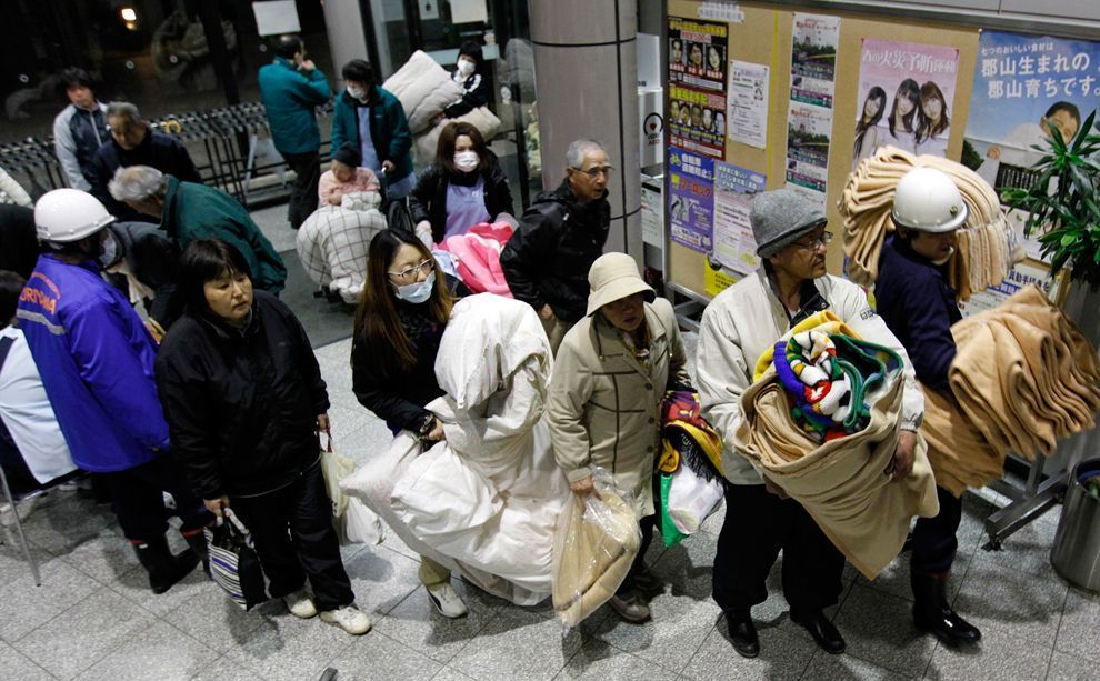
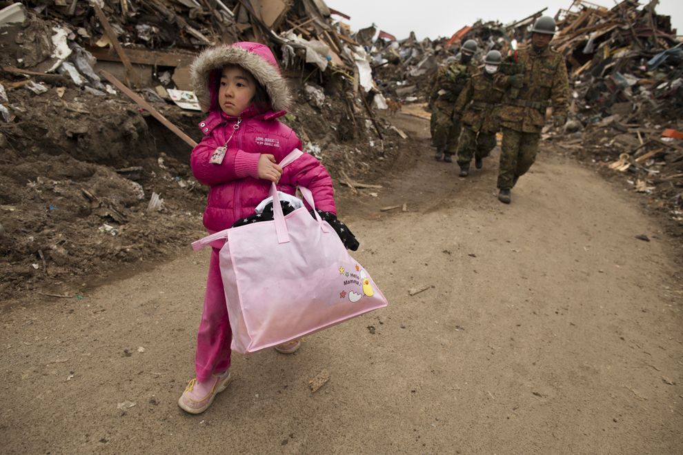
Save the Children reports that as many as 100,000 children were uprooted from their homes, some of whom were separated from their families because the earthquake occurred during the school day. As of 10 April 2011, Japan's Ministry of Health, Labour and Welfare stated that it was aware of at least 82 children who had been orphaned by the disaster.

The Japanese Foreign Ministry has confirmed the deaths of nineteen foreigners. Among them are two English teachers from the United States affiliated with the Japan Exchange and Teaching Program; a Canadian missionary in Shiogama; and citizens of China, North and South Korea, Taiwan, Pakistan and the Philippines.

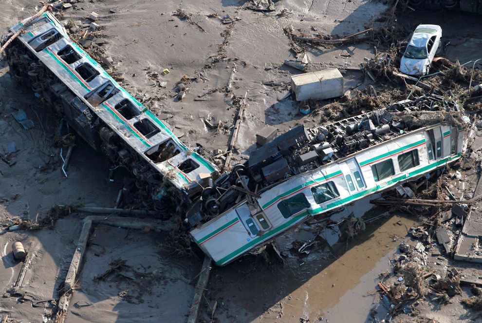
It was reported that four passenger trains containing an unknown number of passengers disappeared in a coastal area during the tsunami. One of the trains, on the Senseki Line, was found derailed in the morning; all passengers were rescued by a police helicopter. Der Spiegel later reported that five missing trains in Miyagi Prefecture had been found with all passengers safe, although this information could not be confirmed locally.

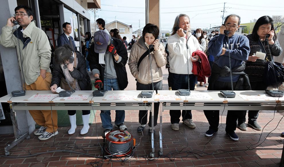
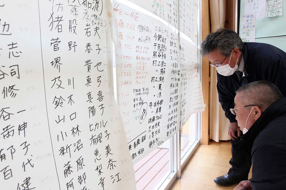
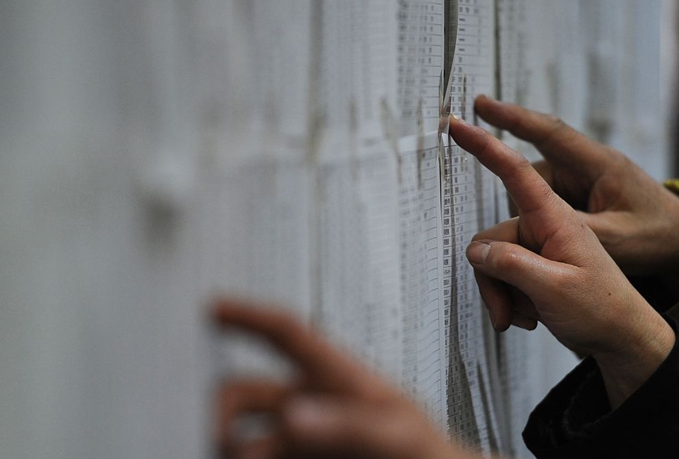
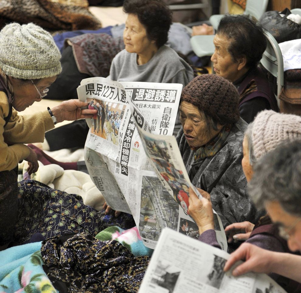
By 9:30 UTC on 11 March, Google Person Finder, which was previously used in the Haitian, Chilean, and Christchurch, New Zealand earthquakes, was collecting information about survivors and their locations. The Next of Kin Registry (NOKR) is assisting the Japanese government in locating next of kin for those missing or deceased.

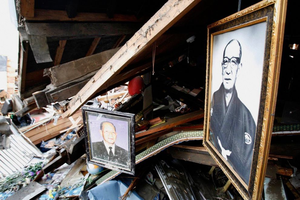
Japanese funerals are normally elaborate Buddhist ceremonies, which entail cremation. The thousands of bodies, however, exceed the capacity of available crematoriums and morgues, many of them damaged, and there are shortages of both kerosene—each cremation requires 50 liters—and dry ice for preservation. The single crematorium in Higashimatsushima, for example, can only handle four bodies a day, although hundreds have been found there and hundreds of people are still missing. Governments and the military have thus been forced to bury many bodies in hastily dug mass graves with rudimentary or no rites, although relatives of the deceased have been promised that cremation will occur later.

The tsunami is reported to have caused several deaths outside of Japan. One man was killed in Jayapura, Papua, Indonesia after being swept out to sea. A man who is said to have been attempting to photograph the oncoming tsunami at the mouth of the Klamath River, south of Crescent City, California, was swept out to sea. His body was found on April 2 along Ocean Beach in Fort Stevens State Park, Oregon, some 330 miles north of where he had been swept out to sea.


Click image for larger version

Name:	398px-US_Navy_110315-N-5503T-756_A_Japanese_search_and_rescue_team_searches_the_rubble_near_a_hi.jpg
Views:	1793
Size:	93.2 KB
ID:	266929
In Tarō district, Miyako, Iwate, search-and-rescue activities are visible amidst the debris left by the tsunami. See The Full Sized Picture Here


Damage and effects

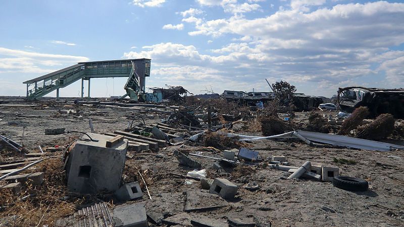
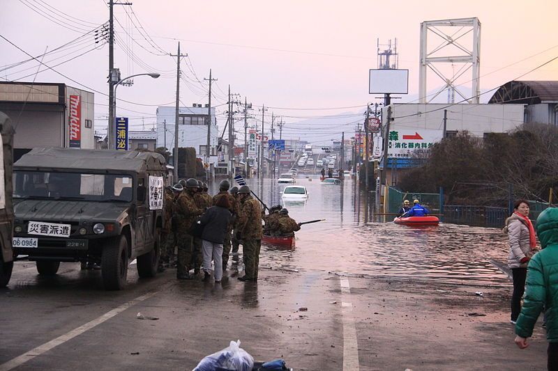
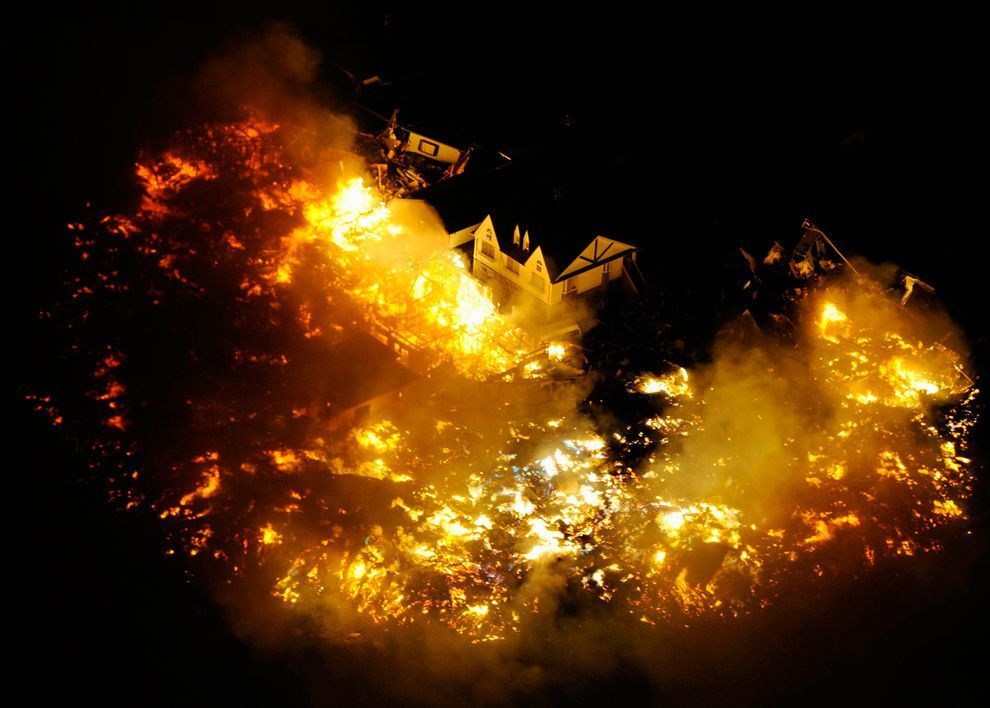
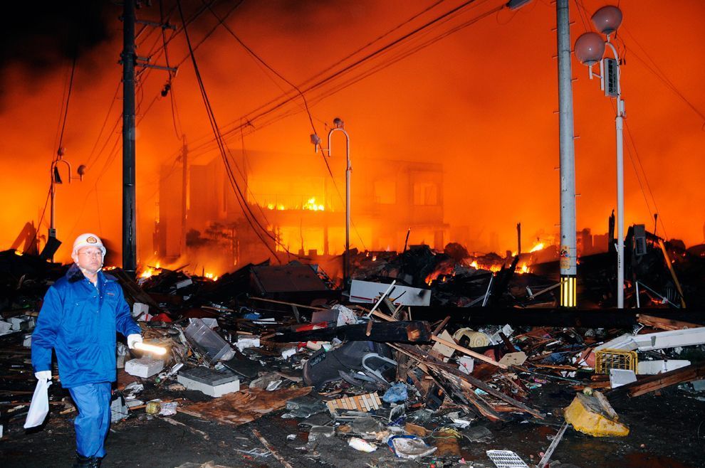
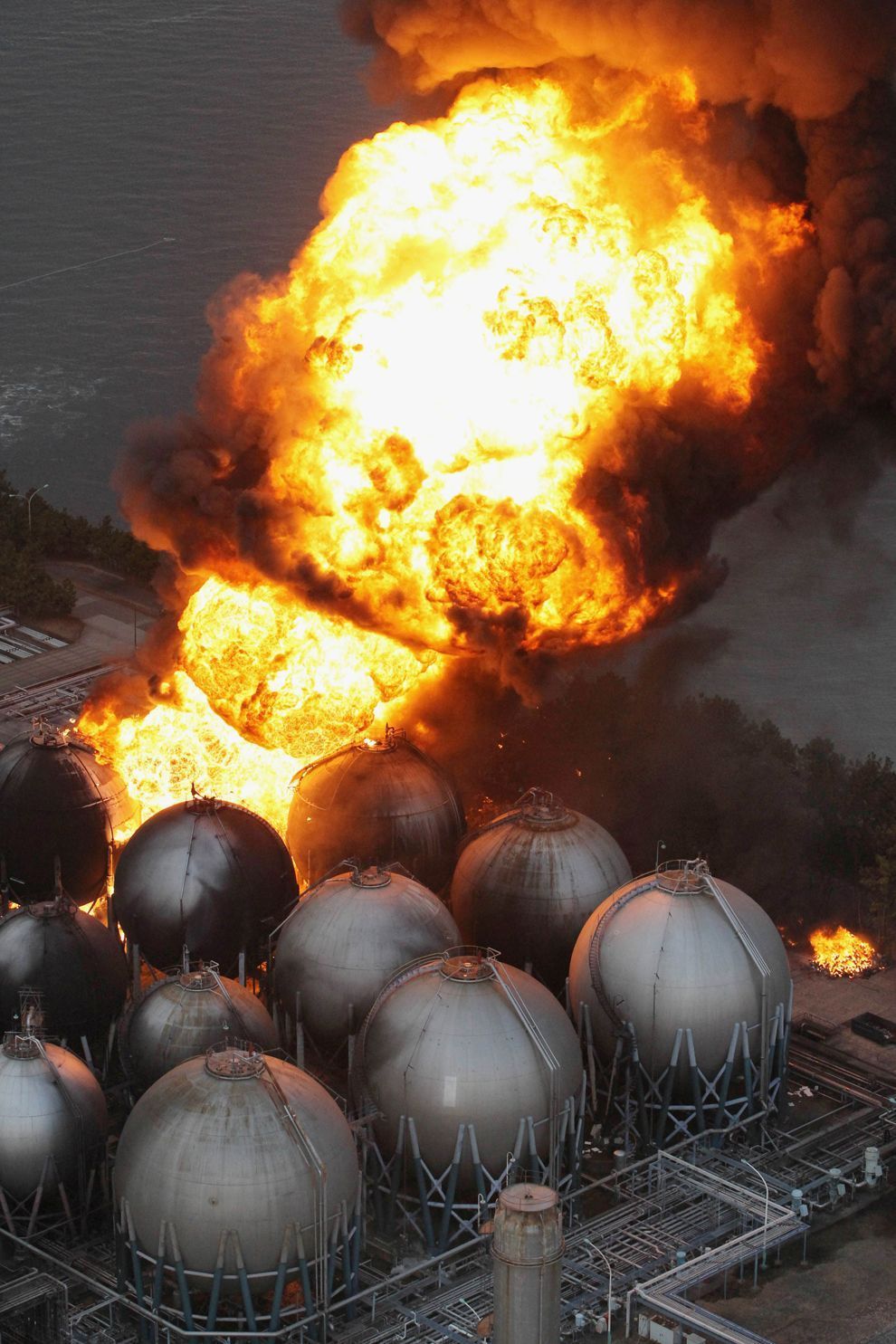
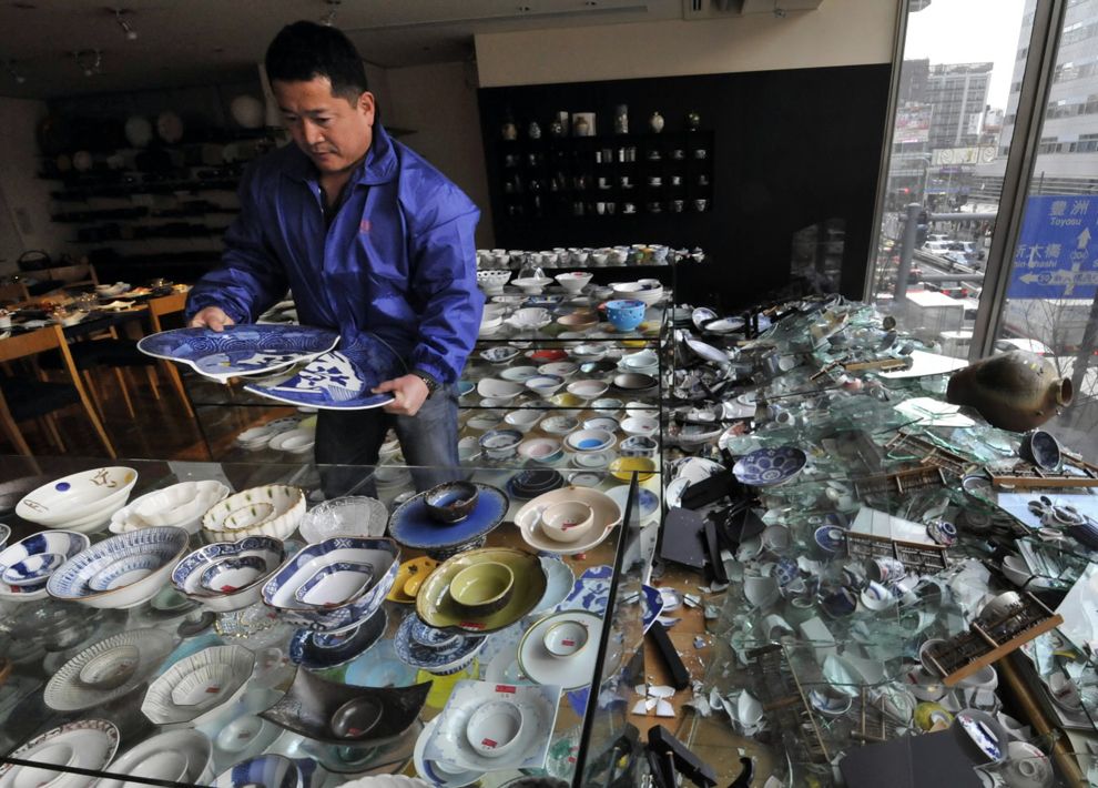
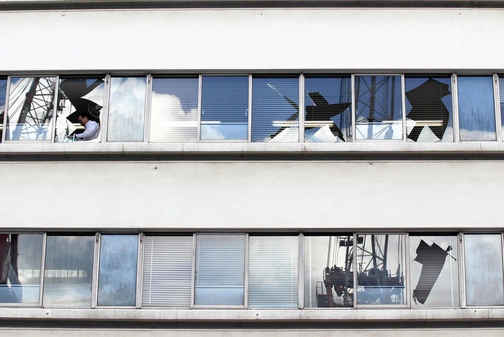
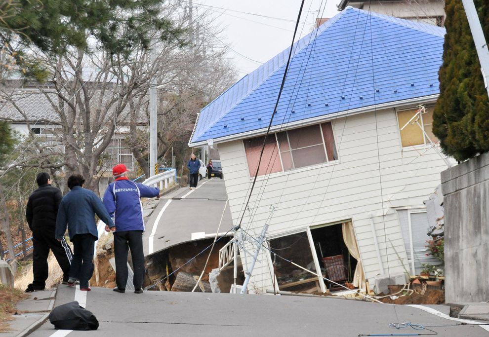
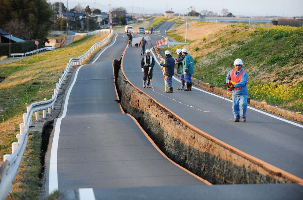
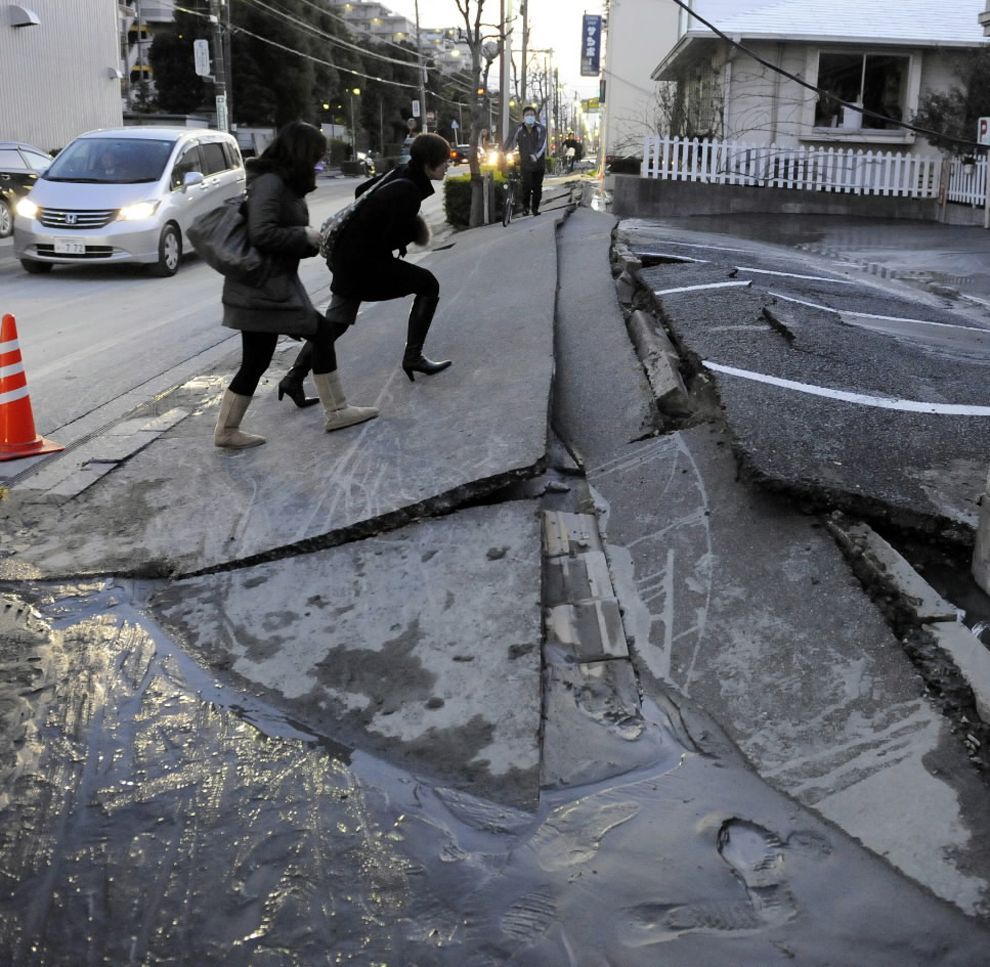
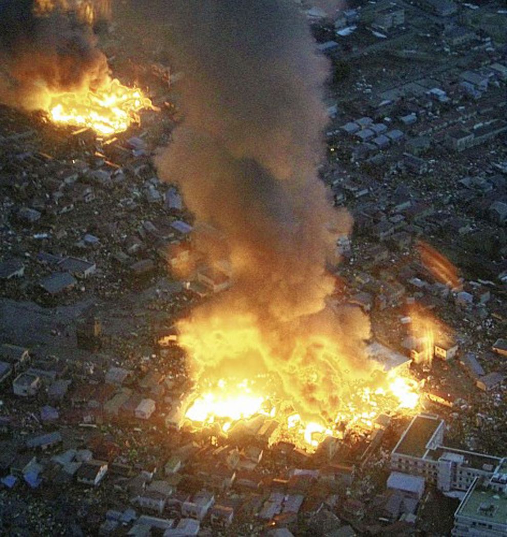
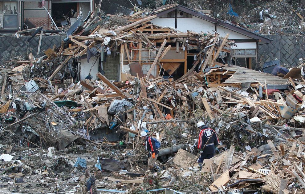
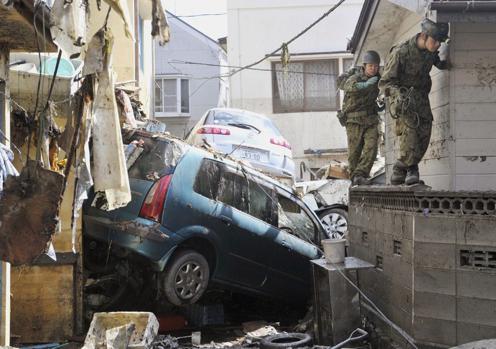
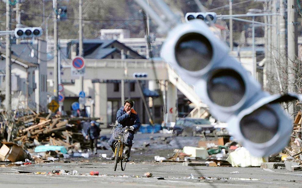
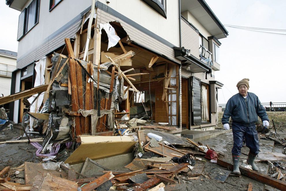
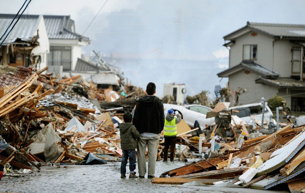
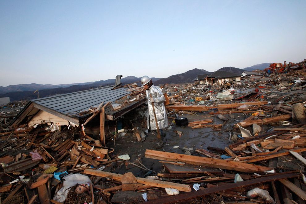
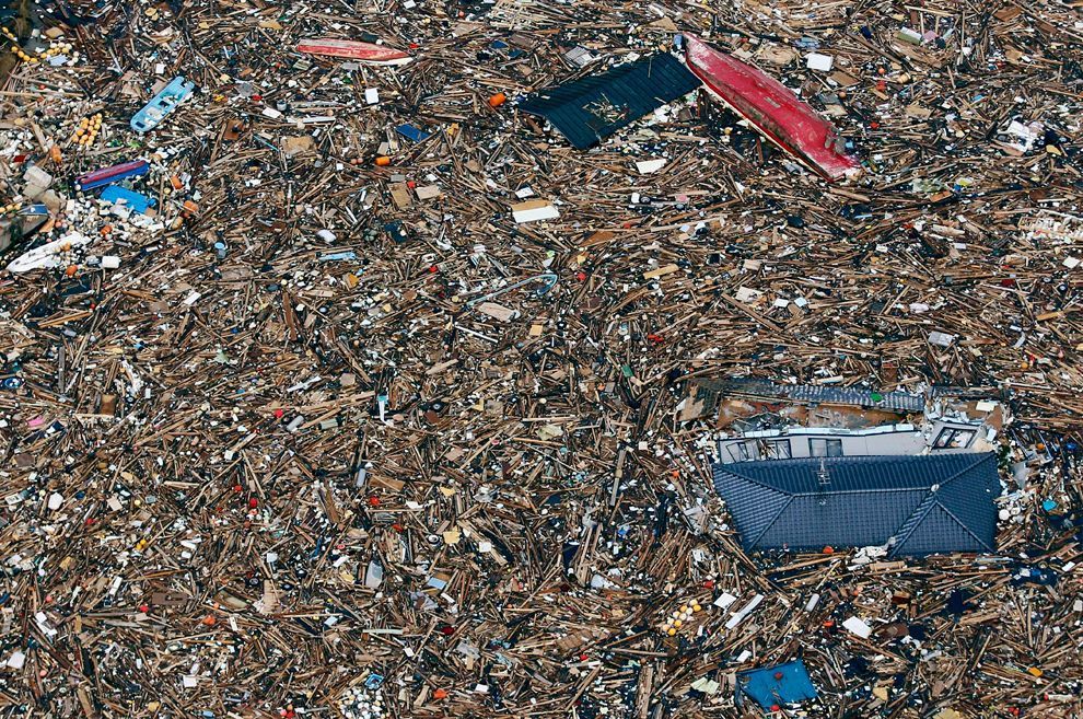
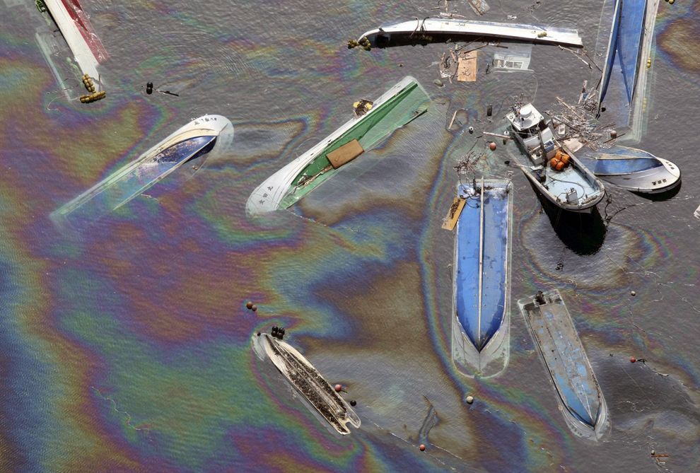
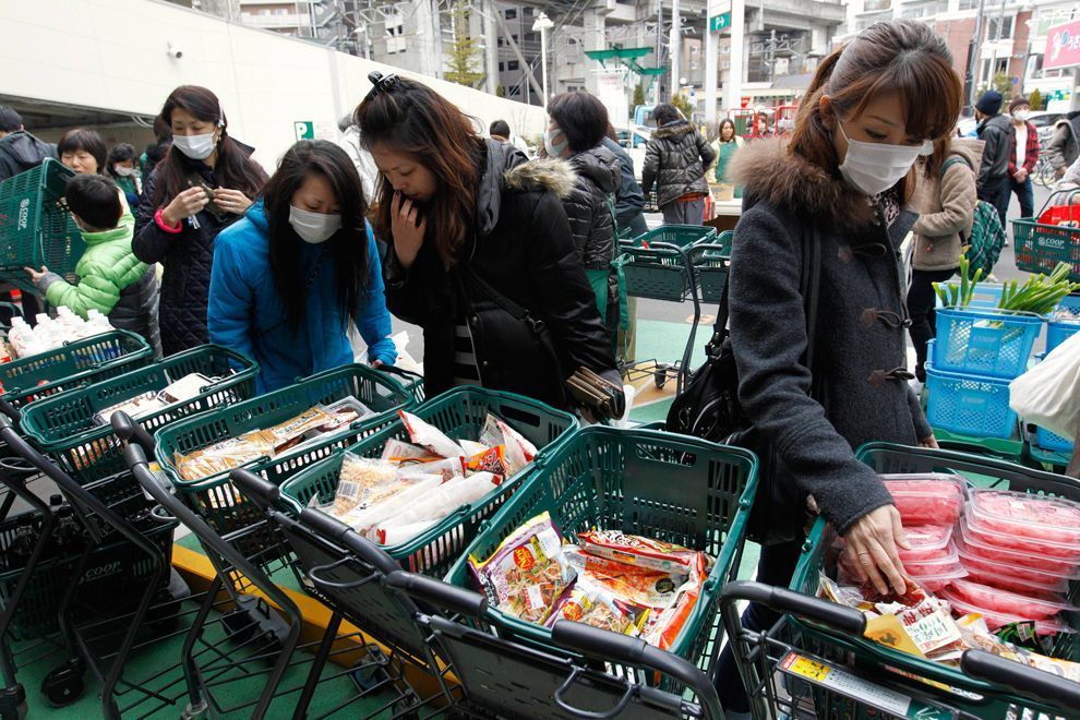
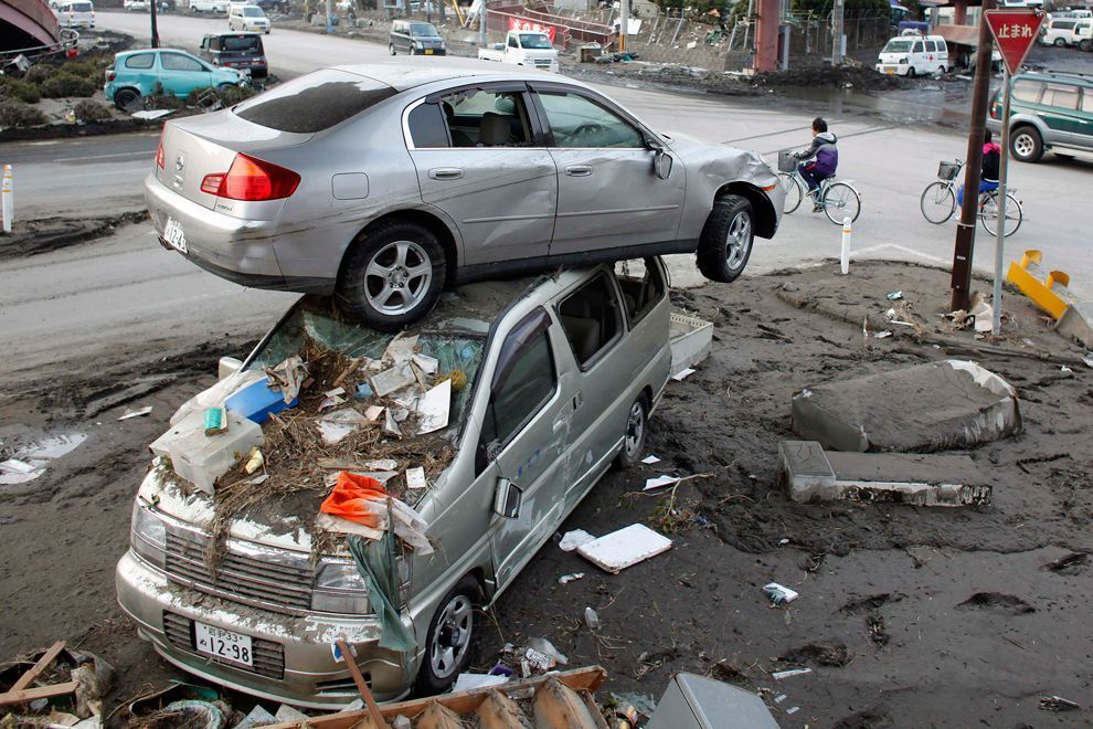
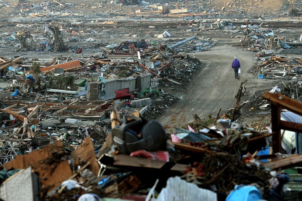
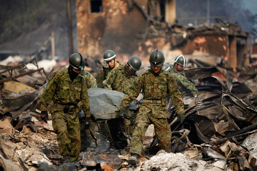
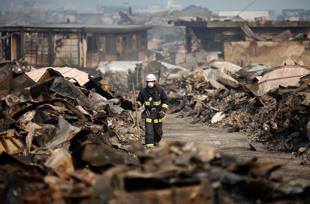
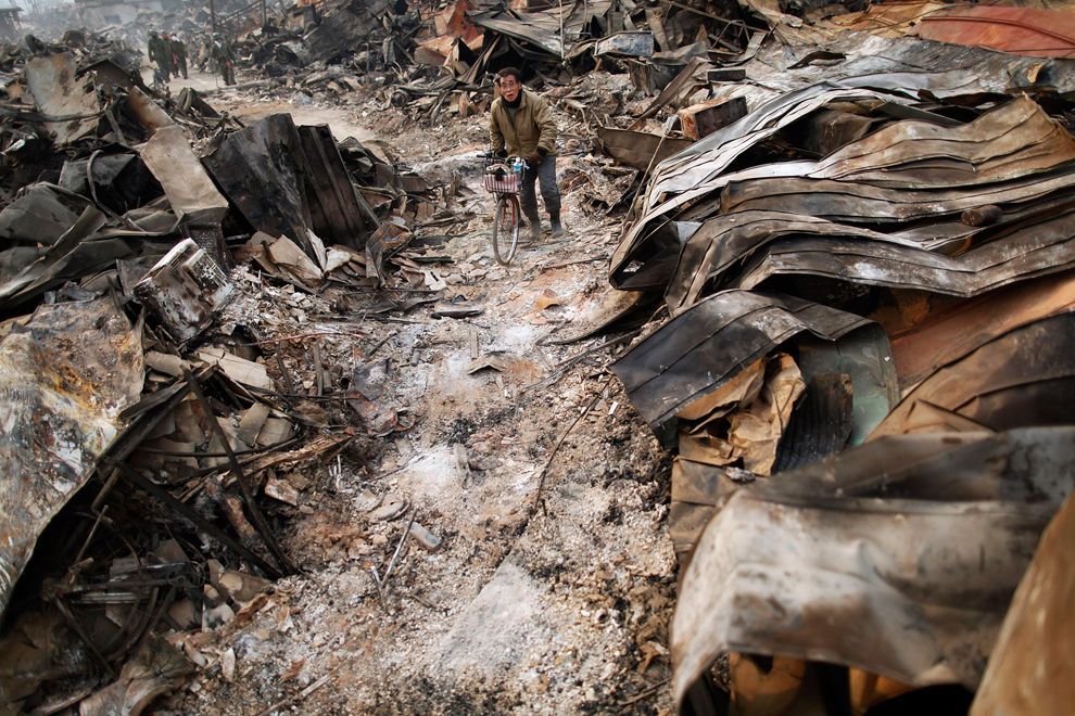
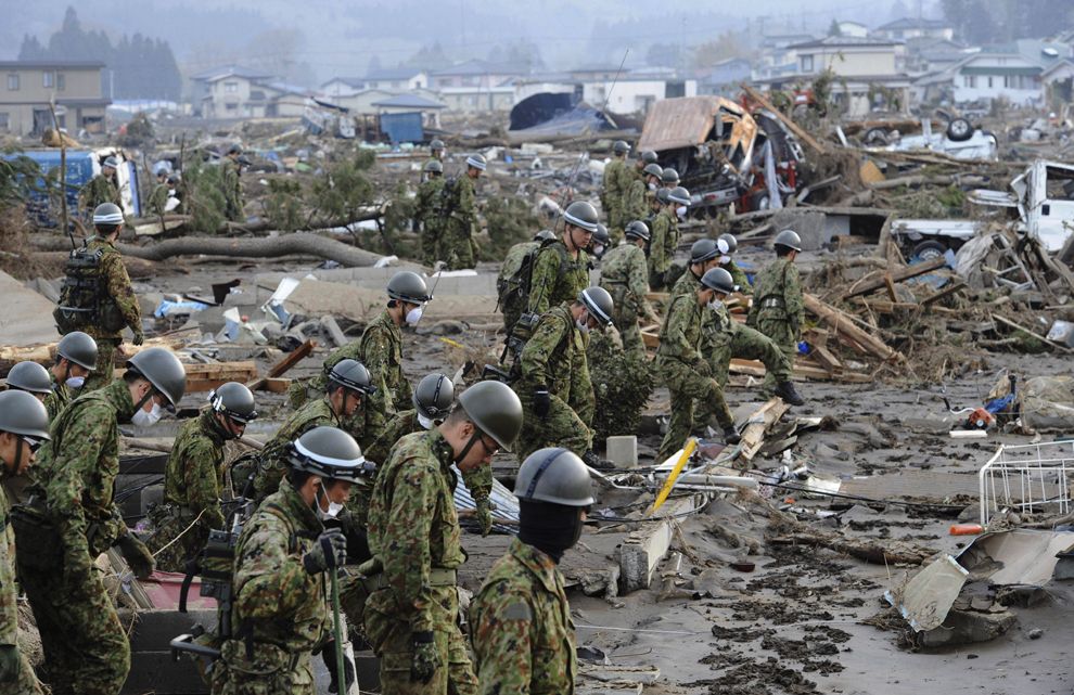
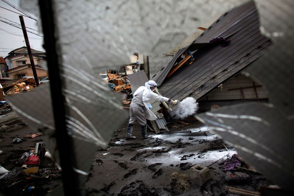
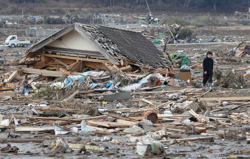
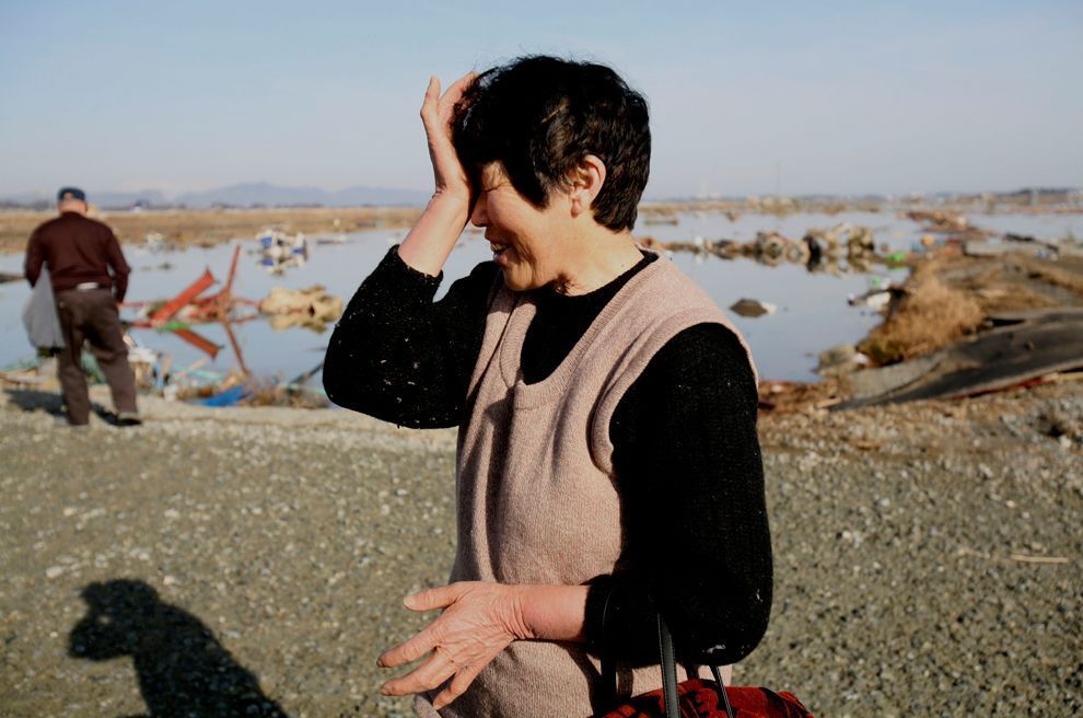
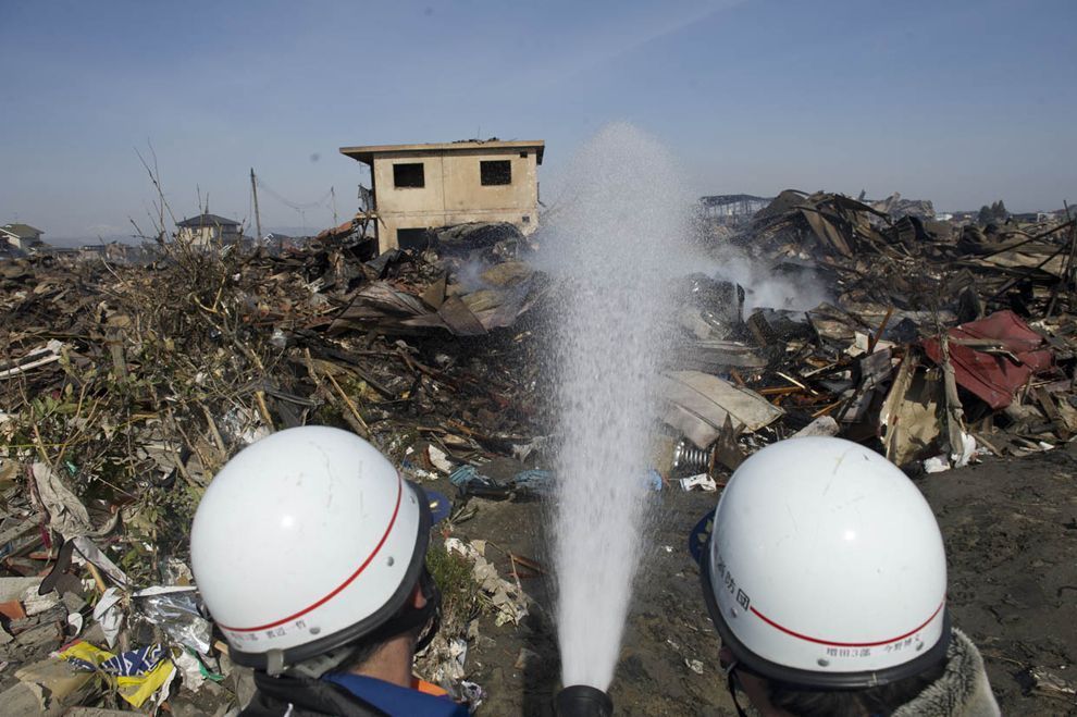
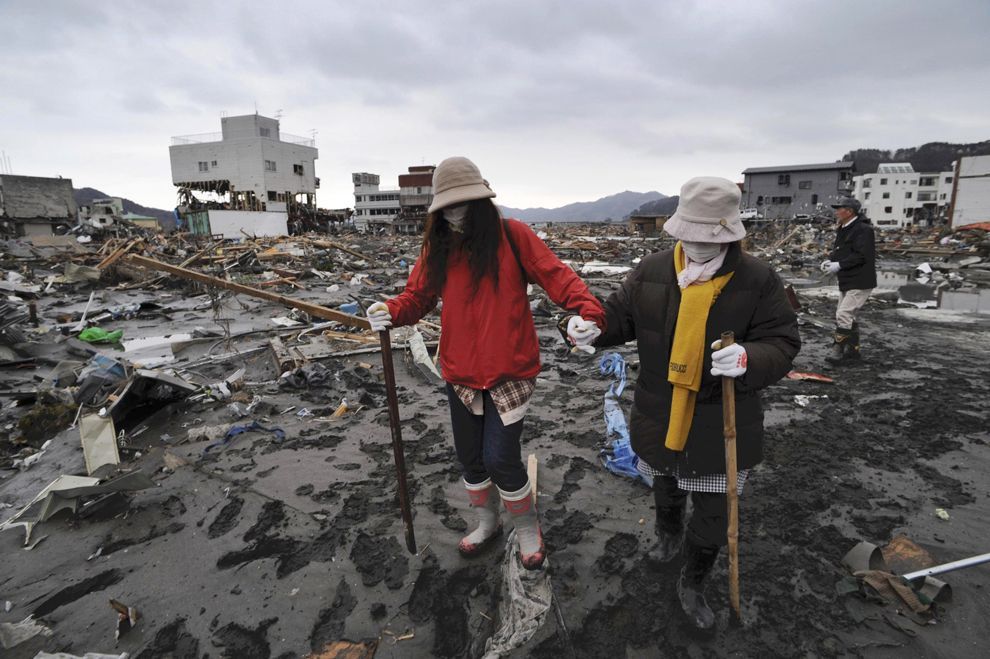
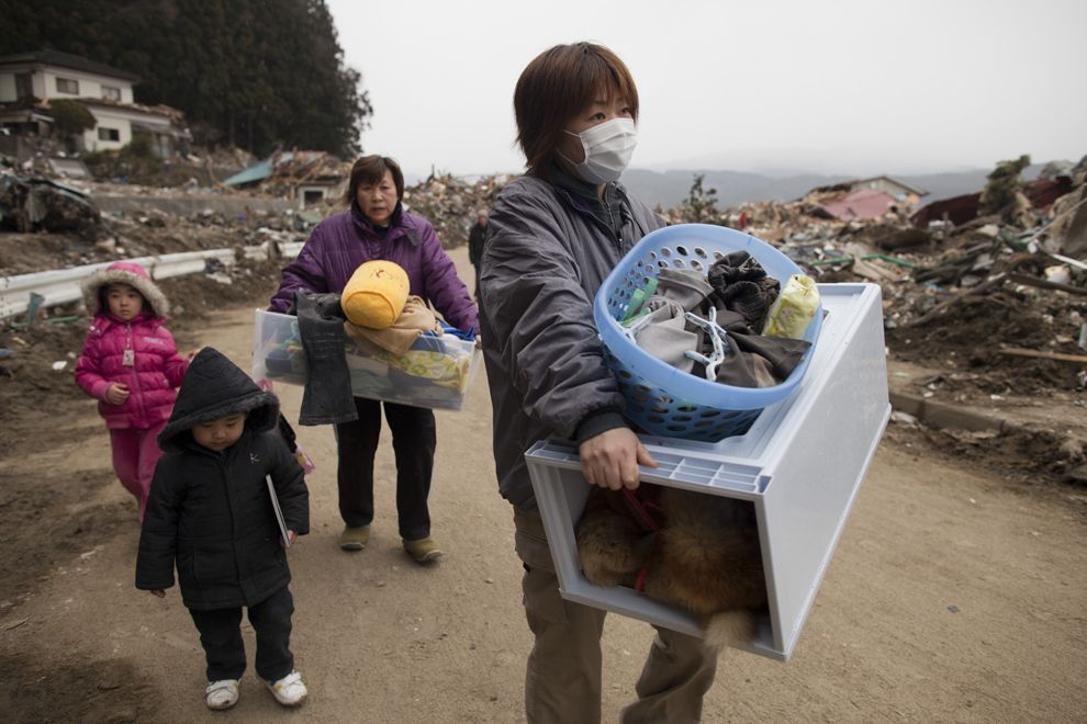
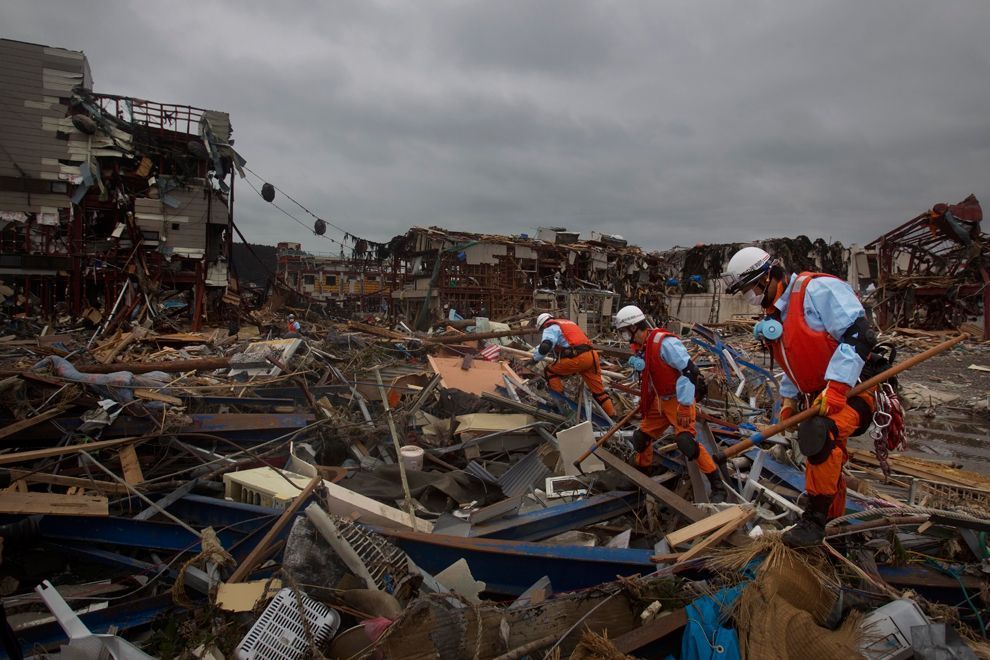
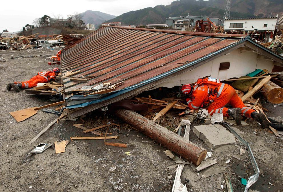
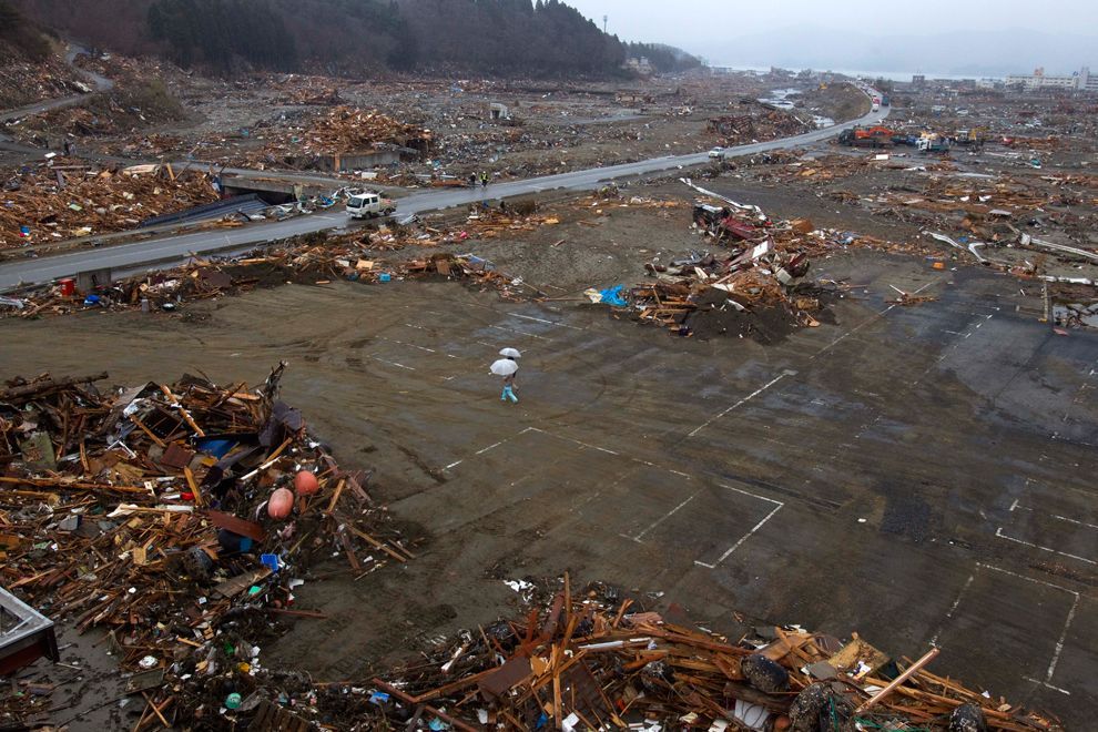
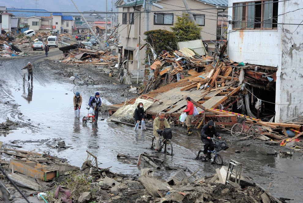
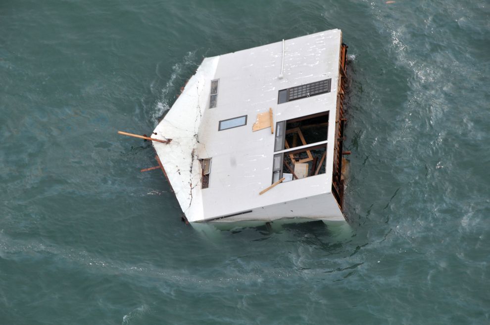
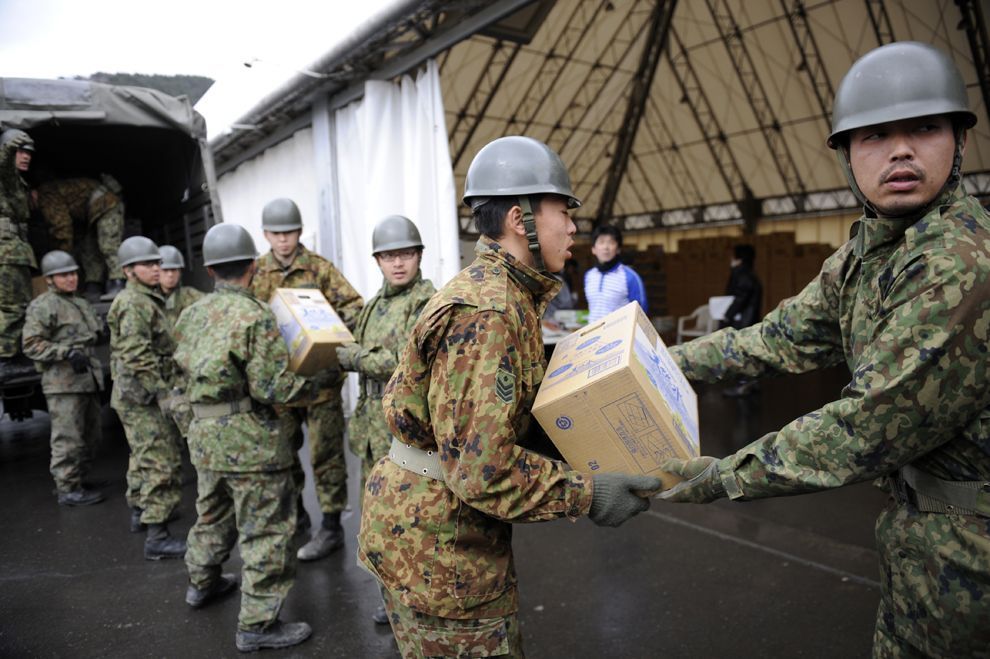
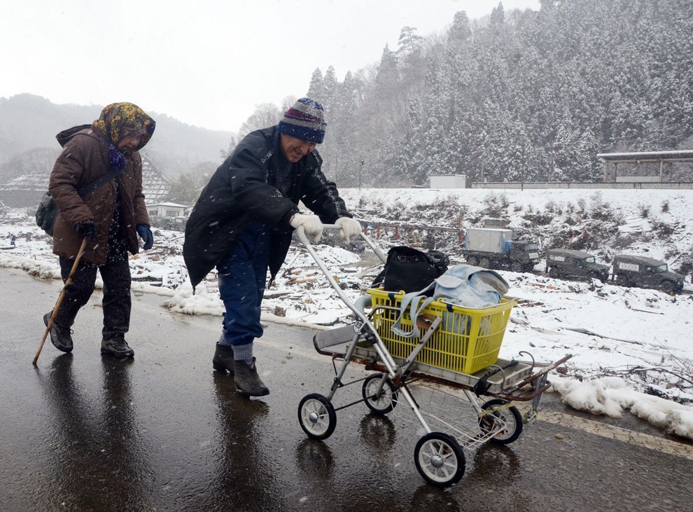
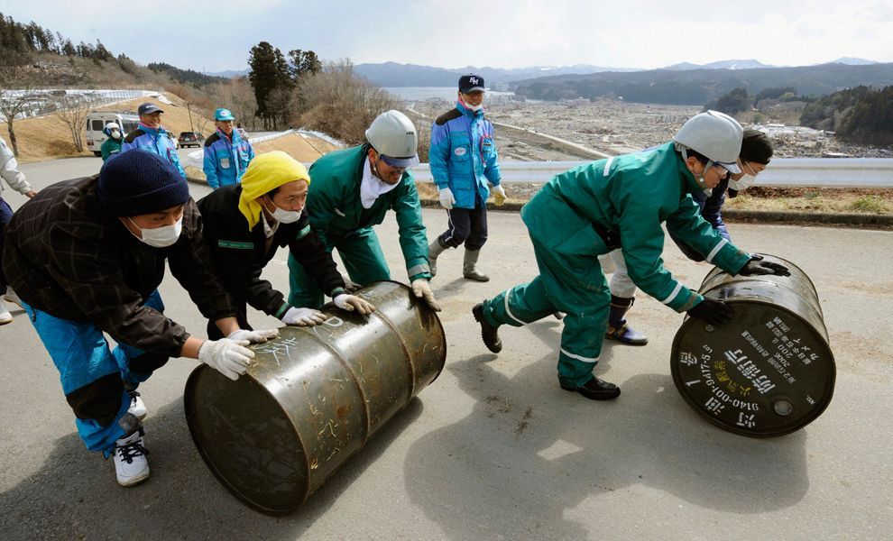
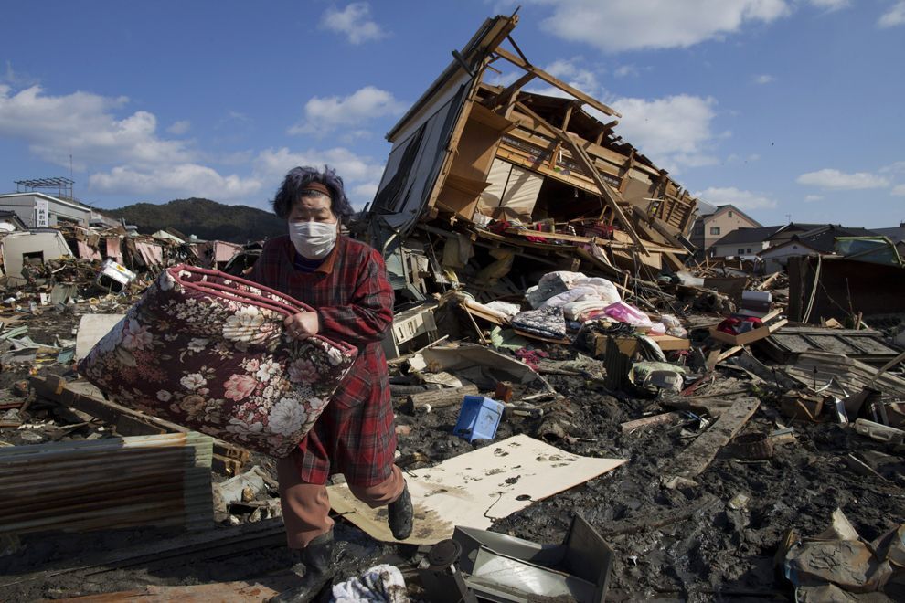
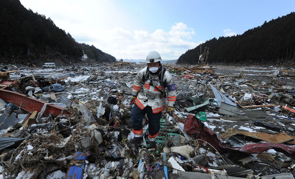
The degree and extent of damage caused by the earthquake and resulting tsunami were enormous, with most of the damage being caused by the tsunami. Video footage of the towns worst affected shows little more than piles of rubble, with almost no parts of any structures left standing. Estimates of the cost of the damage range well into the tens of billions of US dollars; before-and-after satellite photographs of devastated regions show immense damage to many regions. Although Japan has invested the equivalent of billions of dollars on anti-tsunami seawalls which line at least 40% of its 34,751 km (21,593 mi) coastline and stand up to 12 m (39 ft) high, the tsunami simply washed over the top of some seawalls, collapsing some in the process.

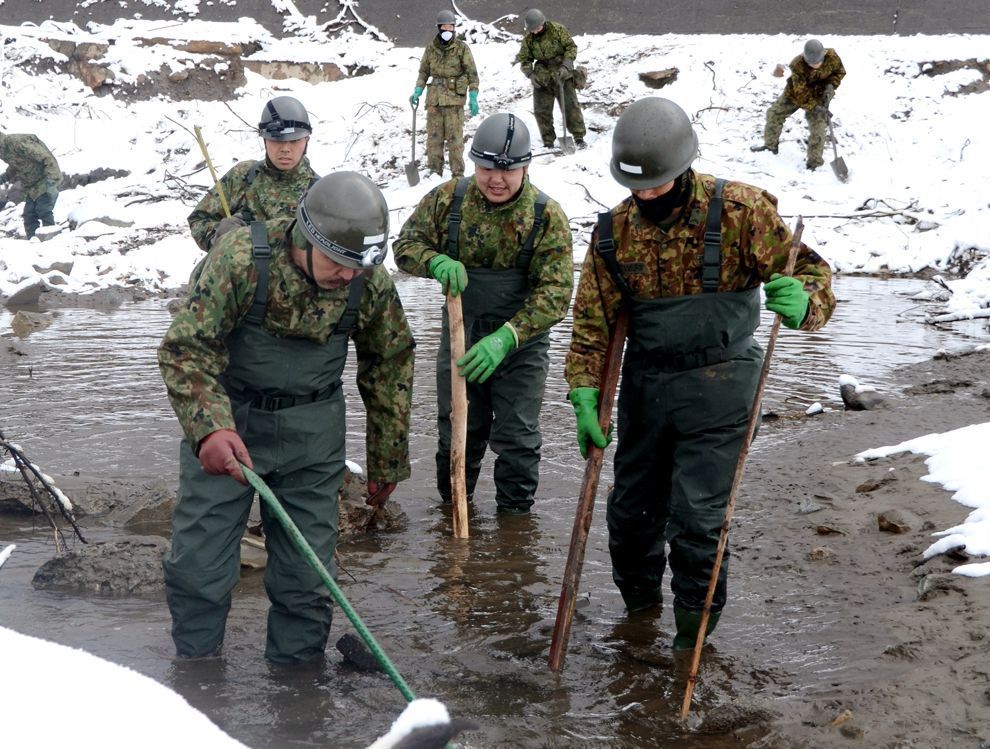
Japan's National Police Agency said on 3 April 2011, that 190,000 buildings were destroyed or damaged by the quake and tsunami. Of those, 45,700 were destroyed. The damaged buildings included 29,500 structures in Miyagi Prefecture, 12,500 in Iwate Prefecture and 2,400 in Fukushima Prefecture. The earthquake and tsunami created an estimated 25 million tons of rubble and debris in Japan.


Click image for larger version

Name:	800px-Fukushima_I_by_Digital_Globe.jpg
Views:	1713
Size:	78.2 KB
ID:	266930
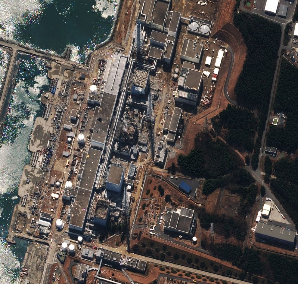
The Fukushima I Nuclear Power Plant after the 2011 Tōhoku earthquake and tsunami.


Nuclear power plants

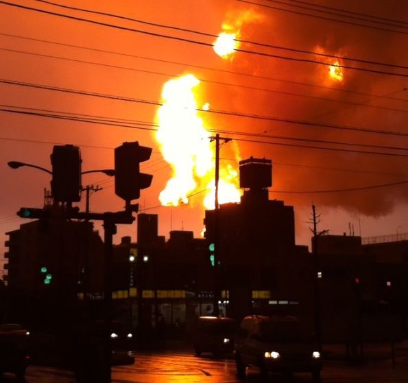
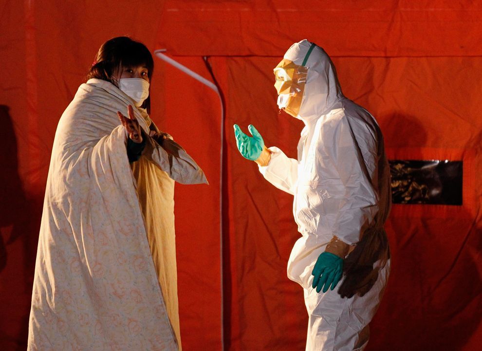
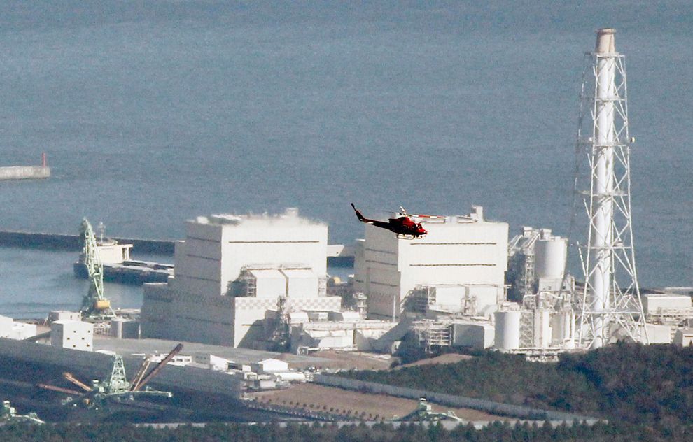
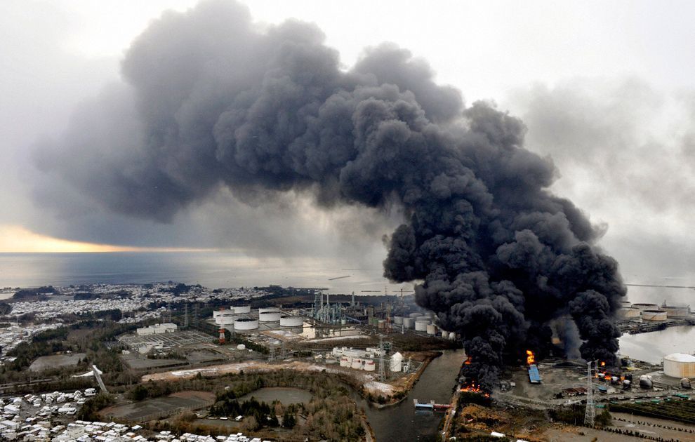
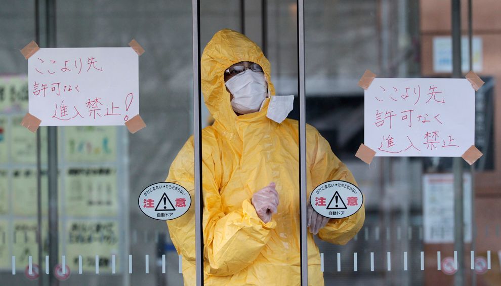
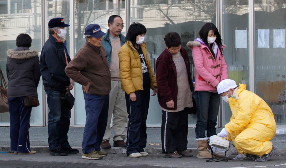
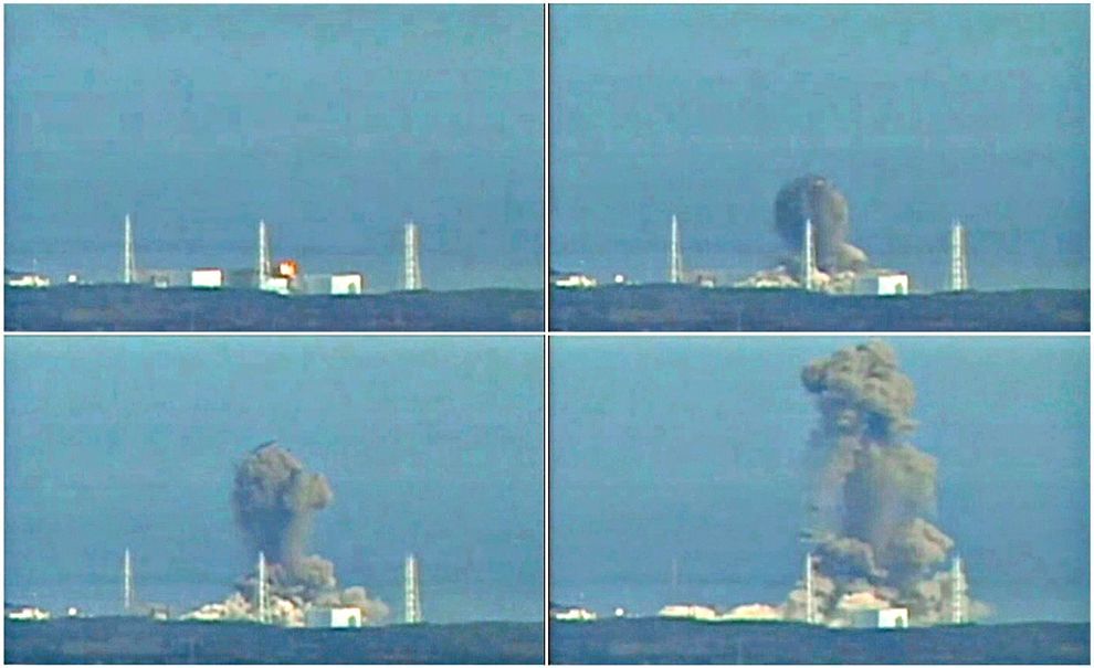
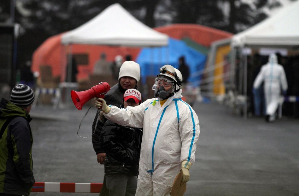
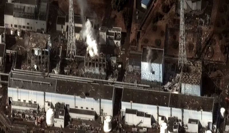
The Fukushima I, Fukushima II, Onagawa Nuclear Power Plant and Tōkai nuclear power stations, consisting of a total eleven reactors, were automatically shut down following the earthquake. Higashidōri, also on the northeast coast, was already shut down for a periodic inspection. Cooling is needed to remove decay heat after a reactor has been shut down, and to maintain spent fuel pools. The backup cooling process is powered by emergency diesel generators at the plants and at Rokkasho nuclear reprocessing plant. At Fukushima I and II tsunami waves overtopped seawalls and destroyed diesel backup power systems, leading to severe problems at Fukushima I, including three large explosions and radioactive leakage. Over 200,000 people were evacuated.

The April 7 aftershock caused the loss of external power to Rokkasho Reprocessing Plant and Higashidori Nuclear Power Plant but backup generators were functional. Onagawa Nuclear Power Plant lost 3 of 4 external power lines and lost cooling function for as much as 80 minutes. A spill of a couple liters of radioactive water occurred at Onagawa.

Europe's Energy Commissioner Günther Oettinger addressed the European Parliament on 15 March, explaining that the nuclear disaster an "apocalypse". As the nuclear crisis entered a second month, experts recognized that Fukushima I is not the worst nuclear accident ever, but it is the most complicated.


Fukushima I and II Nuclear Power Plants

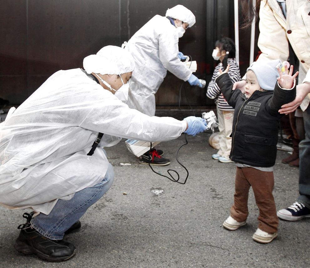
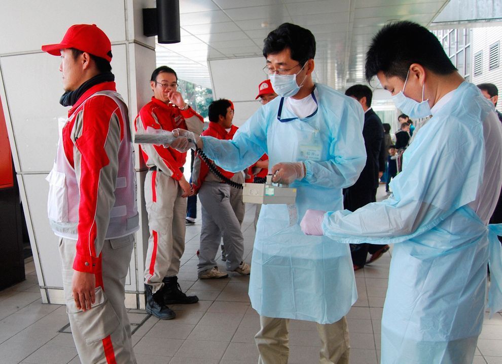
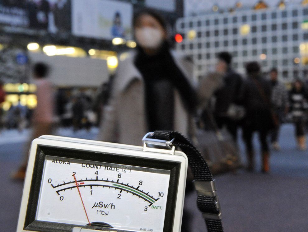
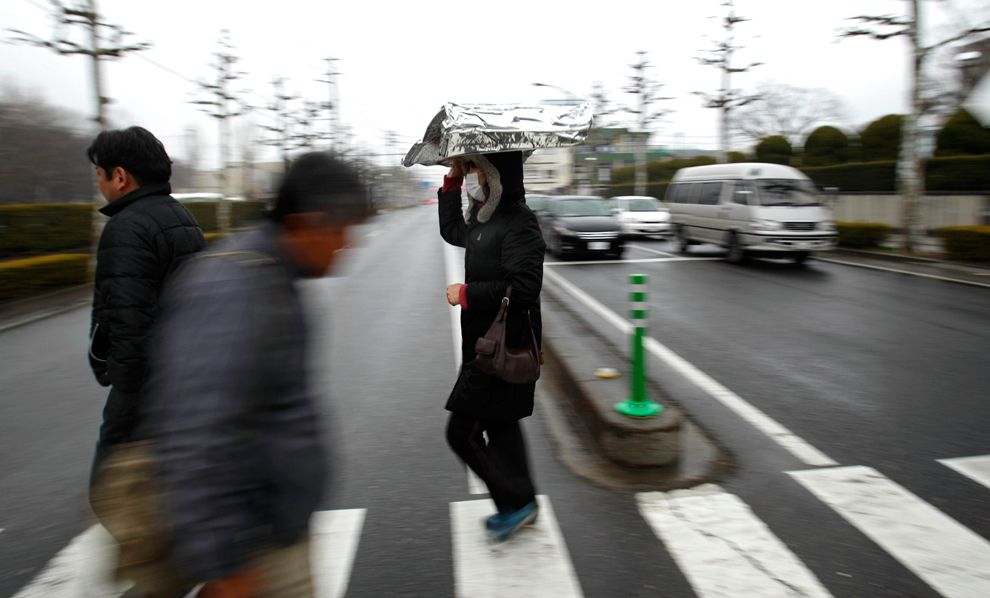
Japan declared a state of emergency following the failure of the cooling system at the Fukushima I Nuclear Power Plant, resulting in the evacuation of nearby residents. Officials from the Japanese Nuclear and Industrial Safety Agency reported that radiation levels inside the plant were up to 1,000 times normal levels, and that radiation levels outside the plant were up to 8 times normal levels. Later, a state of emergency was also declared at the Fukushima II nuclear power plant about 11 km (7 mi) south. This brought the total number of problematic reactors to six.

It was reported that radioactive iodine was detected in the tap water in Fukushima, Toshigi, Gunma, Tokyo, Chiba, Saitama, and Niigata, and radioactive cesium in the tap water in Fukushima, Tochigi and Gunma. Radioactive cesium, iodine, and strontium were also detected in the soil in some places in Fukushima. There may be a need to replace the contaminated soil. Food products were also found contaminated by radioactive matter in several places in Japan. On April 5, 2011, the government of the Ibaraki Prefecture banned the fishing of sand lance after discovering that this species was contaminated by radioactive cesium above legal limits.


Click image for larger version

Name:	Onagawa_Nuclear_Power_Plant.jpg
Views:	1688
Size:	70.7 KB
ID:	266931
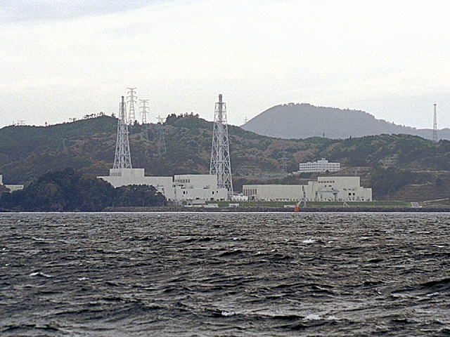
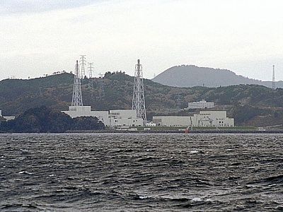
Onagawa Nuclear Power Plant on November 16th 2003.


Onagawa Nuclear Power Plant

A fire occurred in the turbine section of the Onagawa Nuclear Power Plant following the earthquake. The blaze was in a building housing the turbine, which is sited separately from the plant's reactor, and was soon extinguished. The plant was shut down as a precaution.

On 13 March the lowest-level state of emergency was declared regarding the Onagawa plant as radioactivity readings temporarily exceeded allowed levels in the area of the plant. Tohoku Electric Power Co. stated this may have been due to radiation from the Fukushima I nuclear accidents but was not from the Onagawa plant itself.

As a result of the April 7 aftershock, Onagawa Nuclear Power Plant lost 3 of 4 external power lines and lost cooling function for as much as 80 minutes. A spill of a couple liters of radioactive water occurred at Onagawa.


Click image for larger version

Name:	TOKAI-1_and_2_NPP.jpg
Views:	1734
Size:	65.1 KB
ID:	266932
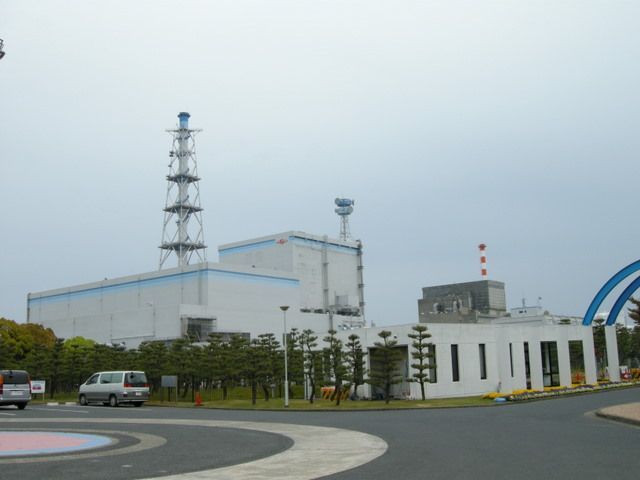
Tōkai Nuclear Power Plant, Unit 1 and 2. May 2009

Tōkai Nuclear Power Plant

The number 2 reactor at Tōkai Nuclear Power Plant was shut down automatically. On 14 March it was reported that a cooling system pump for this reactor had stopped working; however, the Japan Atomic Power Company stated that there was a second operational pump sustaining the cooling systems, but that two of three diesel generators used to power the cooling system were out of order.


Click image for larger version

Name:	800px-Soil-liquefaction_at_Shinkiba_after_after_2011_Tohoku_Pacific_Ocean_offshore_earthquake.jpg
Views:	2031
Size:	115.6 KB
ID:	266924
Soil liquefaction in Koto, Tokyo


Click image for larger version

Name:	2011_Japan_Earthquake_Tokyo_Tower.jpg
Views:	1667
Size:	19.9 KB
ID:	266927
Damage to Tokyo Tower


Click image for larger version

Name:	229px-2011_Earthquake_and_Tsunami_near_Sendai%2C_Japan.jpg
Views:	1691
Size:	51.3 KB
ID:	266934
Tsunami damage between Sendai and Sendai Bay. Check The Full Sized Picture Here


Click image for larger version

Name:	800px-Shinchi_Sta_20110404.jpg
Views:	1895
Size:	118.2 KB
ID:	266936
Remains of Shinchi Train Station


Click image for larger version

Name:	800px-Tohoku_Shinkansen_Damaged_by_2011_Sendai_Earthquake.jpg
Views:	1734
Size:	49.6 KB
ID:	266937
Damage to overhead lines on the Tōhoku Shinkansen


Click image for larger version

Name:	bp9.jpg
Views:	1766
Size:	680.7 KB
ID:	266947
People take shelter as a ceiling collapses in a bookstore during an earthquake in Sendai, northeastern Japan March 11.


Click image for larger version

Name:	bp10.jpg
Views:	1829
Size:	680.2 KB
ID:	266948
10Tsunami swirls near a port in Oarai, Ibaraki Prefecture (state) after Japan was struck by a strong earthquake off its northeastern coast Friday, March 11.


Click image for larger version

Name:	bp11.jpg
Views:	1770
Size:	364.4 KB
ID:	266949
Seismologists pose for the media as they display a seismographic graph showing the magnitude of the earthquake in Japan, on a monitor at the British Geological Survey office in Edinburgh, Scotland March 11, 2011. The biggest earthquake on record to hit Japan struck the northeast coast on Friday, triggering a 10-metre tsunami that swept away everything in its path, including houses, ships, cars and farm buildings.


Click image for larger version

Name:	bp12.jpg
Views:	1932
Size:	489.5 KB
ID:	266950
An energy map provided by the National Oceanic and Atmospheric Administration (NOAA) shows the intensity of the tsunami caused by the magnitude 8.9 earthquake which struck Japan on March 11, 2011. A tsunami warning has been issued for the entire Pacific basin except mainland United States and Canada following a huge earthquake that hit Japan on Friday, the U.S. Pacific Tsunami Warning Center said. The warning includes Hawaii and extends from Mexico down to South American countries on the Pacific, the center said.


Click image for larger version

Name:	bp13.jpg
Views:	1732
Size:	460.9 KB
ID:	266951
This National Oceanic and Atmospheric Administration (NOAA) Global bathymetry map image released on March 11, 2011 shows features of the ocean floor depth (or bathymetry) from a NOAA ETOPO-1 dataset. The image shows the entire Western Pacific basin. Notice how abruptly the Japanese islands rise out of the ocean. Other coastal Asian areas have much more gradual slopes. The islands and mountain ranges throughout the ocean, visible in this imagery, also affect the tsunami travel time and speed. In the open ocean, tsunamis can travel at speeds up to 500 mph (800 kph). This momentum is what creates such a destructive force as the wave moves inland. Tsunami waves rolled thousands of miles across the Pacific Ocean after a massive earthquake off Japan and washed ashore in Hawaii early March 11, 2011, but the tourist hotspot appeared to escape major damage. As sirens blared and Hawaiian authorities rapidly evacuated low-lying areas, the Pacific Tsunami Warning Center reported wave changes at Waianae Harbor at around 3:24 a.m.


Click image for larger version

Name:	bp21.jpg
Views:	1649
Size:	456.0 KB
ID:	266959
Japan's Prime Minister Naoto Kan (center) reacts he he feels an earthquake as he attends a committee meeting in the upper house of parliament in Tokyo March 11. A massive 8.8 magnitude quake hit the northeast coast of Japan on Friday, shaking buildings in the capital Tokyo, causing "many injuries", at least one fire and triggering a four-metre (13-ft) tsunami, NHK television and witnesses reported.


Click image for larger version

Name:	bp38.jpg
Views:	1701
Size:	330.6 KB
ID:	266976
Police place roadside flares along the highway on March 11 in Honolulu, Hawaii. An earthquake measuring 8.9 on the Richter scale has hit the northeast coast of Japan causing tsunami alerts throughout the Pacific Ocean. Thousands along the coast are evacuating their homes in Hawaii as the state prepares for tsunami waves.


Click image for larger version

Name:	bp39.jpg
Views:	1967
Size:	376.8 KB
ID:	266977
Puipui Faletoi, of Moiliili, Oahu, background center, rests in his vehicle with his sons Daniel, left, and Fletcher Faletoi in the parking lot of Manoa District Park in Oahu, Hawaii. The site is a volunteer staging area which could turn into a Red Cross shelter if a tsunami arrives. The Faletoi family plan to take shelter here.


Click image for larger version

Name:	bp40.jpg
Views:	1794
Size:	546.5 KB
ID:	266978
Students hold candles as they pray for Japan's earthquake victims inside their school in the western Indian city of Ahmedabad March 11.


Click image for larger version

Name:	bp6d.jpg
Views:	2095
Size:	455.3 KB
ID:	267142
The 4,724-ton freighter M.V. Asia Symphony lies on a pier after being hit by the tsunami at the port in Kamaishi city, Iwate prefecture on March 16. All 17 Filipino crew (next picture) are safe and living at an emergency shelter near the port.


Click image for larger version

Name:	bp7d.jpg
Views:	1745
Size:	581.1 KB
ID:	267143
A Filipino freighter crew sits in a shelter in Kamaishi city, Iwate prefecture on March 16. Their ship M.V. Asia Symphony (previous picture) was carried onto the pier after being hit by the tsunami.


Click image for larger version

Name:	bp16d.jpg
Views:	1734
Size:	427.1 KB
ID:	267152
People watch a television broadcasting Japan's Emperor Akihito's televised address to the nation at an electronics retail store in Tokyo March 16. Japanese Emperor Akihito said on Wednesday that problems at Japan's nuclear-power reactors were unpredictable and he was "deeply worried" following an earthquake he described as "unprecedented in scale". It was an extraordinarily rare appearance by the emperor and his first public comments since last week's devastating earthquake and tsunami that killed thousands of people.

Sources : Boston.com, wikipedia, google image search, google video search, youtube.com, BBC.co.uk & Telegraph.co.uk
800px-US_Navy_110320-N-OB360-166_An_aerial_view_of_ships_washed_ashore_and_overturned_at_a_port_.jpg
115.2 KB ·2030 views
800px-SendaiAirportMarch16.jpg
88.1 KB ·1743 views
Cosmo_Oil_explosion_2_20110311CROP.jpg
83.8 KB ·1706 views
800px-Rescued_from_Tsunami_at_Ishinomaki.JPG
92.9 KB ·2054 views
bp1.jpg
647.8 KB ·1904 views
bp2.jpg
627.8 KB ·1811 views
bp3.jpg
585.0 KB ·1866 views
bp4.jpg
360.5 KB ·1714 views
bp5.jpg
949.5 KB ·1774 views
bp7.jpg
567.5 KB ·1773 views
bp8.jpg
577.7 KB ·1647 views
bp14.jpg
467.7 KB ·1668 views
bp15.jpg
621.0 KB ·1719 views
bp16.jpg
1.07 MB ·1711 views
bp17.jpg
519.9 KB ·1764 views
bp18.jpg
534.6 KB ·1789 views
bp19.jpg
589.0 KB ·1687 views
bp20.jpg
552.6 KB ·1793 views
bp22.jpg
503.9 KB ·1646 views
bp23.jpg
444.2 KB ·1708 views
bp24.jpg
576.1 KB ·1754 views
bp25.jpg
678.6 KB ·1724 views
bp26.jpg
614.9 KB ·1709 views
bp27.jpg
565.6 KB ·1663 views
bp28.jpg
747.4 KB ·1683 views
bp29.jpg
483.2 KB ·1718 views
bp30.jpg
455.2 KB ·1641 views
bp31.jpg
541.5 KB ·1664 views
bp32.jpg
474.8 KB ·1673 views
bp33.jpg
580.2 KB ·1691 views
bp34.jpg
593.0 KB ·1630 views
bp35.jpg
573.3 KB ·1704 views
bp36.jpg
534.8 KB ·1814 views
bp37.jpg
431.6 KB ·1684 views
bp41.jpg
612.2 KB ·1723 views
bp42.jpg
416.5 KB ·1709 views
bp43.jpg
616.9 KB ·1609 views
bp44.jpg
847.9 KB ·1642 views
bp45.jpg
696.8 KB ·1945 views
bp47.jpg
604.0 KB ·1654 views
bp1a.jpg
461.8 KB ·1715 views
bp2a.jpg
1.02 MB ·1690 views
bp3a.jpg
763.1 KB ·1955 views
bp4a.jpg
474.7 KB ·1738 views
bp5a.jpg
372.5 KB ·1663 views
bp6a.jpg
567.5 KB ·1670 views
bp7a.jpg
664.6 KB ·1619 views
bp8a.jpg
503.0 KB ·1802 views
bp9a.jpg
558.2 KB ·1982 views
bp10a.jpg
514.1 KB ·1655 views
bp11a.jpg
514.1 KB ·1679 views
bp12a.jpg
557.6 KB ·1619 views
bp13a.jpg
561.4 KB ·1696 views
bp14a.jpg
424.7 KB ·1639 views
bp15a.jpg
637.7 KB ·1798 views
bp16a.jpg
573.4 KB ·1824 views
bp17a.jpg
507.9 KB ·1665 views
bp18a.jpg
623.7 KB ·1938 views
bp19a.jpg
808.6 KB ·1668 views
bp20a.jpg
715.8 KB ·1600 views
bp21a.jpg
753.9 KB ·1873 views
bp22a.jpg
648.7 KB ·2038 views
bp23a.jpg
872.9 KB ·1628 views
bp24a.jpg
544.1 KB ·1579 views
bp25a.jpg
814.6 KB ·2413 views
bp26a.jpg
1,004.6 KB ·1737 views
bp27a.jpg
646.1 KB ·2318 views
bp28a.jpg
608.1 KB ·1646 views
bp29a.jpg
389.0 KB ·1676 views
bp30a.jpg
467.9 KB ·1599 views
bp31a.jpg
662.0 KB ·1688 views
bp32a.jpg
675.2 KB ·1555 views
bp33a.jpg
514.9 KB ·1637 views
bp34a.jpg
556.1 KB ·1492 views
bp35a.jpg
1.12 MB ·1498 views
bp36a.jpg
509.8 KB ·1471 views
bp37a.jpg
618.8 KB ·1493 views
bp38a.jpg
665.1 KB ·1482 views
bp39a.jpg
654.3 KB ·1493 views
bp40a.jpg
519.6 KB ·1479 views
bp42a.jpg
1.06 MB ·1500 views
bp41a.jpg
639.3 KB ·1490 views
bp43a.jpg
653.8 KB ·1487 views
bp44a.jpg
728.4 KB ·1471 views
bp1b.jpg
1.10 MB ·1467 views
bp2b.jpg
601.3 KB ·1498 views
bp3b.jpg
678.1 KB ·1494 views
bp4b.jpg
274.3 KB ·1508 views
bp5b.jpg
670.7 KB ·1491 views
bp6b.jpg
570.4 KB ·1484 views
bp7b.jpg
877.7 KB ·1483 views
bp8b.jpg
535.5 KB ·1458 views
bp9b.jpg
698.1 KB ·1460 views
bp10b.jpg
381.2 KB ·1497 views
bp11b.jpg
639.4 KB ·1458 views
bp12b.jpg
555.4 KB ·1496 views
bp13b.jpg
719.5 KB ·1467 views
bp14b.jpg
411.4 KB ·1476 views
bp15b.jpg
398.9 KB ·1487 views
bp16b.jpg
473.9 KB ·1505 views
bp17b.jpg
558.0 KB ·1457 views
bp18b.jpg
520.8 KB ·1457 views
bp19b.jpg
442.1 KB ·1450 views
bp20b.jpg
376.6 KB ·1481 views
bp21b.jpg
395.2 KB ·1477 views
bp22b.jpg
649.4 KB ·1490 views
bp23b.jpg
716.7 KB ·1450 views
bp24b.jpg
795.1 KB ·1464 views
bp25b.jpg
539.9 KB ·1443 views
bp26b.jpg
713.8 KB ·1464 views
bp27b.jpg
755.1 KB ·1445 views
bp28b.jpg
553.7 KB ·1492 views
bp29b.jpg
604.8 KB ·1432 views
bp30b.jpg
535.6 KB ·1427 views
bp31b.jpg
695.6 KB ·1453 views
bp32b.jpg
479.4 KB ·1430 views
bp33b.jpg
603.8 KB ·1447 views
bp34b.jpg
896.5 KB ·1493 views
bp35b.jpg
795.3 KB ·1421 views
bp36b.jpg
607.9 KB ·1439 views
bp37b.jpg
475.4 KB ·1430 views
bp38b.jpg
489.1 KB ·1449 views
bp39b.jpg
357.1 KB ·1469 views
bp40b.jpg
811.3 KB ·1441 views
bp41b.jpg
597.8 KB ·1432 views
bp45b.jpg
490.9 KB ·1480 views
bp46b.jpg
654.7 KB ·1481 views
bp47b.jpg
599.9 KB ·1444 views
bp48b.jpg
600.1 KB ·1468 views
bp49b.jpg
670.0 KB ·1420 views
bp50b.jpg
445.6 KB ·1472 views
bp51b.jpg
472.9 KB ·1453 views
bp3c.jpg
550.7 KB ·1469 views
bp5c.jpg
426.5 KB ·1454 views
bp8c.jpg
316.6 KB ·1460 views
bp11c.jpg
777.9 KB ·1430 views
bp9c.jpg
527.7 KB ·1421 views
bp20c.jpg
492.3 KB ·1442 views
bp21c.jpg
506.0 KB ·1438 views
bp24c.jpg
753.2 KB ·1441 views
bp25c.jpg
462.7 KB ·1442 views
bp26c.jpg
411.6 KB ·1466 views
bp27c.jpg
525.2 KB ·1437 views
bp28c.jpg
587.7 KB ·1416 views
bp29c.jpg
416.1 KB ·1448 views
bp30c.jpg
504.2 KB ·1430 views
bp31c.jpg
459.6 KB ·1437 views
bp32c.jpg
463.8 KB ·1419 views
bp33c.jpg
427.8 KB ·1451 views
bp34c.jpg
578.5 KB ·1440 views
bp35c.jpg
533.9 KB ·1468 views
bp36c.jpg
562.2 KB ·1450 views
bp37c.jpg
706.2 KB ·1436 views
bp38c.jpg
607.3 KB ·1434 views
bp39c.jpg
457.2 KB ·1419 views
bp40c.jpg
650.7 KB ·1442 views
bp41c.jpg
542.3 KB ·1449 views
bp42c.jpg
737.1 KB ·1449 views
bp43c.jpg
435.0 KB ·1449 views
bp44c.jpg
509.4 KB ·1432 views
bp45c.jpg
617.1 KB ·1441 views
bp46c.jpg
673.0 KB ·1434 views
bp47c.jpg
510.7 KB ·1415 views
bp48c.jpg
399.2 KB ·1461 views
bp49c.jpg
501.3 KB ·1453 views
bp50c.jpg
350.9 KB ·1479 views
bp51c.jpg
727.9 KB ·1451 views
bp52c.jpg
869.6 KB ·1441 views
bp1d.jpg
740.1 KB ·1441 views
bp3d.jpg
683.4 KB ·1443 views
bp4d.jpg
428.9 KB ·1471 views
bp8d.jpg
470.9 KB ·1435 views
bp10d.jpg
615.2 KB ·1437 views
bp11d.jpg
640.9 KB ·1438 views
bp12d.jpg
643.6 KB ·1433 views
bp14d.jpg
524.4 KB ·1483 views
bp19d.jpg
815.2 KB ·1419 views
bp20d.jpg
468.7 KB ·1477 views
bp24d.jpg
901.6 KB ·1409 views
bp25d.jpg
844.0 KB ·1445 views
bp26d.jpg
617.0 KB ·1419 views
bp27d.jpg
416.2 KB ·1448 views
bp1e.jpg
548.2 KB ·1431 views
bp2e.jpg
861.3 KB ·1415 views
bp3e.jpg
506.5 KB ·1428 views
bp7e.jpg
634.9 KB ·1420 views
bp17e.jpg
694.4 KB ·1432 views
bp18e.jpg
719.4 KB ·1403 views
bp19e.jpg
536.6 KB ·1432 views
bp20e.jpg
578.5 KB ·1437 views
bp21e.jpg
724.9 KB ·1406 views
bp22e.jpg
572.2 KB ·1419 views
bp24e.jpg
662.6 KB ·1435 views
bp9f.jpg
479.6 KB ·1421 views
bp10f.jpg
730.6 KB ·1405 views
bp12f.jpg
511.0 KB ·1429 views
bp13f.jpg
623.4 KB ·1404 views
bp14f.jpg
557.7 KB ·1413 views
bp15f.jpg
660.0 KB ·1407 views
bp16f.jpg
575.5 KB ·1448 views
bp17f.jpg
585.8 KB ·1414 views
bp20f.jpg
564.7 KB ·1405 views
bp21f.jpg
516.7 KB ·1410 views
bp24f.jpg
935.7 KB ·1408 views
bp25f.jpg
683.8 KB ·1424 views
22 Users Say Thank You For This Post:
amyg36, Bleed, BuggaBugga1104, candymosh, carbo401, Ciora, deadcat1, Faline, Flaka, Iced Coffee Man, jintsy, kellyhound, L1v1ngD3ad, Lobsterbird, Ntwadumela, Phobophile, rknrvt, Sharon, Tiffles, Vixənn, voidinvocation, William May
▼ PROMO FROM DOCUMENTING REALITY
Want a better bang for your buck?
Join Now
Hidden for upgraded members.
  #2  
04-26-2011, 12:19 PM
güttsfükk's Avatar
güttsfükk
Offline:
Super *********
Poster Rank:88
Join Date: Nov 2008
Posts: 17,426
 
Mentioned: 5 Post(s)
Quoted: 99 Post(s)
Activity Longevity
0/20 18/20
Today Posts
0/11 ssss17426
Re: The 2011 Tōhoku Earthquake and Tsunami, Japan. (11 March 2011) -

These are links to DR posts which have videos of the Tsunami & Earthquake

http://www.documentingreality.com/fo...-2011-a-75931/

http://www.documentingreality.com/fo...-bridge-73954/

http://www.documentingreality.com/fo...andfall-76012/

http://www.documentingreality.com/fo...i-japan-75936/

http://www.documentingreality.com/fo...andfall-75937/

http://www.documentingreality.com/fo...prt-2-a-75796/

http://www.documentingreality.com/fo...ng-cars-74124/

http://www.documentingreality.com/fo...to-land-76015/

http://www.documentingreality.com/fo...tsunami-75797/

http://www.documentingreality.com/fo...ndscape-76017/

http://www.documentingreality.com/fo...america-76042/

http://www.documentingreality.com/fo...tsunami-75795/

http://www.documentingreality.com/fo...-inside-73710/

http://www.documentingreality.com/fo...ko-city-75932/

http://www.documentingreality.com/fo...icopter-73331/

http://www.documentingreality.com/fo...ar-park-76016/

http://www.documentingreality.com/fo...a-japan-73332/

http://www.documentingreality.com/fo...on-path-73433/

http://www.documentingreality.com/fo...tsunami-75774/

http://www.documentingreality.com/fo...-2011-a-75494/

http://www.documentingreality.com/fo...ication-75865/

http://www.documentingreality.com/fo...t-japan-74533/

http://www.documentingreality.com/fo...minutes-73562/

http://www.documentingreality.com/fo...-office-77156/

http://www.documentingreality.com/fo...ecorded-76427/

http://www.documentingreality.com/fo...e-house-73330/

http://www.documentingreality.com/fo...tsunami-81306/

http://www.documentingreality.com/fo...0/#post2116150
13 Users Say Thank You For This Post:
Bleed, bliss, carbo401, Faline, Hugh Jardon, kellyhound, Lobsterbird, nsco, Ntwadumela, Pelle, Sharon, St. Geno, William May
  #3  
04-26-2011, 02:32 PM
nsco's Avatar
nsco
Offline:
My Rank: CORPORAL
Poster Rank:1670
Join Date: Jul 2009
Posts: 324
 
Mentioned: 0 Post(s)
Quoted: 3 Post(s)
Activity Longevity
0/20 17/20
Today Posts
0/11 ssssss324
Re: The 2011 Tōhoku Earthquake and Tsunami, Japan. (11 March 2011) -

nice post^^ must have taken you quite time with the pics
  #4  
04-26-2011, 02:59 PM
Faline's Avatar
Faline
Offline:
My Rank: MAJOR
Poster Rank:11
Join Date: Jun 2009
Posts: 93,130
Contributions: 226
 
Mentioned: 91 Post(s)
Quoted: 2009 Post(s)
Activity Longevity
0/20 18/20
Today Posts
0/11 ssss93130
Re: The 2011 Tōhoku Earthquake and Tsunami, Japan. (11 March 2011) -

Great work
  #5  
04-26-2011, 03:17 PM
Shelbeano ^-^'s Avatar
Shelbeano ^-^
Offline:
My Rank: STAFF SERGEANT
Poster Rank:879
Female
Join Date: Apr 2010
Posts: 852
 
Mentioned: 0 Post(s)
Quoted: 8 Post(s)
Activity Longevity
0/20 17/20
Today Posts
0/11 ssssss852
Re: The 2011 Tōhoku Earthquake and Tsunami, Japan. (11 March 2011) -

Wow great effort!
This User Says Thank You For This Post:
William May
  #6  
04-26-2011, 03:28 PM
vnathan's Avatar
vnathan
Offline:
So Fucking Banned
Poster Rank:50818
8=====>
Join Date: Oct 2009
 
Mentioned: 0 Post(s)
Quoted: 0 Post(s)
Activity Longevity
0/20 17/20
Today Posts
0/11 ssssssss0
Re: The 2011 Tōhoku Earthquake and Tsunami, Japan. (11 March 2011) -

Nice compilation. Looks like repairs to infrastructure will take almost an entire year.
  #7  
04-26-2011, 04:19 PM
Pelle's Avatar
Pelle
Offline:
My Rank: MAJOR
Poster Rank:148
Male
Join Date: Feb 2010
Posts: 11,125
 
Mentioned: 6 Post(s)
Quoted: 205 Post(s)
Activity Longevity
0/20 17/20
Today Posts
0/11 ssss11125
Re: The 2011 Tōhoku Earthquake and Tsunami, Japan. (11 March 2011) -

Wow, great collection of pics and info!

This is so fuckin sad
This User Says Thank You For This Post:
William May
  #8  
04-26-2011, 04:32 PM
güttsfükk's Avatar
güttsfükk
Offline:
Super *********
Poster Rank:88
Join Date: Nov 2008
Posts: 17,426
 
Mentioned: 5 Post(s)
Quoted: 99 Post(s)
Activity Longevity
0/20 18/20
Today Posts
0/11 ssss17426
Re: The 2011 Tōhoku Earthquake and Tsunami, Japan. (11 March 2011) -

Originally Posted by nsco
nice post^^ must have taken you quite time with the pics
took roughly 4 hours
5 Users Say Thank You For This Post:
deadcat1, nsco, Phobophile, Sharon, William May
  #9  
04-26-2011, 05:41 PM
Phobophile's Avatar
Phobophile
Offline:
Ien twa trije!
Poster Rank:560
Male
Join Date: Nov 2009
Posts: 1,731
 
Mentioned: 0 Post(s)
Quoted: 7 Post(s)
Activity Longevity
0/20 17/20
Today Posts
0/11 sssss1731
Re: The 2011 Tōhoku Earthquake and Tsunami, Japan. (11 March 2011) -

great work dude!
  #10  
04-26-2011, 07:29 PM
vengence20's Avatar
vengence20
Offline:
So Fucking Banned
Poster Rank:1756
female
Join Date: Apr 2011
Posts: 299
 
Mentioned: 0 Post(s)
Quoted: 0 Post(s)
Activity Longevity
0/20 16/20
Today Posts
0/11 ssssss299
Re: The 2011 Tōhoku Earthquake and Tsunami, Japan. (11 March 2011) -

Documenting Reality Caught on Camera Natural Disasters & Extreme Weather Events The 2011 Tōhoku Earthquake and Tsunami, Japan. (11 March 2011) -


Powered by vBulletin Copyright 2000-2010 Jelsoft Enterprises Limited.

Search Engine Friendly URLs by vBSEO