JavaScript and Cookies are required to view this site. Please enable both in your browser settings.
Volcano, Tropical Storm, Floods, Sinkhole, Landslides. Guatemala. 27May-1June 2010
Documenting Reality True Crime Related Chat & Research Interesting People, Places, Things, Animals Volcano, Tropical Storm, Floods, Sinkhole, Landslides. Guatemala. 27May-1June 2010

Volcano, Tropical Storm, Floods, Sinkhole, Landslides. Guatemala. 27May-1June 2010 

Current Rating:

Unlimited Views No Ads No Algorithms Lifetime Account

Documenting Reality

Community Forum · Est. 2006

Join Now
Thread Tools
  #1  
06-05-2010, 05:36 PM
güttsfükk's Avatar
güttsfükk
Offline:
Super *********
Poster Rank:88
Join Date: Nov 2008
Posts: 17,426
 
Mentioned: 5 Post(s)
Quoted: 99 Post(s)
Activity Longevity
0/20 18/20
Today Posts
0/11 ssss17426
Volcano, Tropical Storm, Floods, Sinkhole, Landslides. Guatemala. 27May-1June 2010

for more threads like this one : http://www.documentingreality.com/fo...me-line-45276/


Also Click For :
Tropical Storm Agatha & Floods
Land & mud slides
The Giant Sinkhole


Click image for larger version

Name:	guatemala-volcanoes.gif
Views:	1485
Size:	11.7 KB
ID:	177857
Click image for larger version

Name:	800px-Pacaya_erupting_in_1976.jpg
Views:	803
Size:	50.2 KB
ID:	177847
An eruption of Pacaya in 1976

Click image for larger version

Name:	Volcan-de-pacaya.jpg
Views:	735
Size:	54.0 KB
ID:	177848


Pacaya is an active complex volcano in Guatemala, which first erupted approximately 23,000 years ago and has erupted at least 23 times since the Spanish conquest of Guatemala. Pacaya rises to an elevation of 2,552 metres (8,373 ft). After being dormant for a century, it erupted violently in 1965 and has been erupting continuously since then. Much of its activity is Strombolian, but occasional Plinian eruptions also occur, sometimes showering the nearby city of Antigua with ash.

Pacaya is a popular tourist attraction. Pacaya lies 30 kilometres (19 mi) southwest of Guatemala City and close to Antigua. The volcano sits inside the Escuintla Department.

In the late 1990s, there were frequent armed robberies on its slopes, which negatively affected tourism. However, by 2006, reports of violence decreased in line with increased security efforts by the government. Guatemalan and foreign tourism have increased.

So far, the last activity reported has been the eruption that peaked on May 27, 2010, causing ash to rain down in Guatemala City, Antigua and Escuintla.

May 2010 eruption


On May 27, 2010, the Pacaya volcano erupted, followed by several tremors. At approximately 20:00 hours there was a strong eruption ejecting debris and ash columns up to 1500 meters. Ash rained down in many Guatemalan cities to the northwest of the volcano, including Guatemala City. The volcanic ash fall has been pelting Guatemala City, and the international airport, La Aurora. The National Coordinator for Disaster Reduction (CONRED) declared a red alert for the communities near the volcano, and recommended the evacuation of some of them. Noti7 reporter Anibal Archila, one of the first to cover the event, was reported killed by volcanic debris.

President Álvaro Colom declared a state of calamity in the region adjacent to the volcano, and the Ministry of Education closed the schools in the departments of Guatemala, Escuintla and Sacatepequez. Heavy rainfall from Tropical Storm Agatha worsened the emergency situation, causing lahars, landslides and widespread flooding across the country. However, people working in coffee fields considered the rain brought by the storm to be helpful, removing ash from their trees


Click image for larger version

Name:	g03_23598495.jpg
Views:	442
Size:	221.4 KB
ID:	177850
Cameraman Byron Secaida recounts his story after being rescued from the Pacaya volcano near Guatemala City May 27, 2010. Byron was working with journalist Anibal Archila who was killed while reporting for local news Noti7 during the eruption.


Click image for larger version

Name:	g06_23603697.jpg
Views:	741
Size:	324.2 KB
ID:	177853
Children being evacuated on a school bus from the town of Calderas, Guatemala, Friday May 28, 2010, peer out from ash covered windows after the Pacaya volcano erupted a day earlier.


Click image for larger version

Name:	g07_23605401.jpg
Views:	577
Size:	139.2 KB
ID:	177854
A man shows the stitches he received after being injured by volcanic rock on the slopes of the Pacaya Volcano on May 28, 2010.


Click image for larger version

Name:	g09_23605461.jpg
Views:	536
Size:	278.5 KB
ID:	177856
Villagers remain outside their homes fearing new outbursts of the Pacaya volcano, south of Guatemala City, in Las Calderas, San Vicente Pacaya, Guatemala.


Main sources :
http://www.boston.com/
http://www.youtube.com
http://www.wikipedia.org
g02_23598199.jpg
75.2 KB ·1155 views
g04_23598319.jpg
167.6 KB ·606 views
g05_23604457.jpg
257.1 KB ·358 views
g08_23606777.jpg
285.3 KB ·728 views
article-0-09E5CFC4000005DC-563_634x361.jpg
23.4 KB ·516 views
article-0-09E5884B000005DC-348_634x408.jpg
40.8 KB ·411 views
article-0-09E587BF000005DC-197_634x342.jpg
22.7 KB ·595 views
article-0-09E587D8000005DC-913_634x381.jpg
37.9 KB ·667 views
Map_guatemala_volcanoes.gif
11.7 KB ·355 views
Click here to remove ›
4.92 MB ·93 views DownloadMember
▼ PROMO FROM DOCUMENTING REALITY
Cheaper than the doctor visit tomorrow
Join Now
Hidden for upgraded members.
  #2  
06-05-2010, 05:40 PM
güttsfükk's Avatar
güttsfükk
Offline:
Super *********
Poster Rank:88
Join Date: Nov 2008
Posts: 17,426
 
Mentioned: 5 Post(s)
Quoted: 99 Post(s)
Activity Longevity
0/20 18/20
Today Posts
0/11 ssss17426
Re: Volcano, Tropical Storm, Floods, Sinkhole, Landslides. Guatemala. 27May-1June 2010

Click image for larger version

Name:	600px-Agatha_29_May_2010.jpg
Views:	488
Size:	89.6 KB
ID:	177872


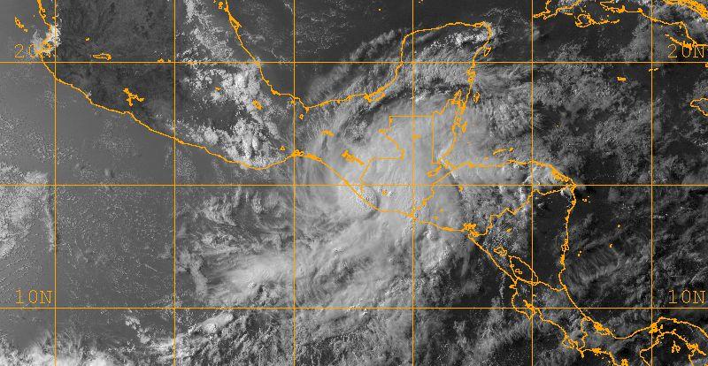
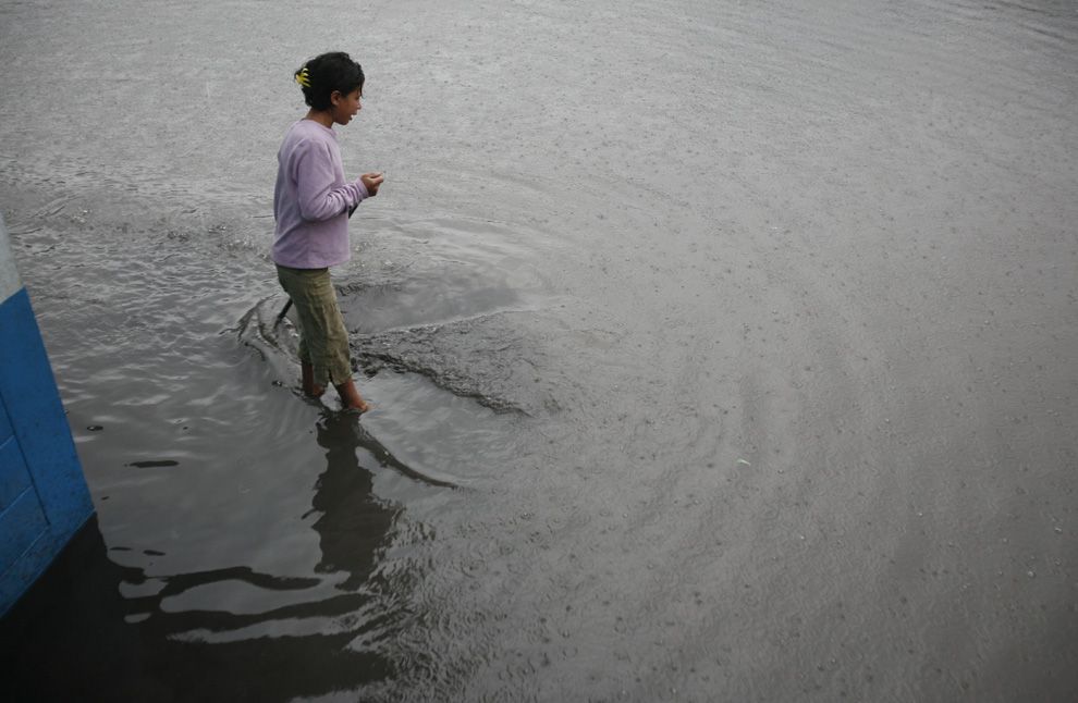
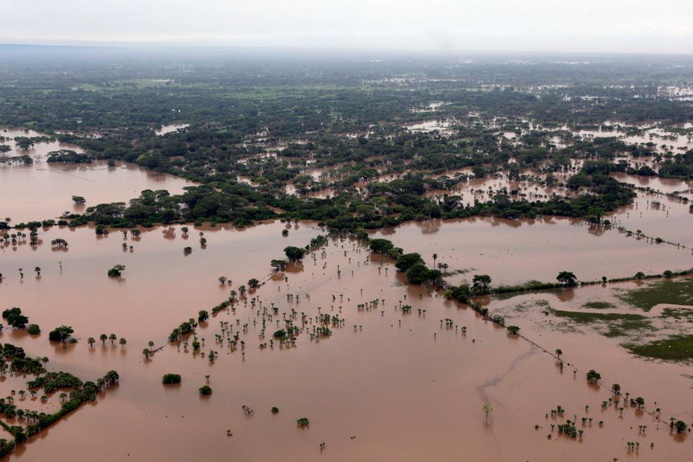
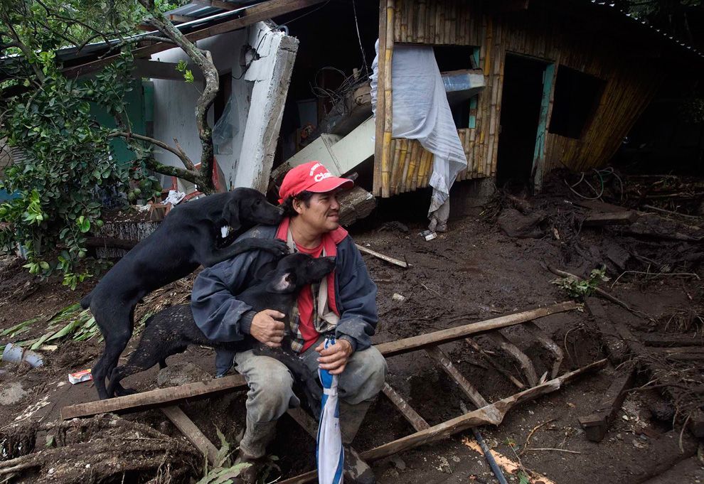
Tropical Storm Agatha was a weak, but catastrophic tropical cyclone that brought widespread floods to much of Central America and was the deadliest tropical cyclone in the eastern Pacific since Hurricane Pauline in 1997. The first storm of the 2010 Pacific hurricane season, Agatha originated from the Intertropical Convergence Zone, which is a region of thunderstorms across the tropics. It developed into a tropical depression on May 29, and dissipated on May 30, reaching top winds of 45 mph (75 km/h) and a lowest pressure of 1000 mbar (hPa; 29.53 inHg). It made landfall near the Guatemala–Mexico border on the evening of May 29. Agatha produced torrential rain all across Central America, which resulted in the death of one person in Nicaragua. In Guatemala, 152 people were killed and 100 left missing by landslides. 13 deaths also occurred in El Salvador. It soon dissipated over Guatemala.


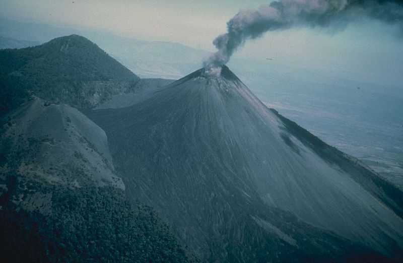
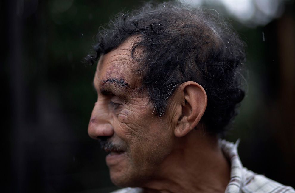
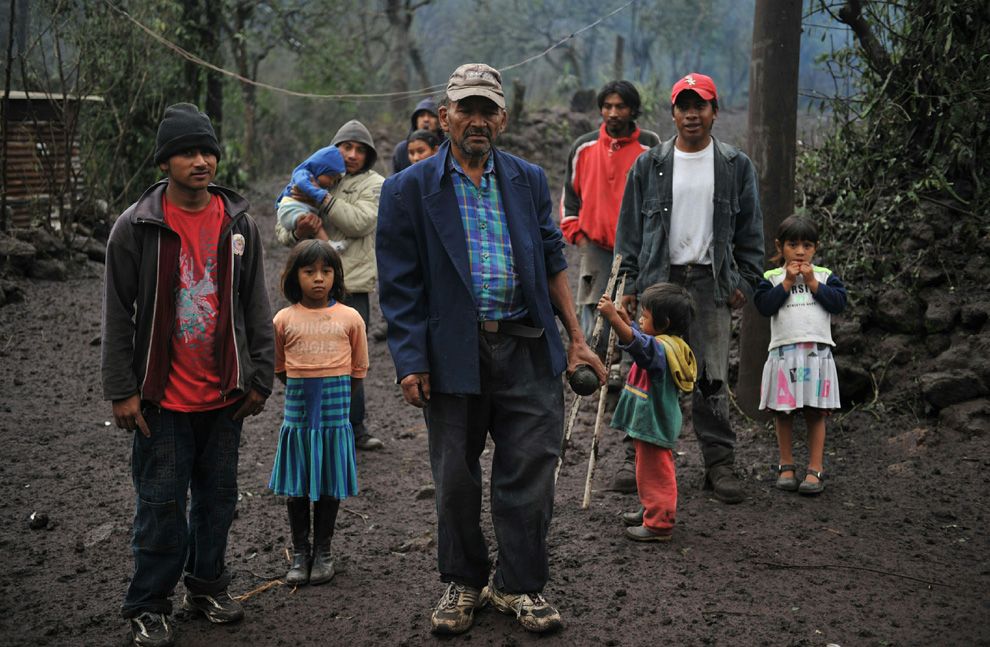
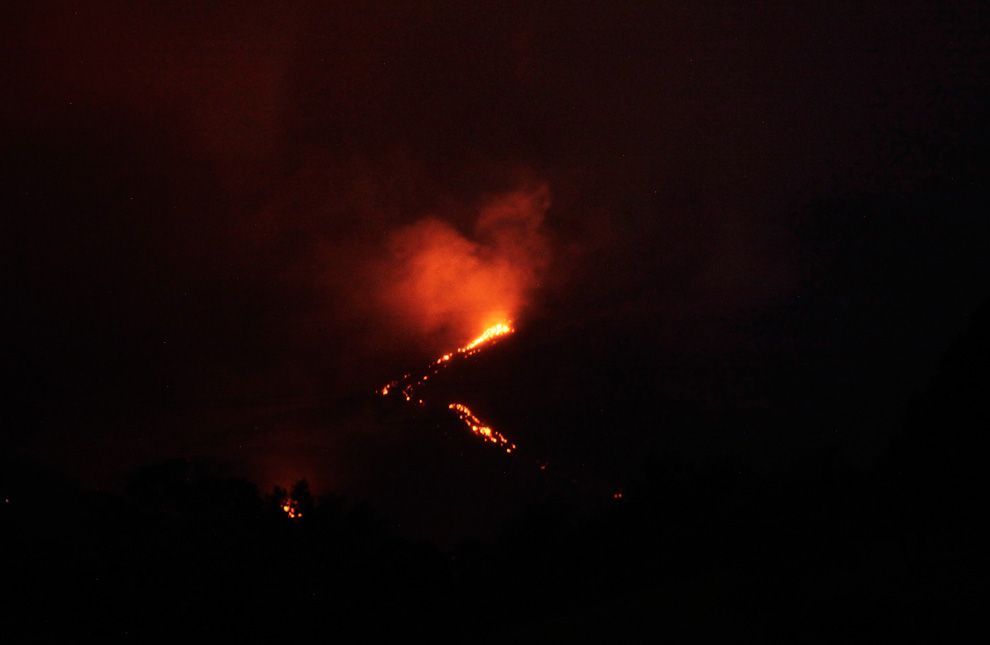
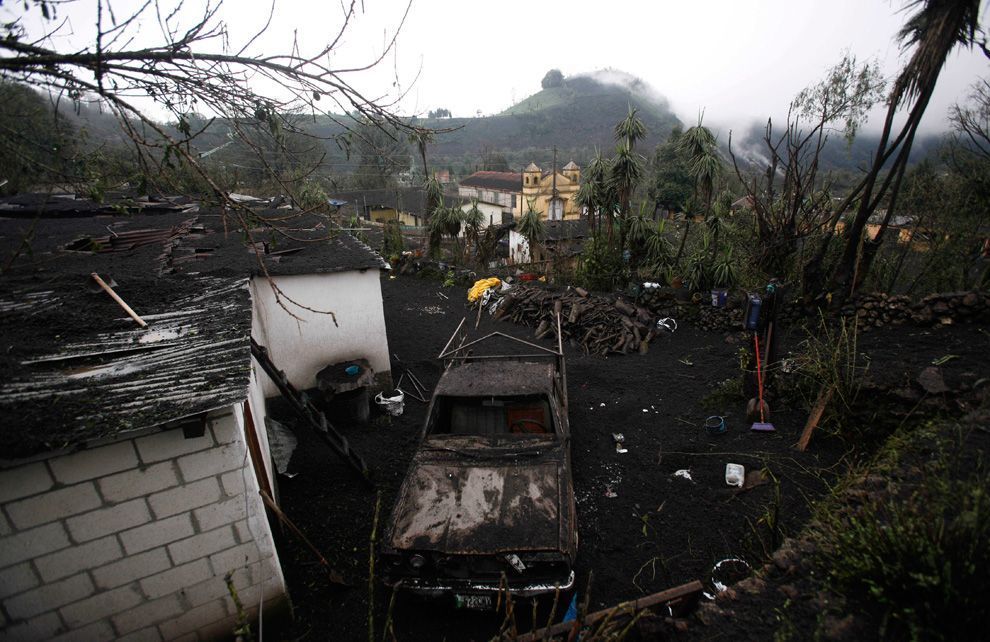
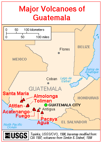
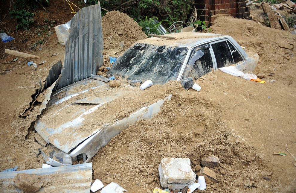
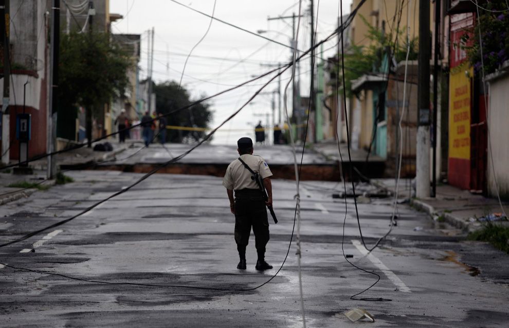
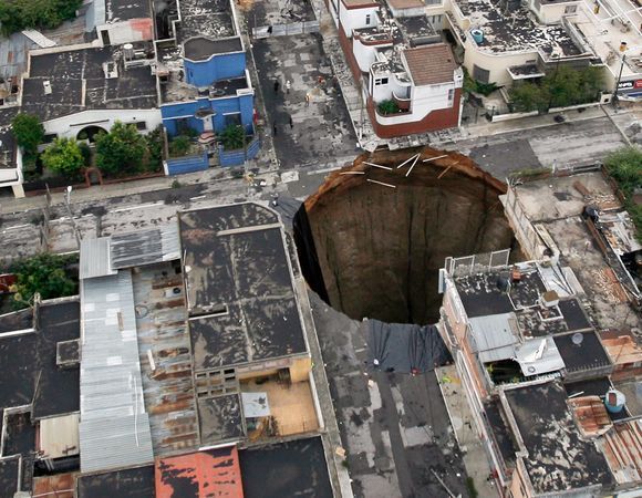
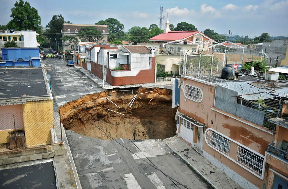
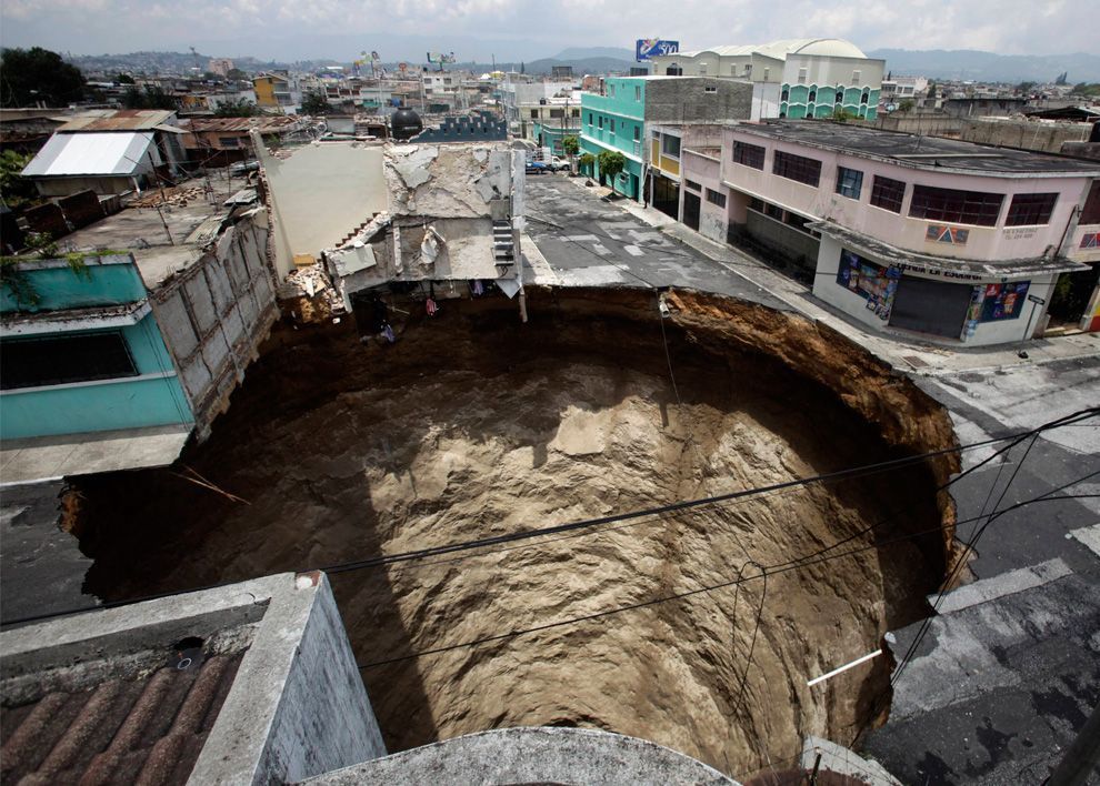
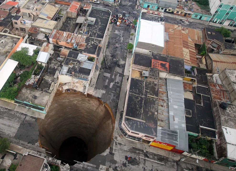
Two days before landfall, the Pacaya volcano, roughly 25 mi (40 km) south of Guatemala City, erupted on May 27, killing one person and forcing over 2,000 people to evacuate, and causing the temporary closing of the main international airport. Excessive rainfall from Agatha in the region could exacerbate the situation and trigger lahars. However, people working in coffee fields considered the rain brought by the storm to be helpful, removing ash from their trees. According to meteorologists in Guatemala, at least 14 in (360 mm) of rain had fallen by the evening of May 29. Several landslides blocked roadways across southern areas of the country, hindering traffic. Following the storm, a three-story building was swallowed by a 30-meter (100-ft) diametre sinkhole caused by Agatha's rainfall.

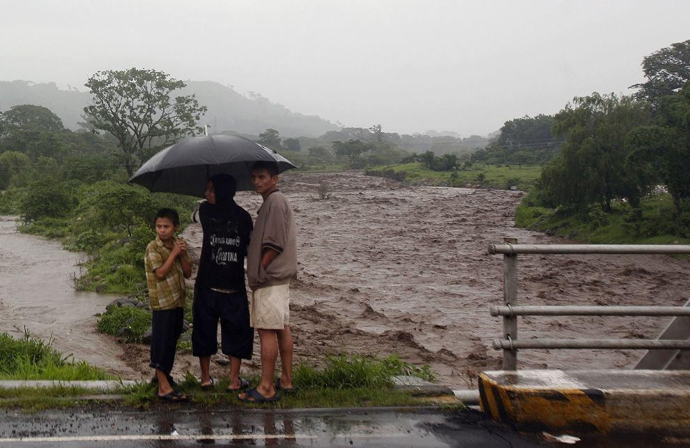
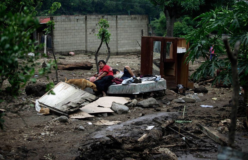
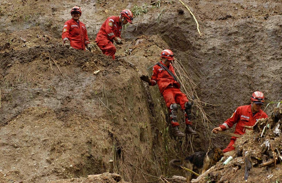
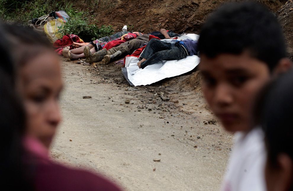
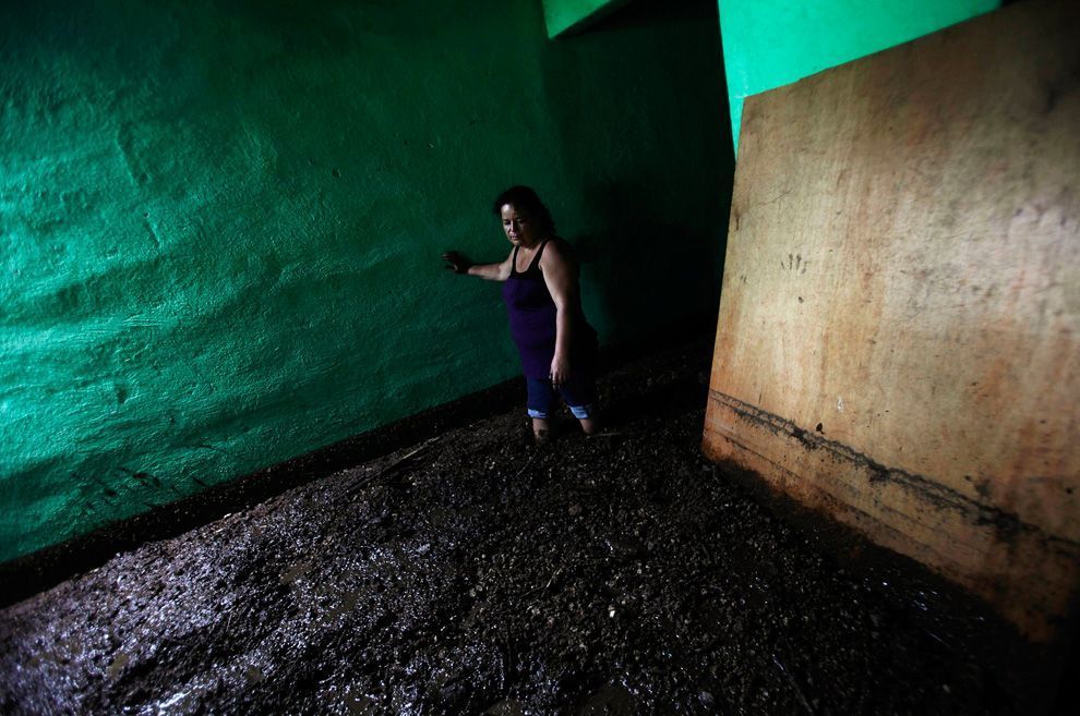
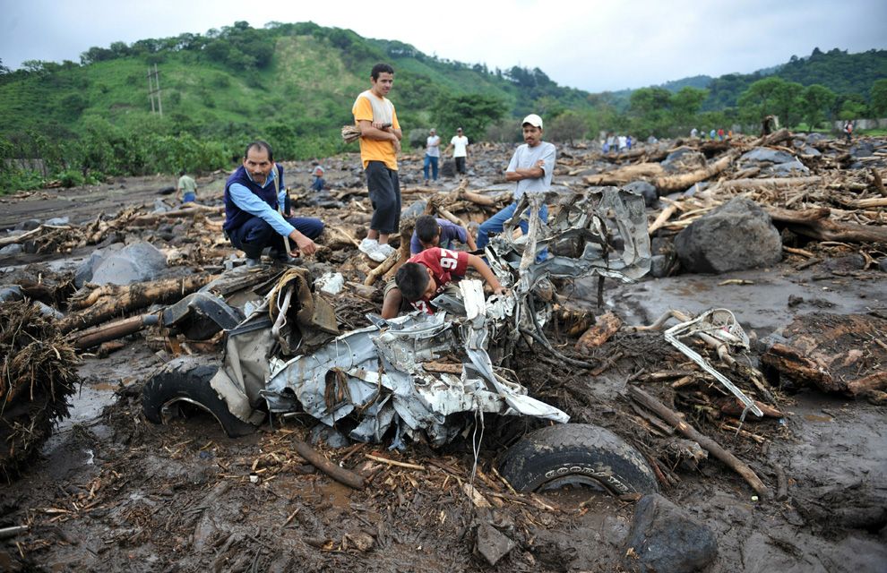
In the town of Almolonga, department of Quetzaltenango, a mudslide triggered by the storm killed four people after destroying their home, and in total twelve people were killed in Guatemala, while another landslide left 11 people missing. Officials in the country declared a state of emergency during the afternoon of May 29 as conditions worsened. Many rivers in the country were already swollen and close to over-topping their banks. Many other homes were destroyed in widespread floods and dozens of emergency rescues had to be made. In a press report, President Álvaro Colom stated that, "We believe Agatha could wreak more damage in the country than Hurricane Mitch and Hurricane Stan". These storms were two of the most devastating tropical cyclones to impact the country, killing 384 and 1,513 people respectively.

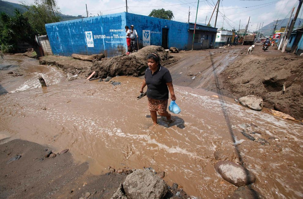
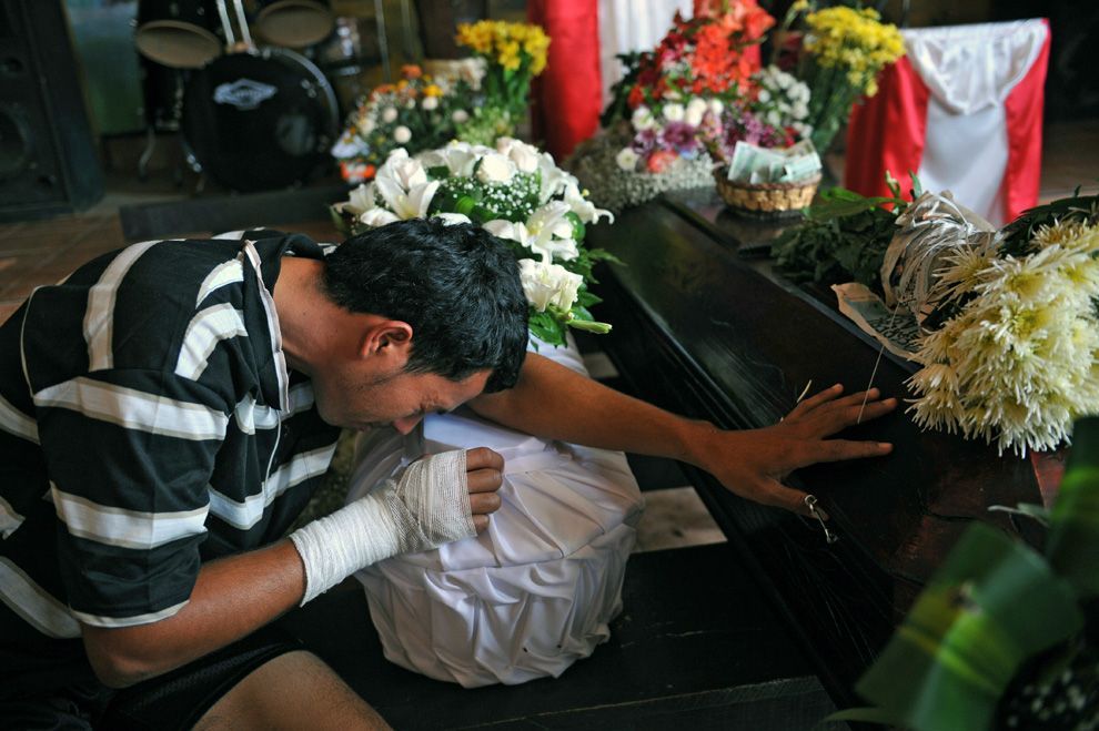
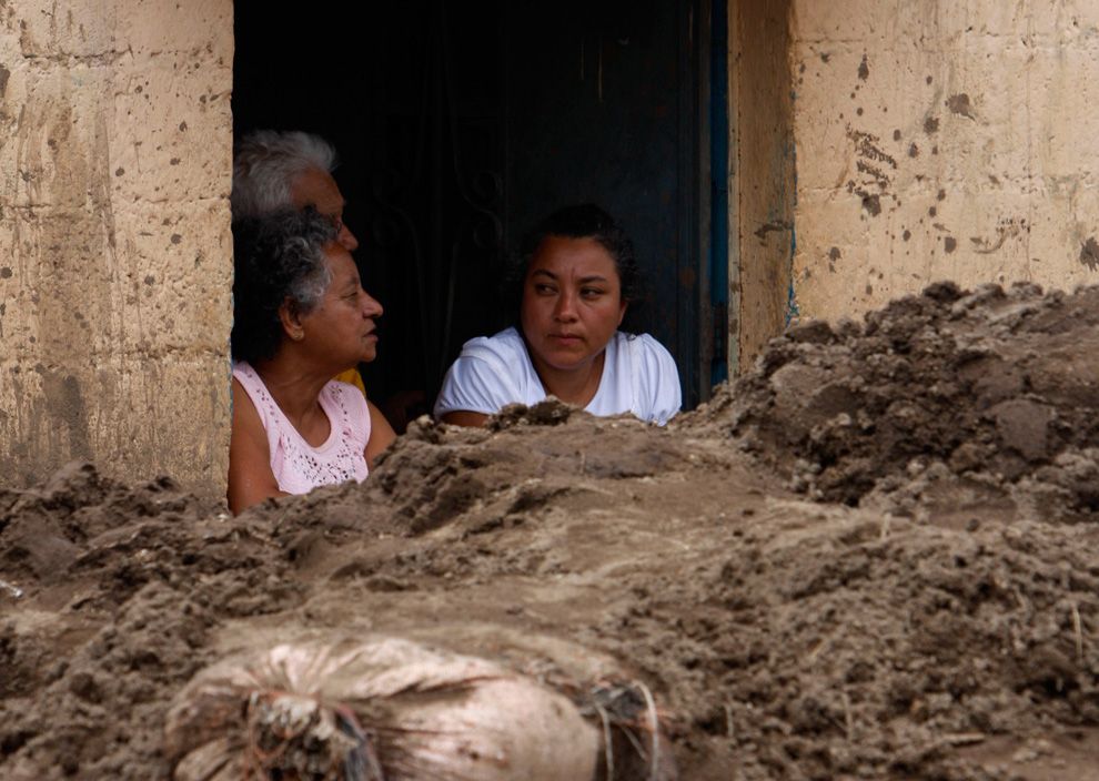
By the afternoon of May 30, reports from the region stated that 15 people had been killed and 22 others were missing throughout Guatemala. Preliminary damage assessments showed that at least 3,500 homes were damaged. A total of 112,000 people were evacuated. Additionally, at least 20,000 people have been left homeless as a result of the storm. Some areas recorded the heaviest rainfall in over 60 years, measuring more than 36 in (910 mm). This also ranks Agatha as the wettest known tropical cyclone to ever strike the country, surpassing Hurricane Mitch. By the next day, the death toll had risen to 92, with another 95 people injured.


Click image for larger version

Name:	Agatha_29_May_2010_landfall_2245z.jpg
Views:	646
Size:	93.9 KB
ID:	177873
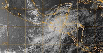
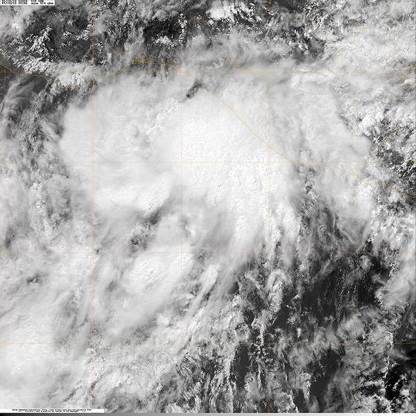
Tropical Storm Agatha at 1000mb on May 29, 2010 making landfall near the Mexico-Guatemala border.


Click image for larger version

Name:	g10_23621595.jpg
Views:	546
Size:	152.1 KB
ID:	177874
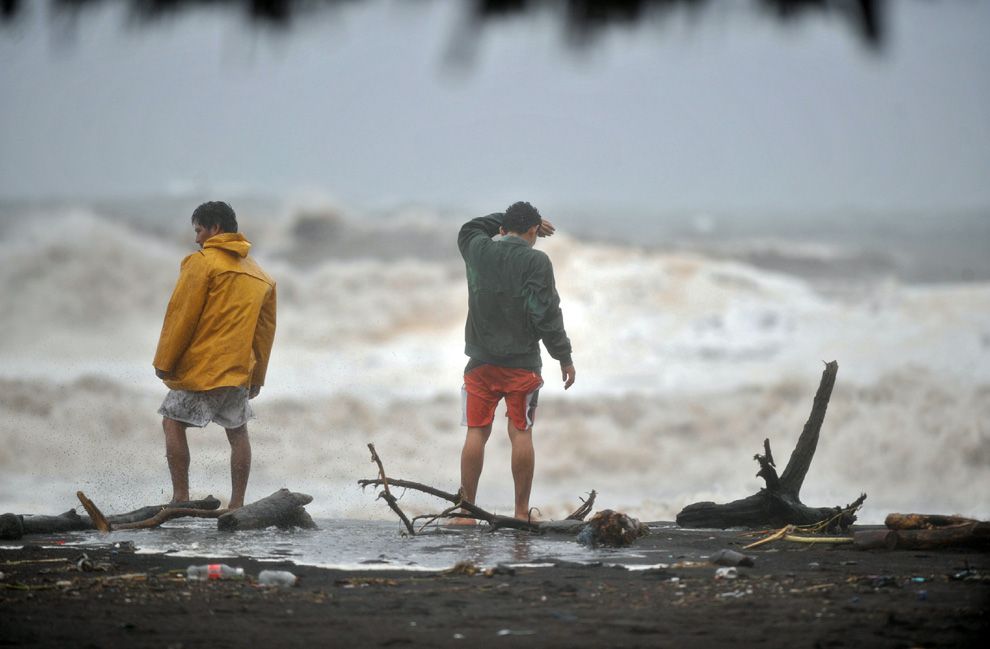
Two men watch a heavy swell on May 29, 2010, in San Jose port, Escuintla, 110 kilometers south of Guatemala City as the season's first tropical storm named Agatha approached bringing drenching rain, mudslides and floods.


Click image for larger version

Name:	g14_23627901.jpg
Views:	984
Size:	296.9 KB
ID:	177882
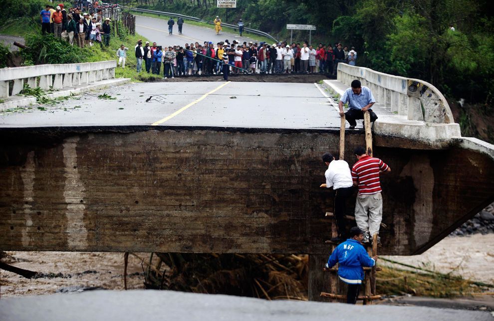
People climb up onto a bridge after a portion of it was washed away by rain water after Tropical Storm Agatha, in Barberena, Guatemala May 30, 2010.


Click image for larger version

Name:	g15_23653525.jpg
Views:	403
Size:	321.3 KB
ID:	177884
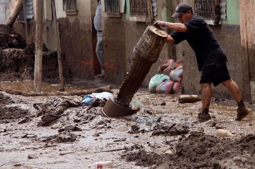
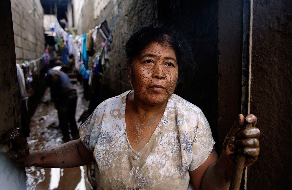
A resident dumps mud removed from his house after the Mico river overflowed due to heavy rains from Tropical Storm Agatha in Amatitlan, Guatemala, Tuesday June 1, 2010.


Click image for larger version

Name:	g22_23656069.jpg
Views:	468
Size:	116.1 KB
ID:	177886
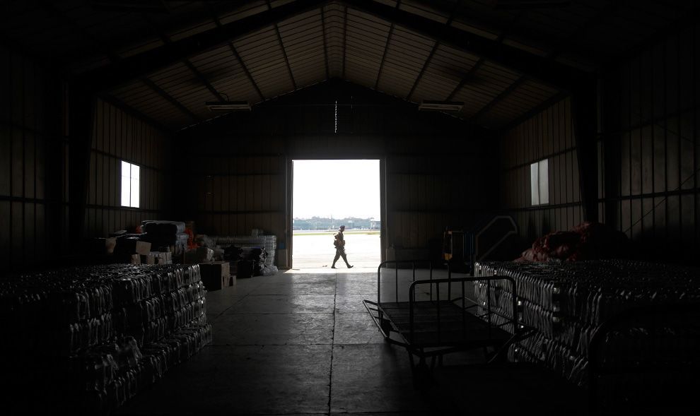
A soldier guards food supplies that will be sent to victims of Tropical Storm Agatha in Guatemala City June 1, 2010.


Click image for larger version

Name:	g23_23656163.jpg
Views:	596
Size:	362.1 KB
ID:	177887
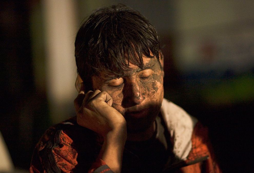
Soldiers unload food supplies for victims of Tropical Storm Agatha in Retauhleu, Guatemala June 1, 2010. Collapsed roads and highway bridges complicated rescue efforts in Guatemala on Tuesday after Agatha drenched Central America, burying homes under mud and killing at least 179 people.
g11_23620451.jpg
229.7 KB ·845 views
g12_23616689.jpg
170.5 KB ·535 views
g13_23620431.jpg
246.2 KB ·299 views
g16_23653311.jpg
332.5 KB ·600 views
g24_23634641.jpg
241.5 KB ·380 views
g32_23632163.jpg
232.8 KB ·352 views
  #3  
06-05-2010, 06:05 PM
güttsfükk's Avatar
güttsfükk
Offline:
Super *********
Poster Rank:88
Join Date: Nov 2008
Posts: 17,426
 
Mentioned: 5 Post(s)
Quoted: 99 Post(s)
Activity Longevity
0/20 18/20
Today Posts
0/11 ssss17426
Re: Volcano, Tropical Storm, Floods, Sinkhole, Landslides. Guatemala. 27May-1June 2010

Land & mud slides


Click image for larger version

Name:	g19_23632027.jpg
Views:	833
Size:	324.4 KB
ID:	177902
A man sits with his two dogs where his house once stood in Amatitilan, Guatemala on May 30, 2010.


Click image for larger version

Name:	g20_23644775.jpg
Views:	388
Size:	117.1 KB
ID:	177903
A woman cries inside her mud-filled home after a mudslide caused by Tropical Storm Agatha hit the el Pedregal neighborhood of Amatitlan May 31, 2010.


Click image for larger version

Name:	g21_23634575.jpg
Views:	1118
Size:	324.1 KB
ID:	177904
A woman and her son rest on a bed after their home was destroyed by a landslide caused by Tropical Storm Agatha in Amatitilan May 30, 2010.


Click image for larger version

Name:	g26_23633897.jpg
Views:	524
Size:	428.2 KB
ID:	177905
Rescue workers look for landslide victims in a settlement called "19 de Mayo" in Guatemala City May 30, 2010.


Click image for larger version

Name:	g28_23633775.jpg
Views:	1315
Size:	219.9 KB
ID:	177906
People gather in front of bodies of victims, killed by mudslides, in Guatemala City, Sunday, May 30, 2010.


Click image for larger version

Name:	g30_23643359.jpg
Views:	511
Size:	382.6 KB
ID:	177907
A car remains buried near the area where 11 people died when a landslide destroyed their home on the northern outskirts of Guatemala City on May 31, 2010.


Click image for larger version

Name:	g31_23643293.jpg
Views:	395
Size:	231.6 KB
ID:	177908
Guatemalan Luis Perez mourns over the coffins of his wife and his two-year-old son, who died along with nine other people, when a landslide destroyed their home in Canaan, in the northern outskirts of Guatemala City.
g01_23644507.jpg
281.3 KB ·371 views
g17_23630275.jpg
351.0 KB ·593 views
g18_23653365.jpg
241.2 KB ·419 views
  #4  
06-05-2010, 06:12 PM
güttsfükk's Avatar
güttsfükk
Offline:
Super *********
Poster Rank:88
Join Date: Nov 2008
Posts: 17,426
 
Mentioned: 5 Post(s)
Quoted: 99 Post(s)
Activity Longevity
0/20 18/20
Today Posts
0/11 ssss17426
Re: Volcano, Tropical Storm, Floods, Sinkhole, Landslides. Guatemala. 27May-1June 2010

The Giant Sinkhole

A sinkhole was formed suddenly in Guatemala in June 2010, where torrential rains from Tropical Storm Agatha and a bad drainage system were blamed for creating a sinkhole that swallowed a three story building and a house. This sinkhole measured approximately 66 feet (20 m) wide and 200 feet (61 m) deep.

The sinkhole formed Saturday, swallowing a clothing factory about three miles from the site of a similar sinkhole three years ago. The clothing factory had closed only an hour before it plunged into the Earth.

Click image for larger version

Name:	g33_23626065.jpg
Views:	562
Size:	198.4 KB
ID:	177914
A security guard looks at the edge of a massive sinkhole in Guatemala City on May 30, 2010.


For more : http://www.documentingreality.com/fo...atamala-52462/
giant-sinkhole-guatemala-city-why_21263_600x450.jpg
77.5 KB ·745 views
g34_23644461.jpg
337.5 KB ·326 views
g35_23652739.jpg
331.1 KB ·241 views
g36_23649477.jpg
363.9 KB ·310 views
2 Users Say Thank You For This Post:
Nickola, Pink.
  #5  
06-05-2010, 11:12 PM
güttsfükk's Avatar
güttsfükk
Offline:
Super *********
Poster Rank:88
Join Date: Nov 2008
Posts: 17,426
 
Mentioned: 5 Post(s)
Quoted: 99 Post(s)
Activity Longevity
0/20 18/20
Today Posts
0/11 ssss17426
Re: Volcano, Tropical Storm, Floods, Sinkhole, Landslides. Guatemala. 27May-1June 2010

Originally Posted by guttsfukk
A woman and her son rest on a bed after their home was destroyed by a landslide caused by Tropical Storm Agatha in Amatitilan May 30, 2010.

yes, i was also surprised by this
  #6  
06-06-2010, 01:31 AM
RogueTrader's Avatar
RogueTrader
Offline:
So Fucking Banned
Poster Rank:278
Female.
Join Date: Apr 2010
Posts: 4,641
 
Mentioned: 10 Post(s)
Quoted: 353 Post(s)
Activity Longevity
0/20 17/20
Today Posts
0/11 sssss4641
Re: Volcano, Tropical Storm, Floods, Sinkhole, Landslides. Guatemala. 27May-1June 2010

What the hell are those stupid people doing so close to that lava flow? Lol and what do they think that a bloody umbrella is really gonna do if they get in trouble? Crazy Mary Poppins believing mfkrs.
  #7  
06-06-2010, 01:31 PM
güttsfükk's Avatar
güttsfükk
Offline:
Super *********
Poster Rank:88
Join Date: Nov 2008
Posts: 17,426
 
Mentioned: 5 Post(s)
Quoted: 99 Post(s)
Activity Longevity
0/20 18/20
Today Posts
0/11 ssss17426
Re: Volcano, Tropical Storm, Floods, Sinkhole, Landslides. Guatemala. 27May-1June 2010

Originally Posted by RogueTrader
What the hell are those stupid people doing so close to that lava flow? Lol and what do they think that a bloody umbrella is really gonna do if they get in trouble? Crazy Mary Poppins believing mfkrs.
I think that the way it is shot makes them look closer to the volcano than they are. but who knows, it is south america and I wouldnt be surprised if most of those people didn't have a proper education like the rest of us probably did, so they might not be very aware of what's going on (i dunno though, just making a guess)
  #8  
03-17-2011, 06:45 AM
güttsfükk's Avatar
güttsfükk
Offline:
Super *********
Poster Rank:88
Join Date: Nov 2008
Posts: 17,426
 
Mentioned: 5 Post(s)
Quoted: 99 Post(s)
Activity Longevity
0/20 18/20
Today Posts
0/11 ssss17426
Re: Volcano, Tropical Storm, Floods, Sinkhole, Landslides. Guatemala. 27May-1June 2010

all images & vids fixed
Documenting Reality True Crime Related Chat & Research Interesting People, Places, Things, Animals Volcano, Tropical Storm, Floods, Sinkhole, Landslides. Guatemala. 27May-1June 2010


Powered by vBulletin Copyright 2000-2010 Jelsoft Enterprises Limited.

Search Engine Friendly URLs by vBSEO