|
#1
●
09-09-2012, 08:42 AM
|
 Super ********* Poster Rank:90 Join Date: Nov 2008 Posts: 17,370 17,370Posts 13,735Thanked 99Quoted 5Mentioned 0Contrib. |
|
Stonehenge in 1867: Ordnance Survey Photographs Under Sir Henry James
In 1867, the Ordnance Survey published eight albumen photographs of Stonehenge on Salisbury Plain in Wiltshire. They appeared in "Plans and Photographs of Stonehenge, and of Turusachan in the Island of Lewis," whose preface was dated May 29, 1867. The views record the monument from several positions and show its trilithons, outer circle, Altar Stone, inclined uprights and fallen stones. Several plates include men for scale, including Ordnance Survey Director Sir Henry James, who appears wearing a top hat. James had established the survey's photographic department in 1855, but the individual who took the Stonehenge photographs was not named. Also covered here: Photographic Time Line 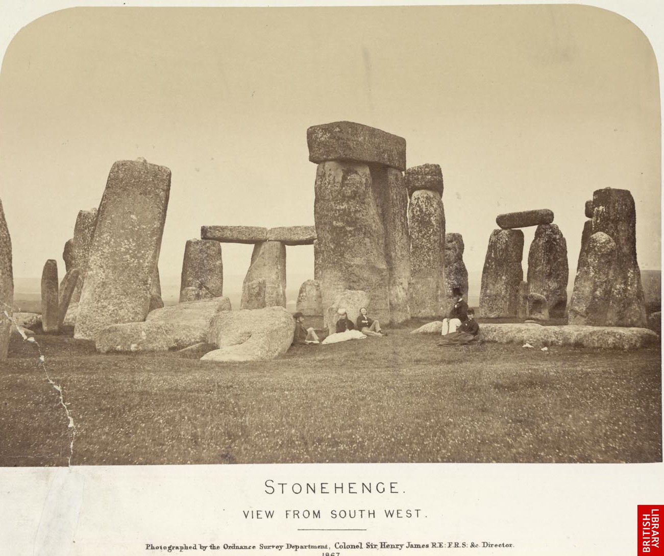 · 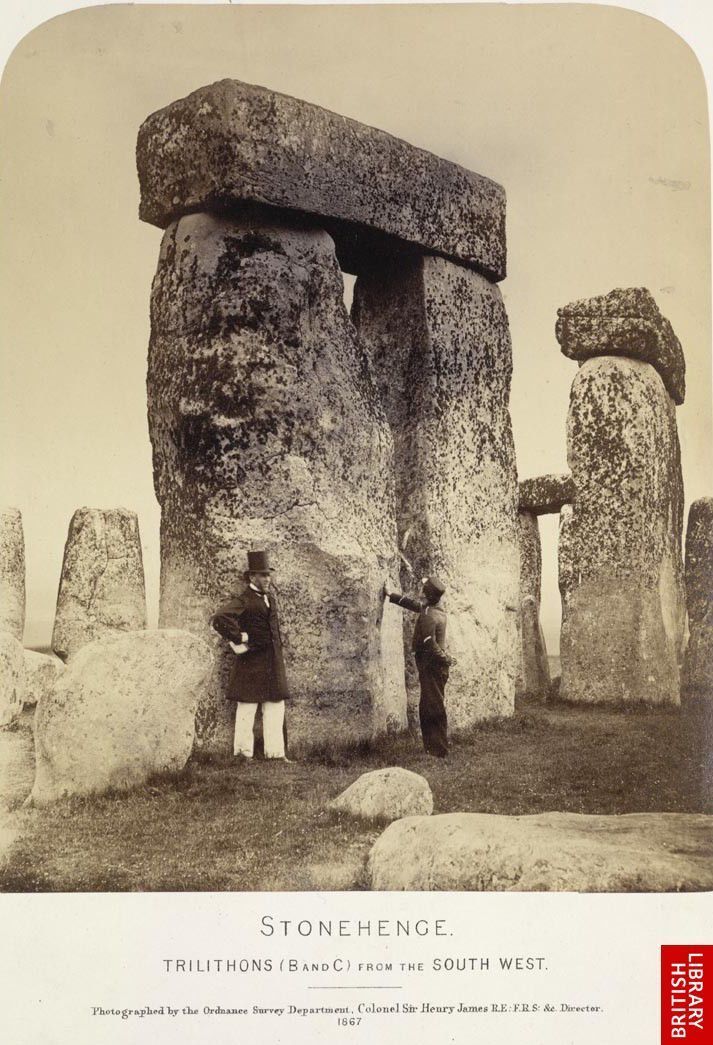 · 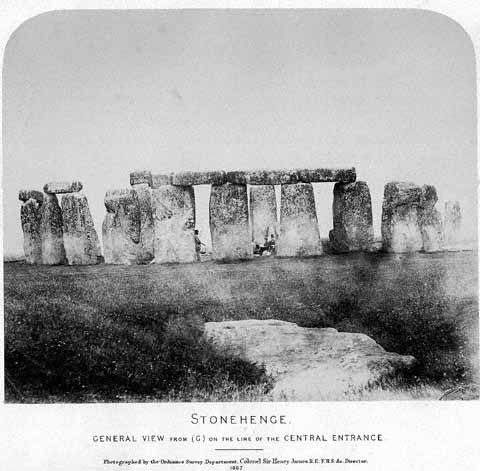 · 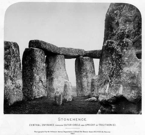 · 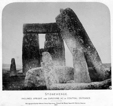 · 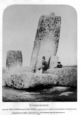 · 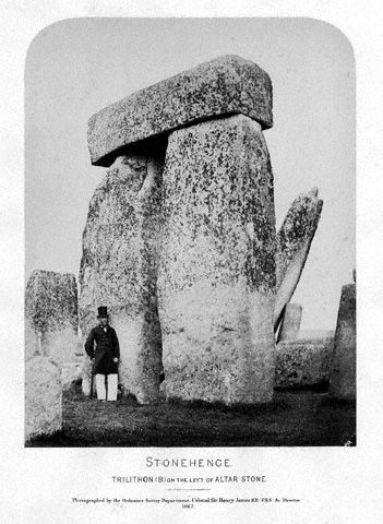 · 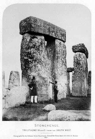 · 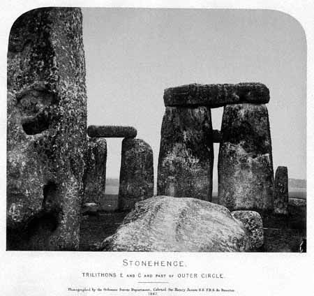 · 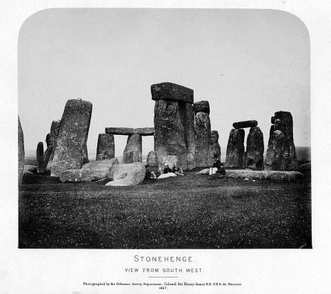 · |
|
#5
●
09-09-2012, 12:11 PM
|
 ♚ Legacy Gold Member ♚ Poster Rank:35 Female Join Date: Nov 2008 Posts: 43,321
Contributions: 233
43,321Posts 76,151Thanked 2,282Quoted 95Mentioned 233Contrib. |
|
Re: Stonehenge in 1867: Ordnance Survey Photographs Under Sir Henry James
1867? Wow  Love the man in top hat and tails - a far cry from the druid look. |
|
#7
●
10-08-2012, 08:53 AM
|
 ★ Legacy Member ★ Poster Rank:2814 Male Join Date: Sep 2009 Posts: 143 143Posts 215Thanked 3Quoted 0Mentioned 0Contrib. |
|
Re: Stonehenge in 1867: Ordnance Survey Photographs Under Sir Henry James
Stonehenge is a great monument, and very mystical - but being ruined by commercialism. How the National Trust can charge what they do for people to look at it from a distance I don't know - you can see it just as well standing outside the fence. I last saw it in August on my way to Cheddar to see the caves, and its beautiful - if you can ignore all the roadworks going on around it at the moment! |