for more threads like this one :
http://www.documentingreality.com/fo...me-line-45276/ 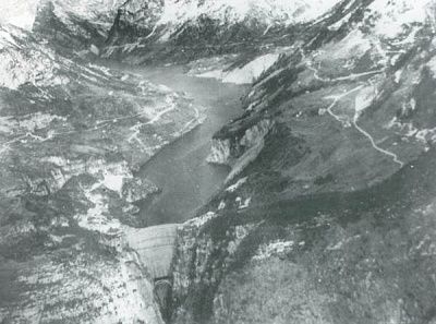 Before
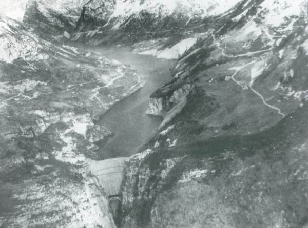
 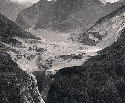 After
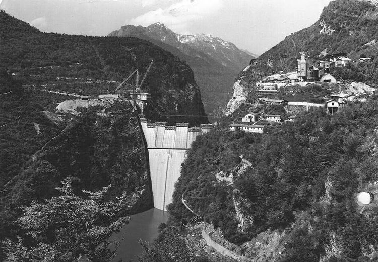
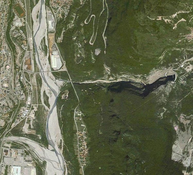
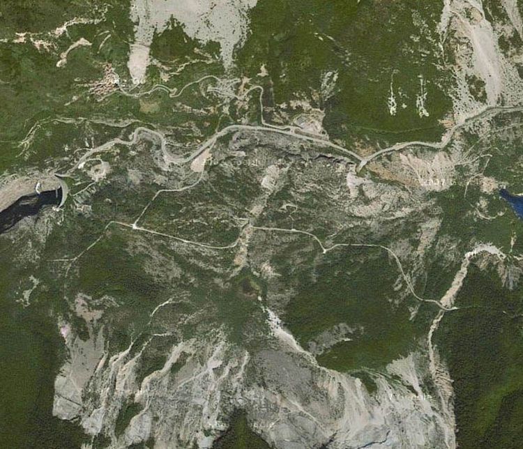
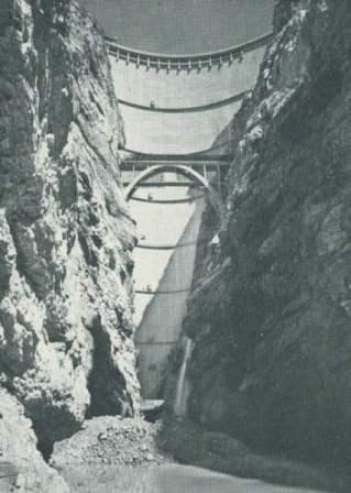
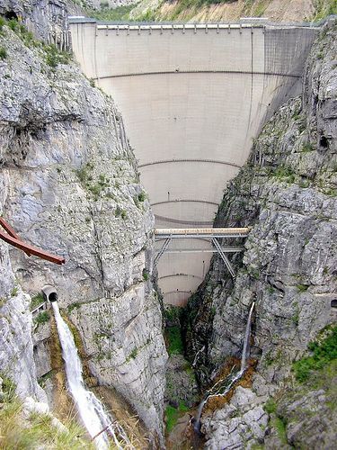
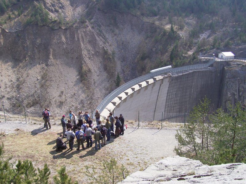
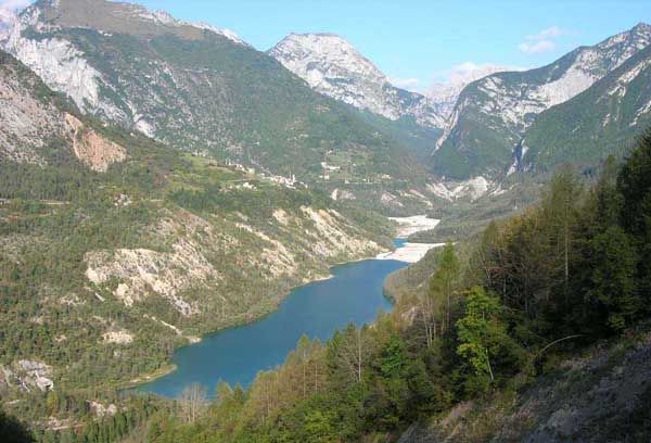
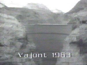
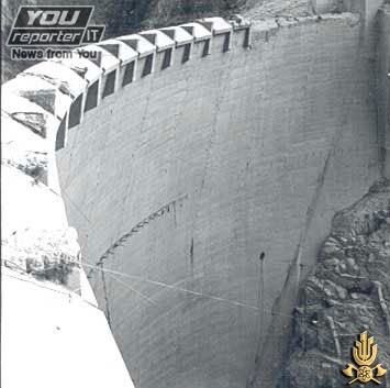
After The Vajont Dam (or Vaiont Dam) is a disused dam, completed in 1959 in the valley of the Vajont River under Monte Toc, 100 km north of Venice, Italy. A 1963 landslide caused the overtopping of the dam and around 2,000 deaths.
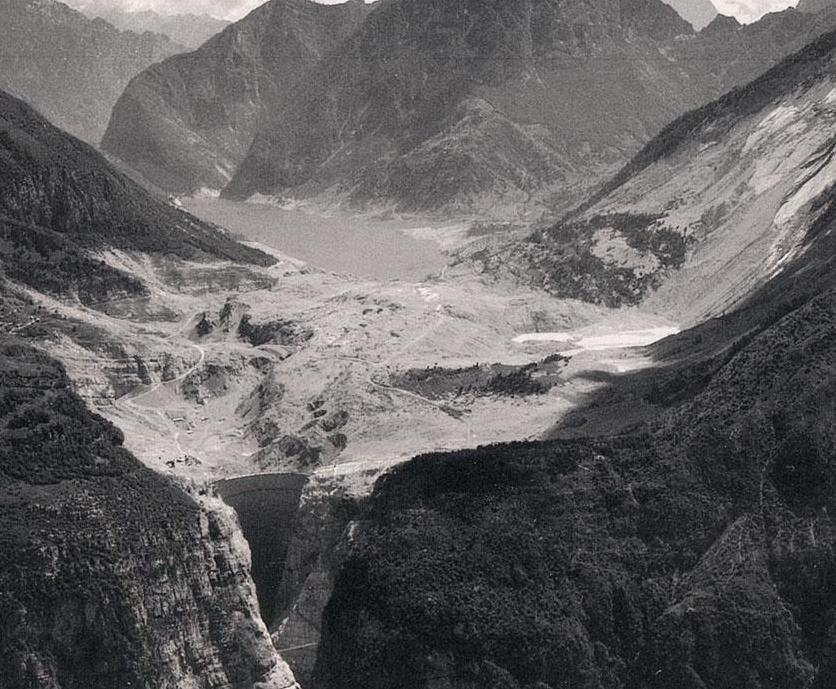
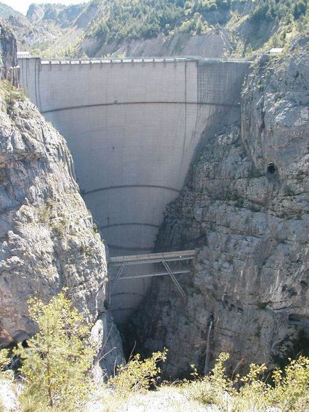
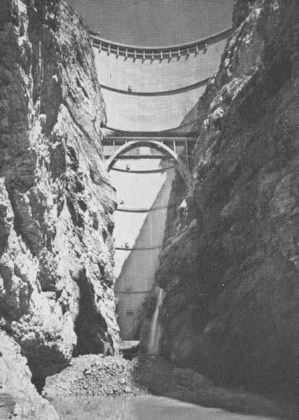
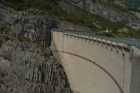
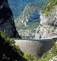
One of the tallest dams in the world, it is 262 m (860 ft) high, 27 m (89 ft) thick at the base and 3.4 m (11 ft) at the top. Its 1963 overtopping was caused when the designers ignored the geological instability of Monte Toc on the southern side of the basin. Warning signs and negative appraisals during the early stages of filling were disregarded, and the attempt to complete the filling led to a landslide, which created a wave that brought massive flooding and destruction to the Piave valley below, wiping out several villages completely.
On 12 February 2008, while launching the International Year of Planet Earth, UNESCO cited the Vajont Dam tragedy as one of five "cautionary tales", caused by "the failure of engineers and geologists".
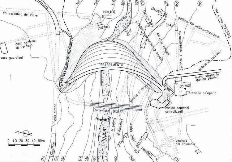
Construction
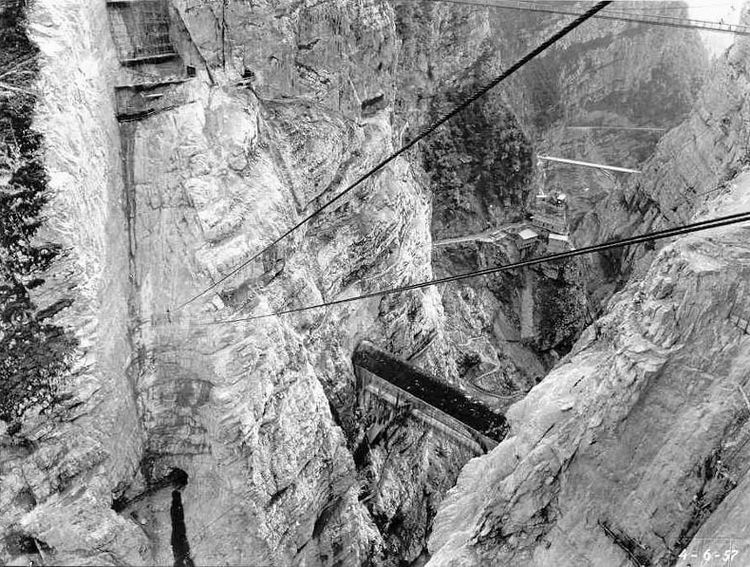
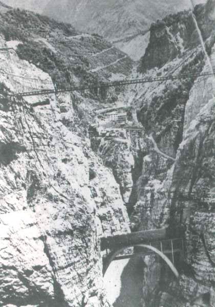
The dam was built by SADE (Società Adriatica di Elettricità, English: Adriatic Energy Corporation), the electricity supply and distribution monopolist in North-Eastern Italy. The owner, Giuseppe Volpi di Misurata, had been Mussolini's Minister of Finances for several years. The 'tallest dam in the world', across the Vajont gorge, was conceived in the 1920s to meet the growing demands for industrialization, but not until the confusion after Mussolini's fall during World War II was the project authorized on 15 October 1943.
The dam and basin were intended to be at the centre of a complex system of water management in which water would have been channeled from nearby valleys and artificial basins located at higher levels. Tens of kilometres of concrete pipes and pipe-bridges across valleys were planned.
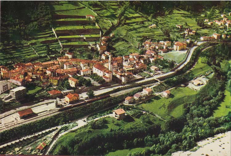
In the 1950s, SADE's monopoly was confirmed by post-fascist governments and it purchased the land despite opposition by the communities of Erto and Casso in the valley, which was overcome with government and police support. SADE stated that the geology of the gorge had been studied, including analysis of ancient landslides, and that the mountain was believed to be sufficiently stable.
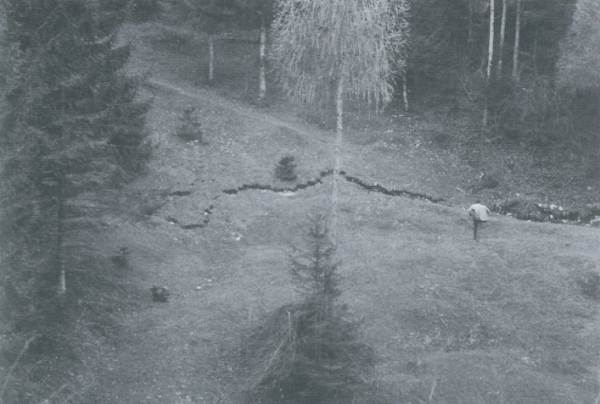
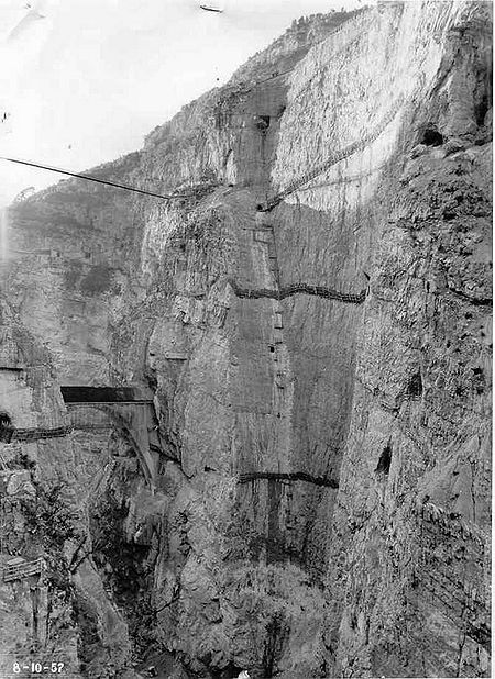
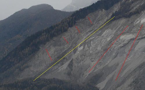
Construction work started in 1957, but by 1959 shifts and fractures were noticed while building a new road on the side of Monte Toc. This led to new studies in which three different experts separately told SADE that the entire side of Monte Toc was unstable and would likely collapse into the basin if the filling were completed. All three were ignored by SADE. In October 1959 construction was completed and in February 1960 SADE was authorised to start filling the basin.
Early Signs of Disaster
Throughout the summer of 1960, minor landslides and earth movements were noticed; however instead of heeding these warning signs, the Italian government chose to sue the handful of journalists reporting the problems for "undermining the social order."
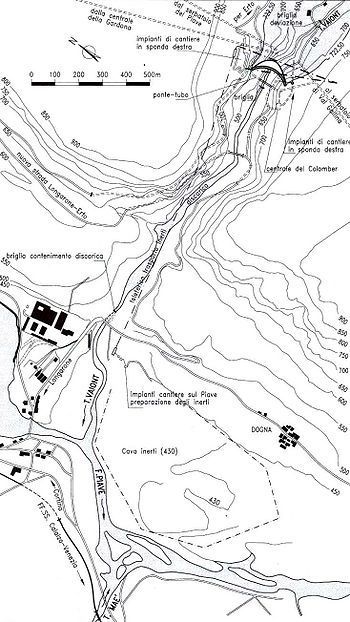
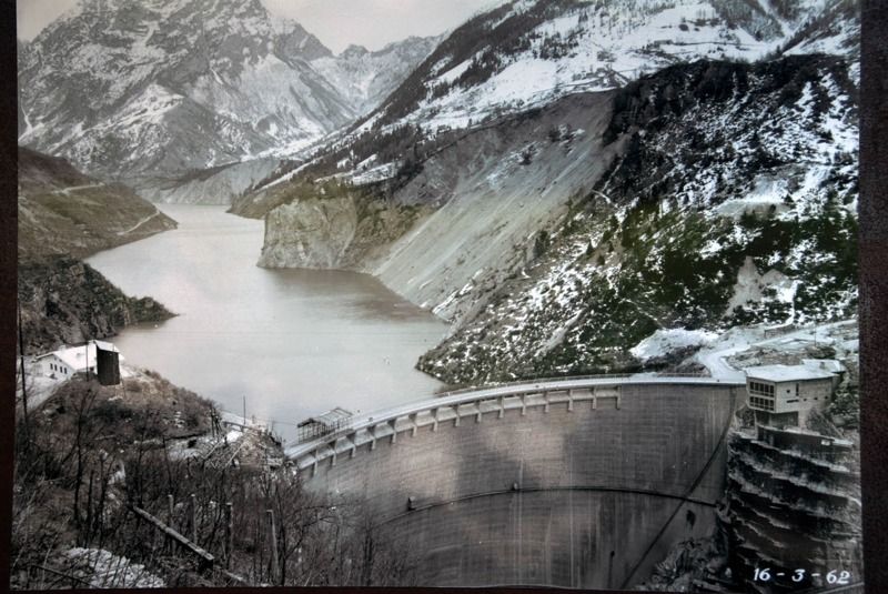
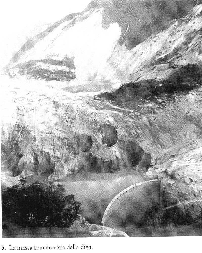
On 4 November 1960, with the water level of the basin at about 190 meters of the planned 262, a landslide of about 800,000 m³ collapsed into the lake. SADE stopped the filling, lowered the level by about 50 m and started to build an artificial gallery in the basin in front of Monte Toc, to keep the basin usable even when the expected further landslides divided it into two parts.
In October 1961, after the completion of the gallery, SADE restarted the filling of the narrow basin under controlled monitoring. In April and May 1962, with the basin water level at 215 meters, the people of Erto e Casso reported five earthquakes of 'grade five' on the Mercalli scale, though SADE downplayed their importance. SADE was then authorized to complete the filling up to the maximum level.
In July 1962, SADE's own engineers reported the results of model-based experiments on the effects of further landslides from Monte Toc into the lake, which predicted a devastating disaster if they happened when the basin was full. The management ignored these results as well.
In November 1962, SADE was taken into the public ownership of ENEL.
In March 1963, the dam was transferred to the newly constituted public company for electricity, ENEL, but the management remained the same. In the following summer, with the basin almost completely filled, slides, shakes and movements of the ground were continuously reported by the alarmed population. On 15 September the entire side of the mountain moved down by 22 cm. On 26 September, ENEL decided to slowly empty the basin down to the level of 240 m, but in early October the collapse of the mountain's south side looked unavoidable: one day it moved almost 1 m. There is no known record of any warning or displacement order being issued to the populace.
Landslide and wave
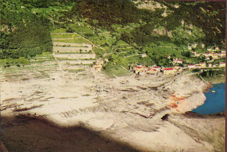
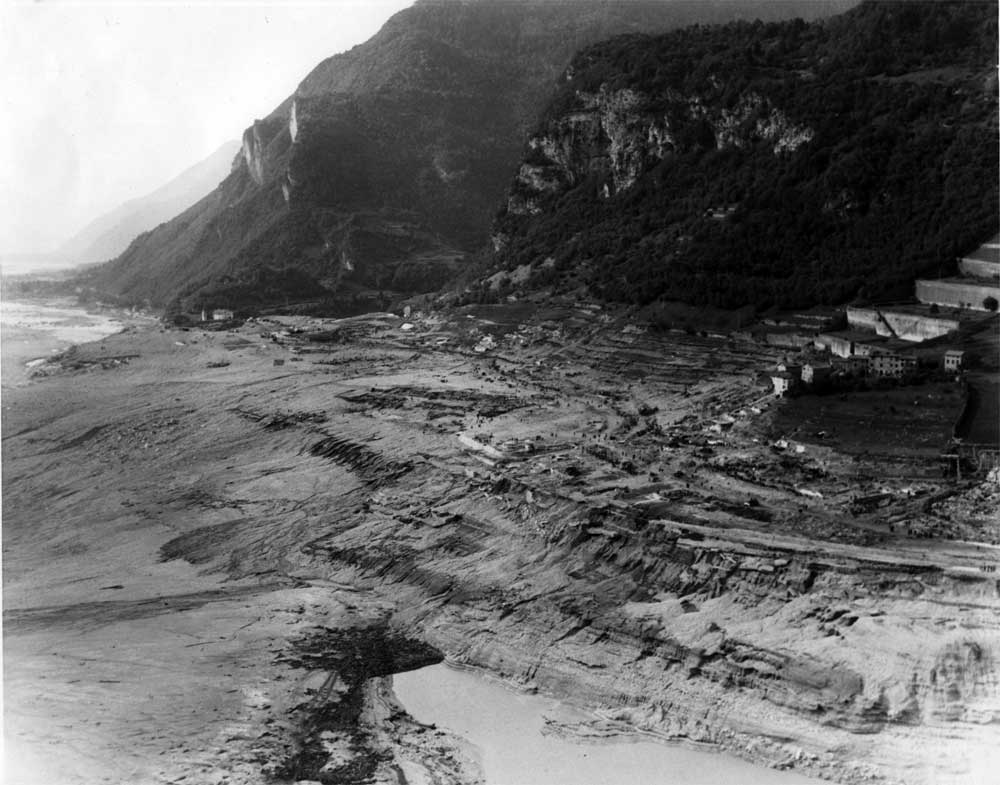
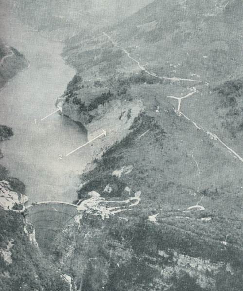
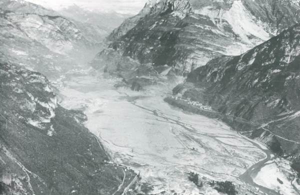
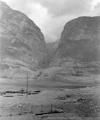
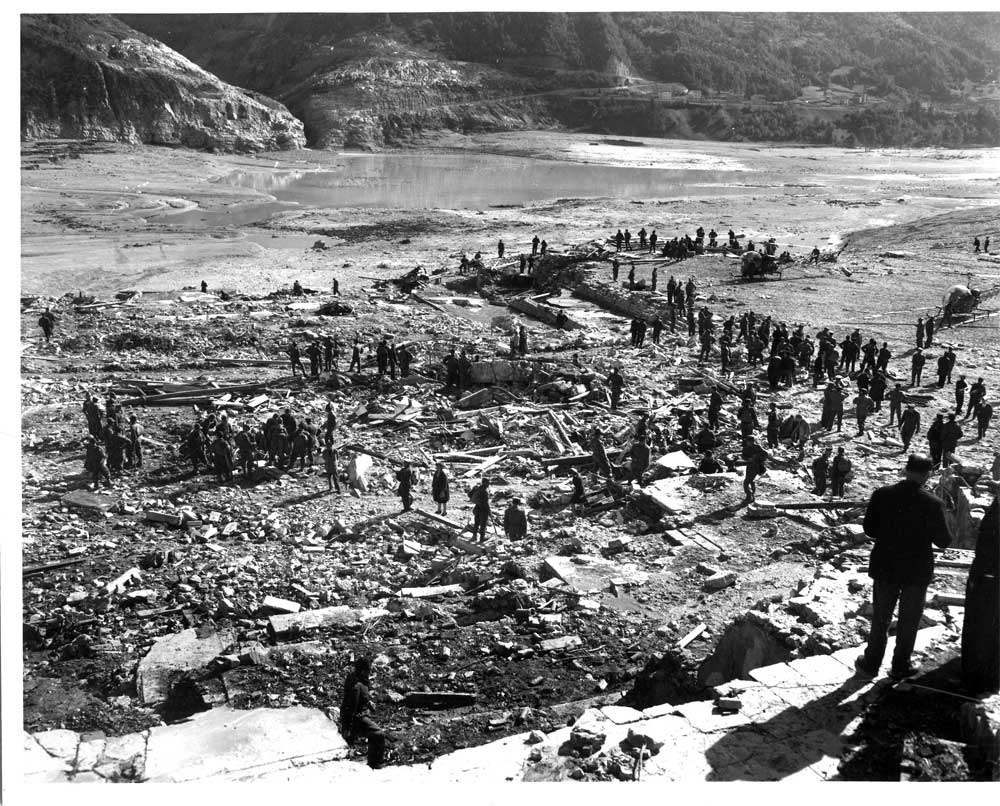
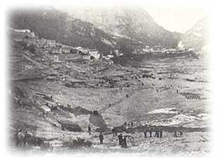
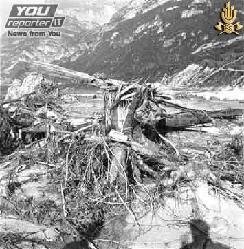
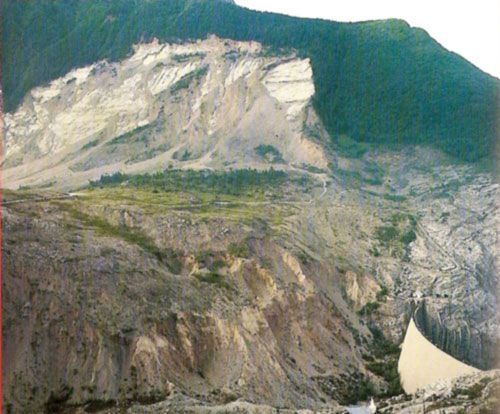
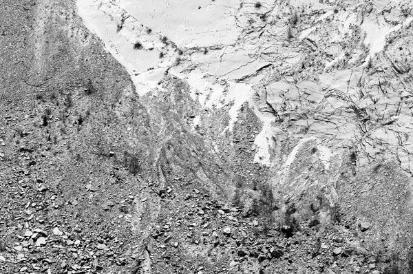
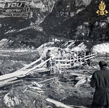
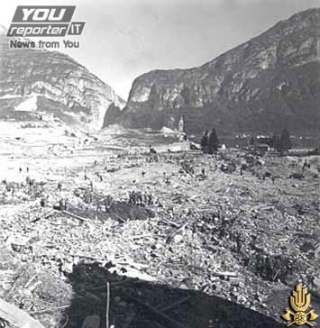
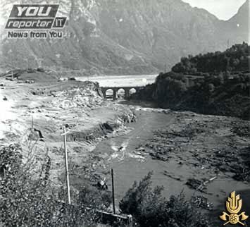
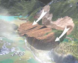
On 9 October 1963 at 10:39 pm, the combination of 'drawing-down the reservoir' and recent heavy rains triggered a massive landslide of about 260 million3 of forest, earth, and rock, which fell into the reservoir at up to 110 km per hour (68 mph) which completely filled up the narrow reservoir in front of the dam. The resulting displacement of water caused 50 million3 of water to overtop the dam in a 250-metre-high (820 ft) wave. Despite this, the dam's structure was largely undamaged — the top meter or so of masonry was washed away, but the basic structure remained intact.
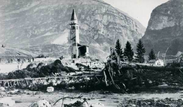
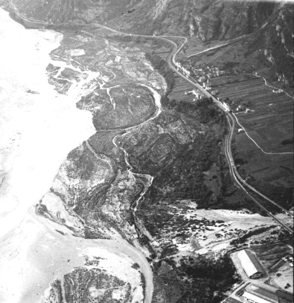
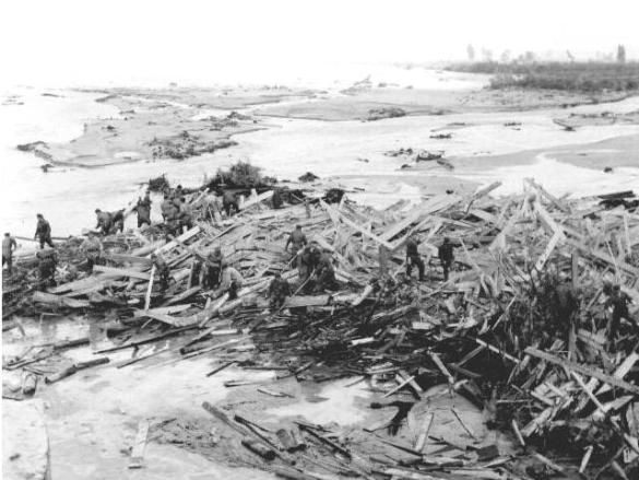
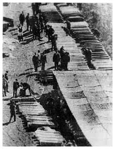
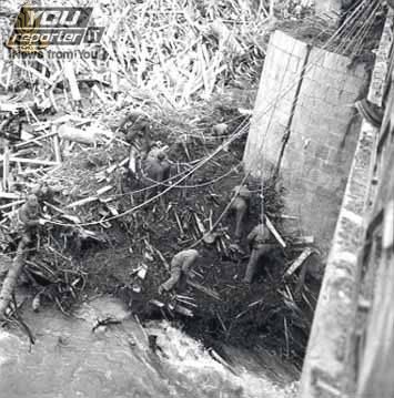
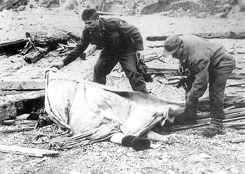
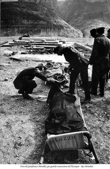
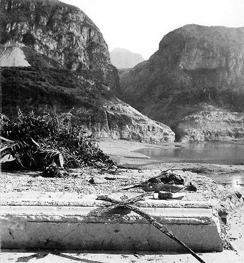
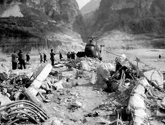
The flooding from the huge wave in the Piave valley destroyed the villages of Longarone, Pirago, Rivalta, Villanova and Faè, killing around 2,000 people and turning the land below the dam into a flat plain of mud with an impact crater 60 meters deep and 80 meters wide. Many small villages in the territory of Erto e Casso and the village of Codissago, near Castellavazzo, were largely wrecked. Estimates of the dead range from 1,900 to 2,500 people, and about 350 families lost all members. Most of the survivors had lost relatives and friends along with their homes and belongings.
The villages near the landslide along the lakefront also suffered damage from the air displacement caused by the impact which was so intense (calculated to be twice the air displacement caused by the nuclear bomb that was dropped on Hiroshima, Japan) that it shredded the clothes of the people in the street and caused significant damage to skin.
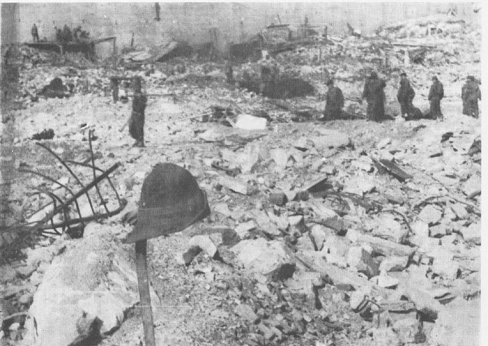
 Longarone Village Morning on Day of The Disaster
  Longarone Village Day After Disaster
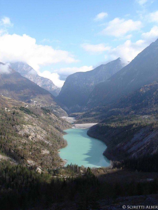
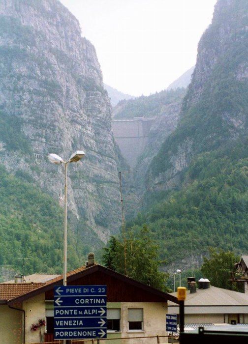
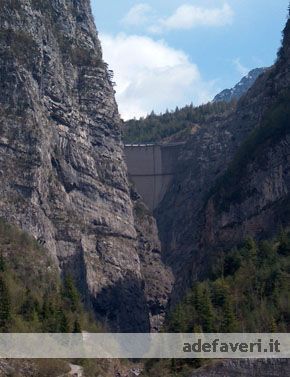
 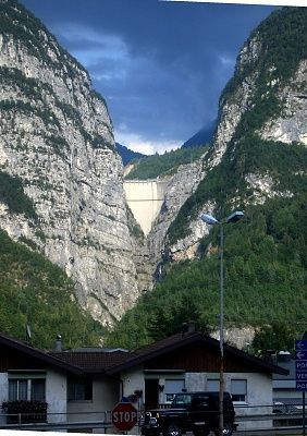 The Vajont Dam as seen from the village Longarone in 2005, showing approximately the top 60–70 meters of concrete. The 200–250-meter wall of water that overtopped the dam and destroyed the village would have obscured virtually all of the sky in this photo.
sources : wikipedia & google image search


