|
#1
●
09-22-2013, 03:08 PM
| ||||||||
 My Rank: MAJOR Poster Rank:12 Join Date: Jun 2009 Posts: 93,128
Contributions: 226
Mentioned: 91 Post(s) Quoted: 2009 Post(s)
| ||||||||
|
The ‘Underwater Waterfall’ Illusion at Mauritius Island
Mauritius is an island nation in the Indian Ocean about 2,000 kilometres (1,200 mi) off the southeast coast of the African continent. Mauritius was first discovered by the Arabs in 975 AD, then by the Portuguese between 1507 and 1513. Since then there have been periods of succession and colonization between the French, Dutch and British. The island became a republic in 1968. Located at the Southwestern tip of the island you will find a fascinating illusion. When viewed from above, a runoff of sand and silt deposits creates the impression of an ‘underwater waterfall’. Satellite views (as seen in the Google Maps screenshots below) are equally dramatic, as an underwater vortex seemingly appears off the coast of this tropical paradise. 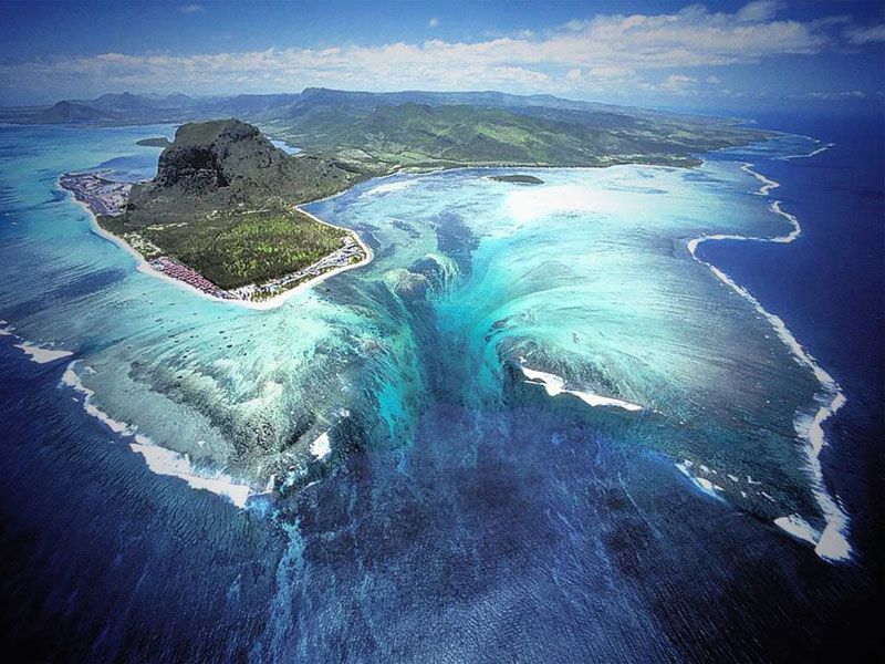 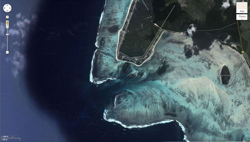 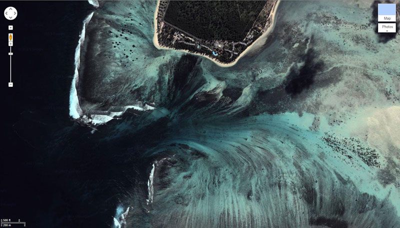 Towering high above is Le Morne Brabant, a basaltic monolith with a summit 556 m (1,824 ft) above sea level. The summit covers an area of over 12 hectares (30 acres) and is situated on Le Morne Brabant peninsula. The area (Le Morne Cultural Landscape) is also recognized by UNESCO as a World Heritage Site: Le Morne Cultural Landscape, a rugged mountain that juts into the Indian Ocean in the southwest of Mauritius was used as a shelter by runaway slaves, maroons, through the 18th and early years of the 19th centuries. Protected by the mountain’s isolated, wooded and almost inaccessible cliffs, the escaped slaves formed small settlements in the caves and on the summit of Le Morne. The oral traditions associated with the maroons, have made Le Morne a symbol of the slaves’ fight for freedom, their suffering, and their sacrifice, all of which have relevance to the countries from which the slaves came – the African mainland, Madagascar, India, and South-east Asia. Indeed, Mauritius, an important stopover in the eastern slave trade, also came to be known as the “Maroon republic” because of the large number of escaped slaves who lived on Le Morne Mountain. http://whc.unesco.org/en/list/1259 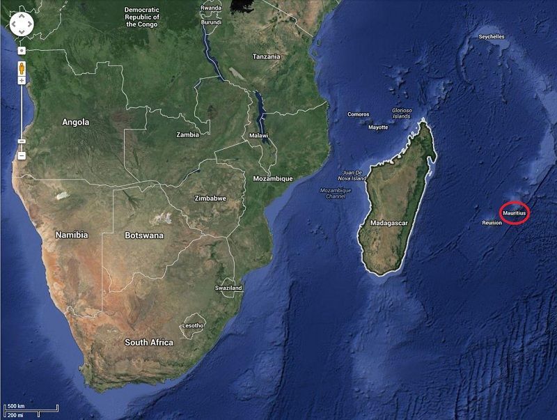 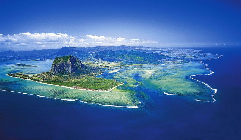 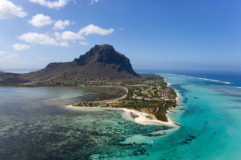 |