for more threads like this one :
http://www.documentingreality.com/fo...me-line-45276/
For info & images from Vietnam, Thailand & Cambodia see
CLICK HERE
For info & images from Laos see
CLICK HERE 
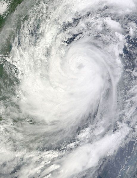
Typhoon Ketsana (International designation: 0916, JTWC designation: 17W, PAGASA name: Ondoy) was the most devastating typhoon in the 2009 Pacific typhoon season with a damage of $1.09 billion and 747 fatalities. The storm was the twenty-seventh tropical storm, eighth typhoon and the second major typhoon in the season. It was the most devastating typhoon to hit Manila, surpassing the Typhoon Patsy in 1970.
Ketsana formed early about 860 km (535 mi) to the northwest of Palau on September 23, 2009. The depression remained weak and was downgraded to a low pressure area later that day by the Japan Meteorological Agency and after drifting through extremely favorable conditions, it intensified the next day and was categorized as Tropical Depression by the Philippine Atmospheric, Geophysical and Astronomical Services Administration and was given the name Ondoy after entering the Philippine Area of Responsibility. The Joint Typhoon Warning Center issued a Tropical Cyclone Formation Alert on the depression. It was then upgraded to a tropical depression by the JMA later that morning before the JTWC followed suit early on September 25, designating the depression as 17W. Soon, Ketsana was upgraded to a Tropical Storm before passing over the Philippines. As it moved into the South China Sea the storm intensified while moving toward the west, and was categorized as a Severe Tropical Storm by the JMA.
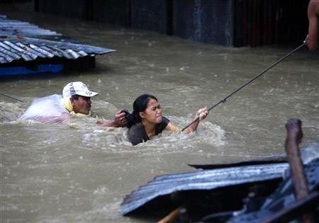
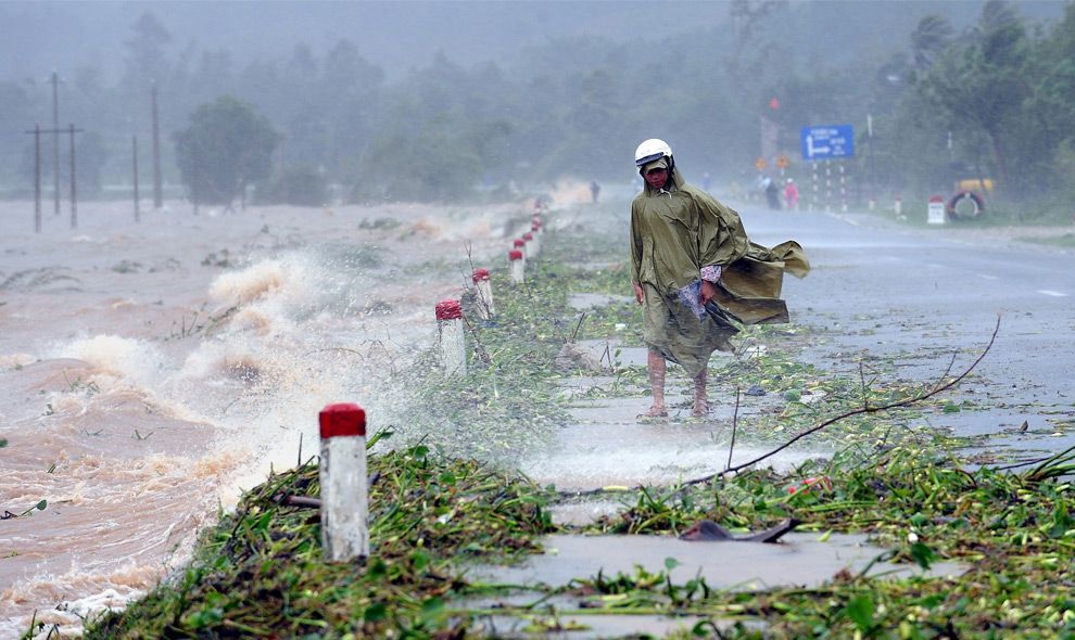
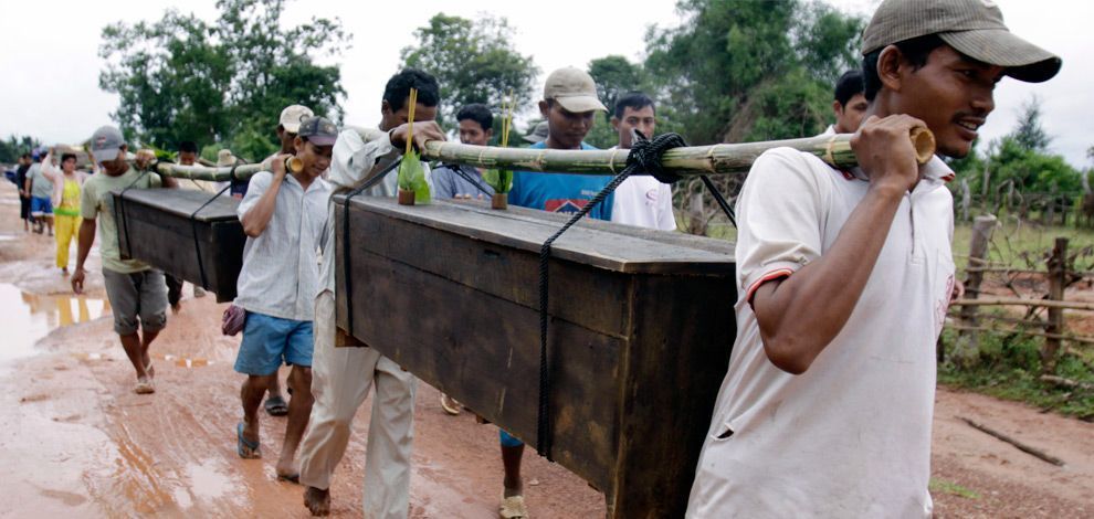
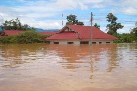
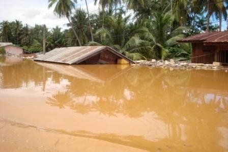
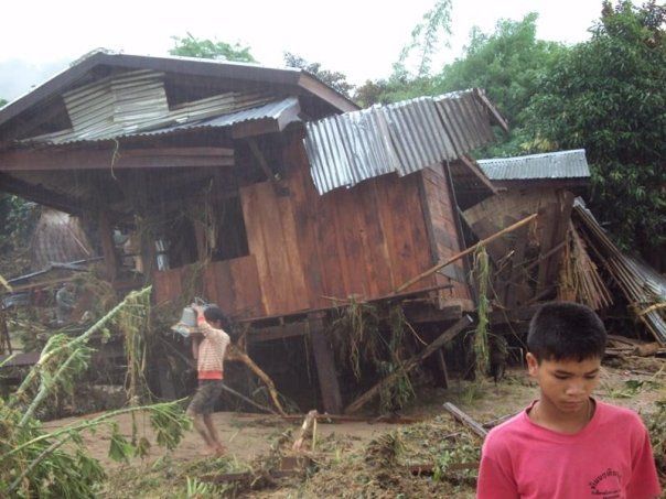
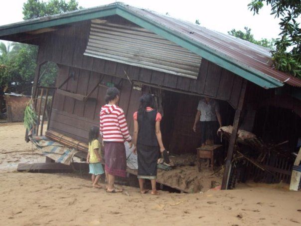
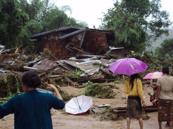
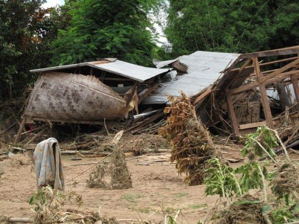
President Gloria Arroyo declared a "state of calamity" encompassing most of Luzon after at least 86 people were initially reported dead in landslides and other incidents. Flood water levels reached a record 20 feet (6.1 m) in rural areas. As of October 24, 2009, at least 464 deaths in the Philippines were officially reported from the typhoon.
Philippines On September 24, 2009, Ketsana was estimated to be 330 km northeast of Virac, Catanduanes, Philippines with a maintaining speed of 55 km/h at its center. A day later, Ketsana was spotted 360 km southeast of Baler, Aurora with maximum winds of 65 km/h near the center and gusts of up to 80 km/h. PAG-ASA activated public storm signal no. 2 for the provinces of Catanduanes, Camarines Norte and Camarines Sur, and Polillo Island in Quezon. On September 26, shortly before noon in PST (around 0400 UTC), Ketsana made landfall on the border of Aurora and Quezon provinces, with maximum winds of 85 km/h near the center and gusts of up to 100 km/h.
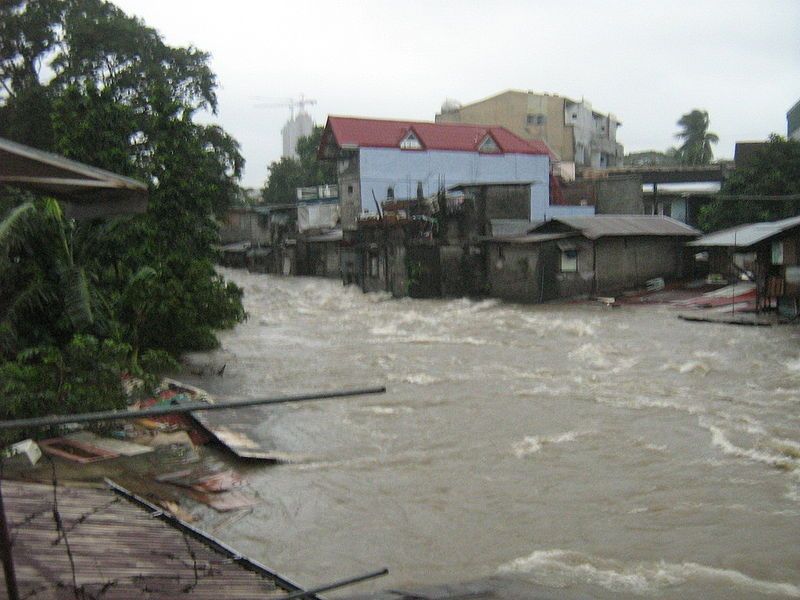
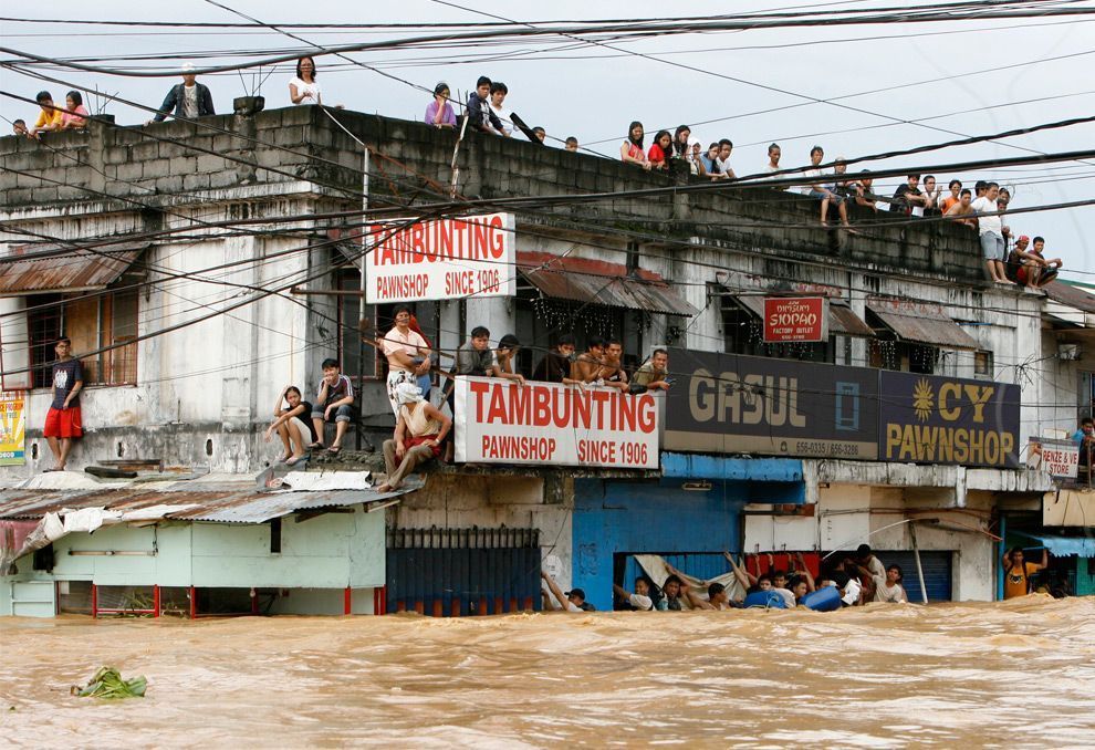
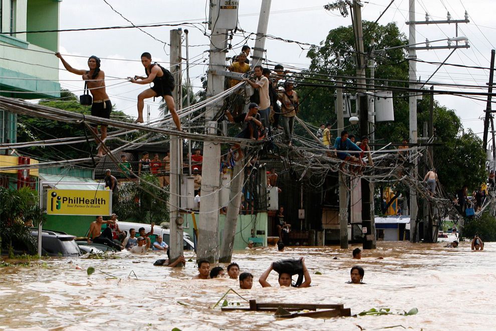
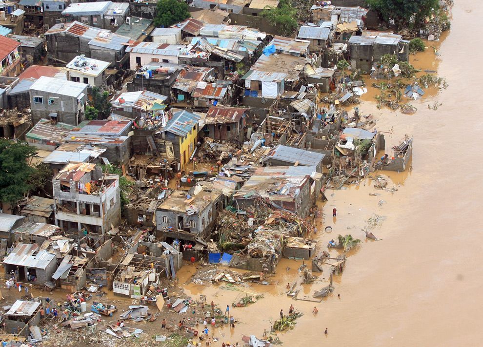
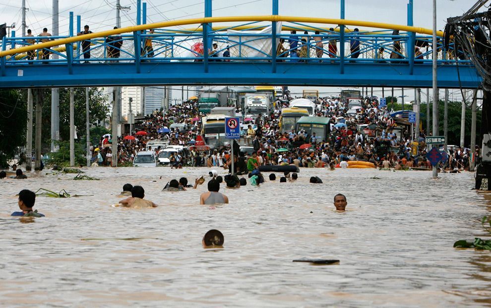
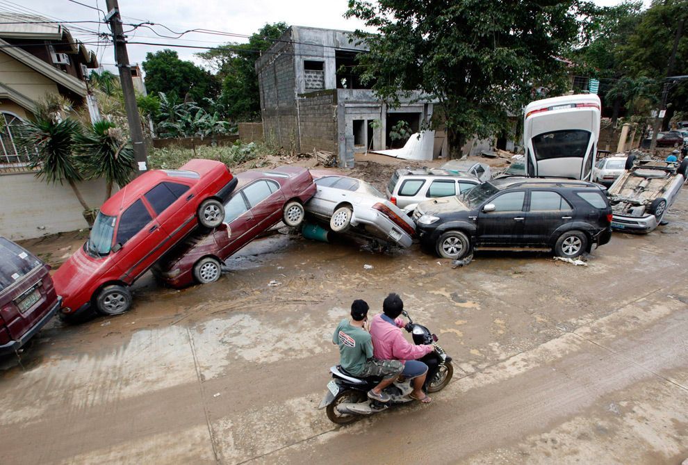
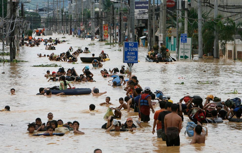
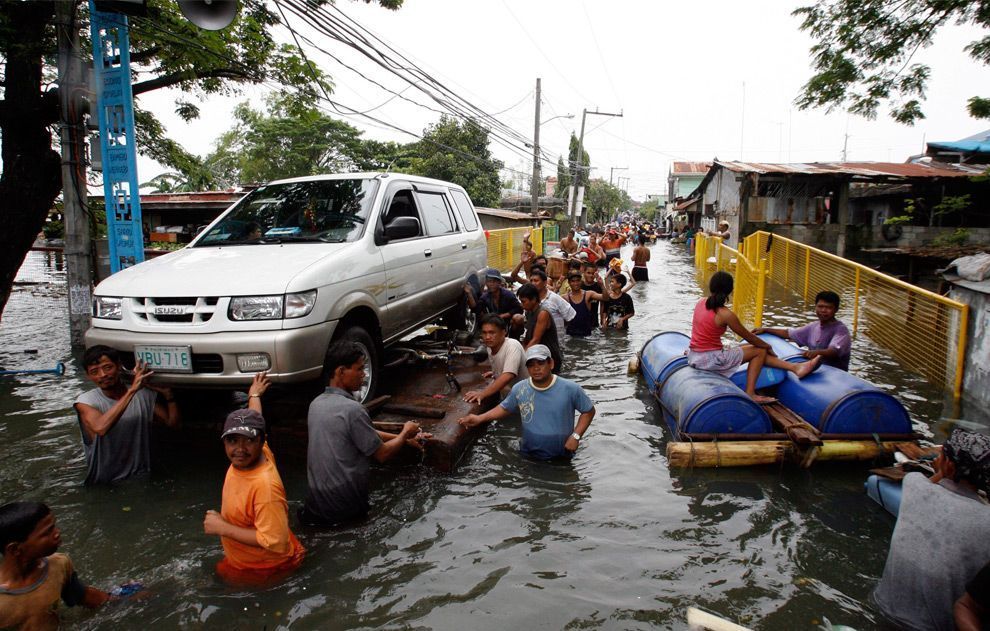
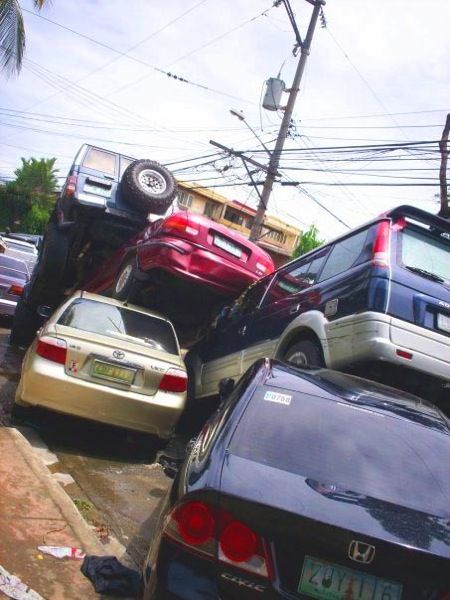
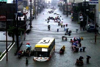
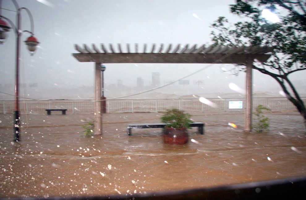
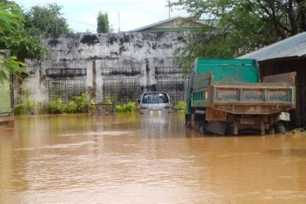
At 2:00 PM PST (0600 UTC) that day, Ketsana approached Metro Manila and caused widespread flooding in the cities of Caloocan, Marikina, Malabon, Muntinlupa, Quezon, Makati, the Manila, Pasay, Pasig, Antipolo, Taguig, Valenzuela, and San Juan. Flooding also occurred in the nearby provinces of Bulacan, Rizal, Laguna, and other Southern Tagalog areas. Major roads were rendered impassable because of huge flood currents and clogged cars. Air flights were canceled because of heavy rains.
Earlier, power interruptions were reported in Camarines Norte and minor landslides occurred in Camarines Sur.
EDSA was closed because of heavy flooding. Defense secretary and National Disaster Coordinating Council (NDCC) chairman Gilberto Teodoro asked the DOTC to keep MRT and LRT lines operational to accommodate stranded passengers.
State of calamity
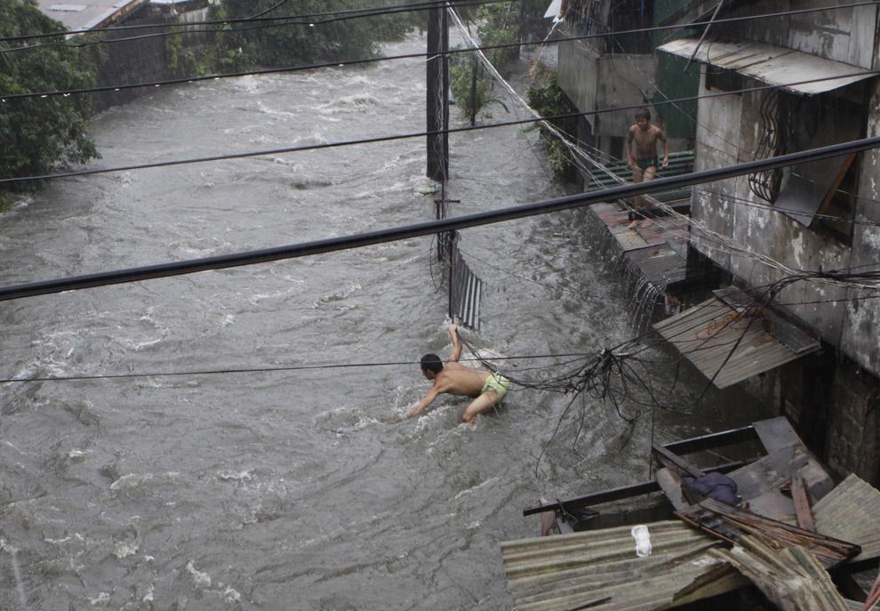
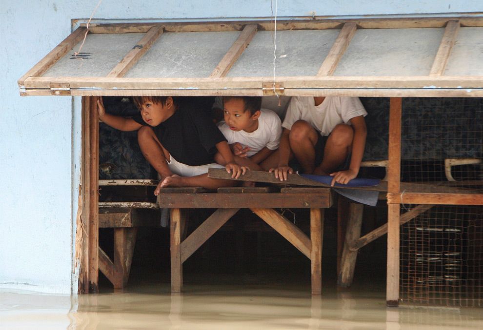
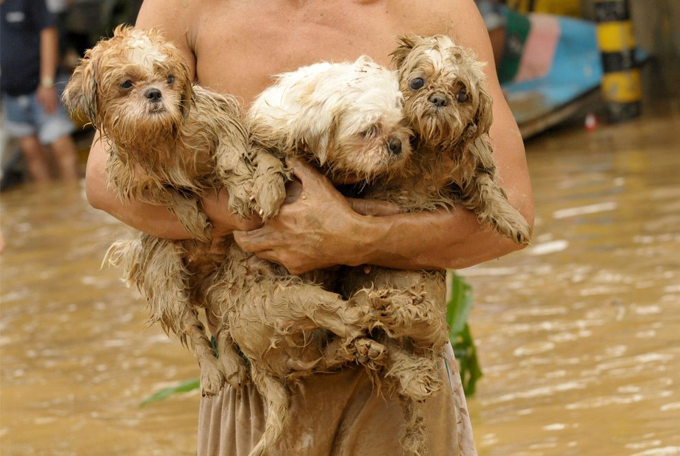
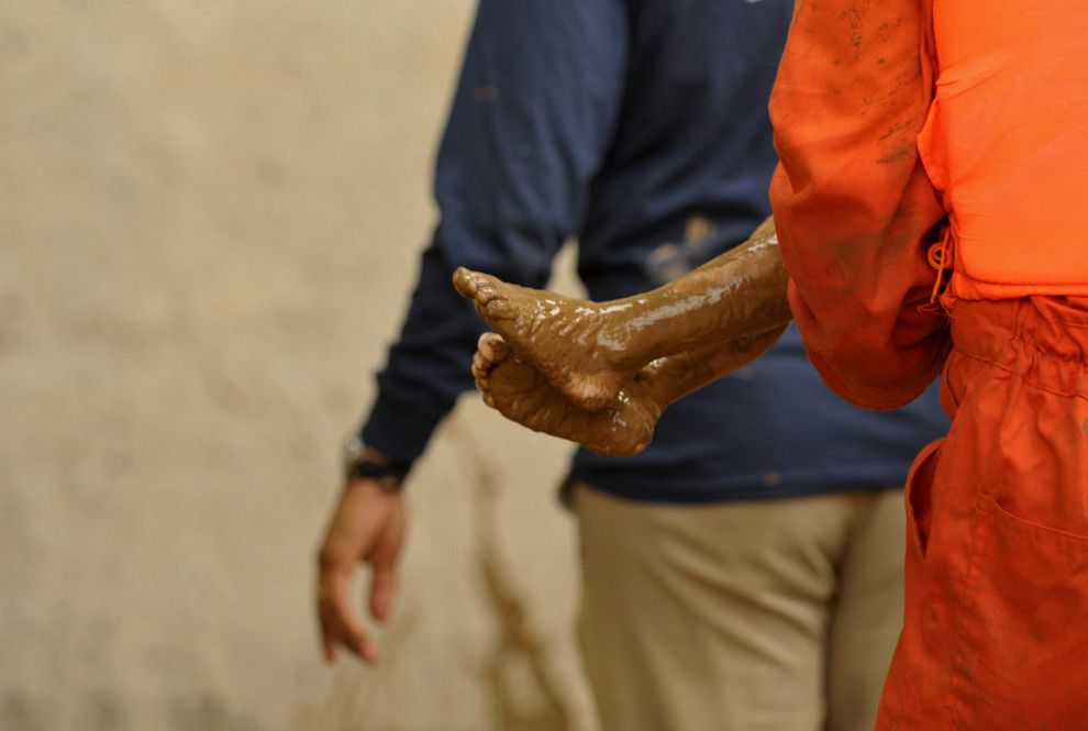
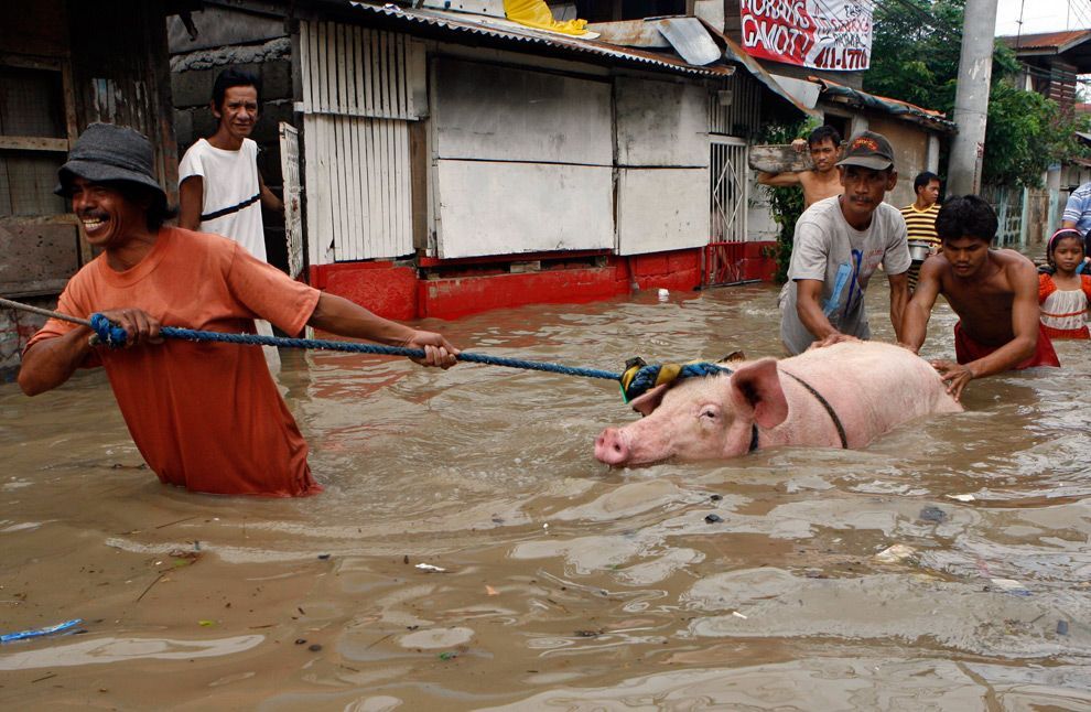
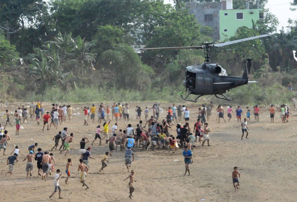
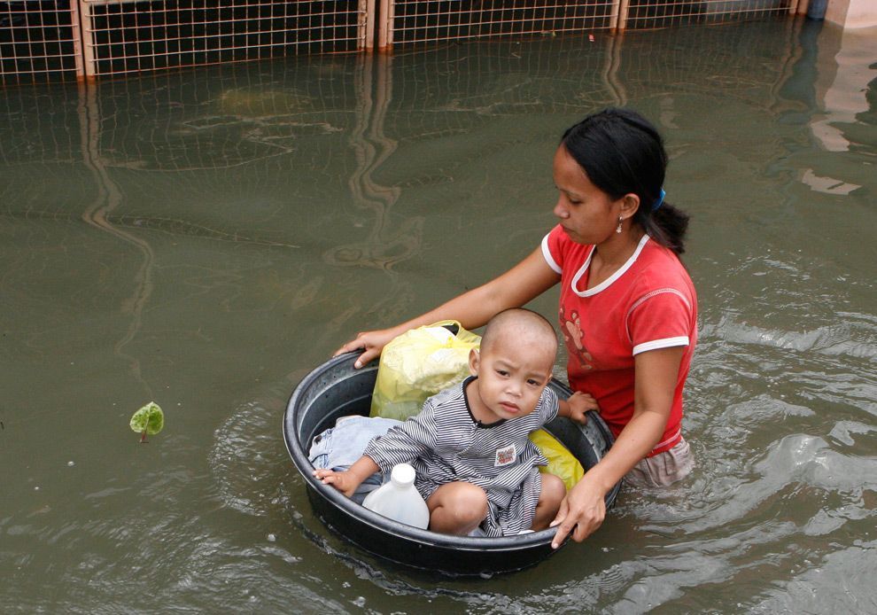
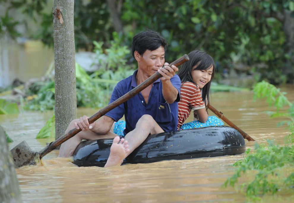
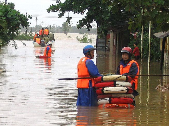
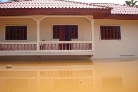
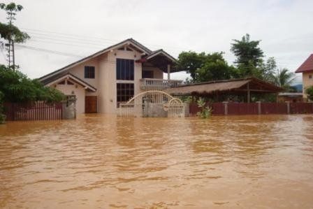
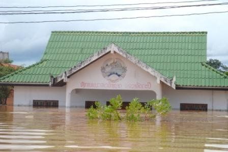
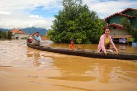
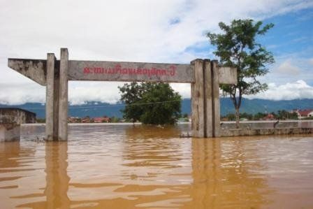
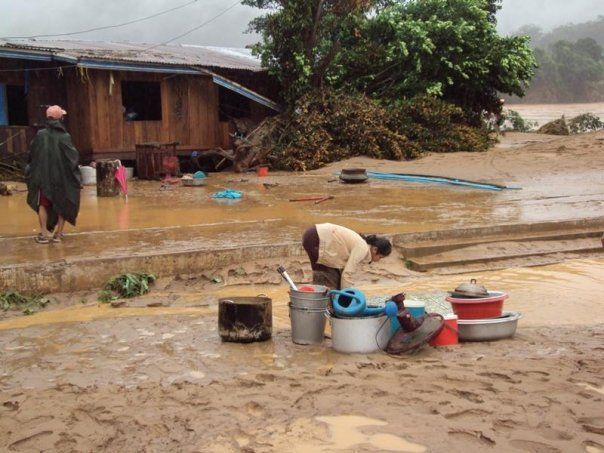
On the afternoon of September 26, Teodoro declared an over-all state of calamity in Metro Manila and the other 25 provinces hit by the typhoon, allowing officials to utilize emergency funds for relief and rescue. Army troops, police, and civilian volunteers were deployed to rescue victims. The Philippine National Red Cross and Philippine Coast Guard dispatched teams to rescue stranded and trapped people. At that time, the average height of flooding was from two feet to waist high, and in some areas more than six feet. Even Malacañang Palace was opened to those who were in need. The landslides and severe flooding left at least 246 people dead and 38 others missing. Public and private roads were clogged by vehicles stuck in floodwater. Thousands of motorists and more than 500 passengers were stranded at the North Luzon Expressway (NLEx). Distress calls and e-mails from thousands of Metro Manila residents and their worried relatives flooded TV and radio stations overnight as most of the power, communication, and water connections were lost. Ketsana also caused flights and operations to be shut down at Ninoy Aquino International Airport for almost a day.
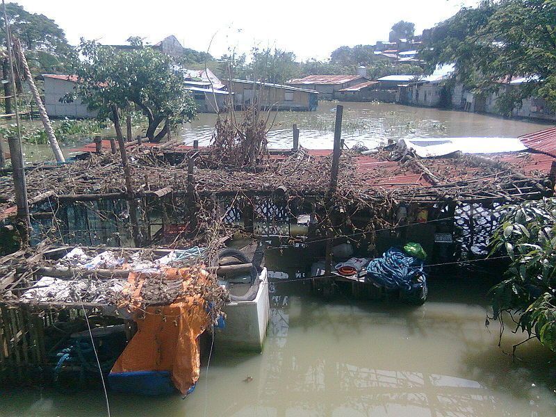
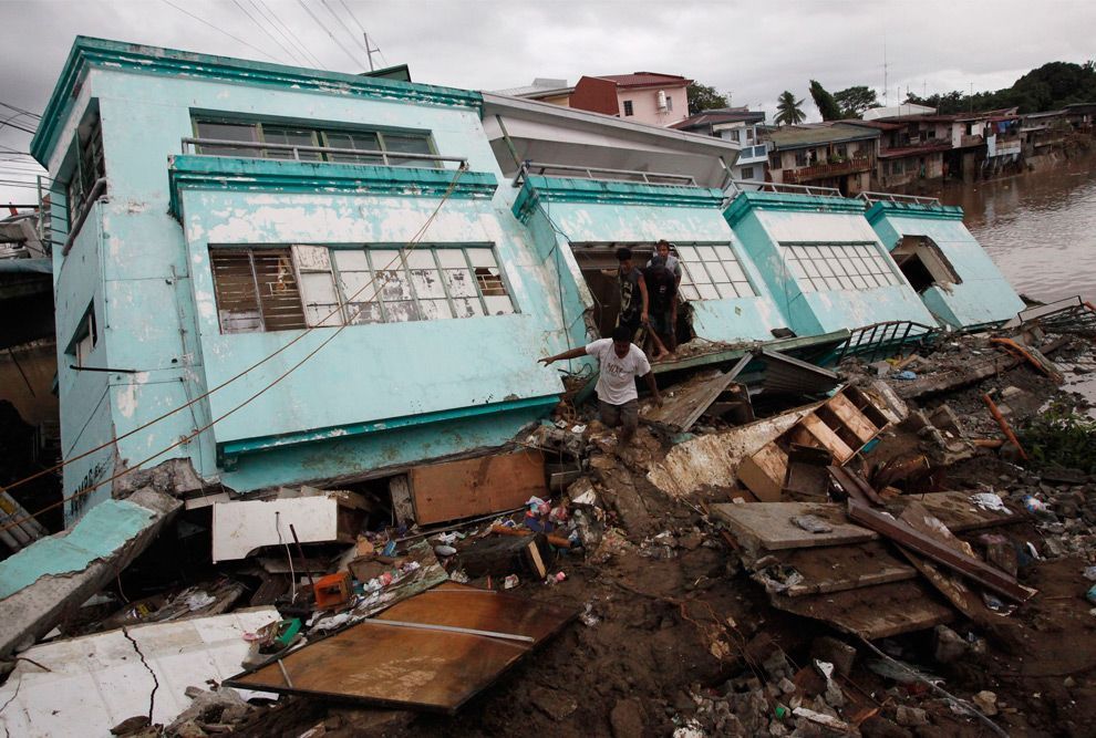
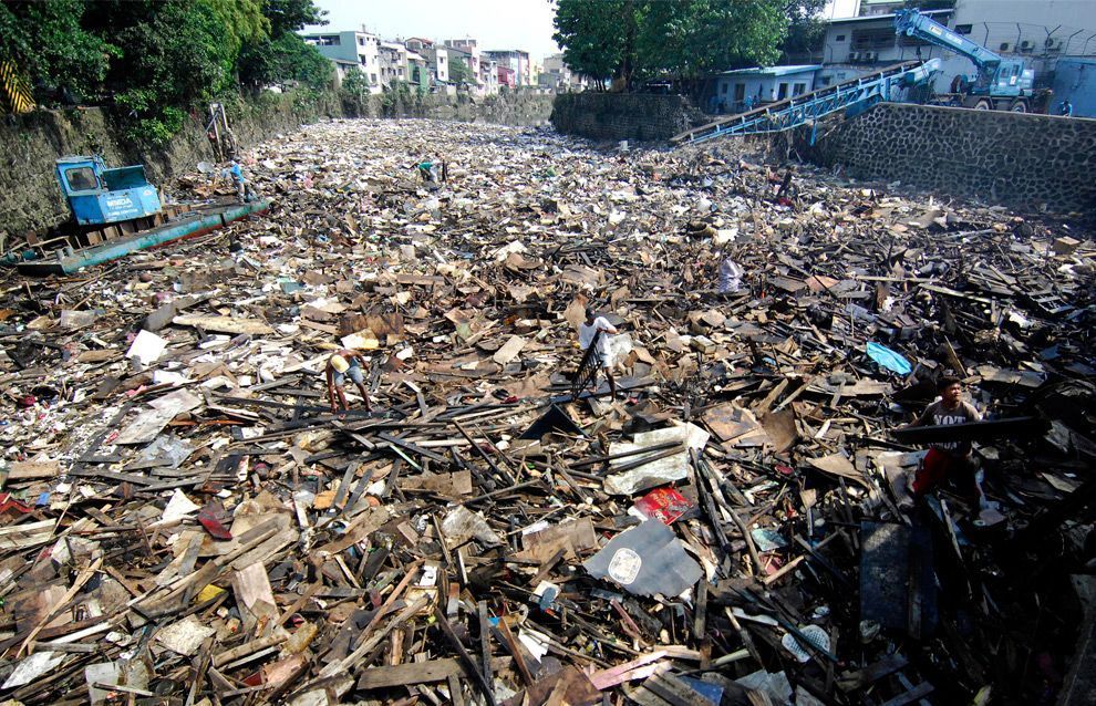
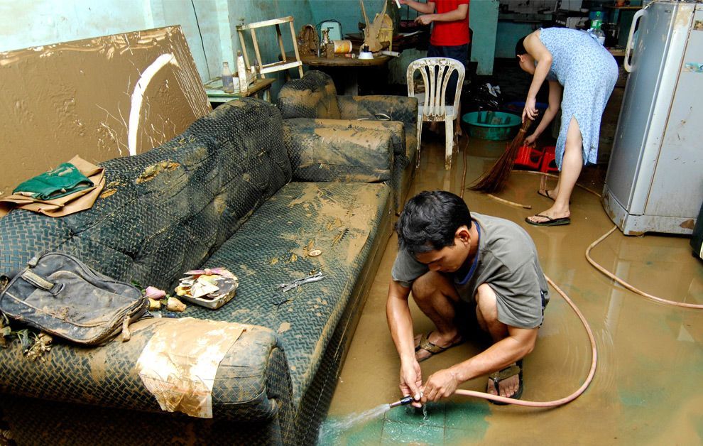
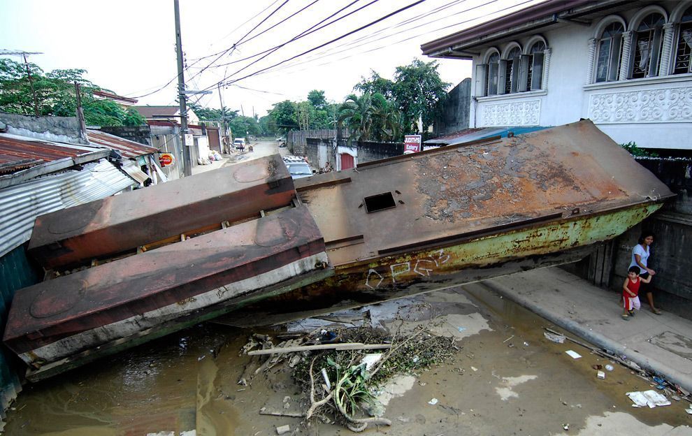
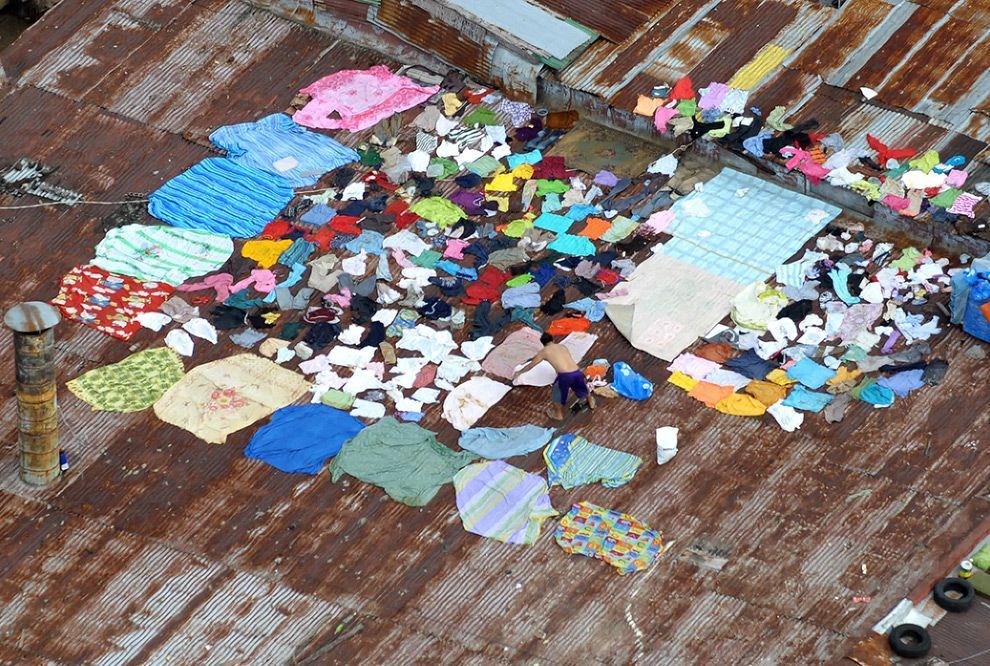
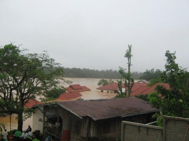
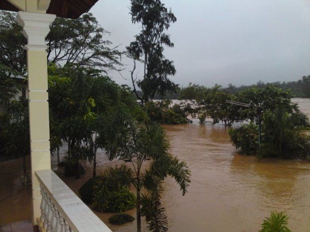
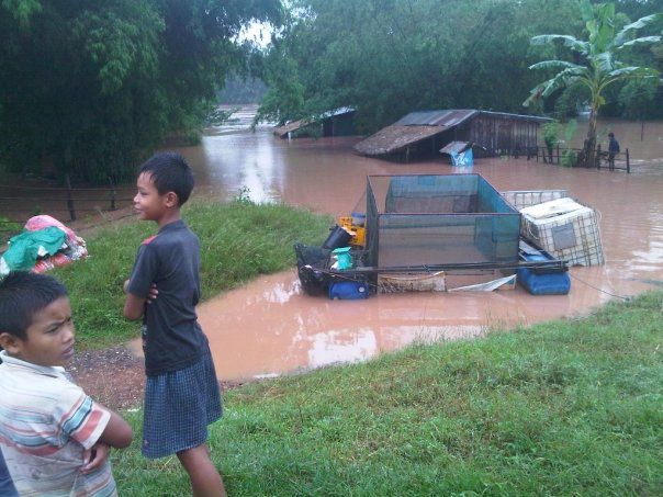
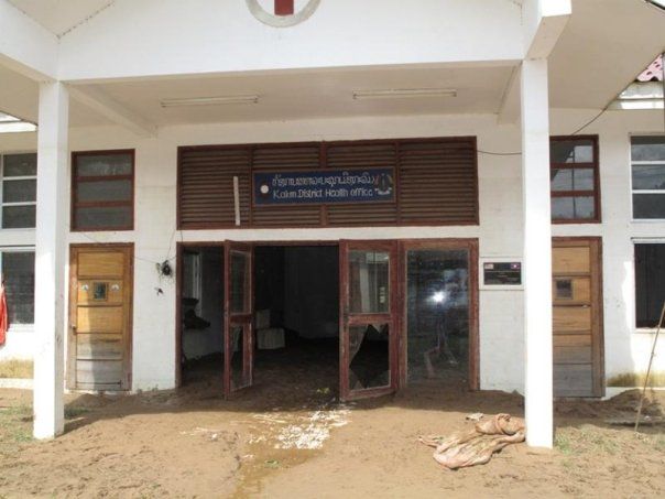
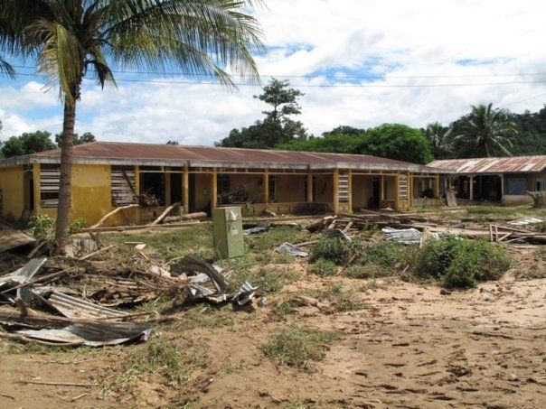
The economic region of Metro Manila and many adjoining provinces incurred damages to both infrastructure and agriculture. As of September 28, 2009, total damages from Ketsana were estimated at $100 million. Internet cafés, entertainment plazas, banks, food stores, building agencies, and stores were soaked with water and mud. Many people were warned of leptospirosis.
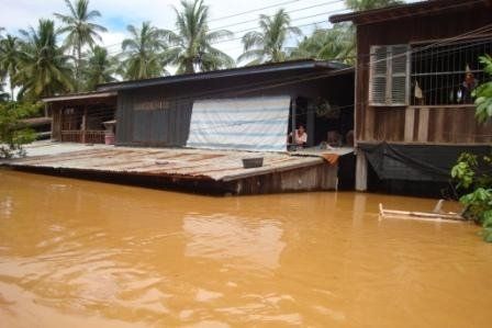
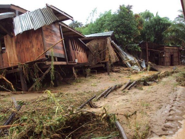
Marikina City, part of Metro Manila, was the most devastated region in the Philippines: almost all of the city's area was submerged in water up to ten feet deep and tons of knee-deep mud. During the typhoon, the Marikina River broke its banks and transformed streets into rivers. Marikina residential areas, particularly Provident Village, were badly affected by flooding; at least eight people were found dead. Marikina itself recorded 78 deaths, the highest among Metro Manila cities.
At the height of the flooding, around 100,000 liters of bunker oil from the paper manufacturing firm Noah's Paper Mill in Marikina City spilled. Most of the oil battered the city's barangays and a relatively small amount was washed into the basement of the SM City Marikina shopping mall. The spill later complicated rescue efforts in the city. Over a two-day period starting on September 29, the National Power Corporation Flood Forecasting and Warning System released 500 cubic meters per second of stored water from the Angat Dam in Bulacan. The dam had accumulated 100 cubic meters per second when Ketsana hit the province.[40] Mandaluyong City also recorded more than 6 feet (1.8 m) of flooding, especially in Gen. Kalentong St., where flooding was more than 10 feet (3.0 m) deep, badly affecting the local campus of Arellano University. The street recorded the highest flooding outside the Marikina City area.
In Mindanao, several towns in Cotabato City and nearby Sultan Kudarat municipalities were submerged. The closing of the national highway in Bulalo, Cotabato City led to the isolation of connecting towns for several days.
On September 28, PAGASA issued an 11 AM advisory canceling all public storm signals in the country when Ketsana left the Philippine Area of Responsibility.
Sources : Wikipedia, youtube, google search & boston.com


