JavaScript and Cookies are required to view this site. Please enable both in your browser settings.
Cirrus Radiatus Cirrus clouds come in many shapes and sizes and occur in the coldest and highest region of the troposphere. The World Meteorological Organization classified the cirrus clouds in five species – fibratus, uncinus, spissatus, castellanus, floccus – and four varieties – intortus, radiatus, vertebratus, duplicatus. http://en.wikipedia.org/wiki/Cirrus_radiatus Shelf Clouds The beautiful shelf clouds are low-level semicircular arcus clouds. Shelf clouds and roll clouds are two types of arcus clouds. Shelf clouds stick out like a shelf from their parent thunderstorm cloud. They form in association with a phenomenon known as gust front. This type of clouds is easily mistaken with wall clouds. The difference is that wall clouds usually appear at the rear of the storm, while shelf clouds on the leading edge of the thunderstorm http://en.wikipedia.org/wiki/Arcus_cloud Mammatus Clouds Mammatus clouds are some seriously weird looking formations. Also known as mammatocumulus, they often occur in association with severe thunderstorms. Convection and buoyancy of air is the key in understanding how these unusual and scary clouds form. In Mammutus clouds, “evaporation causes pockets of negative buoyancy as it cools the air inside the cloud. This makes the clouds puff downward instead of up like cumulus clouds, and they end up being like upside-down bubbles,” says Dan Breed, a scientist of the National Center for Atmospheric. http://en.wikipedia.org/wiki/Mammatus_cloud Morning Glory Clouds The Morning Glory cloud is another rare and equally dramatic phenomenon. These roll clouds occur in the lower atmospheric layer ahead of a storm front and can most often be observed in Northern Australia. Morning Glory clouds have been observed also over Germany, Central US, the English Channel and Eastern Russia. http://en.wikipedia.org/wiki/Morning_Glory_cloud Lenticular Clouds This beautiful lens-shaped clouds are usually created by gravity waves. The stationary clouds can be classified into cirrocumulus standing lenticular (CCSL), altocumulus standing lenticularis (ACSL) and stratocumulus standing lenticular (SCSL). Do you know which is one of the most common misidentified UFOs? Believe it or not, it’s the lenticular cloud. Due to their amazing shape, lenticular clouds are often mistaken for UFOs. http://en.wikipedia.org/wiki/Lenticular_cloud Anvil Clouds The anvil cloud, also known as cumulonimbus incus, is mostly composed of ice particles. It is a mature thunderstorm cloud that can cause a super-cell thunderstorm and then a tornado. Cumulonimbus clouds are divided into two species: calvus and capillatus. There are no varieties, but the anvil cloud is one of the nine accessory clouds. You can find more information on the website of the World Meteorological Organization. Here’s an interesting fact: the high-level anvil clouds often contain heavy snow because of the very cold upper layers of the earth’s troposphere. The snow melts into rain as it falls in warmer layers of air at lower altitudes. According to WeatherQuestions.com, 40 to 50% of the rain “produced by the average thunderstorm originates as ice and snow, even in the tropics”. http://en.wikipedia.org/wiki/Cumulonimbus_incus Noctilucent Clouds Polar mesospheric clouds – night shining clouds – have been seen exclusively around the Polar regions, but noctilucent clouds appeared several times over Europe and the United States. This is a real concern, because scientists believe they are caused by global warming. Since this phenomenon is fundamentally new, it seems that more questions exist than clear answers. This type of clouds was first observed 126 years ago by an amateur astronomer. Located in the mesosphere, the mysterious noctilucent clouds are the Earth’s highest clouds. The clouds that form 50 miles above the Earth’s surface are generally colorless, although pale blue, green, dark yellow and red shining clouds occasionally form. http://en.wikipedia.org/wiki/Noctilucent_cloud Jacques Cousteau Clouds Nicknamed the Jacques Cousteau clouds, undulatus asperatus is a cloud formation proposed two years ago as a separate cloud classification by Pretor-Pinney, British cloud enthusiast and founder of the Cloud Appreciation Society. Pretor-Pinney proposed the formal name – undulatus asperatus – because the cloud’s form of undulation can be described as “very turbulent, violent and chaotic.” According to Guardian.co.uk, the roman poet Virgil used the word asperatus “in a poem to describe the surface of the sea whipped up by the north wind”. http://news.nationalgeographic.com/news/2009/06/photogalleries/new-cloud-pictures/ Polar Stratospheric Clouds Polar stratospheric clouds (PSCs) form in the stratosphere at altitudes of 50,000–80,000 ft. They are classified into Types I (clouds with more diffuse and less bright colors) and II (nacreous or mother-of-pearl clouds), according to their formation temperature and particle size. Unfortunately, Polar stratospheric clouds play a key role in the massive ozone depletion over the Arctic and Antarctic. NASA explains that PSCs “form only at very low temperatures. They help destroy ozone in two ways: they provide a surface which converts benign forms of chlorine into reactive, ozone-destroying forms, and they remove nitrogen compounds that moderate the destructive impact of chlorine. In recent years, the atmosphere above the Arctic has been colder than usual, and polar stratospheric clouds have lasted into the spring. As a result, ozone levels have been decreasing.” http://en.wikipedia.org/wiki/Polar_stratospheric_cloud " /> Cirrus Radiatus Cirrus clouds come in many shapes and sizes and occur in the coldest and highest region of the troposphere. The World Meteorological Organization classified the cirrus clouds in five species – fibratus, uncinus, spissatus, castellanus, floccus – and four varieties – intortus, radiatus, vertebratus, duplicatus. http://en.wikipedia.org/wiki/Cirrus_radiatus Shelf Clouds The beautiful shelf clouds are low-level semicircular arcus clouds. Shelf clouds and roll clouds are two types of arcus clouds. Shelf clouds stick out like a shelf from their parent thunderstorm cloud. They form in association with a phenomenon known as gust front. This type of clouds is easily mistaken with wall clouds. The difference is that wall clouds usually appear at the rear of the storm, while shelf clouds on the leading edge of the thunderstorm http://en.wikipedia.org/wiki/Arcus_cloud Mammatus Clouds Mammatus clouds are some seriously weird looking formations. Also known as mammatocumulus, they often occur in association with severe thunderstorms. Convection and buoyancy of air is the key in understanding how these unusual and scary clouds form. In Mammutus clouds, “evaporation causes pockets of negative buoyancy as it cools the air inside the cloud. This makes the clouds puff downward instead of up like cumulus clouds, and they end up being like upside-down bubbles,” says Dan Breed, a scientist of the National Center for Atmospheric. http://en.wikipedia.org/wiki/Mammatus_cloud Morning Glory Clouds The Morning Glory cloud is another rare and equally dramatic phenomenon. These roll clouds occur in the lower atmospheric layer ahead of a storm front and can most often be observed in Northern Australia. Morning Glory clouds have been observed also over Germany, Central US, the English Channel and Eastern Russia. http://en.wikipedia.org/wiki/Morning_Glory_cloud Lenticular Clouds This beautiful lens-shaped clouds are usually created by gravity waves. The stationary clouds can be classified into cirrocumulus standing lenticular (CCSL), altocumulus standing lenticularis (ACSL) and stratocumulus standing lenticular (SCSL). Do you know which is one of the most common misidentified UFOs? Believe it or not, it’s the lenticular cloud. Due to their amazing shape, lenticular clouds are often mistaken for UFOs. http://en.wikipedia.org/wiki/Lenticular_cloud Anvil Clouds The anvil cloud, also known as cumulonimbus incus, is mostly composed of ice particles. It is a mature thunderstorm cloud that can cause a super-cell thunderstorm and then a tornado. Cumulonimbus clouds are divided into two species: calvus and capillatus. There are no varieties, but the anvil cloud is one of the nine accessory clouds. You can find more information on the website of the World Meteorological Organization. Here’s an interesting fact: the high-level anvil clouds often contain heavy snow because of the very cold upper layers of the earth’s troposphere. The snow melts into rain as it falls in warmer layers of air at lower altitudes. According to WeatherQuestions.com, 40 to 50% of the rain “produced by the average thunderstorm originates as ice and snow, even in the tropics”. http://en.wikipedia.org/wiki/Cumulonimbus_incus Noctilucent Clouds Polar mesospheric clouds – night shining clouds – have been seen exclusively around the Polar regions, but noctilucent clouds appeared several times over Europe and the United States. This is a real concern, because scientists believe they are caused by global warming. Since this phenomenon is fundamentally new, it seems that more questions exist than clear answers. This type of clouds was first observed 126 years ago by an amateur astronomer. Located in the mesosphere, the mysterious noctilucent clouds are the Earth’s highest clouds. The clouds that form 50 miles above the Earth’s surface are generally colorless, although pale blue, green, dark yellow and red shining clouds occasionally form. http://en.wikipedia.org/wiki/Noctilucent_cloud Jacques Cousteau Clouds Nicknamed the Jacques Cousteau clouds, undulatus asperatus is a cloud formation proposed two years ago as a separate cloud classification by Pretor-Pinney, British cloud enthusiast and founder of the Cloud Appreciation Society. Pretor-Pinney proposed the formal name – undulatus asperatus – because the cloud’s form of undulation can be described as “very turbulent, violent and chaotic.” According to Guardian.co.uk, the roman poet Virgil used the word asperatus “in a poem to describe the surface of the sea whipped up by the north wind”. http://news.nationalgeographic.com/news/2009/06/photogalleries/new-cloud-pictures/ Polar Stratospheric Clouds Polar stratospheric clouds (PSCs) form in the stratosphere at altitudes of 50,000–80,000 ft. They are classified into Types I (clouds with more diffuse and less bright colors) and II (nacreous or mother-of-pearl clouds), according to their formation temperature and particle size. Unfortunately, Polar stratospheric clouds play a key role in the massive ozone depletion over the Arctic and Antarctic. NASA explains that PSCs “form only at very low temperatures. They help destroy ozone in two ways: they provide a surface which converts benign forms of chlorine into reactive, ozone-destroying forms, and they remove nitrogen compounds that moderate the destructive impact of chlorine. In recent years, the atmosphere above the Arctic has been colder than usual, and polar stratospheric clouds have lasted into the spring. As a result, ozone levels have been decreasing.” http://en.wikipedia.org/wiki/Polar_stratospheric_cloud " /> Amazing Clouds

Amazing Clouds 

Current Rating:

Unlimited Views No Ads No Algorithms Lifetime Account

Documenting Reality

Community Forum · Est. 2006

Join Now
Thread Tools
  #1  
10-18-2011, 08:10 AM
Faline's Avatar
Faline
Offline:
My Rank: MAJOR
Poster Rank:12
Join Date: Jun 2009
Posts: 93,130
Contributions: 226
 
Mentioned: 91 Post(s)
Quoted: 2009 Post(s)
Activity Longevity
0/20 18/20
Today Posts
0/11 ssss93130
Amazing Clouds

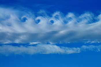
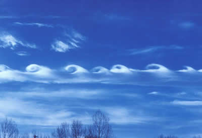
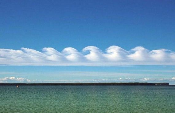
The Kelvin-Helmholtz Wave Cloud
Click image for larger version

Name:	Kelvin-Helmholtz-Wave-Cloud-570x367.jpg
Views:	456
Size:	37.2 KB
ID:	311027
Name:  Cirrus-Kelvin-Helmholtz-1.jpg
Views: 2567
Size:  6.0 KB
Name:  kelvin_helmholtz2_small.jpg
Views: 3092
Size:  8.2 KB
The Kelvin-Helmholtz wave cloud looks like crashing ocean waves. These beautiful clouds are named after German physicist Hermann von Helmholtz and British physicist Lord Kelvin, because they form when two different layers of air are moving past each other at different speeds. The above layer is faster. Some parts of the boundary – a shearing layer – move down, and others move up.

http://en.wikipedia.org/wiki/Kelvin%...tz_instability

<iframe width="640" height="360" src="http://www.youtube.com/embed/DcaqsWtBeL4" frameborder="0" allowfullscreen></iframe>

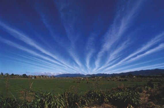
Cirrus Radiatus
Click image for larger version

Name:	Cirrus-Radiatus-Cloud-570x375.jpg
Views:	306
Size:	39.7 KB
ID:	311032
Cirrus clouds come in many shapes and sizes and occur in the coldest and highest region of the troposphere. The World Meteorological Organization classified the cirrus clouds in five species – fibratus, uncinus, spissatus, castellanus, floccus – and four varieties – intortus, radiatus, vertebratus, duplicatus.

http://en.wikipedia.org/wiki/Cirrus_radiatus

<iframe width="640" height="360" src="http://www.youtube.com/embed/9GyfS0myzRc" frameborder="0" allowfullscreen></iframe>

Shelf Clouds
Click image for larger version

Name:	Shelf-Cloud.jpg
Views:	345
Size:	99.0 KB
ID:	311033
Name:  shelf_cloud.jpg
Views: 2350
Size:  17.0 KB
Click image for larger version

Name:	20080615_storm01.jpg
Views:	3923
Size:	48.1 KB
ID:	311035
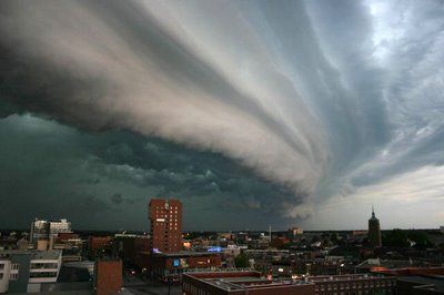
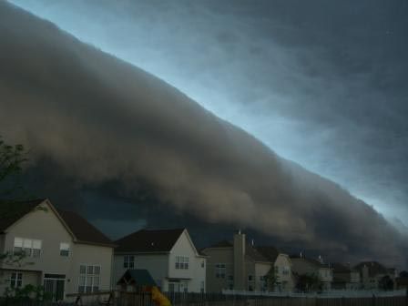
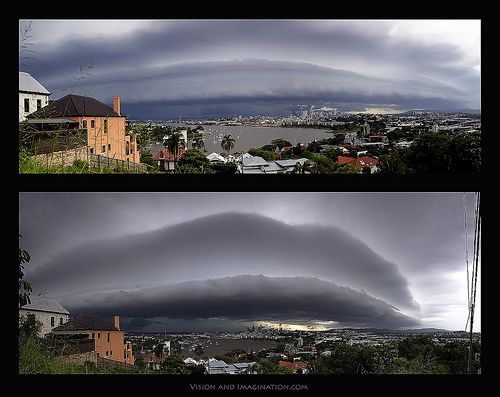
The beautiful shelf clouds are low-level semicircular arcus clouds. Shelf clouds and roll clouds are two types of arcus clouds.

Shelf clouds stick out like a shelf from their parent thunderstorm cloud. They form in association with a phenomenon known as gust front.

This type of clouds is easily mistaken with wall clouds. The difference is that wall clouds usually appear at the rear of the storm, while shelf clouds on the leading edge of the thunderstorm

http://en.wikipedia.org/wiki/Arcus_cloud

<iframe width="640" height="360" src="http://www.youtube.com/embed/mOVwlfrKN2g" frameborder="0" allowfullscreen></iframe>

<iframe width="640" height="360" src="http://www.youtube.com/embed/GqhASsAEkP8" frameborder="0" allowfullscreen></iframe>

Mammatus Clouds
Click image for larger version

Name:	mammatus-cloud.jpg
Views:	333
Size:	42.2 KB
ID:	311036
Click image for larger version

Name:	mammatusclouds_1.jpg
Views:	417
Size:	44.7 KB
ID:	311037
Click image for larger version

Name:	Mammatus-Clouds-by-3D-King.jpg
Views:	317
Size:	59.3 KB
ID:	311038
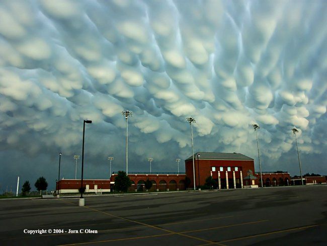
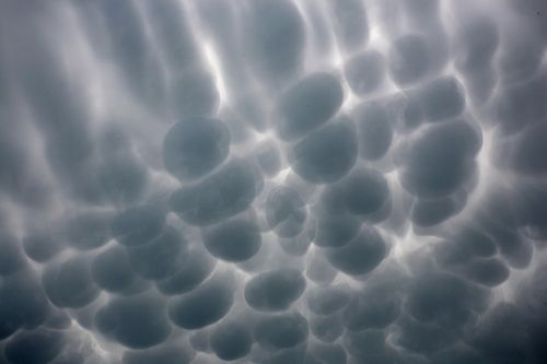
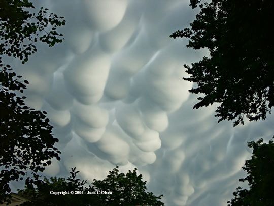
Mammatus clouds are some seriously weird looking formations. Also known as mammatocumulus, they often occur in association with severe thunderstorms. Convection and buoyancy of air is the key in understanding how these unusual and scary clouds form.

In Mammutus clouds, “evaporation causes pockets of negative buoyancy as it cools the air inside the cloud. This makes the clouds puff downward instead of up like cumulus clouds, and they end up being like upside-down bubbles,” says Dan Breed, a scientist of the National Center for Atmospheric.

http://en.wikipedia.org/wiki/Mammatus_cloud

<iframe width="480" height="360" src="http://www.youtube.com/embed/sdvcXcTpX1w" frameborder="0" allowfullscreen></iframe>

Morning Glory Clouds
Click image for larger version

Name:	Morning-Glory-Clouds-570x379.jpg
Views:	282
Size:	33.2 KB
ID:	311039
Click image for larger version

Name:	1254288782xG1SJ1F.jpg
Views:	469
Size:	37.3 KB
ID:	311040
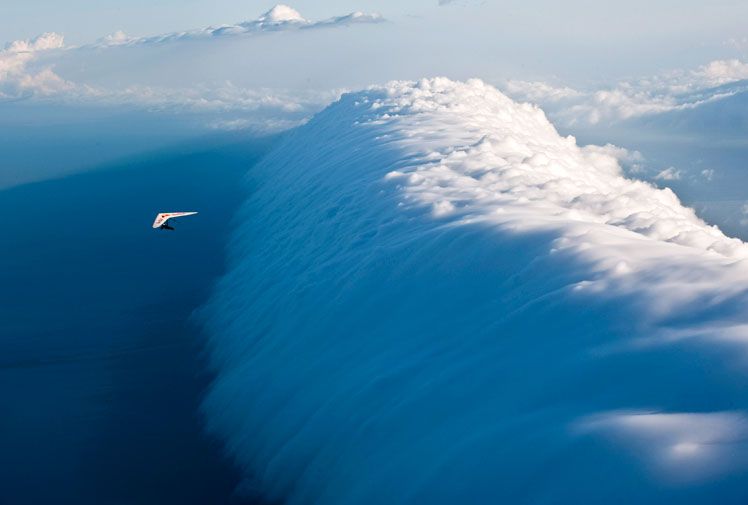
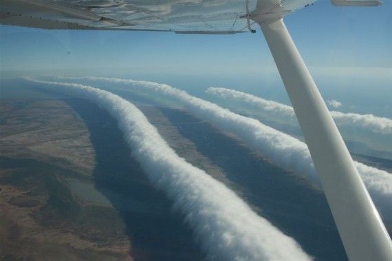
The Morning Glory cloud is another rare and equally dramatic phenomenon. These roll clouds occur in the lower atmospheric layer ahead of a storm front and can most often be observed in Northern Australia. Morning Glory clouds have been observed also over Germany, Central US, the English Channel and Eastern Russia.

http://en.wikipedia.org/wiki/Morning_Glory_cloud

<iframe width="480" height="360" src="http://www.youtube.com/embed/RLDgnKRLFe8" frameborder="0" allowfullscreen></iframe>

Lenticular Clouds
Click image for larger version

Name:	Lenticular-Clouds-570x378.jpg
Views:	280
Size:	36.8 KB
ID:	311041
Click image for larger version

Name:	lenticular-clouds-agr1n8-sw.jpg
Views:	1862
Size:	148.1 KB
ID:	311042
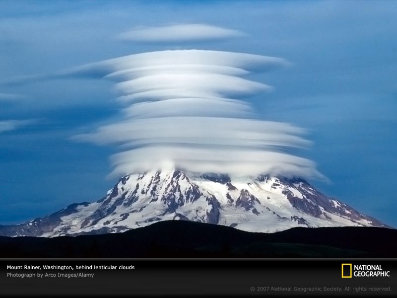
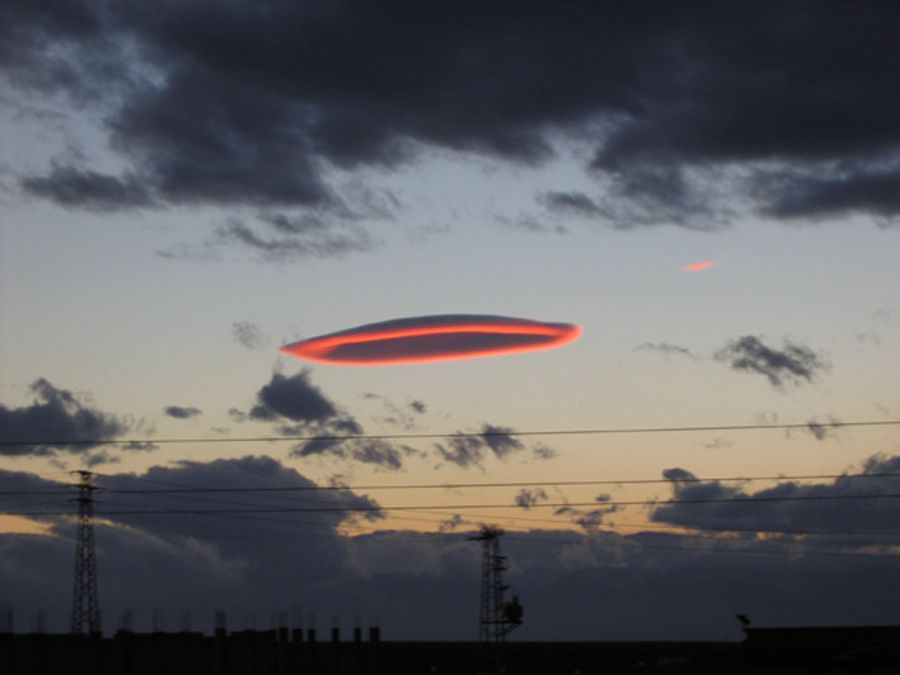
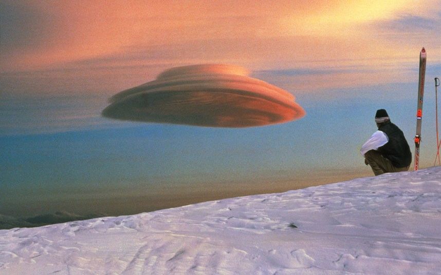
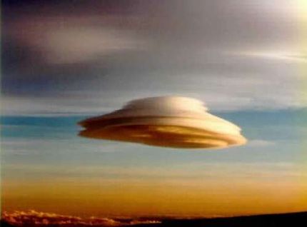
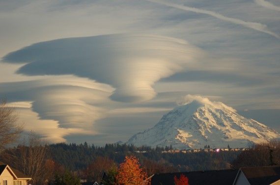
This beautiful lens-shaped clouds are usually created by gravity waves. The stationary clouds can be classified into cirrocumulus standing lenticular (CCSL), altocumulus standing lenticularis (ACSL) and stratocumulus standing lenticular (SCSL). Do you know which is one of the most common misidentified UFOs? Believe it or not, it’s the lenticular cloud. Due to their amazing shape, lenticular clouds are often mistaken for UFOs.

http://en.wikipedia.org/wiki/Lenticular_cloud

<iframe width="480" height="360" src="http://www.youtube.com/embed/vnyqLc8m41A" frameborder="0" allowfullscreen></iframe>

Anvil Clouds
Click image for larger version

Name:	Anvil-Clouds-525x700.jpg
Views:	378
Size:	53.1 KB
ID:	311043
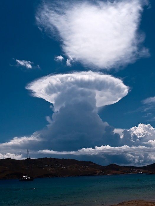
The anvil cloud, also known as cumulonimbus incus, is mostly composed of ice particles. It is a mature thunderstorm cloud that can cause a super-cell thunderstorm and then a tornado.

Cumulonimbus clouds are divided into two species: calvus and capillatus. There are no varieties, but the anvil cloud is one of the nine accessory clouds. You can find more information on the website of the World Meteorological Organization.

Here’s an interesting fact: the high-level anvil clouds often contain heavy snow because of the very cold upper layers of the earth’s troposphere. The snow melts into rain as it falls in warmer layers of air at lower altitudes. According to WeatherQuestions.com, 40 to 50% of the rain “produced by the average thunderstorm originates as ice and snow, even in the tropics”.

http://en.wikipedia.org/wiki/Cumulonimbus_incus

<iframe width="640" height="360" src="http://www.youtube.com/embed/ObCfwdn3Mms" frameborder="0" allowfullscreen></iframe>

Noctilucent Clouds
Click image for larger version

Name:	Noctilucent-Clouds.jpg
Views:	322
Size:	99.8 KB
ID:	311044
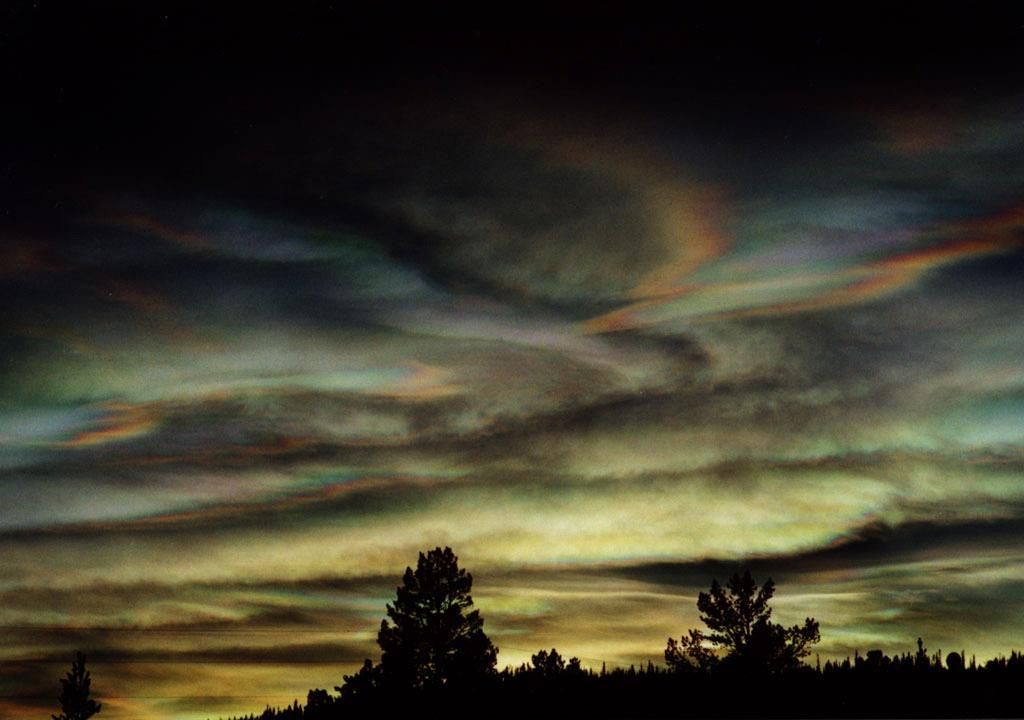
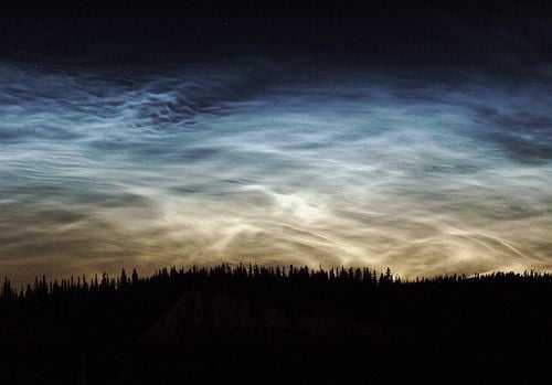
Polar mesospheric clouds – night shining clouds – have been seen exclusively around the Polar regions, but noctilucent clouds appeared several times over Europe and the United States. This is a real concern, because scientists believe they are caused by global warming. Since this phenomenon is fundamentally new, it seems that more questions exist than clear answers. This type of clouds was first observed 126 years ago by an amateur astronomer.

Located in the mesosphere, the mysterious noctilucent clouds are the Earth’s highest clouds.

The clouds that form 50 miles above the Earth’s surface are generally colorless, although pale blue, green, dark yellow and red shining clouds occasionally form.

http://en.wikipedia.org/wiki/Noctilucent_cloud

Jacques Cousteau Clouds
Click image for larger version

Name:	Jacques-Cousteau-Clouds-570x427.jpg
Views:	495
Size:	44.2 KB
ID:	311045
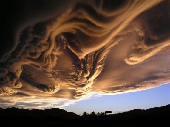
Nicknamed the Jacques Cousteau clouds, undulatus asperatus is a cloud formation proposed two years ago as a separate cloud classification by Pretor-Pinney, British cloud enthusiast and founder of the Cloud Appreciation Society.
Pretor-Pinney proposed the formal name – undulatus asperatus – because the cloud’s form of undulation can be described as “very turbulent, violent and chaotic.” According to Guardian.co.uk, the roman poet Virgil used the word asperatus “in a poem to describe the surface of the sea whipped up by the north wind”.

http://news.nationalgeographic.com/n...loud-pictures/

Polar Stratospheric Clouds
Name:  Polar-Stratospheric-Clouds.jpg
Views: 1985
Size:  19.6 KB
Click image for larger version

Name:	psc-000126c-5_hr_esrange.jpg
Views:	649
Size:	66.0 KB
ID:	311047
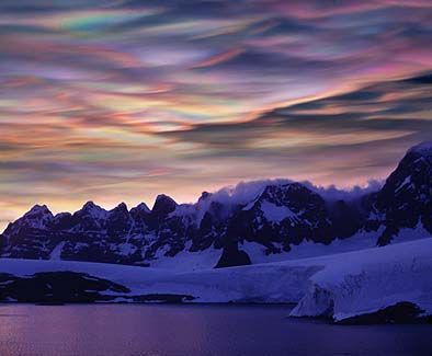
Polar stratospheric clouds (PSCs) form in the stratosphere at altitudes of 50,000–80,000 ft. They are classified into Types I (clouds with more diffuse and less bright colors) and II (nacreous or mother-of-pearl clouds), according to their formation temperature and particle size. Unfortunately, Polar stratospheric clouds play a key role in the massive ozone depletion over the Arctic and Antarctic. NASA explains that PSCs “form only at very low temperatures. They help destroy ozone in two ways: they provide a surface which converts benign forms of chlorine into reactive, ozone-destroying forms, and they remove nitrogen compounds that moderate the destructive impact of chlorine. In recent years, the atmosphere above the Arctic has been colder than usual, and polar stratospheric clouds have lasted into the spring. As a result, ozone levels have been decreasing.”

http://en.wikipedia.org/wiki/Polar_stratospheric_cloud

<iframe width="480" height="360" src="http://www.youtube.com/embed/3BwkfyP1MMY" frameborder="0" allowfullscreen></iframe>

<iframe width="640" height="360" src="http://www.youtube.com/embed/-zFHJxesqm0" frameborder="0" allowfullscreen></iframe>
12 Users Say Thank You For This Post:
DonB, eclips, Enotoff, Feirefiz, ghagi, HollyWood79, kellyhound, MeMyselfandI, mikejudd, powderblue, Sharon, Vorgrus
▼ PROMO FROM DOCUMENTING REALITY
Look. You know you want to
Join Now
Hidden for upgraded members.
  #2  
10-18-2011, 12:16 PM
Viking64's Avatar
Viking64
Offline:
★Wizard Of Gore★
Poster Rank:2
Join Date: Aug 2009
Posts: 127,129
Contributions: 1
 
Mentioned: 450 Post(s)
Quoted: 30201 Post(s)
Activity Longevity
18/20 17/20
Today Posts
2/11 sss127129
Re: Amazing Clouds

Cool pics!! Interesting thread.
  #3  
10-18-2011, 02:25 PM
collaredgirl65's Avatar
collaredgirl65
Offline:
Smartest Retard
Poster Rank:188
Female
Join Date: Feb 2010
Posts: 8,011
 
Mentioned: 1 Post(s)
Quoted: 34 Post(s)
Activity Longevity
0/20 17/20
Today Posts
0/11 sssss8011
Re: Amazing Clouds

Beautiful pictures. I have seen the shelf clouds alot. Rolling in over the Lake, following the front across.
  #4  
10-18-2011, 04:14 PM
kellyhound's Avatar
kellyhound
Offline:
✝Mudderator from Hell✝
Poster Rank:11
e-mail
Join Date: Oct 2006
Posts: 95,759
Contributions: 817
 
Mentioned: 473 Post(s)
Quoted: 10211 Post(s)
Activity Longevity
17/20 20/20
Today Posts
0/11 ssss95759
Re: Amazing Clouds

like the ufo and shelf clouds.
Never saw them myself.
  #5  
10-18-2011, 09:06 PM
Sharon's Avatar
Sharon
Offline:
♚ Legacy Gold Member ♚
Poster Rank:34
Female
Join Date: Nov 2008
Posts: 43,403
Contributions: 204
 
Mentioned: 95 Post(s)
Quoted: 2281 Post(s)
Activity Longevity
0/20 18/20
Today Posts
0/11 ssss43403
Re: Amazing Clouds

Amazing, beautiful thread! I used to stare at clouds and you end up seeing all manner of shapes in them. Very cool.
  #6  
10-18-2011, 09:53 PM
VaBusa's Avatar
VaBusa
Offline:
♚ Legacy Gold Member ♚
Poster Rank:2567
Female
Join Date: Jul 2011
Posts: 167
 
Mentioned: 1 Post(s)
Quoted: 10 Post(s)
Activity Longevity
1/20 15/20
Today Posts
0/11 ssssss167
Re: Amazing Clouds

Truly amazing photos! I'd love to see some of these in person...just beautiful
  #7  
10-19-2011, 06:55 AM
Faline's Avatar
Faline
Offline:
My Rank: MAJOR
Poster Rank:12
Join Date: Jun 2009
Posts: 93,130
Contributions: 226
 
Mentioned: 91 Post(s)
Quoted: 2009 Post(s)
Activity Longevity
0/20 18/20
Today Posts
0/11 ssss93130
Re: Amazing Clouds

<iframe width="480" height="360" src="http://www.youtube.com/embed/oaAkFXQxDBE" frameborder="0" allowfullscreen></iframe>
  #8  
11-24-2011, 12:14 PM
davidcopafeel's Avatar
davidcopafeel
Offline:
My Rank: CAPTAIN
Poster Rank:211
Join Date: Jul 2011
Posts: 7,054
 
Mentioned: 19 Post(s)
Quoted: 1641 Post(s)
Activity Longevity
0/20 16/20
Today Posts
0/11 sssss7054
Re: Amazing Clouds

Polar Stratospheric Clouds AKA Blue waffle clouds
  #9  
11-26-2011, 04:27 AM
Bastet's Avatar
Bastet
Offline:
My Rank: FIRST SERGEANT
Poster Rank:394
Join Date: Apr 2011
Posts: 3,054
 
Mentioned: 2 Post(s)
Quoted: 276 Post(s)
Activity Longevity
0/20 16/20
Today Posts
0/11 sssss3054
Re: Amazing Clouds

Clouds are awesome, like paintings in the sky
  #10  
05-09-2013, 08:14 AM
Sharon's Avatar
Sharon
Offline:
♚ Legacy Gold Member ♚
Poster Rank:34
Female
Join Date: Nov 2008
Posts: 43,403
Contributions: 204
 
Mentioned: 95 Post(s)
Quoted: 2281 Post(s)
Activity Longevity
0/20 18/20
Today Posts
0/11 ssss43403
Re: Amazing Clouds

Believe it or not, it’s the lenticular cloud. Due to their amazing shape, lenticular clouds are often mistaken for UFOs.
No wonder
len1.jpg
116.1 KB ·200 views
len2.jpg
88.6 KB ·260 views
len3.jpg
33.6 KB ·303 views


Powered by vBulletin Copyright 2000-2010 Jelsoft Enterprises Limited.

Search Engine Friendly URLs by vBSEO