|
#1
●
09-09-2012, 10:12 AM
|
 Super ********* Poster Rank:90 Join Date: Nov 2008 Posts: 17,370 17,370Posts 13,735Thanked 99Quoted 5Mentioned 0Contrib. |
|
Krakatoa Eruption Photograph From May 27, 1883
Krakatau began erupting in the Sunda Strait between Java and Sumatra on May 20, 1883, after a long period of inactivity. The principal photograph was taken on May 27 and shows an ash column rising above the low volcanic island during this early phase. Activity continued through the following months before intensifying on August 26 and 27. The paroxysm occurred on the morning of August 27. A second photograph, made around 1885, shows a huge block of coral that the eruption's tsunami threw ashore at Anyer, Java, with a man standing beside it for scale. The remaining illustrations include maps comparing the islands before and after the eruption, an animated island-evolution map and a color lithograph published with the 1888 Krakatoa Committee report. Also covered here: Photographic Time Line 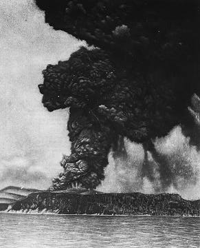  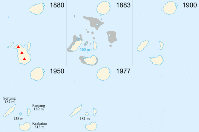 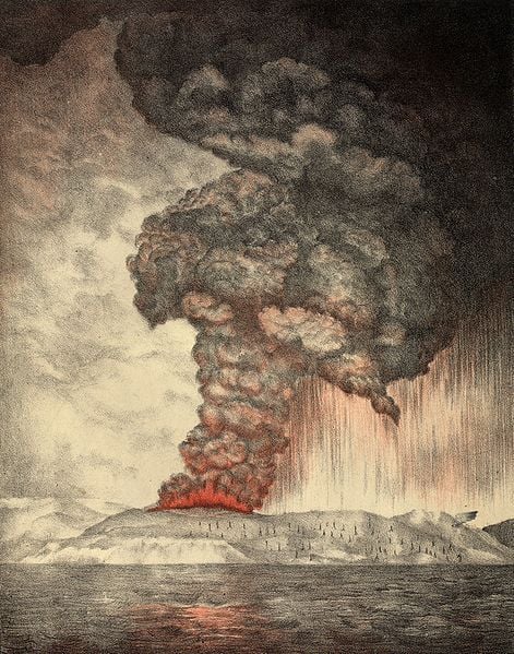 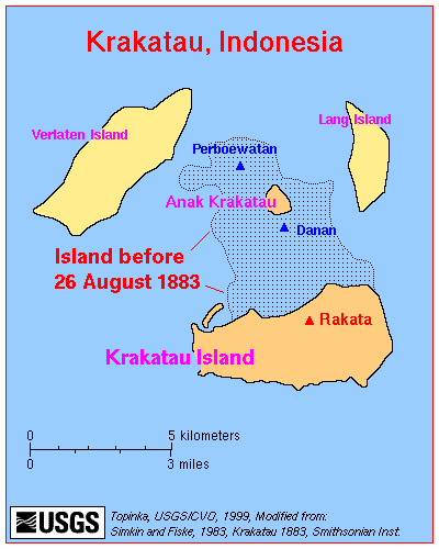 |
|
#2
●
09-09-2012, 12:19 PM
|
 ♚ Legacy Gold Member ♚ Poster Rank:35 Female Join Date: Nov 2008 Posts: 43,321
Contributions: 233
43,321Posts 76,151Thanked 2,282Quoted 95Mentioned 233Contrib. |
|
Re: Krakatoa Eruption Photograph From May 27, 1883
Impressive block of coral!
|
|
#3
●
09-12-2012, 12:06 PM
|
 ★ Legacy Member ★ Poster Rank:4175 It may be little, but my winkie is kinda cute. Join Date: Mar 2012 Posts: 74 74Posts 57Thanked 1Quoted 0Mentioned 0Contrib. |
|
Re: Krakatoa Eruption Photograph From May 27, 1883
Extremely interesting info and pics. Thanks for sharing!  Also Dr. PC's pages are FASCINATING!! A great read, great find! |
|
#8
●
09-14-2012, 08:40 AM
|
| So Fucking Banned Poster Rank:611 N/A Join Date: May 2010 Posts: 1,522 1,522Posts 2,876Thanked 484Quoted 1Mentioned 0Contrib. |
|
Re: Krakatoa Eruption Photograph From May 27, 1883
Actually there is very little carbon in magma, human activity produces more greenhouse gases in one week than the combined eruptions of the last 50 years
|